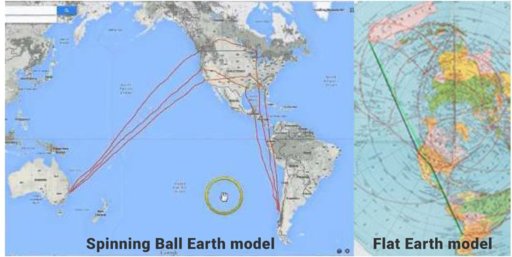
View attachment 26420 Well with all due respect I understand many of you have taken this flight and it has been a huge thorn in the side of the FE community, however the common end factor is the flight is too long and wouldnt have enough fuel. The actual flight is roughly 7,200 miles. Here is the distance on a FE map using proper Equi-Distance measurements. Your flying the same route minus the NASA created globe GPS nonsense. The purple line shows the FE flight path
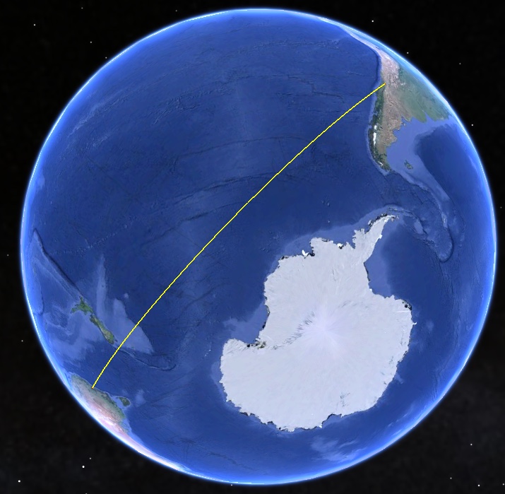
"We get tracked when we leave Sydney. We often fly over New Zealand where we get tracked and when we reach South America we get tracked again."
Like others, I find it hard to work out what you are claiming, and what evidence you have for your claims, for example that the flight at issue would be impossibly long.
However, the flat earth map you show clearly contradicts the everyday experience of people living in the southern hemisphere. For example, it shows Australia to be nearly 3 times as long east-west as it is north-south. I've never found any Australian or foreign visitor who would believe that!
The same with Africa on your favoured FE map. Measure the distance across the waist of the continent from Namibia to Maputo. According to your FE map,Africa from north to south is only this East west distance is only about 1.8 times this east-west distance. In reality, travellers confirm that it about 5.5 times as far N-S as E-W! How can we even begin to use a map with such obvious errors to discuss distances?
http://roundearthsense.blogspot.co.uk/2016/03/ifthe-earth-were-truly-globe-then-every.html
By the way, on your flat earth map, a person standing on the southern tip of Africa and looking South would be looking "rimwards" at an angle of about 70 degrees (or towards 2 o'clock if we take your map as a clock face) .
But someone looking southwards while standing at the southern tip of South America on your map would be looking rimwards at about 160 degrees (roughly 5.30 on a clockface).
The problem is, they see the same stars and constellations in front of them in the southern skies. Yet your proposed flat earth maps says that they are looking in different directions by around 90 degrees!
How can the southern skies appear the same when viewed in two horizontal directions at right angles to one another?


")