Flight tracking Qantas Airlines Flight QF63

I think the labels and heights are correct, the A340 is the skinny plane, and is the upper plane in the photo. It's also the overtaking plane. It appears longer in the video, so it's lower.

An interesting optical illusion with contrails means you can't tell which contrail is higher than another, and frequently you get it wrong. It's because they are additively transparent (they only add light, they don't shadow anything behind them - dark regions are holes).

[Update: See: https://www.metabunk.org/threads/ab...ontrail-is-above-or-below-a-cloud-layer.4334/ ]
 
Last edited:
Thanks. That is why I thought that video was cool when I stumbled across it a few hours ago. The juxtaposition of differing trails illustrate both the difference in trail formation in a relatively small vertical space and the difficulty in discerning that vertical separation from the ground. On second viewing I notice that the path of the A340 must be "slightly" to the left of the path of the A380 if you were to view the paths in plan view. I think that is what created for me the illusion that the 340 path was directly above the 380 path.
 
I see peekay22 has a new video, he seems surprised by changes in routing of QF63/64 which he follows passionately, it seems. He still doesn't accept that jets change routes due to weather and winds, and sometimes run south from Sydney through Hobart, Tasmania, and sometimes runs west passing over Adelaide, Australia.


He also didn't make a comment about the Dec 23nd landing of QF64 in his home town of Melbourne:
Qantas Source said:
23rd December 2011 - VH-OJM QF64 Melbourne Diversion.
Boeing 747-438 VH-OJM operating QF64 Johannesburg - Sydney (depart Johannesburg 23 December) diverted via Melbourne this afternoon.
http://www.theqantassource.com/index.html
 
oh that Crazy Peekay!

He has said both that the route proves spraying, but when the route changes or that he was mistaken, he has said that the route does not matter anyways, because he knows that they are spraying.

I hope he does not read this and found out that the 5 oceanic Navigational Fixes used on the Qantas spray flights from Johannesburg are as followed

Bravo -
Oscar -
Golf
Alpha -
Nvmbr

And then into Sydney
 
Whomever changed my avatar picture, thanks, that's awesome.

Regarding changing routes. I flew to Europe for the first time in 2006 and have flown over and back several times since. The first thing I noticed in 2006 was that we stayed south of 60N going over and on the way back we flew due north from Amsterdam to north of 60 and then flew a great circle route up over Greenland to Canada and then when we were about at the longitude of the US airport to which we were headed we headed almost due south. They post the position, ground speed, and headwind/tailwind info on the little flight tracker on the plane. We had ripping westerly tailwinds heading over and pretty neutral winds heading back. Had the flight tried to fly a great circle route south of 60N we'd have been battling 120kts the whole way. Pretty common sense that it was faster and more fuel efficient to deviate a couple of hundred kilometers north to get out of the headwinds.

Meanwhile flying in the summer between FL and the Northeast US I've been diverted around thunderstorm complexes and hurricanes more than once. I actually flew from MCO to PVD ahead of Hurricane Irene and flying around the western periphery of the system in the upper level anti-cyclone we made ripping fast time going up with a tail wind the whole way. On the way back a couple of days later we flew over the eastern semi-circle of the cyclone granting us tail winds in the upper level anti-cyclone. It was the first time I've flown entirely over water from PVD to MCO and we arrived 20 minutes early to MCO and certainly left a massive contrail flying right smack in the cirrus outflow most of the way.

On another note. There's a rather vigorous frontal system approaching us in the southeastern US today. I was out on the Gulf of Mexico paddling my surfski. Planes were leaving beautiful contrails over central FL, mostly in a north/south orientation which is typical for traffic heading to/from south FL, Caribbean terminals, and various hubs up on the continent. The thing to note was that the westerlies at the tropopause were quite vigorous an the trails that were laid overhead were moved off the eastern horizon within an hour. Spraying overhead would have obviously been useless unless "they" were trying to spray the open Atlantic instead of Florida. I was in the Tampa area and Tampa traffic was leaving no visible trace so, as always, the trails were well elevated. Later in the day, back on the east coast of Central Florida, a very natural pre-frontal cirrus deck moved in as the upper atmosphere saturated ahead of the front and we had a spectacular sunset. MCO and Sanford air traffic flies over me and was leaving no trails as they are below 22,000 feet where I live but Miami, Ft. Lauderdale, and Ft. Myers traffic was leaving vivid trails mixed in the cirrus deck. Beautiful evening as a prelude for the blow to come when the front passes tomorrow into Tuesday.
 
That was me. The "space invaders" automatic avatars were not showing up in the new sidebar, so I gave everyone avatars vaguely related to their user name.
 
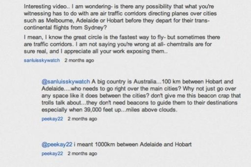
You'll love this one Bill. Peekay reinvents air navigation by the sheer power of his will! Screen grabbed from http://www.youtube.com/watch?v=KgM3Qb6DrOU

I can't wait for something like "don't give me this "landing flaps crap" or "don't give me this wings crap, who needs em' "
Reminds me of a conversation I had with a bloke who reckons they could just put windmills on the front of wings to store energy in batteries, then use all the energy to drive electric motors to power the turbines. Who needs fuel? it's the oil companies holding back brilliant ideas like that of course....


Beacons.jpg
 
Yeah there are 'air corridors' - or to give them their correct name, airways - and you have to plan via them. However once airborne and traffic permitting you can sometimes get short-cut direct to various places. Not likely during the day but pretty common late at night. I did mostly night freight operations in Aus and for example we'd get airborne out of of Sydney, head north out over the ocean then ATC would give us a 'track direct to Jacobs Well'. That's a navaid to the south of Brisbane and the standard arrivals often go over it, and because it's close to the city once you are their you pretty much have to follow the arrival route for noise abatement.

Edit - If you like I can attach some copies of the departure and arrival routes in & out of, say, Melbourne, so you can see why the planes go where they do. My stuff is out of date and they do move the airways around from time to time though so they may well be different.
 
Perhaps we should introduce them to the speed matching runway conveyor belt concept, or the 747 tug of war with a 16wheeler.
Their brains might get stuck in endless loop mode.
 
Perhaps we should introduce them to the speed matching runway conveyor belt concept, or the 747 tug of war with a 16wheeler.
Their brains might get stuck in endless loop mode.

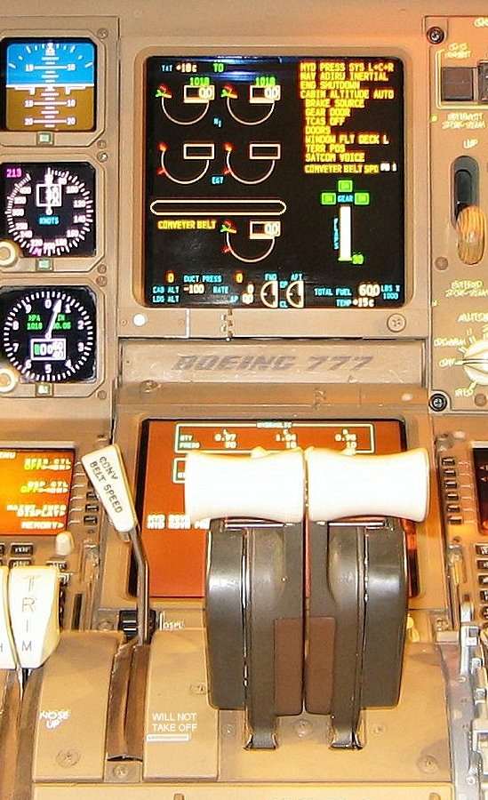
Here's a top-secret photo of the 777 cockpit ...


Sssshhhh ........
 
Last edited by a moderator:
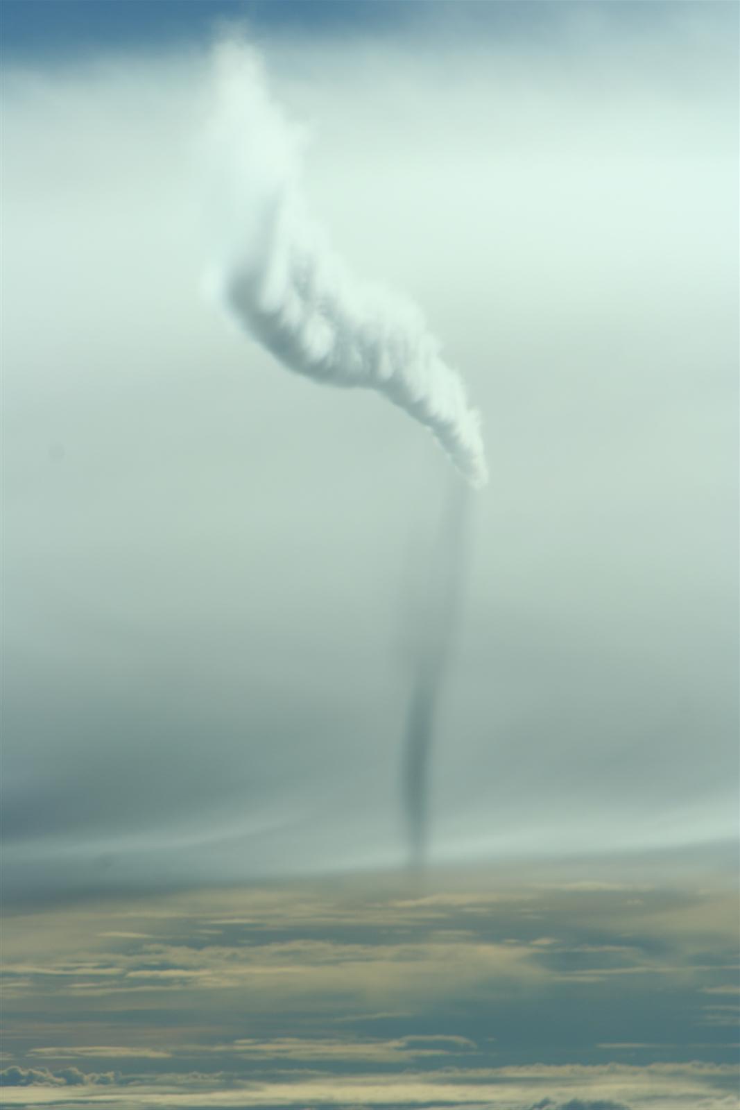
Found a couple of other photos.

This one was when we were going from Amsterdam to Kuala Lumpur, near the eastern side of India.


Very cool contrail that was unstable enough to expand into a proper cloud and also leave a neat shadow coming down from it as well.

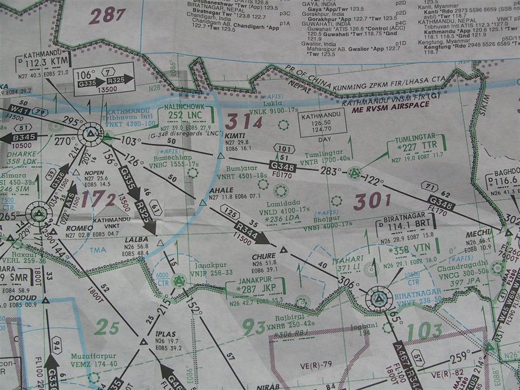
And here's a small section of one of the aviation charts we used to use.


That's northern India, not too far from Mount Everest. The chart initially looks confusing but once you get used to them, they're easy.
 
Last edited by a moderator:
You'll love this one Bill. Peekay reinvents air navigation by the sheer power of his will! Screen grabbed from http://www.youtube.com/watch?v=KgM3Qb6DrOU

I can't wait for something like "don't give me this "landing flaps crap" or "don't give me this wings crap, who needs em' "
Reminds me of a conversation I had with a bloke who reckons they could just put windmills on the front of wings to store energy in batteries, then use all the energy to drive electric motors to power the turbines. Who needs fuel? it's the oil companies holding back brilliant ideas like that of course....


Beacons.jpg
OMG!!!

I can't believe I actually just read that.

Those who talk about navigation beacons are "trolls" now....

Unbelievable.

Great post.
 
Why is he so obsessed with planes flying "right over the main cities"? He's so obsessed with filming "chemtrails" he has to have noticed that the trails pretty much never stay in place (unless the plane happened to be flying directly upwind or downwind).
 
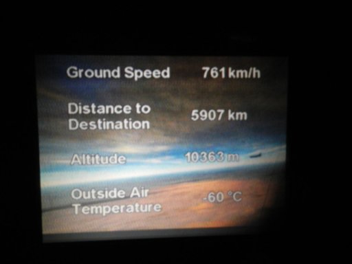
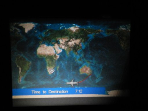
Thought anyone might be interested in an actual inflight image of the wicked QF63 from my chemtrail fact finding flight to South Africa purely for Peekay22's benefit... and to get to Namibia.
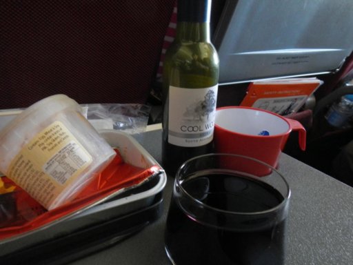
My goodness the NWO passengers get served Shiraz! Oh the humanity! Note the suspicious deviation over the French antarctic islands from surely shorter thedamo63 and peekay22 straight-line on flat map route.
It's minus 60degreesC up there! I'll try to get some pics of the inflight temperature over Australia on the way back in about 8months.
Peekay and thedamo63 were talking in a recent video about how they ran outside and thought it was a hot day so ice crystals couldn't possibly form at Airliner altitude.
The concept of lapse rate doesn't seem to be sinking in.

DSCN0021.jpgDSCN0022.jpgDSCN0019.jpg
 
For anyone interested... I have warned PeeKay what to expect if any Qantas pilots are harmed by him or his bunch of delusional followers. AIPA's lawyers will have a field day with his videos.

Mike
 
Not to mention whatever passes for the public prosecution service in Aus.

But alas I think your "warning" will probably simply be seen as an attempt to censor him - further proof that TPTB don't want anyone knowing about "this" (despite his drivel having been up for months already).

But perhaps it would be a good idea to get copies of his videos just in case he does withdraw them?? After all they might be valuable evidence one day & he shouldn't be allowed to tamper with it.....;)
 
Does RH ever show up on the inflight screen or elsewhere on the flight data? That would be useful information to show when contrails should be formed.
 
Icing's usually from supercooled water droplets, not accretion.

The presence of supercooled water droplets would normally indicate a high humidity, but the converse is not the case.
 
Icing at cruise altitude is generally not an issue. I have used wing anti-ice once in my career, on climb out of Christchurch one winters night. Flying through cirrus clouds usually presents no problems. We only use engine anti ice when in cloud and the temp is higher than -40c.
 
Icing at cruise altitude is generally not an issue. I have used wing anti-ice once in my career, on climb out of Christchurch one winters night. Flying through cirrus clouds usually presents no problems. We only use engine anti ice when in cloud and the temp is higher than -40c.

Not a bad effort - I flew the 747 for ten years and I'm pretty sure I never met anyone that had ever used the wing LE anti-ice gear.
The nacelle anti-ice got used quite a lot of course.
 
I've emailed Peekay and thedamo63 detailed links to crow instability but they even bring the term up in their comments and then dismiss it as BS.
Since Peekay dismisses any length contrail as being a "chemtrail" and refuses to read any links that explain the science it seems all to be water off a ducks back.
 
Hello everyone

This is my first and probably only post here, but I have visited a few times.

Anyway I was in a newsagent in Australia recently and saw one of those conspiracy magazines emblazened with a quote about chemtrails on the cover. Picking it up I noticed that the article was written by the very same peekay22.

Link to the online article is here:

http://thenaturalresponse.org/are-commercial-airlines-spraying-chemtrails-over-australia/

He's not hiding his identity any more.
 
Got a 404, the page has moved here: http://thenaturalresponse.org/are-commercial-airlines-spraying-chemtrails-over-australia/
BTW, have you ever considered inviting a psychologist to join the discussion(s)? Or at least have one advise on how to deal with delusional people? Could be interesting...
Fun site but I don't quite get why all of you care so much about all the conspiracy theorists. Don't get me wrong, I think it's great that you're trying to do something about the whole paranoia, but why bother?
 
Fun site but I don't quite get why all of you care so much about all the conspiracy theorists. Don't get me wrong, I think it's great that you're trying to do something about the whole paranoia, but why bother?


Hi Bob, Have a read of the https://www.metabunk.org/threads/251-Advocating-violence-against-quot-Chemtrail-quot-planes thread.
It's inquisitive and probably obsessive folks like us amongst the public that sometimes spot these paranoid folk and hopefully draw attention to them and prevent anything bad from happening to others.

Some folk spend ages arguing on forums about motorcycles, or the best steam trains, or baseball scores etc
Speaking for myself only here I couldn't give a rats' about team sports and all my hobbies revolve around either travel, science, engineering innovations, history, aviation and fluid dynamics. So chemtrails sort of hits a sweet spot that involves many interests. Most of the other posters here seem to have a similar eclectic range of interests and fascination with both aviation and the psychology of paranoia, belief etc.

It's also a sort of challenge that's addictive.
A mental puzzle to try to solve.
What's the best way to explain reality to someone to help relieve them of the anxiety of the conspiracy belief? Every person is different.
It's pretty obvious that people suffer and are fearful and often miserable as a result of the chemtrail belief so it's not as though we are trying to knock away a comforting belief in the forgiveness of Jesus or the omniscience of Ahura Mazda or Buddha etc.
When someone writes a note back saying thank-you for relieving them or their friends or family of needless fear, that is very satisfying and an encouragement to continue to help others.
 
Last edited by a moderator:
Hello everyone

This is my first and probably only post here, but I have visited a few times.

Anyway I was in a newsagent in Australia recently and saw one of those conspiracy magazines emblazened with a quote about chemtrails on the cover. Picking it up I noticed that the article was written by the very same peekay22.

Link to the online article is here:

http://thenaturalresponse.org/are-commercial-airlines-spraying-chemtrails-over-australia/

He's not hiding his identity any more.

What I really like about that article is that it's been hammered by spambots giving it the old 'great article!', 'bookmarking for later', 'you raise interesting points' treatment, and Editor Al is actually responding to them. Priceless.
 
What I really like about that article is that it's been hammered by spambots giving it the old 'great article!', 'bookmarking for later', 'you raise interesting points' treatment, and Editor Al is actually responding to them. Priceless.

That's actually kind of interesting, as it's possibly indicative of the kind of obliviousness that's required to stay in the rabbit hole - reading things without really understanding what they mean, projecting your own hoped-for meaning onto everything.
 
What I really like about that article is that it's been hammered by spambots giving it the old 'great article!', 'bookmarking for later', 'you raise interesting points' treatment, and Editor Al is actually responding to them. Priceless.

after reading all those friendly trojan comments, I know I shouldn't but I'm finding it actually quite hilarious.
 
Matt from Australians against Chemtrails and other FB pages again makes his appearance with his claims about Relative humidity and how contrails should rarely occur in Northern Australia. He is using the correct graph, but somehow thinks that Sea level temperature and RH are the parameters to be used. :confused:
 
Yeah, it's quite amazing how many people claim contrails can't form, as it needs -40 degrees, and it's in the 90's. It's quite a hard thing to explain to people if they are resistant to new ideas.
 
I recently had a little success with pointing people to sites with Skew-T diagrams, based on weather balloon measurements.

Once the dew point and the temperature curve are explained (and how to read their scale) they can see for themselves:

  1. the temperature measurements in the high altitude levels
  2. the sometimes wild variation of humidity within small altitude increases
On sites providing the available soundings for the U.S., it does not take long to find a recent diagram from places known to be hot and dry which shows dew point jumps and cold temperatures on the common flight levels.

Mick, I'd even suggest a blog article regarding this subject. The diagrams are not easy to dismiss - they just need a bit of explanation (metric scales, help on reading absolute values).

Together with the "cloud argument" they can help with understanding the inhomogenity of the atmosphere.

 
Just saw this on Facebook:

Can anyone tell me how you have hail storms with temps that are in/near triple digits (CA)? Or monsoon conditions in Utah & New Mexico?
This was in the weather report on KTLA this morning.
Content from External Source
The average person, quite understandably, knows very little about how the weather actually works. If we are to teach people about the weather, the first thing we need to ensure they understand is that it gets colder as you go higher.

Skew-T diagrams are, I think, too complicated for most people. Very few people are going to get past their distrust of science long enough to spend the time learning how to read them. Most people don't even undersand "humidity", and think that 100% humidity is underwater.
 
"If we are to teach people about the weather, the first thing we need to ensure they understand is that it gets colder as you go higher."

I've found Mt Kilimanjaro is a good example for people. Most people have heard of it. It 's just under 6000m high, it is in tropical region of Africa, only 250 miles roughly from the equator, yet has a glacier on it, and snowcap most of the year round. A photograph of it usually lets people realise themselves that it gets colder as you get higher.
 
Back
Top