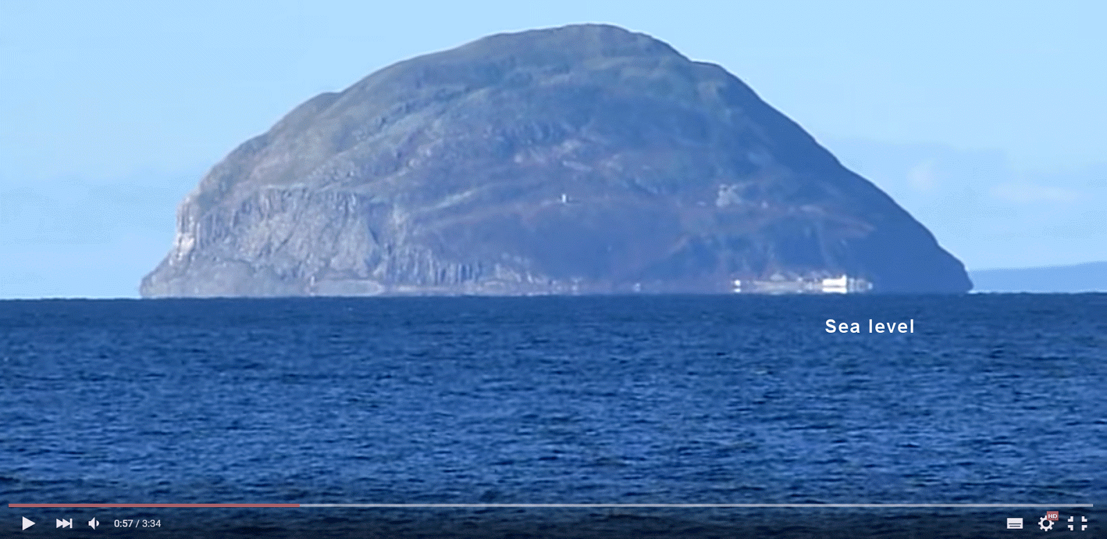
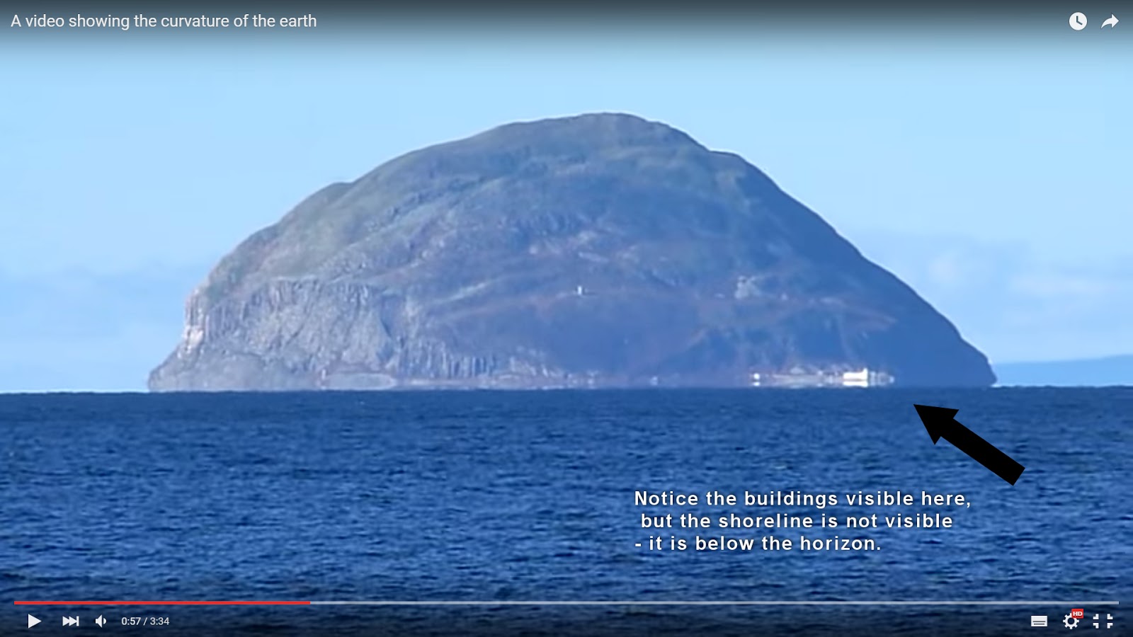
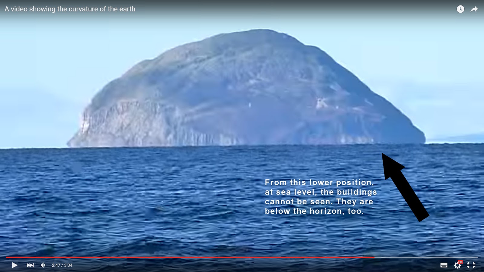
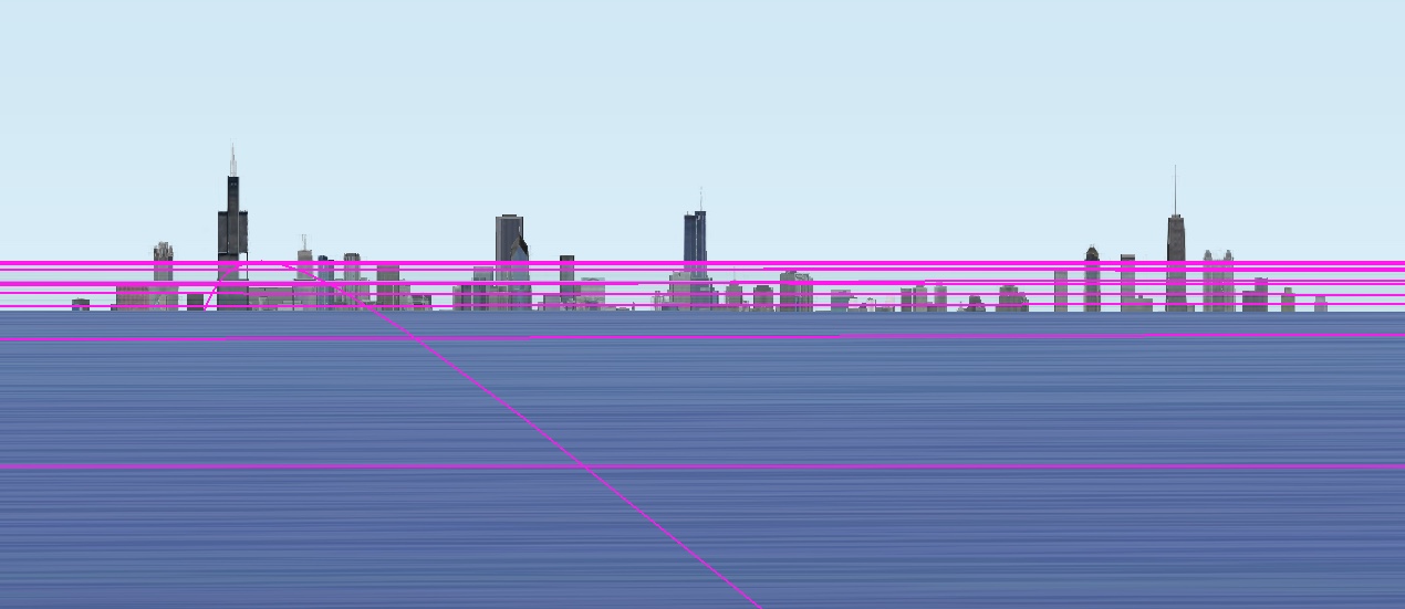
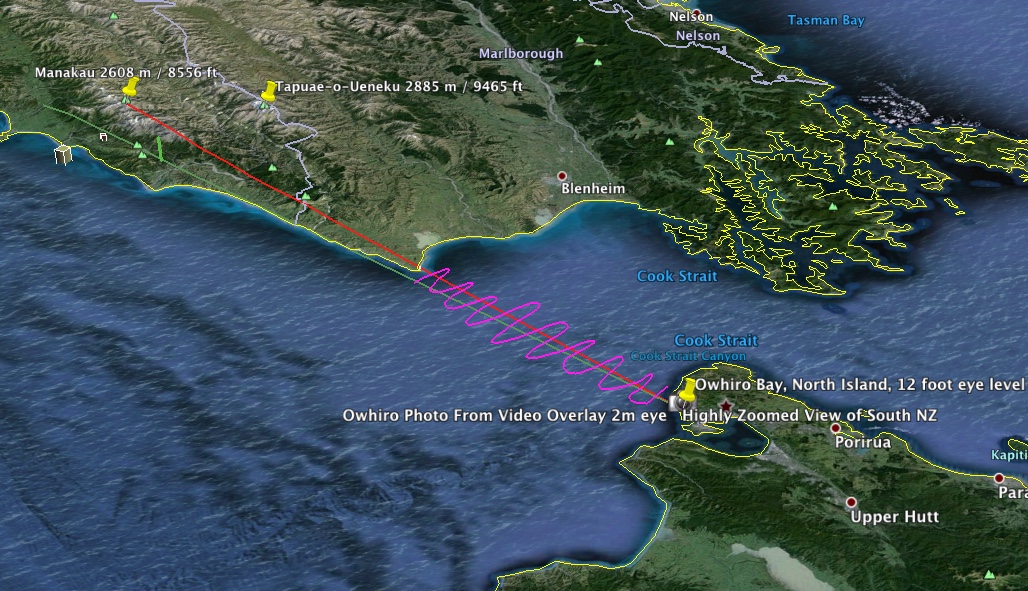
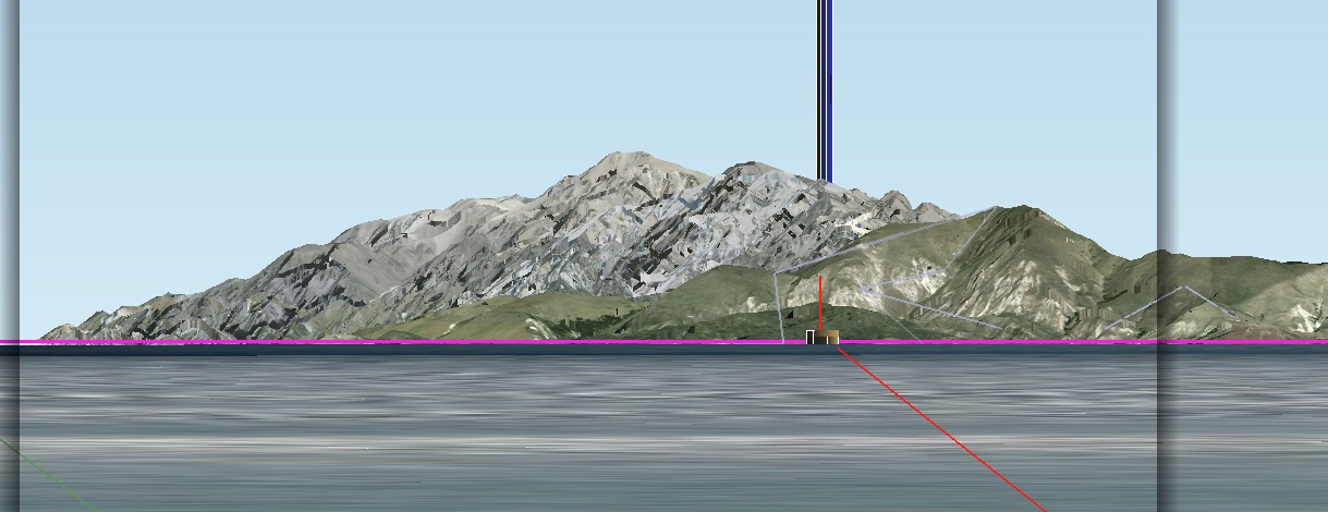
Reports and photographs claiming that visual observers can detect the curvature of the Earth from high mountains or high-flying commercial aircraft are investigated. Visual daytime observations show that the minimum altitude at which curvature of the horizon can be detected is at or slightly below 35; 000 ft, providing that the field of view is wide (60°) and nearly cloud free. The high-elevation horizon is almost as sharp as the sea-level horizon, but its contrast is less than 10% that of the sea-level horizon. Photographs purporting to show the curvature of the Earth are always suspect because virtually all camera lenses project an image that suffers from barrel distortion. To accurately assess curvature from a photograph, the horizon must be placed precisely in the center of the image, i.e., on the optical axis.
...
Interviews with pilots and high-elevation travelers revealed that few if any could detect curvature below about 50; 000 ft. High-altitude physicist and experienced sky observer David Gutierrez [6] reported that as his B-57 ascends, the curvature of the horizon does not become readily sensible until about 50; 000 ft and that at 60; 000 ft the curvature is obvious. Having talked to many other high fliers (SR-71, U2, etc.), Gutierrez confirms that his sense of the curvature is the same as theirs. Passengers on the Concorde (60; 000 ft) routinely marveled at the curvature of the Earth. Gutierrez believes that if the field of view (FOV) is wide enough, it might be possible to detect curvature from lower altitudes. The author has also talked to many commercial pilots, and they report that from elevations around 35; 000 ft, they cannot see the curvature

")
")