Scott Gates
Active Member
No time for much detail, mostly conceptual,
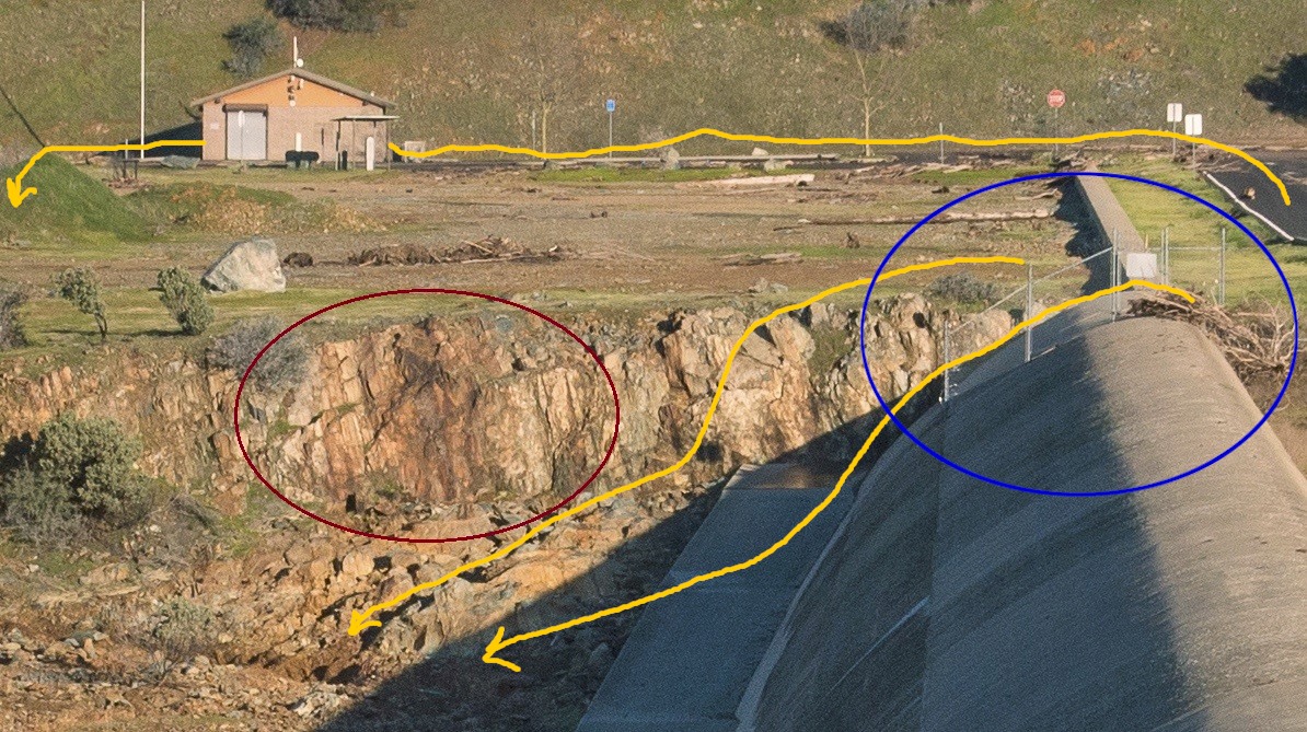
Haven't had time to look at topography or geo map at this point (first image, road bend, post #506) What I see here are stress cracks , water stains still visible suggest very wet underneath, likely cause. The giant ogee weir is almost certainly a very robust structure IF foundation holds. The smaller longer rectangular is an area of concern. Clearly not expected to handle same flows as Ogee, hence less robust. Key issue here is elevation. Higher elevation is your friend, lacking that a problem area could be isolated with sandbags forming a diversion wall and pumping on the problem side of the sandbag diversion. Not pretty, but quick and, at least it lowers local hydraulic head and reservoir supply.
Understanding the problem is critical here , duct tape has it's uses , (not kidding, nor suggesting use here!) Plywood (and a bit of angle iron) extended the Glen Canyon Dam vertically and held back the entire Lake Mead (Lake Powell? poor geography, sorry) from overflowing the face of that dam. It raised the elevation of the entire lake substantially which increased reservoir volume enormously and bought them time. I mention this not as a particular technique, but as an example of clear conceptual thinking . The engineers knew at those low head pressures plywood absolutely could hold back the entire lake. No way to run a dam, under normal conditions, but, perfect in that situation.
Concepts here are channeling 100,000 cfs in a non destructive manner. Currently main spillway is doing that, that could change at any moment in a non-linear fashion . I choose 100,000cfs because it's been compared earlier to the Mississipi and Niagara flows. The big difference here from the Miss. is that the pitch from dam crest to river below is much steeper, additionally that hillside face hasn't been a well scoured riverbed anytime recentl, if ever. It's unlikely that there are many lasting examples of rivers of this flow that maintain an even grade with this much drop in this much horizontal distance .The erosion properties, including that rock alteration takes place sub-surface as well, and rock structure greatly influences resistance have been clearly described by Rock Whisperer. That hard bedrock also can form large hard coherent boulders which also act as very effective scouring and chiseling agents as they're propelled by water downhill.
Not exactly the right analog, but the concept of controlling a fire hose comes to mind, as well as the farther back on the hose from the nozzle one holds the squirrelier it gets. Control matters.
This is a very dynamic (including storm flows) situation.
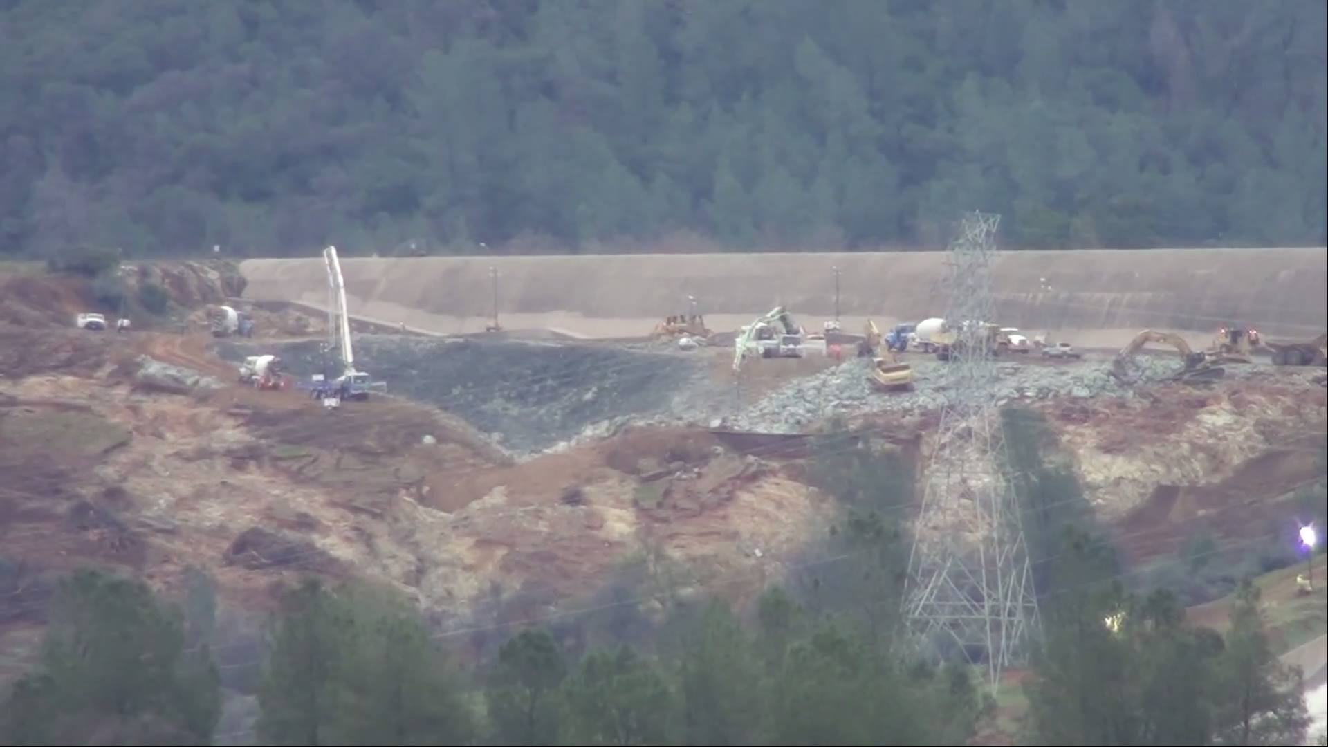
The problems with the parking lot section are serious - and being missed by most.
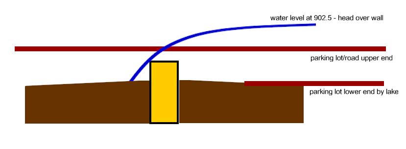
The concrete wall is NOT a weir - it is a narrow bit of concrete that sticks up one foot and is set just 2 feet in the ground.
"The right 800-foot section is a broad-crested weir on a bench excavation. "
More importantly the 800' parking lot section does NOT connect with higher ground. It stops at the access road to the parking lot. Water simply went around the end of the weir flowed down the inside ditch of the road and was cusing significant erosion all down the upslope side of the road. When that water reached a low enough road point it crissed over and help wash out the road.
If/when it actually washed out the road at the corner to turn into the parking lot - the road there is built of 30+ feet of fill. The down slope side is a big drop, which would have allowed a high volume flow to be drawn from around the parking lot weir.
That is why they are working so hard on the parking lot section.
That weir should be extended and until it reaches higher ground at back side of parking lot or it is both largely worthless and a significant failure point.
It was an issue even at 1.6 feet "head" above the 901 weir height ... the problem increases dramatically the higher the lake gets above 901