Pete Tar
Senior Member.
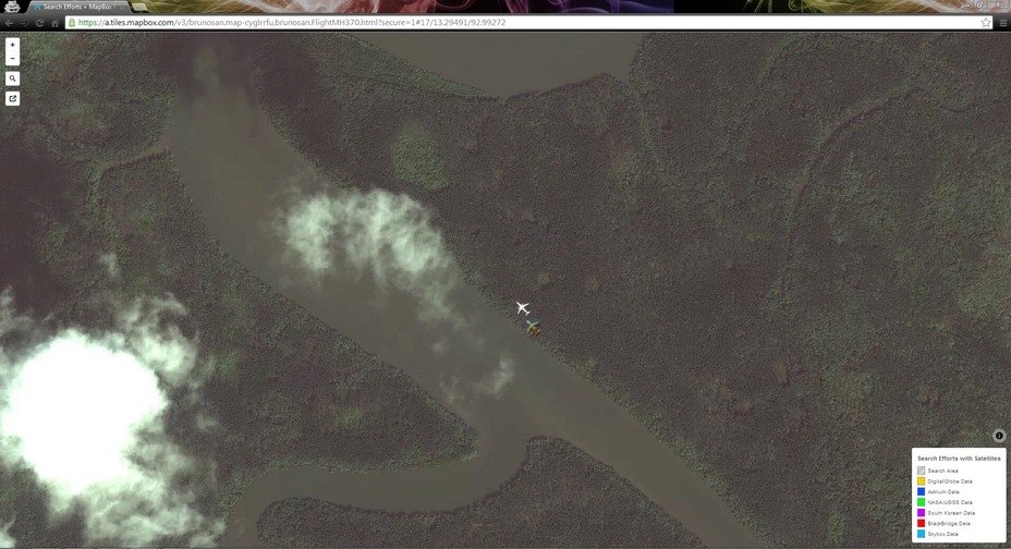
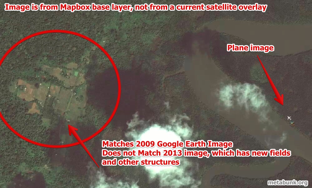
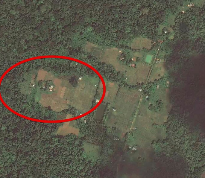
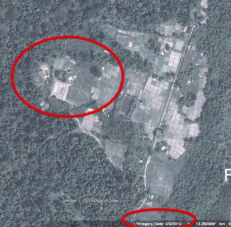
[Update: The plane only exists in the MapBox base layer, which dates from at least 2012 or earlier. It is not a current image, and hence does not show MH370 - See following posts for details]
Anyway to eliminate possible other flights, or confirm its height?
http://ireport.cnn.com/docs/DOC-1105961
As a part of the crowd sourced initiative to find the missing plane, I was going through some of the Satellite Imagery from Mapbox. I decided to look closer to my home country - India, precisely in the Andaman Islands, as some news reports suggested that data from Radar Navigational Waypoints showed the plane was flying toward India's Andaman Islands, a chain of isles between the Andaman Sea and the Bay of Bengal.
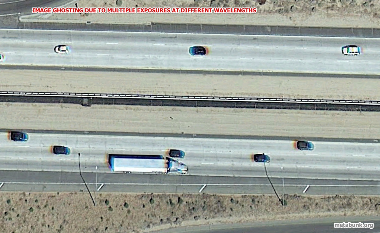
As I was scouring through the imagery (captured by DigitalGlobe Satellite QB02) , I stumbled upon what looked like a plane in the air. I was shocked & thought that this might be incorrect. I looked up the same coordinates on Google Maps. I did not find any signs of a plane (Coordinates:13.29431,92.99277).
From the image, you can see that this is a heavily forested area. You can actually see that the plane is flying very close to the ground, as the clouds appear to be way higher than where the aircraft is flying (The image appeares ghosted because of the speed of the flying plane). This could be a way of avoiding detection by ground based Primary Radar. Since the plane's Transponders were turned off, Secondary Radar cannot detect it either. I believe the plane might be headed further north from that point onwards.
Anyway to eliminate possible other flights, or confirm its height?
Last edited by a moderator:

")