Lake Balaton Laser experiment to determine the curvature of the Earth, if any.

Status
Not open for further replies.
I had wondered about that, but I'm using the yellow line (which I presume is the approximate water surface) and the top of the motor as reference. If it's not squatting, I don't think the yellow line can be correct.

There's also being able to see more of the people on board. There is a seat which looks to be in the middle, in front of the pilot, but the guy on the left appears to be standing all the way through. Maybe the photographer went to higher ground?

Ray Von


Ray the pictures are taken with a different teleobjective lenght - like 500mm in the beggining and 1200mm at the further measurement points

If the boat's rear is going downwards, that is even worse reading fo the GE model.
If we talk about refraction, that must have been upwards, that makes the readings also even worse for the GE model.

The question is: where do you see the beam for example at position C16?

at the FE model height 1.63 meters
or at the GE model height of 2.6 meters?

C16.png
 
Without several reliable points to plot it's impossible to tell. There's no guarantee the laser was level, but it wouldn't matter with enough data and reliable measurements, which we don't have.
 
If you see the laser beam above the board on the jacket, and the same time in the optics, that is because Nick bent his knees LOL

Do you understand that "LOL" is generally taken as a denigrating statement? Do you have ANY photographic evidence that Nick has "bent his knees" at that point?

I ask again: WHERE do you see the laser beam?
at 1.63 meters OR at 2.6 meters?

please answer simply

It depends upon which inset image one looks at. In one, it shows. In the other, it does not.

Where do you determine the divergence of the laser beam at this distance? Please answer simply.
 
If you see the laser beam above the board on the jacket, and the same time in the optics, that is because Nick bent his knees LOL

Do you understand that "LOL" is a denigrating inclusion to a response? Do you show any evidence that Nick has "bent his knees" at that point?

I ask again: WHERE do you see the laser beam?
at 1.63 meters OR at 2.6 meters?

please answer simply

It depends upon which inset image one is talking about. Where is your assessment of the divergence of the laser beam at that distance? Please answer simply.
 
THANKS, this is awsome, I am still evaluating my reading!

you knwo, that this is the same people and university that I am preparing my presentation for?

No wonder they were very interested to see my experiemnt results.

upload_2016-9-7_2-12-40.png
? "level" here doesn't mean flat. also, i dont want to look into the history of this paper too much but they are consistently talking about a geoid... so the paper is probably not saying what you think it is.

also the version linked here is apparetnly not the final version. as the corrections he talks about in the discussion arent in this paper. Perhaps you can find a "final version", or ask them for it for us?
The intention was to have exactly the same colours in the large map and the inset, this will be corrected for the final version. http://www.solid-earth-discuss.net/6/C178/2014/sed-6-C178-2014.pdf
Content from External Source


WELL I did read the WHOLE article and it states that the water surface is level straight.
I will talk to them and get all final docs.
 
Found a useful reference:
the topographic surface? i never would have guessed ellipsoidal shape height meant that! :)

Bill Nye the Science Guy is supposed to have a new series next year where he explains "CT" type stuff, hopefully in his laymen science way. I'll know more then. Hopefully.
 
Am I reading this correctly? Are people asking if variances in geoid height might be a factor in local earth curvature experiments?

Well gosh darn if I haven't been saying this for months. ;)

Also, are we still debating the "direct hit into the camera"? Perhaps we could focus on that and get some agreement.

As far as I can see, the fact that the camera can see the laser tells us nothing about the height of the beam at the point of the camera.

Sandor, do you agree?

[MODERATOR: Example of Canandaigua Lake, NY, USA "Flat Earth experiment" (showing? a flat earth) moved as it is a seperate claim of evidence https://www.metabunk.org/canandaigua-lake-ny-usa-flat-earth-experiment.t7901/ ]

Did you know that sometimes a huge amount of Corsica can be seen from Genoa, over 95 miles away, when - to borrow the phrase - "it should be hidden behind thousands of feet of curvature"?

Again, does this prove that the earth is flat? Or does it perhaps suggest that further analysis needs to be done?

I believe there's something quite pertinent to learn from these two genuine - and accepted - examples of apparent lack of curvature with regard to all this.[/b]
 
Last edited by a moderator:
believe there's something quite pertinent to learn from these two genuine and accepted examples of apparent lack of curvature with regard to all this.

Probably that Refraction is hard to account for and we know it can be extreme over water. As shown by https://www.youtube.com/shared?ci=AcV346e6ysw

image.jpeg


Here is a slam dunk. This is level from Apple Pie Hill - professional surveyor using a Theodolite. Signal WAY above measurement error. http://flatearthinsanity.blogspot.com/2016/08/analysis-apple-pie-hill-to-philadelphia.html

image.jpeg

But these guys insist on replicating the failure of Rowbotham.
 
@Sandor Szekely , I think there is a huge misunderstanding regarding beam spread since the beginning.

In post #30, AUG/1st, two weeks before you experiment, you said your divergence would be 0.3 mRad, and you were warned the spread would be 69cm:
Basically this. You'll recall a radian is a segment of a circle with arc length equal to the circle's radius. If you have a radius of 23,000m (23km) and beam divergence of .00003 Rad (.03 mRad), your spread is the product of the two: 69cm/27".

To what you agreed and replied in post #32 that the divergence would be actually 0.003 mRad, so this was accounted for ...
SORRY, I wanted to say 0.003 mRad collimator lenses.
... This is ONE OF A KIND in the world especially made for this experiment! ...
Thanks for pointing me out to the correct number Spectar Ghost

To what Darkstar responded it was not even physically possible:
... 0.03 mrad really WOULD be amazing ...
... [0.003] was pointed out as IMPOSSIBLE and beyond even theoretical limits ...
... So there is NO WAY you got 0.003 mrad, not even in THEORY ...

After some time you shared more exact info on the colimator ...
You miss understood something - the divergence is huge without a collimator.

We had a perfect collimator for the job :)

here are the details of the laser and camers of the experiment

Laser: 3W laser – adjustable collimator – 0.08mRad divergence

So, the 0.03mRad you initially estimated would already be a low precision colimator, as you also agreed in post #32, AUG/2nd, but you ended up using one that was 3 times LESS precise, stating it was the perfect colimator for the job. On top of that you didn't account for any better method of measuring other than an estimation on a direct hit.

Please refer to
https://www.laserworld.com/en/laserworld-toolbox/divergence-calculator.html
to play around with calculations ...

Sandor, you knew that a 0.03mRad colimator was not a suitable tool for this experiment, and you now know that the 0.08mRad one that you used causes a 80cm spread (without taking into account any other external factors).

Are you still going to rely on your experiment, putting all your chips and your name on an experiment that brought no accurate measurements?

Before answering that, please remember that you are ...
... an inventor with a state reward not a kid from the block
SA.jpg
 
Interesting that that uses the exact same bit of lake:
20160906-135106-tetxt.jpg

I'm not clear what it means though. But there seems to be a 20cm deviation in the surface of the lake from the expected heigh from the north to south shores in the inset section.

You could probably increase that a bit as the authors and data do suggest that the model is somewhat smoothed compared to reality.
 
I ask again: WHERE do you see the laser beam?
at 1.63 meters OR at 2.6 meters?

please answer simply

I am not sure I have no way of telling form the picture if the hight estimations are actuate

more to the point can you explain why you think it should be 1.63 or 2.6 meters what are you basing those fingers off and are you sure that that is actuate?

it seames to me that you should not be tryign to compair your hights to what you think the hights should be on FE and GE but you should be plotting your results and seeing what sort of shape they give. form the figers and graphs you should be able to see ore clearley what was happening.
 
Hey lets not start a new conspiracy. Here's the NUDTZy back story. Sandor was asking me what the name of that area just above the water was. He was calling it the refraction zone but I didn't think that was accurate enough so we came up with a description that seemed to accurately describe and lounged when it sounded like NUTS :) Then I thought I would create my first wikipedia page and see how that worked just to find out it got deleted 12 hours later. Non Uniform Density Transition Zone doesn't describe the area and suggest what would happen with light refraction in that area? Anyway not important enough to waste time on. Lets focus on the data!
 
Hey lets not start a new conspiracy. Here's the NUDTZy back story. Sandor was asking me what the name of that area just above the water was. He was calling it the refraction zone but I didn't think that was accurate enough so we came up with a description that seemed to accurately describe and lounged when it sounded like NUTS :) Then I thought I would create my first wikipedia page and see how that worked just to find out it got deleted 12 hours later. Non Uniform Density Transition Zone doesn't describe the area and suggest what would happen with light refraction in that area? Anyway not important enough to waste time on. Lets focus on the data!
It's fairly important when the video tries to pass something, even terminology, off as fact. It's dishonest! That's also not how Wikipedia works, although I won't go off topic here by explaining how to use a resource like Wikipedia properly. Your video should probably state that you have "coined" the phrase purely for the purpose of the video, and that it is in no way factual! Because if it was factual, it would have a Wikipedia entry, wouldn't it?
 
Hey lets not start a new conspiracy. Here's the NUDTZy back story. Sandor was asking me what the name of that area just above the water was. He was calling it the refraction zone but I didn't think that was accurate enough so we came up with a description that seemed to accurately describe and lounged when it sounded like NUTS :) Then I thought I would create my first wikipedia page and see how that worked just to find out it got deleted 12 hours later. Non Uniform Density Transition Zone doesn't describe the area and suggest what would happen with light refraction in that area? Anyway not important enough to waste time on. Lets focus on the data!

Not important ? well you guys just used it for quickly shake off the fact that instantly debunks flat earth , namely the curvature obscuring objects from bottom up. And you posed as an authority on the subject with clear and proven theory about NUDTZ. But you cant even define it clearly...
 
So in summary:
  1. The collimater by its own specs could not have reduced the beam divergence to be as small as claimed. So beam divergence was not controlled for.
  2. Direct hits were not controlled for and thus any data after a certain distance is invalid and the video evidence even indicates that claims otherwise are unsubstantiated (i.e. showing indirect hits at points).
  3. Boat speed and distances indicated by the data don't line up at some points calling the reliability of the data into question. Additionally, the speed of the boat is evidently far too fast for precise hits to the camera to have occurred IF beam divergence was negligible. It would have been nigh impossible for a fast moving boat to remain precisely aligned.
  4. Refraction was not controlled for and seemingly explained away as an effect of the camera lens (or did I miss something?). Additionally, no data on any gradients presence were taken despite mirages being sufficiently evident. Not that I believe it would be possible to compensate without a ridiculous amount of measurements and curve fitting, but to ignore it out right unscientific.
  5. Single points of data were taken and no graphs were produced. As a result of the lack of measurements, error and variance in measurement were not calculated.
  6. This particular part of the lake is apparently extra 'level' by elevation standards? But, elevation doesn't measure curvature and equipotentially level doesn't mean flat so that's not particularly relevant.
Items 1-5 mean that no claims can be made by scientific standards. At the very least given all of the non-controlled variables, a confidence metric of some sort was needed (i.e. lots of and lots of points of data at the same locations along the path, as well as a computation of the variance at the very least). That would have given an idea about the reliability of the claims being made in spite of the variables present. Without which, it's pretty much a fundamentally flawed experiment.

As a bit of a digression, I'm not really surprised to see these things being ignored and this being used as proof regardless. I do question the intentions of the experimenters and why the experiment was done in the manner it was. But, I suppose that is immaterial in the face of the rest of the issues presence here with the experiment itself.

EDITED to account for what Ray Von said. He's right.
 
Last edited:
Thanks for the reply Sandor

Ray the pictures are taken with a different teleobjective lenght - like 500mm in the beggining and 1200mm at the further measurement points
Understood, but I don't think that really explains how we can see more of the people on the boat over the top of the board. Wouldn't that indicate a change in angle somewhere?

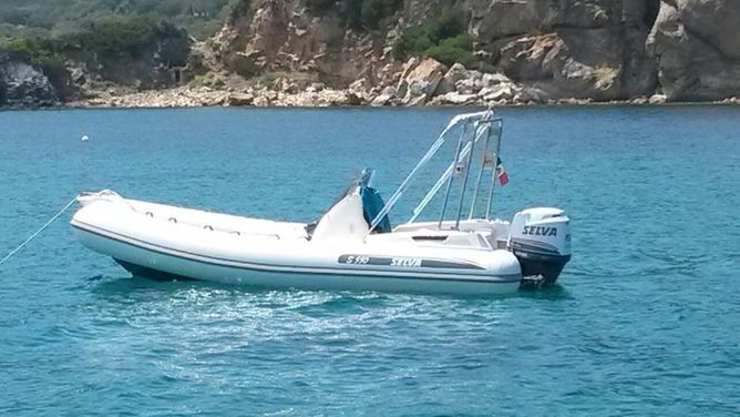
Just to illustrate why I think you need to take into account, here's a picture of a similar boat at rest


and a video of one in motion


If the boat's rear is going downwards, that is even worse reading fo the GE model.
If we talk about refraction, that must have been upwards, that makes the readings also even worse for the GE model.
Well, not if the rest of the boat is actually raised and you're measuring height within the boat ;)

That's not even the point though, the point is that you should have tried as much as possible to get accurate data, and you've no apparent way to show whether it's accurate or not. Where are the close-ups of the measurements on the boat for example?

It's really not about whether more accurate results would be better or worse for whichever model, it's about the accuracy of the results. That statement alone causes me concern that you'd rather make data fit a conclusion than the other way around. Data vs opinion - which one do you think that statement is apparently most reliant upon? ;)

You were advised to measure with the boat flat, you were advised to keep people in as near the same position as possible, you were advised to have some method to show your measurements. I'm happy to be corrected if wrong, but did you follow any of that advice, and if so where's the evidence?

The question is: where do you see the beam for example at position C16?

at the FE model height 1.63 meters
or at the GE model height of 2.6 meters?

C16.png
On C16 I see a "blob" of light which looks to be on the pilot's jacket, I can't see anywhere that shows how big it was, how the height was measured or anything like that, and that's the same with all the images I've seen so far.

Out of interest, the pilot's jacket is clearly white but was it also reflective? Of all the photos I've seen the only place the beam is visible is on the white board and jacket, it'd be interesting to confirm that it's not just that it doesn't show up on anything else (like the people in darker colours) and that's why we don't see the total spread (like the significant spread visible in the other photos). Again, close-ups would be very useful here.

On divergence, I've also seen your claims about the beam and "direct hits on the camera", which aren't borne out by your photographs. Look at the green splotches on the inset photos of the board in C11 and C12 for example, The beam is all over the place. Do you think that, had it'd been dark, those pictures would look much different to the other night-time ones that showed obvious divergence problems?

Ray Von
 
Last edited:
Just as an observation, can we take a bit of the heat out, pretty please :)

I could be wrong but I've not seen anything that links Steve directly to the experiment or Sandor? There are many (I think) legitimate criticisms of the experiment that many of us would like to see Sandor address and on past history accusations are unlikely to help.

Much better to stick to the methods and results of the experiment itself.

Ray Von

Fair assessment. It's true that Steve may not have been involved. I edited my post accordingly.
 
Just as an observation, can we take a bit of the heat out, pretty please :)

I could be wrong but I've not seen anything that links Steve directly to the experiment or Sandor? There are many (I think) legitimate criticisms of the experiment that many of us would like to see Sandor address and on past history accusations are unlikely to help.

Much better to stick to the methods and results of the experiment itself.

Ray Von
Steve was involved in the evaluation of the data and creating the 3d animation for the video according to the description of the video that is being presented. Sandor and Steve are also friends on Facebook. So although he may not have been present on the two days the experiment took place he most certainly was given access to all/much more of the data than anyone else here on Metabunk. So I feel he should be very able to answer questionson the data we're seeing in the video, he's supposed to have understood the methods enough to evaluate it.
 
My dictionary doesn't agree with that statement.

Level:
adjective
1 having a flat and even surface without slopes or bumps: we had reached level ground.
How about this then, in scientific terms when speaking about something on the scale of a planet, level does not mean flat. What you did there was cherry pick an example of something that suited your idea! Look at the broader picture instead of jumping to conclusions.
 
Not important ? well you guys just used it for quickly shake off the fact that instantly debunks flat earth , namely the curvature obscuring objects from bottom up. And you posed as an authority on the subject with clear and proven theory about NUDTZ. But you cant even define it clearly...
From a flat earth perspective, it describes the area accurately but lets not distract from the test results. Sandor was simply trying to explain the effect where objects near the surface get obscured by multiple angles refracting. I was trying to help him and couldn't find any reference to it being described that way. Of course science is going to describe in relation to the slope but we found no evidence of a slope. Only evidence of refraction near the surface that obscures objects. This doesn't effect the test results at all so lets focus on those instead. The test refutes spherical earth and finds no evidence of ANY curvature. I'm working on a graph now to plot the data points over the distance to show that it is a line. I recall Mick wanting exactly that type of data in his simplified version of the test which is what was actually performed. Multiple readings over the distance. Have you tried graphing it already Mick? The data is there for any one to do this.
 
From a flat earth perspective, it describes the area accurately but lets not distract from the test results. Sandor was simply trying to explain the effect where objects near the surface get obscured by multiple angles refracting. I was trying to help him and couldn't find any reference to it being described that way. Of course science is going to describe in relation to the slope but we found no evidence of a slope. Only evidence of refraction near the surface that obscures objects. This doesn't effect the test results at all so lets focus on those instead. The test refutes spherical earth and finds no evidence of ANY curvature. I'm working on a graph now to plot the data points over the distance to show that it is a line. I recall Mick wanting exactly that type of data in his simplified version of the test which is what was actually performed. Multiple readings over the distance. Have you tried graphing it already Mick? The data is there for any one to do this.

And which data you want to plot ? The one smaller batch measured with a not so pinpoint ribbon ruler or the ones that are guesstimated by camera, and shining on jackets, or both ?
 
Steve was involved in the evaluation of the data and creating the 3d animation for the video according to the description of the video that is being presented. Sandor and Steve are also friends on Facebook. So although he may not have been present on the two days the experiment took place he most certainly was given access to all/much more of the data than anyone else here on Metabunk. So I feel he should be very able to answer questionson the data we're seeing in the video, he's supposed to have understood the methods enough to evaluate it.
I definitely will answer any questions that I can! It is true I was given access to the data but I think that same data is publicly available. Sandor, Zack and I spent many many hours going over the data. I was modeling it based on all known evidence. I wasn't at the location but I was following it from the beginning of this thread. I liked the direction Sandor was taking and how receptive he was to good scientific evaluation no matter what the outcome. Yes he believes it's flat, because he's personally done the test and also analyzed the data. I believe our next test will remove absolutely all test and will address the main complaints about this one. The few weeks I've known Sandor, I can say he is going all the way with this and the results will get more obvious as test goes to longer distances.
 
How about this then, in scientific terms when speaking about something on the scale of a planet, level does not mean flat. What you did there was cherry pick an example of something that suited your idea! Look at the broader picture instead of jumping to conclusions.
I just looked it up in my dictionary. Why don't you post a reference that supports your statement. Sandor will talk to them directly so he can ascertain what they meant by level.
 
And which data you want to plot ? The one smaller batch measured with a not so pinpoint ribbon ruler or the ones that are guesstimated by camera, and shining on jackets, or both ?
The ones in the video and also shown on the animation with photo evidence. If you have a dispute with the evidence, Sandor is more than willing to answer any questions as he has been doing.
 
Level surface: A level surface is defined as a curved surface which at each point is perpendicular to the direction of gravity at the point. The surface of a still water is a truly level surface. Any surface parallel to the mean spheroidal surface of the earth is, therefore, a level surface.
Content from External Source
http://www.civileblog.com/levelling/
 
I just looked it up in my dictionary. Why don't you post a reference that supports your statement. Sandor will talk to them directly so he can ascertain what they meant by level.

It's a matter of scale. Clearly, a piece of ground where you are standing which has some "bumps" isn't "level" across the bumpy spots. If the Earth was as smooth as a billiard ball, but expanded to Earth-size, what was formerly called "smooth" would be pretty bumpy. A perfectly smooth sphere the size of Earth would appear to be completely "flat" to someone standing on it, but actually it is not.
 
If you have a dispute with the evidence, Sandor is more than willing to answer any questions as he has been doing.

we do and we have but he seamed to be ignoring the point we have sevral times asked the simple question

"how do you know that the camera hits where direct hits"
 
Status
Not open for further replies.
Back
Top