Debunked: Radar anomalies and severe weather

solrey

Senior Member.
Here's a dutchsinse vid from 6/16/2013 where he claims that tornadoes were spawned by a radar spike afflicting the Central Illinois radar KILX in Lincoln, IL. He thinks that strong stationary returns seen on a composite map were severe storm cells.

http://www.youtube.com/watch?v=7iPbCapfyxQ

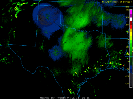
At the 0:27 mark he goes to the nearby WSR-88D radar out of Chicago, IL where those storm cells DO NOT APPEAR, although if those cells were real they should have also been detected by the radar in Chicago. So he quickly moves from the Chicago radar to the Lincoln radar. That little sequence from 0:27 to 0:35 proves that the radar signature is unique to the Lincoln radar only and not detected by adjacent radar stations. This means they were not actual storm cells. Looking at the radar from Lincoln, IL this morning, the spike is still there and the purple color code indicates "range folding" which means the source of the spike is likely outside interference such as a cell tower or it could even be internal noise. The strong isolated returns could be the result of switching Volume Coverage Patterns and their stationary nature indicates that the next few volume scans did not happen for some reason. In that situation the last volume scan from that particular radar will be momentarily "frozen" on the composite maps.

And there was no severe weather reported in those locations.


In another thread I detailed the fact that Intellicast is owned by The Weather Channel Companies. Intellicast and TWC seem to be using the same or similar rendering software. Michael "dutchsinse" Janitch claims multiple systems in the above vid:

(storm returns detected by multiple storm tracking systems on Intellicast and the Weather Channel).
Content from External Source

The RADAR pulses showing as , AND DESIGNATED AS possible tornadoes, damaging winds, as well as strong cell thunderstorms with hail.

This pulse producing a storm return, is another example of Radio Frequency heating having a PHYSICAL EFFECT on the weather, not just RADAR for observation, but manipulation of incoming systems, and in this case real life storm creation.
Content from External Source
No, Michael, this is yet another example of you making stuff up about technology you don't understand at all.

Edit:
Oh, and "strong cell thunderstorm" is NOT a proper meteorological term. The term "strong cell" is just a label used on Intellicast maps to indicate an area of stronger precipitation and/or convection.
 
Last edited by a moderator:
Those stationary strong returns actually appear to be wind farms. The locations of the strong returns match up quite well with the locations of a handful of wind farms; Grand Ridge I & II, Top Crop, Streator Cayuga Ridge (damaging winds detected), Twin Groves I & II (tornado detected) and one simply labeled "39". There are also two just across the state line in Indiana; Hoosier Wind Farm (strong cell detected) and Fowler Ridge. On further reflection I'm going to say that the KILX radar switched to a different Volume Coverage Pattern after the main weather system passed, at which point strong stationary returns were produced by wind farms in the region.


http://www.leam.illinois.edu/sustrantoul/data/WindFarmStatus.pdf/image_view_fullscreen

http://en.wikipedia.org/wiki/Wind_power_in_Indiana

http://sincedutch.wordpress.com/201...dar-pulse-haarp-ring-produces-storm-realtime/
 
Last edited by a moderator:
Here's a good article about wind farms interfering with weather radar.

http://www.erh.noaa.gov/buf/windfarm.htm


During the last several years, New York State has been a leader in supporting the growth of wind energy. As a result of this effort, there have been several "wind farm" projects developed across the region. ... The towers are on top of ridges at elevations that exceed 1600 feet above mean sea level.

Unfortunately, the Wyoming county wind farms and their turbines are within the radar line of sight (RLOS) of the NWS doppler radar in Cheektowaga. The height of the wind turbine towers are about 265 feet above the ground, and the turbine blades extend an additional 125 feet. Hence, the top of the wind turbine rotors are about 400 feet above the ground in western and southern Wyoming County.

At this height, the rotating turbine blades of the wind farm impact the KBUF Doppler Radar beam. As you can see in the above image depicting most of western New York, the rotating wind turbines are having an affect on the radar beam.

A small part of the electromagnetic energy radar beam sent from the radar is reflected back by the rotating turbines. The radar processes this "returned energy" as an area of precipitation and plots it accordingly on the map. This contamination of the base reflectivity image as illustrated in the below image, has an effect on the radar algorithms used to estimate rainfall and to detect certain storm characteristics.

[/QUOTE]

I was actually in Rochester in toward the end of June 2009 training for world's with my k2 partner. I actually saw an automated flash flood warning scrolling across the TV screen on a sunny day because the radar had wrongly detected heavy rain under a stationary cell because the WNW wind had the blades spinning and oriented perfectly to screw with the Buffalo radar.

Something Dutch and his followers do not (or will not) realize is that the colors on the radar are just the reflected energy. It isn't a massive "frequency spike". When you have a discrete return that is some distance from the radar then you know it is the radar's reflected energy because the only way to measure distance (the Ranging part of RADAR) is to know the travel time of the signal out and back. Incoming interference just looks line a continuous line. If the interence were a "massive spike" that happened to be in the narrow band that weather radar detects then it would simply blind the radar as it would be above the radar's design limit.
 
I had been finding the farms and putting the coordinate for them in videos by Dutch and several of his proteges. I don't bother anymore. Many of them just decided that wind farms must be part of the weather control system as they automatically assumed that the returns on the map were "frequency" coming from the wind farm.
 
More information on wind farms and radar.

http://www.norman.noaa.gov/2011/06/when-radar-met-wind-farm/

The following link includes links to detail pages for the general public as well as for wind farm developers. The link for wind farm developers includes links to thing like maps of the radar line of site for the NEXRAD network.

http://www.roc.noaa.gov/WSR88D/WindFarm/WindFarm_Index_GreatFalls.aspx?wid=*

http://www.roc.noaa.gov/WSR88D/WindFarm/LineOfSightMap.aspx?wid=dev

http://www.roc.noaa.gov/WSR88D/WindFarm/GeneralPublic.aspx
 
Not the first time this radar (KILX) has seen this type of interference (spike).

http://www.pjstar.com/news/x1926905...t-radar-anomaly-in-Mason-County#axzz2WUICpTtl

KILX was still showing stationary targets and "spikes" earlier this morning but if you look at the direction those "spikes" are facing, they line up pretty close to the direction the Chicago WSR-88D and the northern Indiana WSR-88D are located. I would not be surprised if the Lincoln radar was detecting some of those radars' energy. That is NOT supposed to typically happen, but will occasionally when any number of varying mechanical or atmospheric conditions are in place. Whatever is causing those spikes, it operates at or near the same frequency as the weather radar.

KILX.JPG
wsr88d_sites(2).gif

This article does a nice job explaining the sunrise and sunset "spikes" and why they look like spikes.

http://www.erh.noaa.gov/ctp/features/picothemonth/dec98.php

The same can be applied to any other source of RF interference that is at or near the WSR-88D operating frequency and why those interfering sources will look like spikes as well. I highlighted one sentence:
The radar assumes that this constant stream of energy that it receives is a very long hydrometeorological target with increasing strength as the target is farther away from the RDA site.

BTW, with the exception of tonight, the forecast in that area is pretty fair so I doubt there will be any further "confirmation" videos from Dutch. And that radar has been up and down today with text messages being sent out notifying of maintenance being performed.
 
. That is NOT supposed to typically happen, but will occasionally when any number of varying mechanical or atmospheric conditions are in place. Whatever is causing those spikes, it operates at or near the same frequency as the weather radar.

KILX.JPG
wsr88d_sites(2).gif

I think the problem could be mechanical. Many of those wind farms (e.g. Fowler's Ridge over in Indiana in the eastern edge of the image you posted) are far away (180km to Fowlers) and under the RLOS for the Lincoln WSR-88D. Absent conditions that would favor refraction of the signal, I think the radar was not aiming at the correct angles and was picking up interfernence from sources it normally shoots over.
 
Actually, in re-examining that screenshot I posted yesterday, the more prominent "spike" is nothing but the daily sunrise event seen every day whenever the radar has a clear view of the sun. I didn't even notice the time stamp on the image. Oops :) 1034 UTC would be 5:34 a.m.

However, the less prominent "spike" was NOT sunrise and is still visible on KILX today. As stated earlier, most likely a cell tower, probably 4G. The forecast for that area remains almost perfect the rest of the week. There will be no severe weather as a result of Dutch's ongoing "pulse". Just another example of him finding something, anything he can call a "pulse" and then using any weather that happens to be in the area as his "confirmation". Dutch's "pulses" seem to have an incredibly wide variance in size, shape, and duration, literally anything that looks the least bit abnormal qualifies as a "pulse" to him.
 
Here's a dutchsinse vid from 6/16/2013 where he claims that tornadoes were spawned by a radar spike afflicting the Central Illinois radar KILX in Lincoln, IL. He thinks that strong stationary returns seen on a composite map were severe storm cells.

[...]

When i was an air traffic controller there were always anomalies on the radar. Different radar sites had different anomalies, everything from buildings to 18 wheelers on a highway. The computer would use the different radar sites to create a mosaic radar image - sort of like a "best of" image - for us to use as a reference.
 
One of his followers who lives in central IL provides ground truth confirmation that those stationary returns are indeed wind farms.

rushfan9thcmd 3 days ago
Dutch, you probably don't remember but this part of central ILL is where I live. These blotches are windmill farms. One is just northwest of Bloomington/Normal, the long one to the east is toward the Saybrook area, One is east of Pontiac by Saunemin and up through Odell to Dwight. One is near Ransom and just north of Ransom is the La Salle Nuclear plant. We had showers last night but nothing severe. these windmills show up often. seems these were given extra energy last night via Lincoln.
Content from External Source
 
As has been mentioned to Dutchsinse too many times to count, there are NUMEROUS explanations for weather radar anomalies, none of which are HAARP, and not ALL of which are explained to be birds, bees, and other bugs (which seems to be his favorite retort when confronted) . Here is yet another example - weather radar seeing ships on Lake Superior. The article and accompanying link does a nice job explaining ducting, which DOES account for a lot of various radar anomalies and increased clutter.....

http://www.crh.noaa.gov/news/display_cmsstory.php?wfo=dlh&storyid=95822&source=0
 
http://www.wpxi.com/videos/weather/weather-radar-shows-giant-storm-of-dust-bugs-in/v5hXR/

Back on the 28th of June cold front drifted down through Texas and Oklahoma. It kicked up a lot of fine particulates that clouded the base reflectivity across a huge region. It was visible primarily on the base reflectivity in clear air mode. It was impressive. It was also clearly particulates as it was obviously drifting with ambient wind along and behind the front. The motion was discernible on the reflectivity loops as well as on the relative velocity products.

I noticed it on the College of Dupage regional mosaic. It was impressive and long lasting. Of course I thought "I wonder what dutchsinse will make of that"? I wish I had screen capped the images from College of Dupage.

He is calling it a "pulse" and laughing at meteoroligists' explanations.


I asked him some simple questions and he provided no response other than insult:

Linked Comment


  • scombrid2 2 days ago
    Seriously. The radar scans at multiple angles starting at 0.5 degrees off the horizon. This "stuff" only showed up on that base scan and not on the scans that look up at the sky at higher angles. Why would a frequency pulse only show up on the scan that is looking at the sky pretty my parallel to the horizon? And why did it look like particles that were drifting at about 20kts?
    ·

  • dutchsinse 34 minutes ago
    you've always got some kind of denier explanation.
    funny to see you keep spinning in the mud. LOL @ your "HAARP Rings are bugs and birds" BS
    You're pushing maximum density, and Im not talking about weight.
    · in reply to scombrid2


    499 characters remaining
Uploader Comments (dutchsinse)


  • scombrid2 2 days ago
    It isn't a "pulse" when is it on the loop pretty much all day. Velocity data indicate that it was particles too. Particles near the surface moving at about the speed of the ambient wind is what would be deduced from the velocity data. Checking the different tilt elevations of the radar demonstrates that the stuff was low to the ground as well. It only showed up on the reflectivity image.
    ·

  • dutchsinse 33 minutes ago
    yeah right...
    · in reply to scombrid2
Content from External Source
 
Last edited by a moderator:
Here's a reply dutch wrote responding to one of my comments on the video in the OP. As per his usual habit, he deleted the comment soon after submitting it. What's the matter Michael, don't want your fawning flock to see your true colors?


hey obsessor.. you like to leach on my channel for attention.

daily.. there you are .. coming to MY venue to promote your hair brained pseudo science.

Don't you have an old episode of "ripleys believe it or not" to be watching?

now please, for the last time, leave, go outside and play a nice game of hide and go fuck yourself.

you've been WRONG 100% of the way now.. saying "birds and bugs" saying "clear air mode switch" saying "background clutter"

Pick one will you, asshat?
Content from External Source
It would be impossible for me to comment on his vids daily since he keeps me blocked most of the time, and when he unblocks me I'm good for maybe one or two polite comments on one vid before he blocks me again.

And the stuff Michael comes up with to explain common radar anomalies... whew, talk about hair brained pseudo-science.
 
I said to him in response to his first insult:

"I'll take your insult to indicate that you cannot answer my questions."

He has responded:


dutchsinse 42 minutes ago
you accused me of STEALING WEATHER FORECASTS TO BE ACCURATE ...
you accused me of fraud.. you accused me of HOAXING the rings.. they you make vapid claims about how you and others WORK FOR THE NWS.. .
Liars.
Your pseudo science dismissive explanations from 2011 -- saying RADAR could NOT do XYZ... well.. the nasa experiments RADAR can.. the NAVY experiments prove HAARP can.. and the laboratory experiments prove Microwaves can make tornadoes.
your questions are childish and amateur at best.
Content from External Source


More insult and no answer to straightforward questions.

Sadly I caved and responded to the insults:

scombrid2 1 second ago
By the way. I have never accused you of hoaxing the rings. It has always been my stance that the rings are post-processing artifacts in the case of many Intellicast renderings and/or non-precipitation returns in most other cases. Nor have I ever claimed to work for NWS. I'm a biologist that happened to take graduate level courses in meteorology, remote sensing, and climatology in my spare time because the weather is fascinating.
· in reply to dutchsinse (Show the comment)
 
Last edited by a moderator:

dutchsinse 2 hours ago
sorry.. your forum.. I get you and the other people from metabunk mixed up.
I thought you were the bugs and birds and hoax guy... drop the hoax.. add in murder accusations... or is that not you either?
· in reply to scombrid2

  • scombrid2 1 second ago
    Call me the birds and bugs guy if you like. Birds and bugs are but a couple of many sources of clutter and rings on weather radar images. You get bats in the Austin area all summer into the fall in the evenings. It's getting to be Purple Martin Roost Ring season from now into September. Then there are the spring and fall nocturnal migrants. Are the aeroecologists lying when they claim to be tracking those things with weather radar? Then there's Intelilcasts problems with virga...
    · in reply to dutchsinse (Show the comment)
Content from External Source
So you read the forum here. You obviously don't want to get into technical details following your videos. Maybe you can explain to us all why birds is such a ridiculous explanation for the nocturnal "frequency" outbreaks that occur ahead of cold fronts in the spring as chronicled fairly extensively by woodcreeper.com and various other birdwatching enthusiasts.

Or in the case of the event in Texas. Why did the "pulse" mimic low level particles (dust and bugs) scattering the radar signal?
 
Last edited by a moderator:
I don't know how to capture the image from weather underground that shows the different tilt angles. But today, July 9th at 1720 EDT, the base reflectivity images from Austin to Oklahoma City are clouded with "stuff" that is drifting from south to north at about 10kts in hot fair weather. Scans above the 0.5 degree tilt elevation are only showing returns very close to the radar sites. Attached is the most recent regional mosaic of base reflectivity from College of Dupage.
 

Attachments

  • TX.rad.gif
    TX.rad.gif
    66.5 KB · Views: 636
Here's a vid that shows video footage of the actual dust storm that was blowing through on the day of the aforementioned Texas anomaly:

http://www.wsoctv.com/videos/weather/weather-radar-shows-giant-storm-of-dust-bugs-in/v5fTR/

The Texas Storm Chasers Facebook page also had pics posted that same day of the event.

What's annoying about that video is the way he says "professionals vexed"...the latter meteorologist interviewed seemed to have a pretty good handle on what was happening. The former, the female meteorologist, was probably an intern and not very experienced. Interns are often chosen to speak to the media when senior forecasters do not wish to, at least for bothersome topics such as radar anomalies. And I have personally seen how things get lost in translation from what the media is told to what they print.

He sounds so smug in that video, apparently not realizing what a fool he is being.

And I am probably the one he accuses of "claiming" to work for the NWS. I am thinking of taking my video camera to work and making a walk through video of the WSR-88 site so we can see if we can find Dutch's and WeatherWar's secret pulsating weapons of weather havoc.

And he seems bothered by accusations of murder. Well Dutch, maybe YOU haven't said or wrote it personally, but your minions have and WHERE are they getting these ideas in their heads without you and others like you propagating this ridiculous notion that people are somehow capable of controlling the weather, and doing so to the detriment of mankind :

7513.JPG


comment 62813.JPG
 
Dutchsinse at it once again, claiming to have captured yet another "HAARP Ring", and once again not even doing the simplest form of investigation - checking the data that is most easily accessible to the general public - the radar status free text message. Reading the all the comments is both amusing and sad at the same time. His subscribers really buy into his bunk.

72813.JPG 72813-2.JPG
 
Has he explained away the fact that HAARP is not active at the moment?

Been going against the tide of folks saying it is closed, at one point even blasting Infowars for saying HAARP is closed. Continued misinterpretation of budget documents and generator use at the facility is his "backbone."
 
There were no reports of severe weather anywhere near Albuquerque, nor did the radar data indicate any sort of hazardous weather. All they got were the kind of brief heavy downpours, small hail and moderate wind gusts that are typical for the middle of monsoon season, accurately forecasted by the NWS a couple of days prior. Michael just relies on inaccurate auto-generated labels instead of putting in the hard work it takes to learn how to properly interpret radar data. He doesn't even bother to verify whether or not the auto-generated labels are correct. He sees one of those labels and calls it good, that's his level of "confirmation", not very robust is it?

 
Last edited by a moderator:
No, it isn't very robust....I was thinking of a way to point that out on my previous post...thanks for doing do!

And to further confirm this latest "haarp ring" was exactly as the Albuquerque NWS said it was - a calibration error - I took a look at the general status message for that site from approximately the time of his "ring". Take a look at the items near the bottom labeled Horizontal and Vertical Reflectivity Calibration Correction. They should be at or as close to zero as possible. Both channels numbers are way off, and numbers that high would likely induce all sorts of issues, including a ton of internal noise, which is undoubtedly what generated his "ring". I wonder, does he ever notice that these anomalies NEVER appear on neighboring radars whose range overlaps the mischievous radars?


KABX 28 JULY 13.JPG
 
I wonder, does he ever notice that these anomalies NEVER appear on neighboring radars whose range overlaps the mischievous radars?

He has noticed and I mentioned his reaction in the OP. In his vids when he checks nearby radars and they show no anomalies he quickly moves on like "nothing to see here", whereas on his blog he simply doesn't include those screencaps.

Here's a reply I got from him on a vid about the Albuquerque radar anomaly:

dutchsinse 18 hours ago

Timsolrey.. denying that storms (hail, damaging winds) hit albuquerque last night?

tim, you're a known hoaxer.

Multiple hoaxes @ your forum , called "metabunk", claiming you have DEBUNKED TESLA?

Your hoaxing forum claimed HAARP rings were "background clutter".

Other hoaxes at metabunk include saying HAARP rings are "switch between clear air mode and precip mode".

Another hoax from metabunk -- saying HAARP rings are birds and bugs?

Now its "calibration issues".

whatever
Content from External Source
That's funny because in my comment I said that Albuquerque got "the kind of brief heavy downpours, small hail and moderate wind gusts that are typical for the middle of monsoon season." I said there were no reports of SEVERE weather. But he interprets that as me denying that storms hit the area? Might want to work on those reading comprehension skills there, Michael.

Of course all radar anomalies are the same to him, as he fails to see the differences between the signatures of the various anomalies.

Once again he pulls out the "Tesla debunked" strawman, a thread I have not even participated in. And that thread debunks the MYTHS surrounding Tesla, not the man or his actual achievements.

If anybody is a hoaxer it is you, Michael... regardless of how much you try to psychologically project that behavior onto others.

Here's the vid with the aforementioned comments:

 
After a long hiatus, Dutch is back at it again and remains as technically uneducated about weather radar as he ever has been. His analysis in this comment is shocking. What's more shocking is people buy into it without a lick of their own research.


dutch 22aug13.JPG
 
  • Here's another nonsensical comment.


  • terryandteresa 20 hours ago

    What exactly is a radar pulse?

    Reply ·

  • DutchsinseReloaded
    19 hours ago

    best described as a high frequency pulse of microwave energy .. (coming from the RADAR).

    The high frequency pulse contains electricity, and heat.

    We watch the center of the pulse for storm activity AFTER the pulse occurs, usually within 24 - 48 hrs.. sometimes up to 72 hours.

    The high frequency pulse inserts itself into the earths magnetic field, the electromagnetism flowing from the point of emission up into space (earths magnetosphere) then back down to the south pole. .THEN it bounces back

    Reply · 15 in reply to terryandteresa
Content from External Source

He just makes shit up as he goes along. "... a high frequency pulse of microwave energy", what does that even mean? WSR-88D radar transmits at between 2.7 - 3.0 GHz (UHF, Ultra High Frequency) in short bursts or "pulses". The pulse repetition frequency is between 300 and 1300 pulses per second or 300 Hz to 1300 Hz (ULF, Ultra Low Frequency). The HF (High Frequency) band is between 3 MHz and 30 MHz. He just uses terminology without actually knowing what it means.

Electromagnetic waves, like radio and microwaves, do not "contain electricity, and heat". EM waves can be converted into electricity and heat with a proper antenna and receiver, but to say EM waves contain electricity and heat is straight up nonsense.

And is he trying to say that a pulse of electromagnetic waves, traveling at the speed of light, takes from 24 to 72 hours to propagate from somewhere in North America to the south pole and back? Even taking into account his imaginary pulse looping through the magnetosphere it would only take about a second to complete that journey.

And there is a perfectly reasonable explanation for those concentric rings seen on the Kansas City and Springfield radars.


4.5.1 Recognition of Cloud Layers. With the high sensitivity of the WSR-88D, it is possible to obtain reflectivity estimates within clouds at all heights which generally reflect at levels between -12 and +5 dBZe (Figure 4-10). Moreover, it has been observed that refractive index gradients within atmospheric layers that are undergoing cooling and lifting prior to actual cloud formation are also sometimes detectable.

The depth of cold cloud layers may often be inferred from particulate detection and warm cloud layers from detecting refractive index gradients. Cloud layers very often appear as concentric rings about the radar location. The inner edge of the ring marks the cloud base while the outer edge marks the cloud-layer top.
Content from External Source
http://www.ofcm.gov/fmh11/fmh11partd/pdf/PartD_Chap 4a-Rev52.pdf

A front was approaching the area and radiosonde data collected a few hours earlier from Topeka, KS, just west of the Kansas City radar, indicates a shallow, warm, dry layer of air from between 5,900' and 6,800'. At the 0.5 deg. and 1.5 deg. elevation scans that would put narrow "rings" starting at around 100 miles and 45 miles respectively from the radar, and that is precisely what we see on Michael's radar captures. The "rings" to the east appear a little closer, indicating a slope to the airmass which is consistent with an approaching front. The following radiosonde data shows a calm, moist layer of air right above the warm dry layer of air, an indication there could be stratiform precipitation that would evaporate as it falls through the dryer layer of air below, a.k.a virga. What I see in the radiosonde data are conditions that would produce radar returns like the ones in his vid.

http://weather.uwyo.edu/cgi-bin/sounding?region=naconf&TYPE=GIF:SKEWT&YEAR=2013&MONTH=08&FROM=2200&TO=2200&STNM=72456

http://weather.uwyo.edu/cgi-bin/sounding?region=naconf&TYPE=TEXT:LIST&YEAR=2013&MONTH=08&FROM=2200&TO=2200&STNM=72456

More on concentric rings on radar:
http://www.lakeeriewx.com/CaseStudies/CaribouRadar/ConcentricRadarRings.html
 
Last edited by a moderator:
So was there any severe weather in the areas highlighted in that vid? Just a handful of straight-line wind reports later that morning of the 22nd, between 0730 to 1030 local time. The reports were along an E-W line, likely a gust front associated with a mesoscale convective system, a small cluster of storms, in southern WI just N of the IL state line. Otherwise those areas were distinctly devoid of severe weather, most notably the areas surrounding those dreaded concentric rings.

Storm reports for 8/22 - 8/24.


http://www.spc.noaa.gov/climo/reports/130822_rpts.html


http://www.spc.noaa.gov/climo/reports/130823_rpts.html


http://www.spc.noaa.gov/climo/reports/130824_rpts.html
 
Last edited by a moderator:
My favorite HAARP ring theorist is back at it again today. As soon as I saw this on the national mosaic this morning, I just knew either him or one of his minions would jump on it. Amazing how now even irregularly shaped blobs fit his definition of a "ring". Sigh....

https://www.facebook.com/photo.php?...7073092.106418.296574443728320&type=1&theater


With that said, KLOT was struck by lightning several days ago and has been plagued by maintenance issues ever since. Lightning and electronics do not mix well. The resulting system failures and quirky behavior may not become apparent right away and often take months to finally resolve completely.

This is a screenshot of the KLOT network status. The yellow entries all signify an alarm condition of some type, meaning some type of maintenance is required. Without speaking to the technicians in that office, I cannot be certain exactly what is going on with that radar, but I can almost guarantee Dutch's "pulse" is related.

KLOT 9 sept.JPG
 
dutchclaimsthesearebadstorms.jpg

Now he isclaiming that showers along a weak front well north of Chicago are strong to severe storms caused by the Chicago pulse.

His facebook page has screen caps of the current radar up there and links back to posts of the 9/9 Chicago "pulse". His post caption says:

Hail and Strong cell thunderstorms breaking out across Michigan , and Wisconsin (North of Chicago inbetween Madison and Milwaukee)

Thing is, there's no bad really bad weather along that front and the weather is nowhere near Chicago.
 
dutchclaimsthesearebadstorms.jpg

Now he isclaiming that showers along a weak front well north of Chicago are strong to severe storms caused by the Chicago pulse.

His facebook page has screen caps of the current radar up there and links back to posts of the 9/9 Chicago "pulse". His post caption says:


Thing is, there's no bad really bad weather along that front and the weather is nowhere near Chicago.


Just more examples of him shoehorning whatever weather might appear to fit his "forecasts". Doesn't he normally state the weather will hit in the pulse "epicenter"? I see he made a follow up reference on his Facebook page pointing out the "pulse" from Monday as weather was breaking out across northern WI and MI. The lagging edge of the weather he was claiming resulted from that "pulse" was near Green Bay, a good 200 miles to the north.

As far as the image he posted with the emoticon, that's just his style. Grab imagery that has the craziest looking graphics, in this case the fluffy looking 3D images, to wow his fans who have absolutely no clue what they are looking at. For big impact, he usually prefers College of Dupage and its "Star Warsy" looking graphics with the concentric radius rings that almost makes it look like a "targeting scanner".

Dutch is, essentially, a self proclaimed meteorologist, radar technician, geologist, seismologist and super sleuth who uncovers things nobody else can. Yet it seemingly never occurs to any of his subscribers how incredibly unlikely it is that he can be so knowledgeable in all those fields.
 
stormreports.JPG

He's claiming that the Chicago NEXRAD caused the hail that occured near Chicago yesterday along that front. What about all those events nowhere near that location? All the events that he said nothing about and did not predict? Isn't is just a happy coincidence that there's a front draped over that region.
 
Today's offering?
1235195_605088236210271_792765679_n.jpg
A real life game of "missile command"? Hoping everyone realizes we're only 12 years away from "owning the weather 2025".

What are all those green blobs on the radar at midnight? Weather control? Or something that is in the air every fall?

What say the bird watchers today?
http://www.woodcreeper.com/2013/09/12/fronts-stacked-up-and-filled-with-birds/

Fronts stacked up and filled with birds
Posted on 9/12/2013 by David La Puma
National overview
Check out the three fronts stacked up across the Midwest! And between each cookie layer there’s a heaping filling of sweet migrant goodness. Migration was heaviest across the Upper Midwest and down through the Central U.S. with only the Northeastern U.S. neglected due to poor conditions last night. That will change as these fronts move through and cooler air brings birds down from the Boreal breeding grounds over the next few days. Fallout potential is best along the precipitous frontal boundaries while otherwise widespread movement will bring new birds to migrant traps across the U.S. this morning. No time to do the individual radars today, so go ahead and take a stab at them yourselves; besides, you all know what you’re doing by now

overlay_20130912.gif
 
All anyone with any sense of true investigation would need to do is check the free text messages the Chicago NWS has been sending out the past 2 weeks. As stated earlier, that radar was hit by lightning and that strike caused all sorts of equipment failures that are continuing to manifest themselves over time. It should not really be that difficult for anyone with any level of understanding to believe such failures would cause anomalies visible on the data being put out.


klox 12 sept.JPG


The WSR-88s have lightning protection, grounding, bonding, shielding, etc. but that does not mean they are not susceptible to being damaged. It happened to the northern Utah radar, KMTX, when I was a tech there. A direct hit to the radome managed to overpower all the built in protection and blew out all sorts of components. It took us months to work out all the quirks and problems continued to plague that radar for months. The same thing will probably happen in Chicago, so Dutch should have plenty more chances to capture some more "directed pulses". "targeted pulses", and 'haarp rings"...


KMTX_Dome_Damage-3.jpg
 
Yep, here's the latest in what is sure to be a string of videos, blog and facebook posts about "pulses" from KLOT.


Here's a new vid from one of his other channels claiming some kind of "pulse"/"HAARP ring" from Munich Germany.


In the description for the Munich Germany vid, he claims that the frequencies used at the airport for radio communications are instead the frequency range for Munich International Airport's weather radar.

The RADAR at this particular Airport is working in the 120-130MHz spectrum -- compared to our NEXRAD RADAR (here in the USA) working at 2,000MHz to 3,000MHz (2-3GHz).
Content from External Source
Here's a link to pilot info for Munich International:

http://www.ourairports.com/airports/EDDM/pilot-info.html

He thinks that because a couple of those frequencies have the word RADAR next to them, that those are the frequencies that the weather radar at Munich uses. For example the listing "ACC: 123.9 MHz (RADAR)" is the frequency for pilots to communicate on the radio with the Area Control Center, which controls all IFR (Instrument Flight Rules) traffic in their region. An Area Control Center would use radar to monitor/control air traffic.

He can't even get the frequency range of the WSR-88D's right, which is 2.7-3.0 GHz, not 2-3 GHz as he claims.

For pilots, there is no reason to list the operating frequency of weather radar at airports. What pilots need to know are the radio frequencies used to communicate with airport personnel.

German weather radar transmits/receives at 5.6 GHz, the same frequency used by Terminal Doppler Weather Radar in the US.

http://www.dwd.de/bvbw/generator/DW...ty=publicationFile.pdf/Radarbroschuere_en.pdf

Weather radar operates in the microwave range for a reason. The frequency range of 120-130 MHz would be useless for detecting targets as small as raindrops. The shorter the wavelength the smaller the target that can be detected.

If the wavelength is much shorter than the target's size, the wave will bounce off in a way similar to the way light is reflected by a mirror. If the wavelength is much longer than the size of the target, the target may not be visible because of poor reflection.
Content from External Source
http://en.wikipedia.org/wiki/Radar

At a frequency of 3 GHz used by WSR-88D radars, the wavelength is slightly less than 10 centimeters, or about 4 inches... short enough to get a usable reflection from raindrops. A frequency of 120 MHz is a wavelength of about 250 centimeters, or over 8 feet... way too long to get a detectable reflection from raindrops. Frequencies between 50 and 300 MHz are used for specialized long range surveillance, and over the horizon radar, for detecting large targets like ballistic missiles. However, the frequencies between 120-130 MHz listed in pilot info for Munich International are for radio communications only.

http://www.radartutorial.eu/07.waves/wa04.en.html

http://www.aewa.org/Library/rf_bands.html

So here we have yet more evidence that Michael Janitch is utterly clueless about every subject he touches upon.

Edit: Just thought I'd mention that my comments pointing all this out were deleted and I was blocked from his new channel in less than an hour of being posted, and without explanation he deleted his comments relating to radar frequencies in the vid description. That guy has never, ever admitted to being wrong about anything, instead he just shoves it all down the memory hole. He doesn't want his viewers to know just how totally ignorant he really is.
 
Last edited:
Another example of Dutch either being clueless or willfully ignoring what he has already been told in the past. "RF" DOES NOT stand for radio frequency when viewed as a velocity product of a weather radar Dutchsinse!!!! It means Range Folding!!!

Normally, only targets within a radar’s normal range are detected. Occasionally, however, a pulse strikes a target outside of normal range and returns during the next pulse’s listening time. These echoes are often "unfolded" by system software but where the system cannot do so, it colors those echoes purple indicating range folding is a problem there.

Let's say the maximum range for a particular WSR-88D is 200 miles (this max range varies and is dependent upon other factors such as pulse recurring frequency, aka number of pulses transmitted per second). If a storm is located at 215 miles from the radar, the radar might detect the storm as being 15 miles from the radar instead. Any energy returned to the radar beyond 200 miles would be range folded. This occurs because the radar energy bounced off the distant storm is returning to the radar after the radar has already sent out another pulse and is "listening" for return echoes.

I just cannot get how tens of thousands of people can follow what appears to me to be such willful neglect of the truth and facts......

rf.JPG


And more nonsensical jibberish. So now HAARP can stop missiles??!??!?? Wow......o_O


rf 2.JPG
 
Dutch's latest "catch", easily debunked with a couple of logical questions.......


rocket launch.JPG


Here's a question Dutch, if you happen to see this.....

WHY are "rocket launches" visible on weather radar, but aircraft are not? If weather radar can see and then display an object as large as a rocket launch, why are the national weather mosaics not littered with thousands of fast moving returns representing all the aircraft in the sky at any given time?

Hmmmmmmmm........

Maybe because post processing of the raw data immediate eliminates them via built in algorithms that recognize objects that are both larger than and moving faster than a typical weather return?

Wrong again Dutch.....
 
Another clueless comment from Dutchsinse:

No clue.JPG

No Dutch, decibels in weather radar application are NOT a measurement of sound, nor do decibels "come from the radar". Decibels in weather radar are a measurement of the amount of returned energy of the transmitted pulse, called "reflectivity". This guy literally has no understanding at all of weather radar....or anything else his flock considers him an "expert" on.

http://www.wunderground.com/radar/help.asp
 
Michael has also put up a couple of vids where he claims that glitches in MIMIC-TPW animations produced tropical cyclones. The most glaringly obvious error in his claim is that cyclonic circulation around a tropical low was already well established long before the glitch occurred. The not so obvious error, to most people anyway, is the fact that those MIMIC-TPW animations are COMPUTER MODELS. The data is acquired from multiple sources, including another computer model of forecast winds, then the data is processed into a computer model. Those glitches in MIMIC-TPW animations are literally errors in a computer model.

He made this inane comment on somebody else's vid highlighting a research paper about how the electric field generated in thunderstorms affects the formation of hail:

dutchsinse 2 days ago

good report! and now we know (via the 1975 NASA goldstone wireless power transfer experiment) RADAR transmits electrical potential at near 80% efficiency !! way more efficient than using wires to transmit power.

So.. RADAR can transmit electricity.. and electricity can suppress hail.

This is another piece of the puzzle , VERY good find. Singh is the author of several very good articles on weather modification... never saw this one before.

:)
Content from External Source
No Michael, electricity in the form of an electric current or an electric field is not sent through the air by a microwave transmitter. The microwaves are converted into electricity by rectennas, basically antennas with diodes. The 80% efficiency quoted is actually the maximum efficiency of the transmitter, the max efficiency ever achieved on the RF-DC conversion side is a little over 90%. However there is no getting around the inverse square law which means that transmitted power drops off rapidly with distance. Besides, if microwaves interacted with the atmosphere the way Michael claims, the energy would be attenuated to the point of rendering the technology useless for wireless power transfer.

Michael literally has zero understanding of any subject he touches upon.

http://tropic.ssec.wisc.edu/real-time/mimic-tpw/prodDesc/

ftp://ftp.cira.colostate.edu/ftp/Kidder/201006221557515-16151.pdf
 
Per his own comment recently, he cuts trees for a living. Now to be clear I am not denigrating that type of work, just wanting to point out that.....shouldn't that make people just a little cautious about unconditionally excepting every single one of his theories and explanations on subjects ranging from geology to meteorology to seismology to electronics and electrical theories to radar principles to aviation? How could this one man be so vastly knowledgeable in all those fields and so much more and not at least be employed in one of those fields of expertise?

trees.JPG
 
Back
Top