contrail or long skinny cirrus?

Marin B

Active Member
I was looking at yesterday's timelapse video (24 hr in 2 minutes) taken from the Berkeley hills looking west to the Golden Gate Bridge. At 1min, 12 seconds, a cloud starts to form just right of center, and it forms into a long contrail-esque cloud, that passes out of view at 1 min, 15 seconds. From the way it appears in the timelapse, it doesn't look to me like it was caused by a plane. But, it also doesn't look natural. What do you think? (see attached file -hopefully it's in a viewable format).

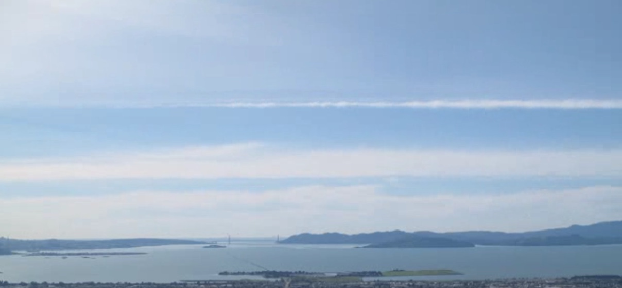


https://www.metabunk.org/attachments/sfbay_23feb16-avi.17657/
 

Attachments

  • SFBay_23Feb16.avi
    11.6 MB · Views: 843
Last edited by a moderator:
I think it's a contrail that starts out too faint to be really visible. It's also possible it interacts with a cloud layer, kind of like making a long fallstreak.
 
Seeing the segment looped the way you have it makes it look more evident to me that it's a contrail. Given the timing, my guess is that it was right about 3pm, which is around the time we routinely get LAX-bound jets from Asia flying over the bay area.
 
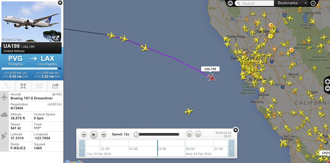
I looked at flightradar24 playbacks but no plane fits the bill. All fly well below contrail altitudes.
 
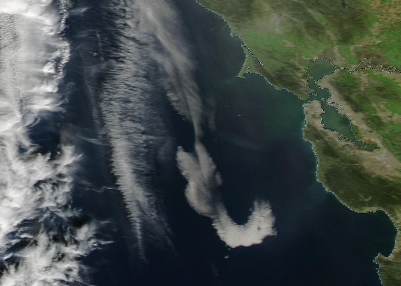
I think it was a natural linear cloud. There was one in the Aqua satellite image taken on February 23, 2016 around 22:00 UTC (2 PM PST):

It has a correct orientation and tapered end and by 3 PM it would be brought to about right distance from SF/Berkeley by a high altitude westerly wind with the windspeed of 105 km/h (70 mph).

This cloud reminded me about an unusual linear cloud that I saw the last Summer:
https://www.metabunk.org/striped-linear-cloud-over-norfolk-england-kelvin-helmgoltz-cloud.t6755/
 
I've modelled the location and orientation of the linear cloud on Google Earth using its photo from another thread:
SF Halo GE.jpg
This photo was taken shortly before it was posted on Facebook at 2:54 PM EST. Viewed from Berkeley Hill, the same model (purple line) placed at altitude of 10,000 meters (33,000 ft) runs parallel to the linear cloud in the time lapse video:
Berkeley Hill GE.jpg
The model line is approximately parallel to the linear clouds in the Aqua photo in the previous post, but is about 100-110 km (70 miles) closer to SF:
SF Linear Cloud GE.jpg
The camera icons mark the camera location of the above photos.
 
It's funny how you can observe something for the first time, and then suddenly you start seeing it everywhere. Today I spotted a "linear cloud", which before yesterday I had never heard of. I suppose had I seen this in the sky before yesterday I would have just automatically assumed it was a contrail. I guess February is a good month for skywatching in the SF bay area :)


skinnycloud.JPG
 
Back
Top