contrail or long skinny cirrus?

Marin B

Active Member
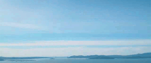
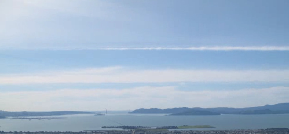
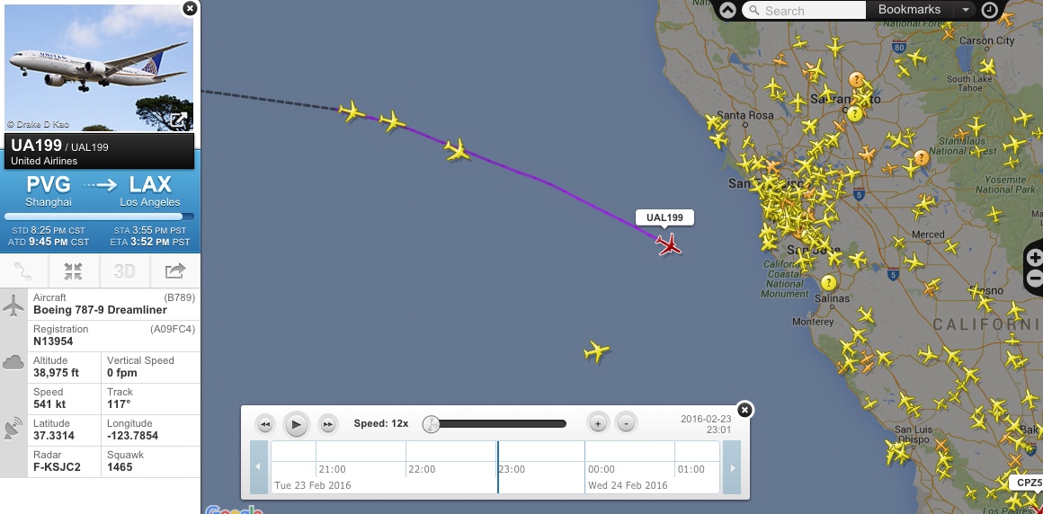
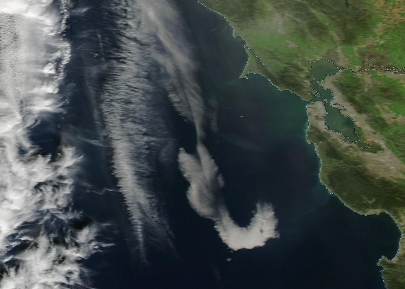
I was looking at yesterday's timelapse video (24 hr in 2 minutes) taken from the Berkeley hills looking west to the Golden Gate Bridge. At 1min, 12 seconds, a cloud starts to form just right of center, and it forms into a long contrail-esque cloud, that passes out of view at 1 min, 15 seconds. From the way it appears in the timelapse, it doesn't look to me like it was caused by a plane. But, it also doesn't look natural. What do you think? (see attached file -hopefully it's in a viewable format).


https://www.metabunk.org/attachments/sfbay_23feb16-avi.17657/
 

Attachments

  • SFBay_23Feb16.avi
    11.6 MB · Views: 799
Last edited by a moderator:

Mick West

Administrator
Staff member
I think it's a contrail that starts out too faint to be really visible. It's also possible it interacts with a cloud layer, kind of like making a long fallstreak.
 

Marin B

Active Member
Seeing the segment looped the way you have it makes it look more evident to me that it's a contrail. Given the timing, my guess is that it was right about 3pm, which is around the time we routinely get LAX-bound jets from Asia flying over the bay area.
 

skephu

Senior Member.
I looked at flightradar24 playbacks but no plane fits the bill. All fly well below contrail altitudes.
 

Trailspotter

Senior Member.
I think it was a natural linear cloud. There was one in the Aqua satellite image taken on February 23, 2016 around 22:00 UTC (2 PM PST):

It has a correct orientation and tapered end and by 3 PM it would be brought to about right distance from SF/Berkeley by a high altitude westerly wind with the windspeed of 105 km/h (70 mph).

This cloud reminded me about an unusual linear cloud that I saw the last Summer:
https://www.metabunk.org/striped-linear-cloud-over-norfolk-england-kelvin-helmgoltz-cloud.t6755/
 

Trailspotter

Senior Member.
I've modelled the location and orientation of the linear cloud on Google Earth using its photo from another thread:
SF Halo GE.jpg
This photo was taken shortly before it was posted on Facebook at 2:54 PM EST. Viewed from Berkeley Hill, the same model (purple line) placed at altitude of 10,000 meters (33,000 ft) runs parallel to the linear cloud in the time lapse video:
Berkeley Hill GE.jpg
The model line is approximately parallel to the linear clouds in the Aqua photo in the previous post, but is about 100-110 km (70 miles) closer to SF:
SF Linear Cloud GE.jpg
The camera icons mark the camera location of the above photos.
 

Marin B

Active Member
It's funny how you can observe something for the first time, and then suddenly you start seeing it everywhere. Today I spotted a "linear cloud", which before yesterday I had never heard of. I suppose had I seen this in the sky before yesterday I would have just automatically assumed it was a contrail. I guess February is a good month for skywatching in the SF bay area :)


skinnycloud.JPG
 
Top