Useful Chemtrail Debunking Images and Infographics

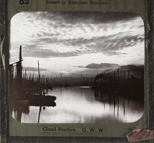
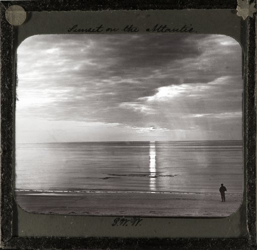
I purchased some glass slides from the 1890's (edit: 1880s ??), from an internet auction site. They shipped from England.
The photographer is George Washington Wilson (G.W.W.).
You can read about him here.

(I took photos of these slides with a macro lens, with a home-made light box.)


The first image, is an early example of Altocumulus and Altostratus , and are believed by some to be "HAARP clouds" or "scalar clouds"........but these natural clouds have always been around.


GWW_glass_1890s-2.jpg


GWW_glass_1890s-4.jpg
 
Last edited:
Ah, but these are from the 1890's, the time of Nikolai Tesla. So watch "true Believers" claim that HAARP is reproducing the work of Tesla and these clouds were caused by a Tesla tower.
I shouldn't give them ideas,.
 
but these are from the 1890's, the time of Nikolai Tesla. So watch "true Believers" claim that HAARP is reproducing the work of Tesla and these clouds were caused by a Tesla tower.

The problem with that, is Tesla was not experimenting with high freq/high energy radio waves until 1899 --at the very earliest.....and were quite low-power. The experiments and inventions noted by conspiracy believers, were from the early 1900's and onward.
G.W.W. (the photographer in the prior post) ...died in 1893, so these cloud photos were well before Tesla's time of wild experiments. The above photos were likely from the 1880's, or earlier.
University of Aberdeen Photographic Archive
 
A 1996 (or earlier ?) educational film primarily for sailplane/glider pilots. Though it is basic, it has good info.
Photographed and narrated by Brian Cosgrove.
The film has large contrails @1:50, and Cosgrove describes the lack of adequate cloud types and descriptions found in average textbooks, because of space and cost (budgetary concerns) for these books to go any more in depth.

He photographs and describes nearly all the conspiracy's "disputed clouds"....lenticular, mammatus, mackerel sky, etc...


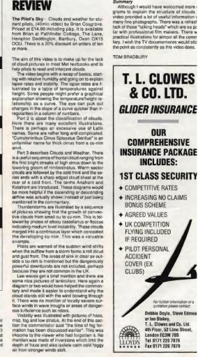
Evidence for this film, and the year it was made....I found a review of it, in the bi-quarterly publication "Sailplane & Gliding" April-May 1996. (link)
pilots_sky_review_2.jpg
pilots_sky_review_1.jpg
 
Last edited:
A recent review in the New York Times, introducing a new book about the history of meteorology, has made me aware of Thomas Forster, an English weather and cloud observer of the early 19th century.

In his 1813 work "Researches About Atmospheric Phaenomena", he references and extends the cloud classification by his fellow countryman Luke Howard. Later editions of the book include his weather and nature observation journals from 1806 to 1819.

The full second edition is available at Google books and in itself an interesting read that I've only just started.

However, most striking are the seven illustrations by the author himself - which may come handy in discussions about this or that cloud "not being natural". These plates were first printed in 1806.

Among others there are several halo variations, cirrus uncinus, ripples and a thunderstorm, nowadays referred to as "chem-bomb" by some believers. Here is an example:

ThomasForster_Clouds.png

The illustrations - except for the halos - are at the end of the book, preceded by their explanation.

(Just for fun, I searched for available copies of the original book. I found two offers for German translations - from 1819 - one for 400, the other one for 680 Euros ... There are several reprints on eBay available though)
 
Here is yet another early publication showing "mackerel skies" (alto-cumulus)....1916.
(they were common, before HAARP)
This is another eBay purchase of mine.


uvc006.jpg

uvc007.jpg
 
The usefulness of that image is more that it's in a physical book from 1997. The entire book oversimplifies things.
 
From CNN, a short article and video explaining cloud seeding and showing the apparatus used (which is often mistakenly promoted by chemtrail CTers as chemtrail spray equipment).


Link


Step 1: Get an airplane
Cloud seeding is performed by pilots who fly into areas of moisture in the atmosphere. It requires flying a small aircraft that can easily navigate through stormy weather, such as a Cessna or Beechcraft King Air.
Step 2: Fly into clouds
To seed a cloud, pilots fly directly into cumulonimbus, or towering cumulus clouds. They resemble tall, fluffy marshmallows and are shaped by powerful updrafts from the ground. Over time, these clouds typically develop into thunderstorms.
Step 3: Release salt into the air
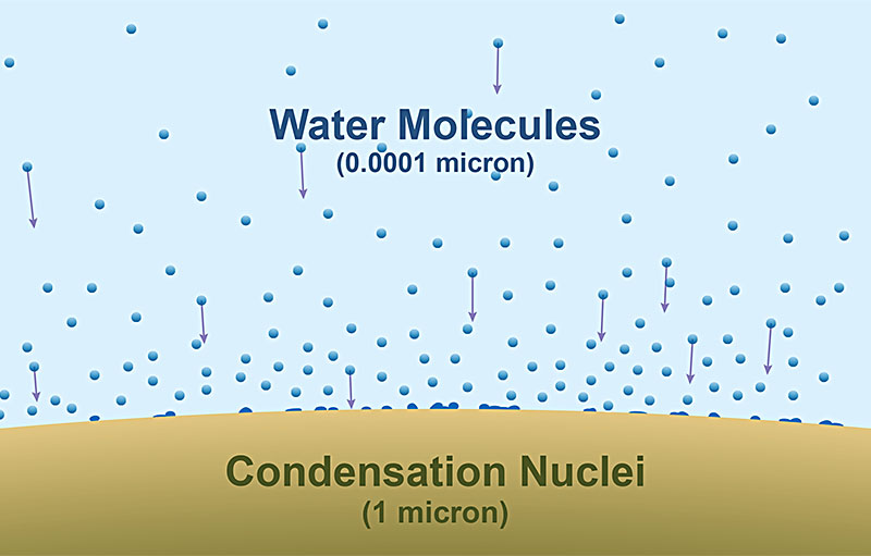
Once the airplane flies inside a cloud, the pilot ignites one of dozens of flares that are fixed on the aircraft's wings by a firing mechanism in the cockpit. The flares release smoke and salt compounds, such as sodium chloride or potassium chloride, into the air, which attracts water vapor in the cloud to form water droplets. These droplets coalesce into bigger droplets and, once heavy enough, can eventually fall as rain.
Step 4: Aim for the turbulence
Most pilots are trained to avoid flying directly into thunderstorms. But cloud-seeders have to aim for updrafts, which are created as warmer air from the ground is drawn into the base of cumulonimbus clouds. These updrafts help to mix the salt and smoke throughout the entire cloud, but they also make for a very bumpy ride.
Step 5: Repeat
Cloud-seeding flights can take three to four hours, during which time pilots can release dozens of flares. The more salt and smoke injected into the air, the better the chances of producing rain.
So, does it actually work? Meteorologists in the United Arab Emirates, one of the world's driest countries and top consumers of water, believe cloud seeding is increasing rainfall in the desert, though scientists are still trying to quantify precisely how much.
Content from External Source
 
Last edited:
A pair of US Air Force videos intended to be used to train meteorologists.

The first dates from 1962


The second dates from 1966

 
Located another pair of US Airforce meteorology training films from 1971. These ones deal with interpreting satellite imagry. Both were uploaded in two parts. To date the uploader has not re-uploaded the films in 1 part versions.

Satellite Meteorology: Cloud Patterns (USAF Weather Forecasting, 1971) Pts 1 & 2


Satellite Meteorology: Upper Air & Tropical Synoptic Applications (USAF Weather Forecasting, 1971) Pts 1 & 2


Last edited:
This is something I had been meaning to do for a while: take a map of flight paths in my area from skyvector.com and overlay it into the sky in Google Earth at typical airliner cruise altitude, then compare the ground-level view to the contrail patterns I see from my location in various directions.

1:

upload_2016-10-17_17-18-0.png

upload_2016-10-17_17-18-28.png


2:

upload_2016-10-17_17-19-13.png

upload_2016-10-17_17-20-55.png


3:

upload_2016-10-17_17-27-19.png

upload_2016-10-17_17-28-46.png


Not a perfect match, by any means, as contrails do not exactly follow flight paths due to wind etc, but I think it's a fairly good illustration of how normal commercial flight paths produce these patterns.
 
I was watching my way through the 12 part series on the history of photography by the George Eastman (Kodak) Museum and saw something in the 11th episode on color photography that I had not known before and which may in part explain the rise in claims that 'all clouds are fake'.

The detail in question was that many 19thC emulsions had equal sensitivity to blue and white causing the sky to be reproduced as a uniform shade. The relevant bit runs from 0:50 to 0:15.

 
It is talking about mid 19th Cent...around 1850.

Interesting stuff, but way, way too early to contribute to the "chemtrails" nonsense.

Well one tendency (Aside from Americocentrism and finding a convoluted way to blame the whole thing on Jews) I've noticed among conspiracy theorists of all stripes is a tendency to push the boundaries of a conspiracy theory further and further back in time. And with some Chemtrailers denying that clouds exist it is worthwhile making information like this available.
 
I'm painting a Christmas display.
While not realisticaly or scientifically accurate, thier design reminds me of crisscrossing trails....
1479185293345-617277525.jpg
 
Jeff Quitney re-uploaded one of the two US Airforce weather forecasting films I linked to earlier in a unified version as opposed to two parts. As I cannot edit the old post. Here is the link to the current version.

Satellite Meteorology: Cloud Patterns (USAF Weather Forecasting, 1971)

 
Here's me painting some contrails and cirrus.....for a TV commercial.

DS2_0860.jpg

DS2_0901.jpg

Finished.....with changes, and a piece of tape.

DS2_0965.jpg
 
Last edited:
An interesting phenomenon is occurring at Yellowstone's Old Faithful geyser that visually demonstrates how the introduction of super-heated water into a frigid temperatures results in an expanding 'cloud', which seems similar to how super-heated water/emissions found in aircraft contrails form and expand in the colder air found in high altitudes.

IFLScience article


What happens when a geyser erupts into air temperatures of -17.8°C (0°F)? Well, you get instant snow, of course!

Just 22 meters (72 feet) beneath the surface, the water is about 118°C (244°F), and it often retains this heat as it explodes out onto the surface.
Content from External Source


However, when you shoot this broiling fluid up into the sky, its water droplets will freeze quite suddenly and snow will emerge like magic. Unfortunately, much of the water remains too hot to freeze that quickly, but because the temperature of the geyser is so much greater than the surrounding frigid air, it is far less dense than usual – which means the geyser billows out and drifts upwards far higher than usual.
Content from External Source


In comparison to Old Faithful erupting in warmer temperatures... also noteworthy is the prisming (?) of light that is displayed in the video.

 
Last edited:
An interesting phenomenon is occurring at Yellowstone's Old Faithful geyser that visually demonstrates how the introduction of super-heated water into a frigid temperatures results in an expanding 'cloud', which seems similar to how super-heated water/emissions found in aircraft contrails form and expand in the colder air found in high altitudes.

It's related but not really the same. Geysers are mostly liquid water by mass, a lot of what you see is that water evaporating, condensing, then (if it's cold enough) freezing. Similar to throwing a cup of near-boiling water on a sub-zero day, as hiscussed here:
https://www.metabunk.org/debunked-b...-you-throw-it-in-the-air-at-40-degrees.t2902/
 
Last edited:
Here's a nice resource showing the percentage of aluminium in topsoil in England and Wales:

http://mapapps2.bgs.ac.uk/ukso/home.html

(click the + button at the top right then add the "NSI Topsoil Aluminium" layer)

Note the typical range of figures, and that the southeast, which has the heaviest air traffic, tends to have generally lower levels.

upload_2017-4-25_19-7-14.png

The highest and lowest levels I can find, from semirandom clicking in the red and blue zones, are just over 10% in Somerset and just over 2% in the Yorkshire Dales. My own area in northeast Hampshire is well below average at around 3%, but that's still 30,000ppm!
 
I was reading a 1960 novel by author David Beaty ('Village of Stars') and stumbled across the quote attached which mentions a jet aircraft leaving contrails, which comes from page 108 of the 1962 printing. Some of David Beaty's novels are being reprinted in eBook form and this may become available again later in the year.
Village_of_Stars_P108.png
 
Last edited by a moderator:
Back
Top