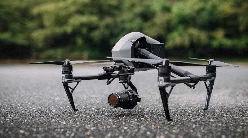
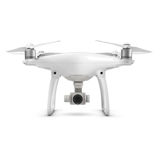
But we have zero evidence of any US Fire Depts, organisiations or individuals using this exact model. Until we can confirm that this drone, or a similarly shaped one, is being operated in California by a known organisation or individual this will have to remain a "
UFO".

I have to say, requiring this level of certainty borders on the absurd.
This is not how practical epistemology works, and it's perhaps THE biggest problem that plagues UAP "research."
Virtually all knowledge is just a probability landscape. If you see a drone-shaped object hovering in the sky, and then identify like 50 models that look very similar to it, and then confirm some of these models are probably in use in that area... While the exact object in this particular video is technically unidentified, the mystery is, in effect, solved. We "know" what this is. It's a probability, but it's a high one.
There are so many cases like this. And the average UFO believer I encounter thinks every UAP has a 50/50 chance of being an alien craft if "the skeptics" can't prove the identity down to the serial number & sworn testimony of the drone operator and 2 other witnesses.
This sort of burden of proof ignores everything we understand about probability, and how it is used it "know" things.
I enjoy solving these puzzles, and enjoy identifying them down to the exact make, model & serial number. But, practically, this a drone. And Gimbal rotates because of the gimbal artifact. And Go Fast is a high & slow balloon or bird + parallax. And FLIR1 is a distant plane that isn't related to the Tic Tac eyes on visual.
If the UAP "researchers" don't use these sort of probability/evidence-supported working theories to advance understanding, they're doomed to get into these same 50/50 "might be an alien!" discussions until the heat death of the universe.