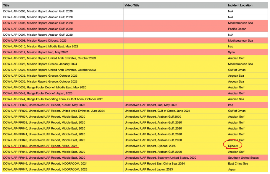
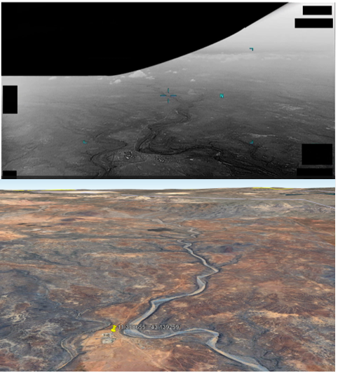
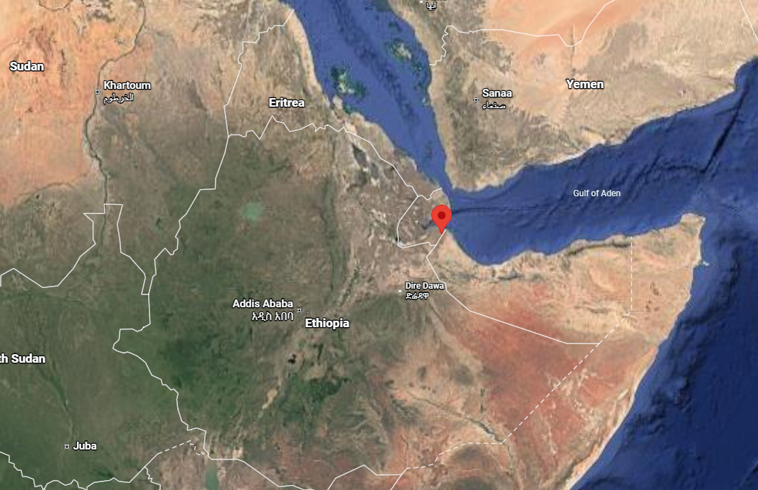
PR043 Africa - Djibouti

flarkey

Senior Member.
Staff member
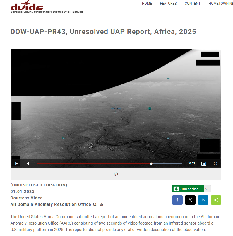
https://www.dvidshub.net/video/1006159/dow-uap-pr43-unresolved-uap-report-africa-2025


Video Description:00:00-00:02: A small, barely distinguishable area of contrast moves from the left side of the sensor field-of-view to the right side, exiting the scene from the bottom right quarter of the screen.

1778654119238.png

1778657293828.png


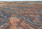
Djibouti....
1778657136541.png


11.388655° 43.139259°
1778654324853.png
 

Attachments

  • 1778654217569.png
    1778654217569.png
    1.6 MB · Views: 41
Last edited:
They should recognize that if there's an identifiable feature in the video, then it's the same as giving the location. While geolocating is fun, they should really just unredact the lat/lon.
This may become a test of how really interested Congress is these videos being released.
If I was in Congress I would demand that they repeat this exercise and NOT obscure the geographic coordinates.
Some things like airspeed and altitude might, in some cases, be classified but when analysis of the image can reveal the location you are just being obnoxious by blocking geographic coordinates.
 
They should recognize that if there's an identifiable feature in the video, then it's the same as giving the location. While geolocating is fun, they should really just unredact the lat/lon.
In most of the Mission Reports and Range Foulers (some of them related to the videos), the MGRS coordinates are provided.
 
It's the US Military If its the rules that's what they will do, if the book says obscure everything they obscure everything, even if the Eiffel Tower is present in the video.
 
Article:
Together with my brilliant postdoc and council member, Dr. Devesh Nandal, we realized that unknown UAP parameters can be tightly constrained through a known background terrain, which can be used as a coordinate system to infer the motions of the target object as well as the camera, as functions of time.

To demonstrate the remarkable power of this method, we studied the declassified case DOW-UAP-PR043, involving an unresolved UAP report from Africa in 2025, released by the All-Domain Anomaly Resolution Office (AARO) in the Pentagon here. Amazingly, we were able to do better than AARO and resolve this case as a likely fast missile. Our full analysis report is available here. Below are some details of the related scientific analysis.


This one looked exactly like your standard zip-by from parallax and motion blur, but they seem to lean heavily towards "missile"

Time for some Sitrec!
 

Attachments

This one looked exactly like your standard zip-by from parallax and motion blur, but they seem to lean heavily towards "missile"
I always admire a good video that I can watch three times and not see the UAP. I admire, also, those of you who can pry these things apart and actually learn something about them!

QUESTION: Is it possible/probable that Dr. Loeb has access to information that we don't have that might inform him that there is a likelihood of a missile or two flying about there/then?
 
It looks to me that the small moving bright feature is first visible moving from approx. the area within the yellow ellipse,

d1.jpg


This might be a silly question, but why doesn't the "Detected target path" shown in Nandal and Loeb's "Terrain-stabilized target track" picture start at roughly this location?

1_M70_PGUAo0sX_0VEbIjZCw.webp

Accompanying text reads,
External Quote:
Terrain-stabilized target track. The red circles mark the 13 measured target centroids from frame 61 to frame 73, and the yellow line shows the fitted direction of motion. The target moves toward the lower right. The small frame-to-frame departures from the line are minor compared with the total track length and are consistent with centroid and image-processing uncertainty. (Image credit: Nandal & Loeb 2026
From "The Declassified DOW-UAP-PR043 in the PURSUE Disclosure is Likely a Missile", Avi Loeb, "Medium" website, 06 August 2026.
link as per Mick's post #6 (Apologies, I couldn't post the URL here without an annoying chunk of that webpage being visible in the post).

Is it because they couldn't establish a terrain-stabilized path before the f61 location, or some other reason?
 
It looks to me that the small moving bright feature is first visible moving from approx. the area within the yellow ellipse,

View attachment 92534

This might be a silly question, but why doesn't the "Detected target path" shown in Nandal and Loeb's "Terrain-stabilized target track" picture start at roughly this location?
...
Is it because they couldn't establish a terrain-stabilized path before the f61 location, or some other reason?
I suspect neither of them is a trained observer.
 
External Quote:
We also built a conditional camera model. The internal best-fit horizontal field of view was 65.6◦,
with a 5% score band from 60.4◦ to 71.0◦.
Under this model, the sensor altitude was 2.26 km
That's interesting because the largest hfov for the mts-b is 45°.
 
Is it possible/probable that Dr. Loeb has access to information that we don't have that might inform him that there is a likelihood of a missile or two flying about there/then?

I think the location in the video includes a small military outpost or base of some sort, approx. 1600 metres / 1 mile from where the moving feature is first seen.
It doesn't look like the moving object is aimed at the (possible) outpost.

dj2 flark.jpg


djib 1.jpg


djib 3.jpg


The Djiboutian army has a few dozen Humvees, Wikipedia https://en.wikipedia.org/wiki/List_of_equipment_of_the_Djiboutian_Army
More possible Humvee-type vehicles elsewhere in the compound.

dj6.jpg


In addition there's a US Navy base in Djibouti, Camp Lemonnier (Wikipedia https://en.wikipedia.org/wiki/Camp_Lemonnier).
This is at 11°32′37″N 43°08′55″E, less than 20 km approx. north from the compound at 11°23'19.2"N 43°08'21.3"E.
No idea if there might be any connection between the two.

dj7.jpg


I'd guess the compound is a military outpost, and this might increase the chance that the moving object is a projectile of some sort.
Even in peacetime, many armed forces fire missiles/ rockets, sometimes to test systems but perhaps more often (particularly with smaller infantry weapons) to provide familiarization for those who might be required to use them.
 
Last edited:
I'd guess the compound is a military outpost, and this might increase the chance that the moving object is a projectile of some sort.
Even in peacetime, many armed forces fire missiles/ rockets, sometimes to test systems but perhaps more often (particularly with smaller infantry weapons) to provide familiarization for those who might be required to use them.
The Compound nearby is or was a military outpost, controlled entry points with guard towers, painted rocks to keep soldiers from driving over the commanders cactus garden, that sort of thing, as of the 6/6/2023 Google Earth photo.

Some sort of missile fired in training? I would assume that nobody there would be shooting at US drones.

Do the analyses assume horizontal flight path for the object? Did any try to fit a ballistic trajectory to that short bit, or is it too brief? Thinking unguided artillery rocket.
 
Do the analyses assume horizontal flight path for the object?
Yes. Height is considered as a constant parameter.
Did any try to fit a ballistic trajectory to that short bit, or is it too brief?
They try to fit the speed to a quadratic equation but have to dismiss it as inconclusive because the estimates vary widely. The trajectory bit is to short to distinguish clearly between propelled and ballistic trajectory.
External Quote:
The short track does not show statistically significant acceleration or deceleration, so it cannot distinguish a powered missile from a sufficiently high ballistic-coefficient object that is coasting.
 
Back
Top