View attachment 24841
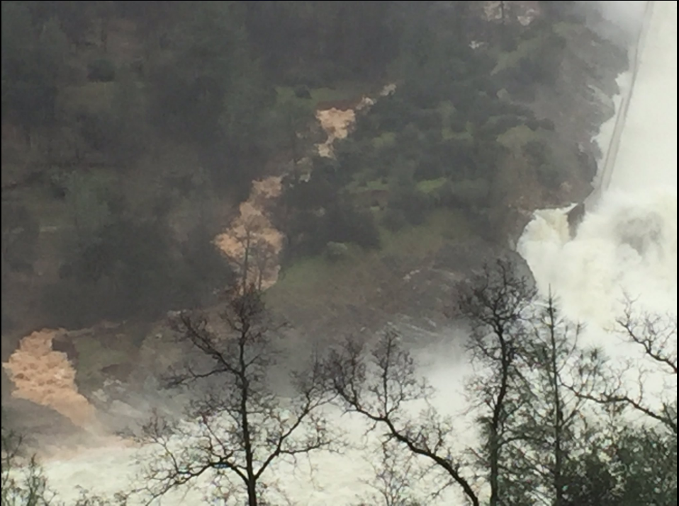
Internet, cable, and power out here as the storms hit the central California coast. Thanks for the pic, Sean T. Looks like there's still heavy erosion from the muddy outflow flow carving into the hillside, so this ravine could potentially 1.) wear down to bedrock similar to the e-spillway or 2.) it could fan outwards in the coming days/weeks similar to the other side of the waterfall. As mentioned previously, the bottom isn't as important as the top of the spillway, however, it will have impact on debris and the Hyatt Powerplant repair project.
It does look like there is a large chunk of solid bedrock to the right of the bottom of the stream. This might extend further up the waterfall and could explain why the concrete wall on the left side is still intact. Perhaps someone more knowledgeable about geology can advise?
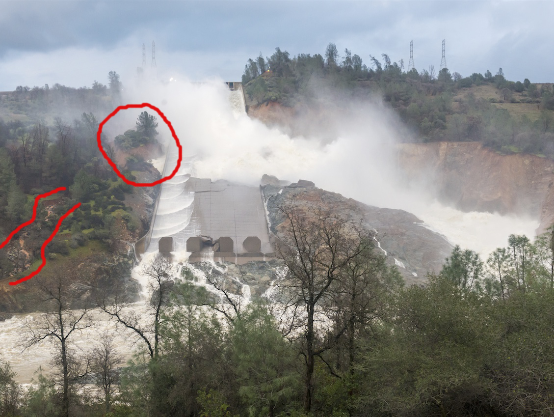
I wasn't able to watch the presser but interesting the media is calling this a "new steam of muddy water." Been watching it develop since Tuesday. I asked an LA Times photographer about it yesterday and he didn't seem to notice it while he was on ground (perhaps distracted by the waterfall or didn't have the right vantage point). I would hope DWR have been aware and watching this develop as much as we have.
Edit: Insert larger image