Source:
https://www.cnn.com/2018/08/23/us/hurricane-lane-hawaii-wxc/index.html
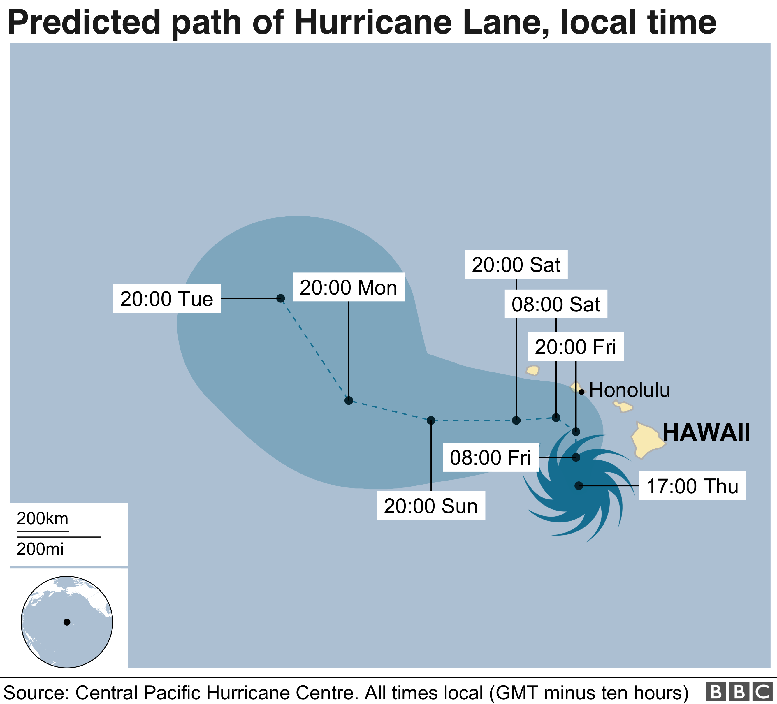
I'd expect this one, as the first significant event of the season, to be the subject of conspiracy speculation. The current forecast has it making a sharp left turn just before it hits Honolulu (which, in a bit of conspiracy geek dot connecting, in the site of Pearl Harbor). However the tracks is still a bit uncertain, and landfall is possible.External Quote:
Hurricane Lane's outer bands have been pummeling parts of Hawaii's Big Island with rain Thursday morning, triggering landslides and threatening serious flooding as the Category 4cyclone moves perilously close to the Aloha State.
The center of the storm -- which could become the first major cyclone to make landfall in the state in 26 years -- is expected to move very close to the main islands or cross land Thursday through Friday, the Central Pacific Hurricane Center said.
It could be so devastating that Hawaii Gov. David Inge has urged residents to set aside two weeks' worth of food and water.
"Hawaii is going to be impacted by Hurricane Lane. The question is, how bad?" Federal Emergency Management Agency Administrator Brock Long told reporters Thursday.
Why the left turn? It the prevailing winds in the north.