Flooding in Colorado caused by HAARP, nothing to do with Climate Change?

Critical Thinker

Senior Member.
The videos the poster linked to are just videos of the storm, no accusations or evidence presented in them.... The conspiracy pushers must be getting lazy, they don't bother with any claims of evidence now... just a sensationalist claim in a headline is all they need to convince the believers.


CL.JPG


Capture.JPG


BS.JPG
 
To be fair, Colorado has flooded like this before. So I don't think climate change is too accurate. It's a natural cycle combined with crumbling infrastructure and the fact that the area is built on Canyons!
 
To be fair, Colorado has flooded like this before. So I don't think climate change is too accurate. It's a natural cycle combined with crumbling infrastructure and the fact that the area is built on Canyons!

According to the article this is not being blamed solely on climate changes, but climate change is likely a contributing factor.... and there was no mention of HAARP being the cause. The actual BUNK I am calling out is the claim that the flooding is a result of HAARP.


According to Udall, to link the Colorado flooding to climate change is an invitation to criticism from some people in the climate science community, but "if anybody wants to tell me that climate change is not at least partially at work here, I'm going to tell them that they are (in denial)."

Determining whether the contribution is a few percent or 99 percent, he added, is beside the point and perhaps impossible with current modeling ability. That's the uncertain nature of climate science, he explained. But "some things are uncertain and scary enough that you actually do have to act."

Udall has spent much of the past decade lecturing on the threat of drought that climate change poses to the southwestern U.S. while downplaying the risk of floods, he noted. But climate models do indicate occasional high flow years on the Colorado River, which make sense given the increase in water vapor and high mountains to squeeze out the water, he said.
Content from External Source
In this second article they discuss ...


But as Adam Andrew Freedman of Climate Centralnoted, it wasn’t just weather that was playing a role in the biblical Colorado floods:

An increase in the frequency and intensity of extreme precipitation events is expected to take place even though annual precipitation amounts are projected to decrease in the Southwest. Colorado sits right along the dividing line between the areas where average annual precipitation is expected to increase, and the region that is expected to become drier as a result of climate change. That may translate into more frequent, sharp swings between drought and flood, as has recently been the case. Last year, after all, was Colorado’s second-driest on record, with the warmest spring and warmest summer on record, leading to an intense drought that is only just easing.


Read more: http://science.time.com/2013/09/17/the-science-behind-colorados-thousand-year-flood/#ixzz2fFY6ktYc
Content from External Source
 
Last edited:
To be fair, Colorado has flooded like this before. So I don't think climate change is too accurate. It's a natural cycle combined with crumbling infrastructure and the fact that the area is built on Canyons!

1976 was the last similar flood. Wasn't as widespread or quite as large. Killed more people though. Better forecasting and emergency management saved a bunch of lives because there was a lot more property in the way this time around.

Interestingly on the natural cycle front, the weather pattern this year has been similar to 1976 from the position and persistence of high pressure systems to the pattern of tropical cyclones in the Atlantic (though a hurricane did hit Long Island that year). Winter of '76/'77 was one of the coldest on record in the eastern US. The Chesapeake Bay froze over (combo of fresher than average water and colder than average weather) and Florida had accumulating snow in a lot of areas and flakes as far south as Miami. That was about when Time magazine had its global cooling issue that all the 'skeptics' claim represented a scientific concensus that the earth was going into an ice age. We seem to be in that cool phase of a multi-decadal cycle, except that instead off cooling, the temperature has been about level. Will be interesting when we come out of the cool phase of the cycle. Will we ratchet up as fast as in the 80s and 90s? Wonder if this winter will be as cold as '76/'77.
 
1976 was the last similar flood. Wasn't as widespread or quite as large. Killed more people though. Better forecasting and emergency management saved a bunch of lives because there was a lot more property in the way this time around.

The 1976 flood was the result of a severe thunderstorm that dumped 11 inches of rain in 4 hours over a much smaller are, the Big Thompson river. It caused a wall of water down the canyon and killed over 100 people with no real warning. Residents at the time sated it was over as fast as it arrived.

This year was either 500 or 1000 year event and was the result of just right conditions, a broad upper level low over Las Vegas bringing subtropical moisture from Mexico, and stuck there for days and on the surface a SE wind that causes upslope conditions and so we had a perfect storm. Upslope is a real tricky condition and creates locally different results based on just a little wind direction change. It uses the mountains to wring out moisture. In the winter this is how the Denver area gets larger snows, some neighborhoods could get a foot while others less the 3 inches.

Make no mistake over the area of the front range of Denver we have never seen anything like this before.
 
The 1976 flood was the result of a severe thunderstorm that dumped 11 inches of rain in 4 hours over a much smaller are, the Big Thompson river. It caused a wall of water down the canyon and killed over 100 people with no real warning. Residents at the time sated it was over as fast as it arrived.

No doubt the 2013 event was much more widespread and muuucchh longer in duration. But the synoptic weather pattern that set the stage was similar. An event in 1965 would have been a better comparison to 2013.

We had an event like the 2013 Colorado flood in June 1995 in Virginia with blocking high to the east, moist SE winds, and upper low to the west providing cool upper level temps and difluence. The eastern side of the Blue Ridge in Madison and Greene counties experienced upslope enhanced stationary storms that resulted in slope failure and debris flows. It was impressive. Nelson coutny was also hammered pretty hard.
 
It was a textbook Omega block, in the right position to draw tropical moisture up into the Front Range where said moisture was wrung out of the atmosphere like a wet mop by orographic lift.

The Omega Block


Below is an upper air map from 9/10/2013. The top right panel shows the classic omega pattern in winds and pressure gradients at 30,000 feet, centered just west of the Mississippi valley.


IR satellite image below corresponding to the same time as the upper air maps.


An Omega block in a slightly different position as seen in early Nov. 2010 to demonstrate that the Omega block is not uncommon.


An explanation of the rains in Colorado from a meteorologist in Philly.

http://philadelphiaweather.blogspot.com/2013/09/explaining-colorado-flooding.html

That youtuber weatherwar101 takes a simplistic explanation of cloud formation, literally made for children, and uses that to mis-represent water vapor transport and lifting mechanisms in the atmosphere, like convection and orographic lift. He totally mis-interprets water vapor images, either not realizing or shielding his viewers from the fact that water vapor images are only valid for the mid to upper troposphere above 13,000 feet. Water vapor images do not show surface or low level moisture. He tries to claim the dry line shows there is not enough moisture being drawn up from the Pacific to account for the rain. Fact is those water vapor images show there is also plenty of moisture being drawn into eastern Colorado, and the boundary between the dry line and moist airmass is where the heaviest rains will occur and that boundary was parked right over the front range.
 
Last edited by a moderator:
http://journals.ametsoc.org/doi/pdf/10.1175/1520-0434(1999)014<0384:TMCVFF>2.0.CO;2

The Madison County, Virginia, Flash Flood of 27 June 1995

MICHAEL D. PONTRELLI,GEORGE B RYAN,
AND
J. M. F RITSCH

Department of Meteorology, The Pennsylvania State University, University Park, Pennsylvania
(Manuscript received 19 February 1998, in final form 5 February 1999)

ABSTRACT
Between 25 and 27 June 1995, excessive rainfall and associated flash flooding across portions of western
Virginia resulted in three fatalities and millions of dollars in damage. Although many convective storms occurred
over this region during this period, two particular mesoscale convective systems that occurred on 27 June were
primarily responsible for the severe event. The first system (the Piedmont storm) developed over Madison County,
Virginia (eastern slopes of the Blue Ridge Mountains), and propagated slowly southward producing 100–300
mm of rain over a narrow swath of the Virginia foothills and Piedmont. The second system (the Madison storm)
developed over the same area but remained quasi-stationary along the eastern slopes of the Blue Ridge for
nearly 8 h producing more than 600 mm of rain.

Analysis of this event indicates that the synoptic conditions responsible for initiating and maintaining the
Madison storm were very similar to the Big Thompson and Fort Collins floods along the Front Range of the
Rocky Mountains, as well as the Rapid City flood along the east slopes of the Black Hills of South Dakota. In
all four events, an approaching shortwave aloft coupled with high-level difluence/divergence signaled the presence
of local ascent and convective destabilization. A postfrontal ribbon of relatively fast-moving high-ue air, oriented
nearly perpendicular to the mountain range, provided a copious moisture supply and helped focus the convection
over a relatively small area. Weak middle- and upper-tropospheric steering currents favored slow-moving storms
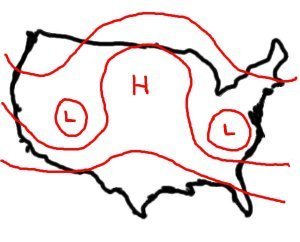
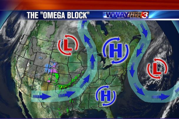
that further contributed to locally excessive rainfall. A conceptual model for the Madison–Piedmont convective systems and their synoptic environment is presented, and the similarities and differences between the Madison County flood and the Big Thompson, Fort Collins,
and Rapid City floods are highlighted.
 
No doubt the 2013 event was much more widespread and muuucchh longer in duration. But the synoptic weather pattern that see the stage was similar. An event in 1965 would have been a better comparison to 2013.

We had an event like the 2013 Colorado flood in June 1995 in Virginia with blocking high to the east, moist SE winds, and upper low to the west providing cool upper level temps and difluence. The eastern side of the Blue Ridge in Madison and Greene counties experienced upslope enhanced stationary storms that resulted in slope failure and debris flows. It was impressive.

Yes that would be similar. The other piece to it is mountain drainages. Aurora, CO got almost the same amount of rain that Boulder got. There was surface flooding all over the place, parks were now temp lakes but not nearly the damage. The reason is to the west of Boulder the mountains drain more like an funnel. All the water converges and usually in very tight confines. Same thing would happen with similar geographics.
 
Yesterday I saw Jim Lee (Rez8d) was claiming that these floods were caused by ground based cloud seeders operating 24/7/365. I replied linking to an article which explained the ground based seeding was done only in wintertime to augment snowfall, and was done by local people who lived there including the meteorologist. Some of them are simply ranchers who volunteer to run the propane burners on their own property. Here is the article:
http://www.durangoherald.com/article/20121213/NEWS01/121219795/The-man-who-sows-snow---

I also linked to an article explaining that that seeding ended in April:
https://groups.google.com/forum/#!msg/wq-news/sJm7ZEm6ZfI/WMFassDscJAJ

I challenged Jim Lee to produce evidence for his claims, but I don't know if he ever did.

He "unfriended" me for some strange reason and I think he deleted the exchange.

If you debunk these hardened believers, they do what my signature says (quoting JFK) and keep on going.
 
He totally mis-interprets water vapor images,

You mean as at the 15:08 mark when he states:

"Explain why this superheated water vapor generation occurs at night, when it's coldest, as opposed to during the day when 'natural' evaporation would occur"

That is after he showed the water vapor loop with the "superheated water vapor generation" being the cold cloud tops associated with diurnal convection? So he claims that it is super heated water vapor generation when it is cold cloud tops. And he claims it is occurring at night when the loops he shows depict daytime convective flare ups. And the time of peak evaporation isn't necessary when you expect peak convection. Heck, the moisture feeding the convection is not locally sourced, it rarely is anywhere.


He tries to claim the dry line shows there is not enough moisture being drawn up from the Pacific to account for the rain. Fact is those water vapor images show there is also plenty of moisture being drawn into eastern Colorado,

Yep, he ignores the moisture feed from the S and SE.

The statement "explain why all the precipitation originates over land from where there are no natural water sources" is really over the top. Even the most rapid HAARP/Chemtrail weather control believer knows that thunderstorms form over land all the time when you have moisture + instability. Plus, moisture can travel great distances distances.

His point 4:

Explain why these bursts of sudden superheated water vapor occur at the same time every night...like clockwork

It is cold cloud tops over top of thunderstorms. The "bursts" happen in the afternoon when the solar heating of the surface destabilizes the atmosphere. Same as it's been with such weather systems forever.

Something stinks with the inability to read time stamps on the imagery and the repetition of "at the same time every night...like clockwork" statements. Those are hallmarks of another weather conspiracy clergyman. He's either behind this or he's being spoofed by a troll/hoaxer.
 
You mean as at the 15:08 mark when he states:

I didn't have to get that far into it to tell it's just more repetition of his bogus claim that rain only forms above rapid evaporation from the surface below, which is why he latches onto that old 1950's sixth grade evaporation/condensation demonstration. Water vapor in the atmosphere is usually transported hundreds if not thousands of miles from the source before condensing out as rain, except maybe sometimes in the Intertropical Convergence Zone.

Something stinks with the inability to read time stamps on the imagery and the repetition of "at the same time every night...like clockwork" statements. Those are hallmarks of another weather conspiracy clergyman. He's either behind this or he's being spoofed by a troll/hoaxer.

He seems to have a number of influences, but I think he's cobbled them into his own version.


Aren't the 'Omega highs' often responsible for some of the major heat waves we see in areas?

Blocking highs in general are often the cause of heat waves in the areas under the influence of the high pressure, but when lows are with them as in the Omega block and the Rex block, the areas where the lows draw up tropical moisture can produce persistent heavy rain, especially around the upslope of mountainous regions. The blocking high that caused the Russian heat wave of 2010 developed a Rex block, with a low over Pakistan south of the broad high over Russia. Along with the heat wave in Russia, it produced massive flooding in Pakistan.
 
People may be looking at the time on satellite images and other data that are time stamped in UTC, thinking that the time is a local time of some sort. Since the US is 5 to 8 hours behind UTC, times like 2000, to 2300 hours (actually UTC) at the max. diurnal heating/convection time of 2pm to 5pm local will look like night time. The further west, the further into the night.

(So happy to live in UTC+12 - makes these mental calculations of UTC to Local so much easier. OTOH, we down here almost never speak of an Omega Block; they are inverted-Omega shaped down this side. Lucky that "cyclonic" still works in either hemisphere.)
I am even luckier to forecast in UTC + 0!

I am off to the Falklands for a while next year and think I may find the time difference takes a bit of getting used to! I sometimes find even the 1 hr summertime difference here annoying... actually I guess the reverse rotation of everything may be more of a shock...

Back to the topic, seems like a classic case of confirmation bias with people who do not understand the way weather works. They simply look at data and draw incorrect conclusions to support their theories
 
People may be looking at the time on satellite images and other data that are time stamped in UTC, thinking that the time is a local time of some sort. Since the US is 5 to 8 hours behind UTC, times like 2000, to 2300 hours (actually UTC) at the max. diurnal heating/convection time of 2pm to 5pm local will look like night time.

People like Dutchsinse and this WeatherWar youtuber should know better. As much time as they spend watching radar and making videos they should have noticed that when they are viewing the current radar in Missouri that the clock reads +5hrs during daylight saving time.

I have made simple polite comments to their videos in the past correcting UTC to local time with the response being insults and blocking.

Such errors on their part, whether deliberate or not, should cast doubt on their "expertise" but this doesn't seem to be the case.
 
Isn't HAARP offline at the moment??
Yeah, I've tried that line out on a few CTers.

You either get: "It's not really offline - they're just lying", or, "There's plenty of other HAARP stations around the world that they can use".
 
Yeah, I've tried that line out on a few CTers.

You either get: "It's not really offline - they're just lying", or, "There's plenty of other HAARP stations around the world that they can use".

According to Dutchsinse, the WSR-88D weather radar sites ARE smaller versions of HAARP.....and they can stop missiles....and control minds.....

He has another video posted of a Grand Junction, CO "haarp ring" event. I know the electronics techs in that office. Perhaps I can ask them what they have been up to.......

I doubt it's a technical issue, that looks like bright banding. The forecast, weather reports and radiosonde data all indicate snow in the higher mountain passes and peaks above 10,000 feet or so, with rain below those elevations. Radiosonde data out of SLC from 12Z 22 Sep - 00Z 23 Sep 2013 shows 0C with high relative humidity from around 11,500 to 12,500 feet. If the farthest band is around 60 miles from the radar station at the 0.5 deg. scan angle, that would indicate a mixing layer at around 12,700 feet.

http://www.lakeeriewx.com/CaseStudies/CaribouRadar/ConcentricRadarRings.html

http://journals.ametsoc.org/doi/abs/10.1175/1520-0469(1950)007<0145:AQSOTB>2.0.CO;2

http://www.radartutorial.eu/15.weather/wx19.en.html

http://www.denverpost.com/weathernews/ci_24154343/storms-drop-rain-snow-colorado-evacuate-riot-fest

http://weather.uwyo.edu/cgi-bin/sou...AR=2013&MONTH=09&FROM=2212&TO=2300&STNM=72572
 
The "what they have been up to" comment was sarcasm. :)

They obviously are trying to hide something, but are not able to hide from Dutch's keen eye, according to one of his follower's comments.

And no, it did not appear to be any technical problems at all. There were no alarm conditions for that site nor any FTMs sent out.
 
He has another video posted of a Grand Junction, CO "haarp ring" event.

And now he is claiming a "confirmation".

http://sincedutch.wordpress.com/201...-confirmation-winter-weather-advisory-issued/

Move forward 3 days (just under 4 days) , September 26, 2013 9pm MST, and we see the same pulsed area now under a “winter weather advisory” along with strong cells developing to the North of Grand Junction towards the Wyoming border.

haarp-ring-confirmation-colorado-winter-weather-advisory-sept-26-20131.jpg


So his old 24-48 hours has turned into 3 or 4 days and I'll be damned if I can see any bad or unusual weather in his confirmation image.
 
They obviously are trying to hide something,

Apparently.

Dutchsinse shared a link.

15 hours ago

1. You wouldn't normally think the NWS would cut its feeds , or omit data, however this is fairly obvious. Only the national non-quality controlled feed .. non censored feed shows the activity.


Cut the feed, censor the data, all because of the pulses. Suspect activity on the part of the NWS.

2. If you check the actual station data, you will see the pulses are missing from the feed. Proving the deliberate obfuscation of data from what you THINK is an automated computer controlled non-biased view of reality.

Instead, we've got politics, and dishonesty coming forth.. the removal of data to suit the needs of those performing the 3. EXPERIMENTS UPON THE PUBLIC.


Dutchsinse
19 hours ago
We've got them ON THE RUN ! Now they are reduced to having to CENSOR the NON-quality controlled feed !!!!! Censoring what is supposed to be the 'uncensored' feed.

LOL!! Epic fail from the NWS.

Censorship of the pulses. South Colorado (Pueblo).. you won't see this on any feed.

The only way you can see this pulse is by seeing the lack of this pulse !

hahahah

1. Actually you would think the NWS would cut the feed from a station into the system when the data from that station are bad. Happens all the time. Users of the data don't want the faulty data.

2. So he has learn to check the station data. Guess he learned something from Solrey. Nice to see him putting new information to good use.

3. There he goes again accusing the National Weather Service of killing people. No he doesn't say it directly but if NWS is helping "those performing the experiments upon the public" then NWS is guilty of killing the public when the supposed "experiments" have deadly results.
 
Yah, I saw all of that jibberish. My favorite line is "The only way you can see this pulse is by seeing the lack of this pulse!"

Huh?

Wouldn't you think most rational minds would read something like that and go "what is he talking about?" Nope. Instead such nonsense gets shared over 100 times.....

Oh and just a heads up for any future "haarp events" and confirmations in the next few days. Lots of ducting going on this morning with the great lakes regional weather radars. Marquette, Green Bay and Milwaukee all for sure were experiencing it. Milwaukee and Green Bay both were picking up some wind farms which will surely become one of Dutch's or his minions "ghost" or "stationary" storms. All of them were picking up lots of clutter and interference from other RF sources, leading to some crazy looking returns on the .5 degree reflectivity. All one would have to do is to then check the higher angle reflectivity cuts on Dutch's favorite site, College of Dupage. They would then notice those "stationary storms" disappear the higher the tilt angle of the radar's beam, but "investigators" like Dutchsinse never do that.....heck, he thinks the DBZ measurement is a measurement of sound when used in weather radar applications....

There is no severe weather anywhere in the forecast for WI or the U.P., just a chance for light showers Saturday Night. But if Dutch or one of this legion caught these "events" today, then light showers tomorrow night surely will be good enough for a "confirmation"......

One last thing - there is a disclaimer at the bottom of that WDSS page, the page where he saw the "pulse that wasn't a pulse", that says "Disclaimer: Images on these pages are experimental."

An explanation of ducting:

http://www.theweatherprediction.com/habyhints/234/


GB 27 sept 13.JPG mke 27 sept 13.JPG
 
Back
Top