Curvature of earth - the definition

Kriss3d

New Member
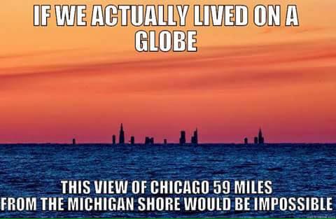
Im quite active against the flat earthers by posting actual scientific sources. Ofcourse earth isnt flat. Its impossible.

My question is this. When claimed that according to the curvature charts and the various calculations ( 8 inch per mile squared) there will be something like "this distance shouldhave x feet of curvature where is it?".

I think i might not actually know what the "drop" is defined as ?
As I understand it, if you stand on earth 6 feet above sea level and look straight ahead - a line tangent to earth, and you look at something say 10 miles away. Wouldnt the drop be what is hidden beneath the bulge ? Or is the drop defined as the bulge itself ? (though this im pretty sure is NOT right as the bulge doesnt have to be very high.)

When people say something is x miles away. Wouldnt that normally be the distance along the curve then ? Then it should be possible to take the miles as the distance and calculate how much should be hidden ?

Most curvature calculators would take the distance as the straight line from your POV to the top of whatever youre looking at but the distances used by people would be the distance along the curve thus this distance would be longer as i understand it right ?


Basically im looking for how to take the poor measurements of the flat earthes which would be distance along the curvature and apply that to calculate how much should be hidden.
It doesnt seem to me that the curvature calculators i can find does this. So do any of you people know a formula i could use for this ?
 
Most curvature calculators would take the distance as the straight line from your POV to the top of whatever youre looking at but the distances used by people would be the distance along the curve thus this distance would be longer as i understand it right ?

At normal distances (<100 miles) there's no real difference. Have a look at my calculator.
https://www.metabunk.org/curve/

Click on "advanced" and compare the "amount obscured" with "true hidden"
https://www.metabunk.org/curve/?d=4&h=6&r=3959&u=i&a=a&fd=60&fp=3264
Distance d = 4 Miles (21120 Feet)
Radius of Earth r = 3959 Miles (20903520 Feet)
Distance to horizon, a = sqrt((r+h)*(r+h) - r*r), a = 3 Miles (15838 Feet)
Amount obscured x = sqrt(a*a - 2*a*d + d*d + r*r)-r, x = 0.67 Feet (8.01 Inches)

The following is the amount obscured calculated using slightly more complex trig
And assuming the 'distance' is the distance across the surface of the earth
This is more accurate for large distances and heights
But essentially the same for distances under 100 miles
True hidden = r/cos( d/r - asin(sqrt(h*(2*r+h)) / (r+h) ) ) - r = 0.67 Feet (8.01 Inches)
Content from External Source
At 100 miles the difference is <0.1%
 
My question is this. When claimed that according to the curvature charts and the various calculations ( 8 inch per mile squared) there will be something like "this distance should have x feet of curvature where is it?".

I think i might not actually know what the "drop" is defined as ?

There's two different things - there's the drop from the horizontal plane, and the amount of something that is hidden from a particular viewpoint. In the second one you have to account for the height of the viewer.

This video is a bit long, but if you watch it all you should understand the different numbers.

Source: https://www.youtube.com/watch?v=W1KJANfK71A
 
Thank you very much. I just quite often get the memes with distances where its quite clear that buildings and such shouldnt be visible at the distance even using your calculator. So im trying to figurere out what im doing wrong..
 
Thank you very much. I just quite often get the memes with distances where its quite clear that buildings and such shouldnt be visible at the distance even using your calculator. So im trying to figurere out what im doing wrong..

Can you give an example?
 
Thank you very much. I just quite often get the memes with distances where it's quite clear that buildings and such shouldn't be visible at the distance even using your calculator. So I'm trying to figure out what I'm doing wrong.
I've probably seen a lot of those memes. In general they: a) get the distance wrong; b) don't factor in for the viewer's elevation; and c) show a "missing curvature" figure that is actually the "drop height" for a viewer at sea/lake/horizon level, rather than the "hidden amount" as outlined above.
 
Thank you very much. I just quite often get the memes with distances where its quite clear that buildings and such shouldnt be visible at the distance even using your calculator. So im trying to figurere out what im doing wrong..
I think you really should take a look at those video's.
 
There's two different things - there's the drop from the horizontal plane, and the amount of something that is hidden from a particular viewpoint. In the second one you have to account for the height of the viewer.

This video is a bit long, but if you watch it all you should understand the different numbers.

Source: https://www.youtube.com/watch?v=W1KJANfK71A

Just finished the fifth video, and there she corrected her first definition of "drop". Maybe something to bear in mind if someone is interested.
 
Thanks a bunch guys.
Just a quick search got me this one which though not being entirely what i was going for but typical that you drown in shitty memes when not wanting them and cant ever find the right one when youre looking:
 
Thanks a bunch guys.
Just a quick search got me this one which though not being entirely what i was going for but typical that you drown in shitty memes when not wanting them and cant ever find the right one when youre looking:
Yes, that's a famous one. In another thread Mick already pointed out that the buildings are clearly partly hidden behind the horizon, thus proving there is at least a certain amount of curvature anyway. The picture was taken by Joshua Nowicky, I believe, taken from a dune at Grand Mere State Park. The dunes there go up to 200m.
Without atmospheric refraction or mirages taking into account let me take two possible standpoints, first at 5 m above the water level, 2nd at 200 m above the water level.
5m: 594m hidden behind the horizon
200m: 155m hidden behind the horizon.
Next to the Sears Tower you can see about 1/2 of 311 S Wacker building, which means that about 150 m is behind the horizon. My guess is that Joshua was standing on the highest dune. (which I would have done if I wanted to have the best view)
Note: according to me the distance is more like 56 mi, which reduces the numbers to 515m and 116m respectively.
 
Agreed.

You see a lot of the Nowicki photos around. This is one of the ones I was referencing above. In general, they get the distance wrong - I've usually seen it quoted as 60 miles, up to as high as 80 - and totally fail to take into account the viewer's elevation.

There are other claims about the Nowicki pictures, based on the weatherman who first reported them misstating that "Chicago shouldn't be seen from that distance due to a mirage." What he should have said was that "more of Chicago than normal was being seen due to a mirage."

I believe if you search on here for "Nowicki" you'll come to some good information. :)
 
Yes, that's a famous one. In another thread Mick already pointed out that the buildings are clearly partly hidden behind the horizon, thus proving there is at least a certain amount of curvature anyway. The picture was taken by Joshua Nowicky, I believe, taken from a dune at Grand Mere State Park. The dunes there go up to 200m.
Without atmospheric refraction or mirages taking into account let me take two possible standpoints, first at 5 m above the water level, 2nd at 200 m above the water level.
5m: 594m hidden behind the horizon
200m: 155m hidden behind the horizon.
Next to the Sears Tower you can see about 1/2 of 311 S Wacker building, which means that about 150 m is behind the horizon. My guess is that Joshua was standing on the highest dune. (which I would have done if I wanted to have the best view)
Note: according to me the distance is more like 56 mi, which reduces the numbers to 515m and 116m respectively.
I made this as a response to those sort of memes, a while back. It's not exactly the same photo but it's the same principle.

roundchicago.jpg


As for the distance issue, this it the link for the photo: https://joshuanowicki.smugmug.com/Looking-toward-Chicago-from-Mi/i-3dCDGJX

It says it is from Grand Mere State Park. We don't know exactly where, but measuring the distance from the highest point on the dunes in the park, to N Michigan Avenue, I get 55.5 miles approximately, so I should probably amend that image:

upload_2017-1-10_11-18-27.png
 
Last edited:
Back
Top