Thank you for the answers. What is your opinions on this one
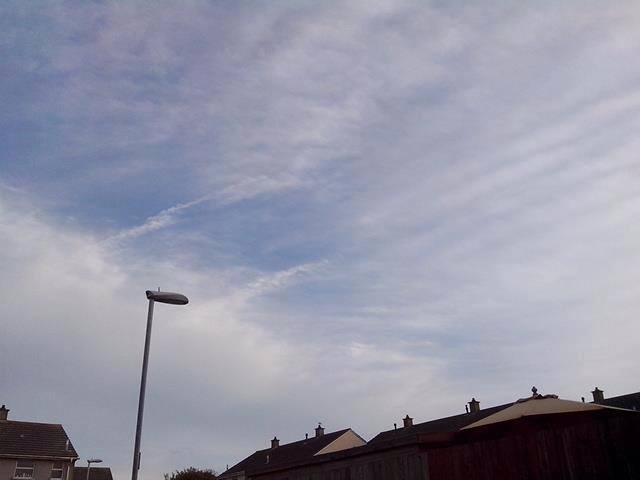
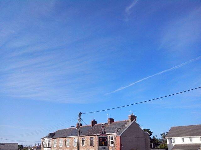
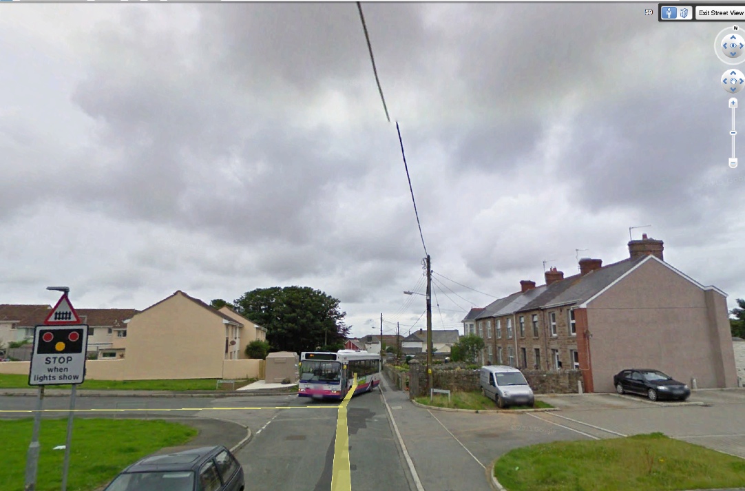
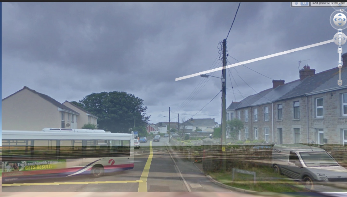
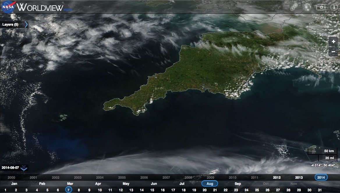
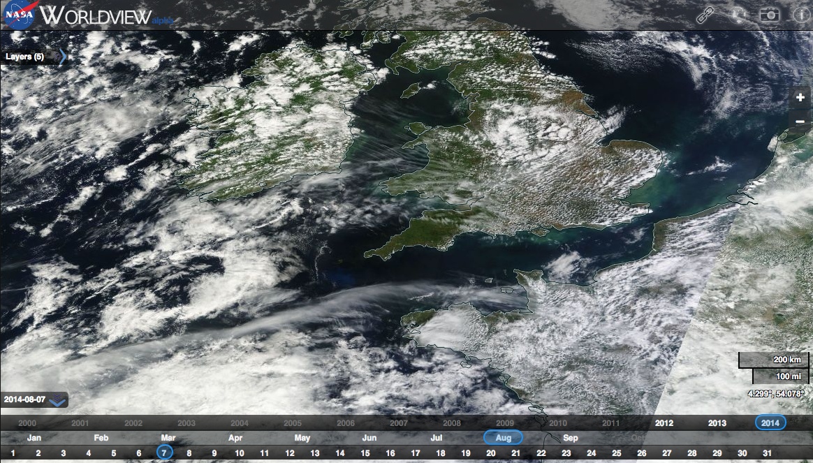
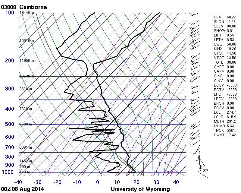
It is from Camborne 07.08.2014 it contains more data. You can see it clearly..
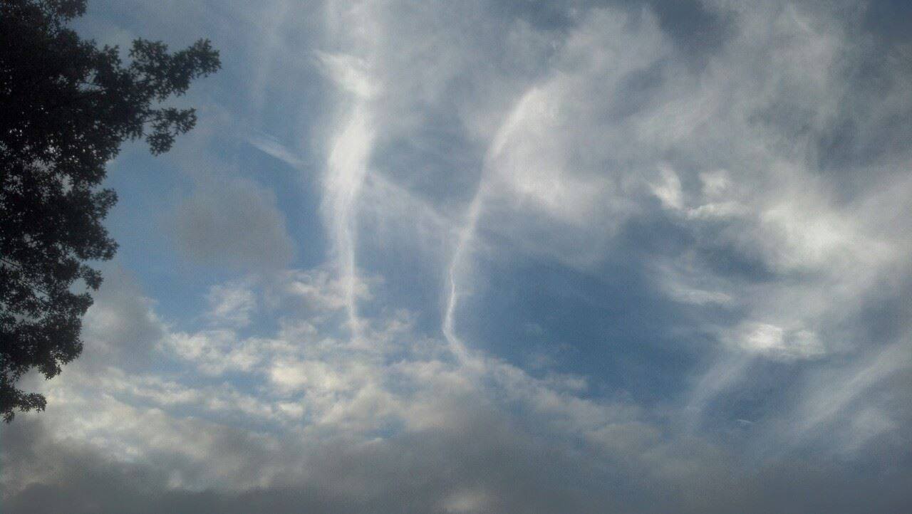
There can be no ¨Persistant Trails¨ occur as you can see in the picture and the available data.
https://www.facebook.com/len.duggan.1/media_set?set=a.10152806604474954.1073741845.549534953&type=1
*Pictures of Camborne on 07.08.2014
------------------------------------------------------------------------------------------------------------------------------------
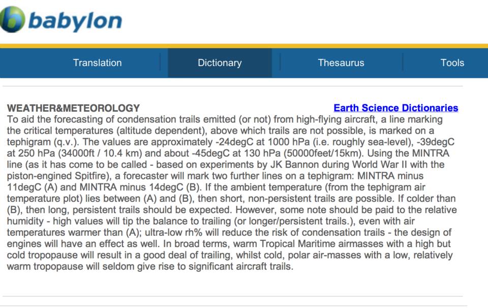
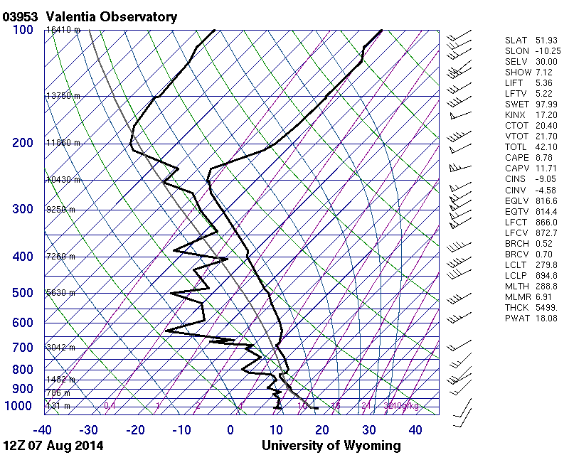
*This is the definition of the MINTRA line (minimum trail line).
It was investigated during WW2 because the white line behind the aeroplane would have meant death to the pilot from enemy fire.
Top scientists discovered this relationship between pressure, temperature and humidity.
The link below is a 1996 updated investigation into the Appleman study that discovered the MINTRA line.
http://journals.ametsoc.org/doi/pdf/10.1175/1520-0450(1997)036<1725:COACFC>2.0.CO;2
-----------------------------------------------------------------------------------------------------------------------------------
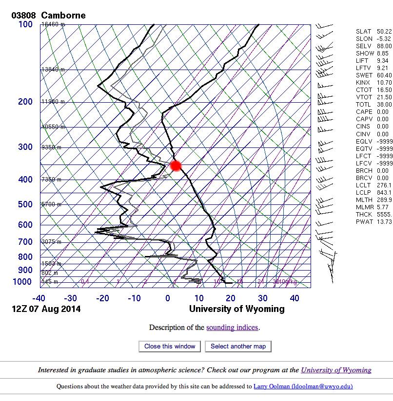
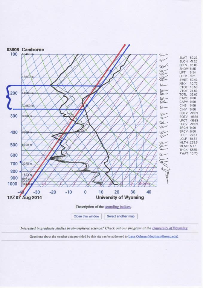
*Here is a frost point at 8,300 meters and cloud could occur from the freezing of the water vapor into ice crystals if it was cold enough..
If the humidity line met the temperature line then you would get clouds and rain.
------------------------------------------------------------------------------------------------------------------------------------
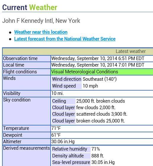
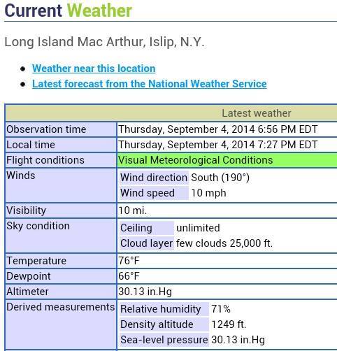
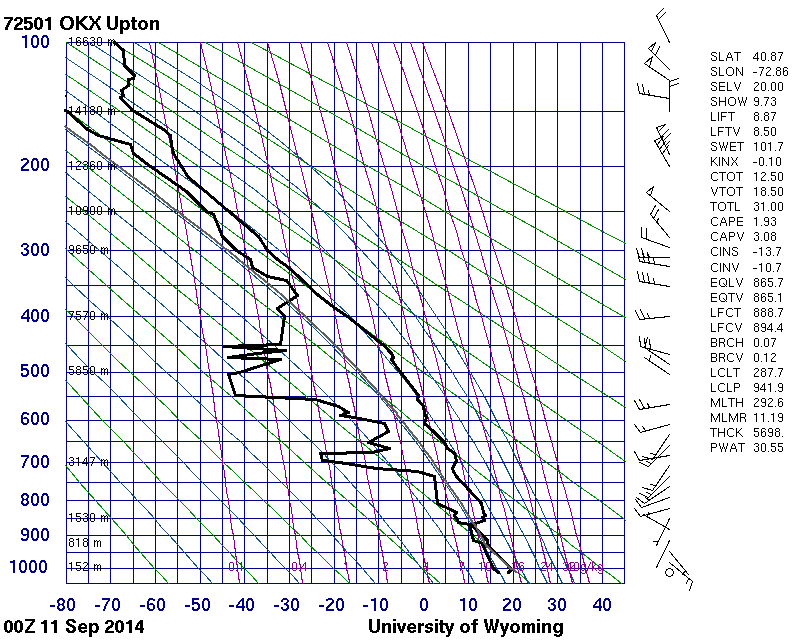
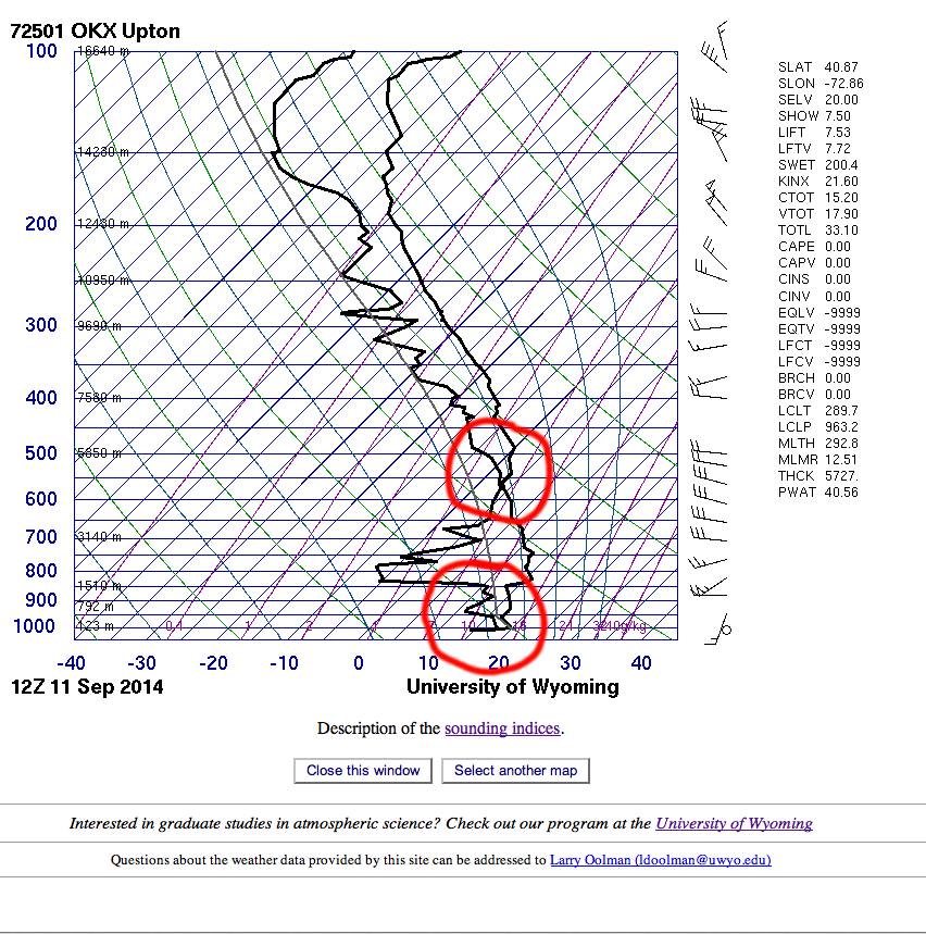
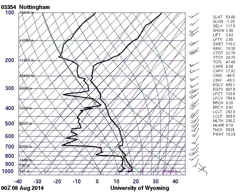
*You can get clouds here. Maybe morning dew at ground level or ground frost if it is clod enough and cloud or rain at 4,000 meters in Upton US on 11th sept 2014
--------------------------------------------------------------------------------------------------------------------------------
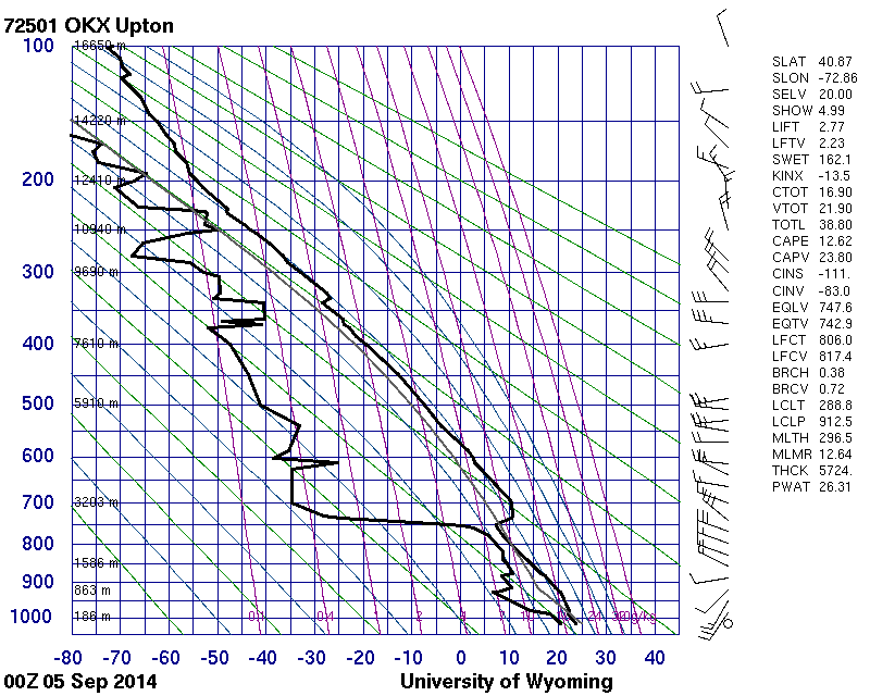
*Here is the height that trails might occur but not persistently (non persistent trails)..
Between 10,200 and 12,000 metes
-----------------------------------------------------------------------------------------------------------------------------------
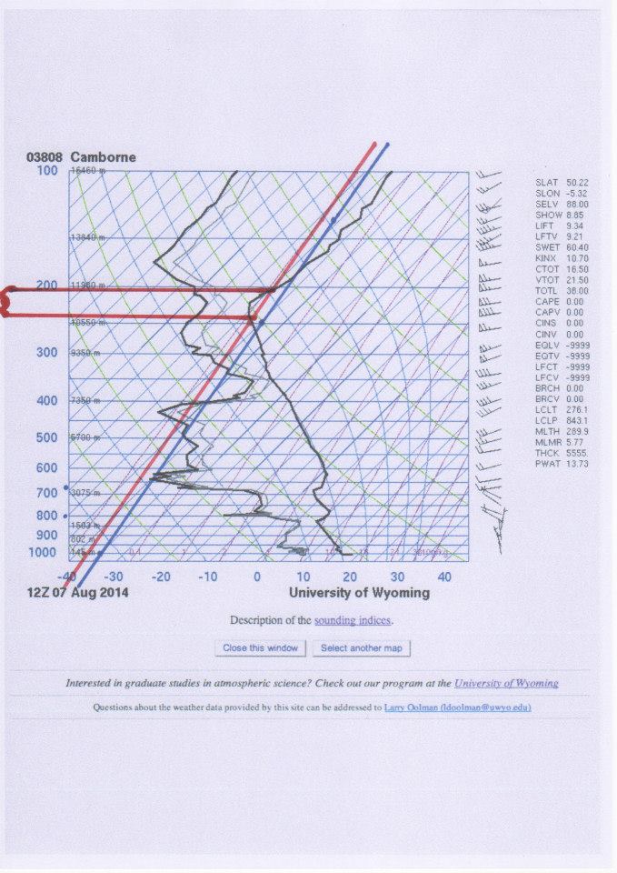
*Here is the height that trails will persistently occur.
"Persistant Trails" is the biggest con in the understanding of trails.
Between 10,600 and 11,900 trails will occur persistently.
This has nothing to do with how long they will last in the sky.
The length of time they lasted was never investigated.
We can see that no frost point exists between these heights as the thin line does not meet the other temperature line on the right. No clouds will form from ice nucleation of water vapour.
------------------------------------------------------------------------------------------------------------------------------------
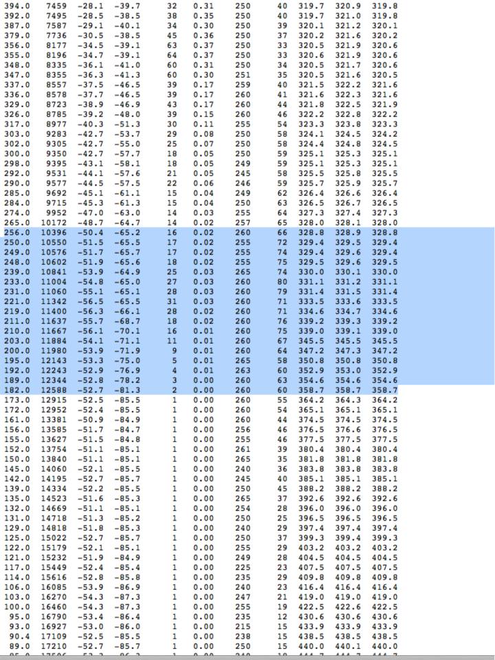
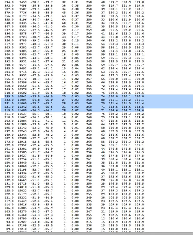
*Then we get the data in list form and check the humidity between the heights that are cold enough to make trails.
We can see that there is a maximum of only 31%RH at 11342 meters.
This means that the trails would have dispersed quickly as the water from the plane exhaust would have dissipated in the dry air.
The trails would definitely not spread out into clouds.
http://weather.uwyo.edu/cgi-bin/sounding?region=europe&TYPE=TEXT:LIST&YEAR=2014&MONTH=08&FROM=0712&TO=0712&STNM=03808
https://www.facebook.com/len.duggan.1/media_set?set=a.10152806604474954.1073741845.549534953&type=1