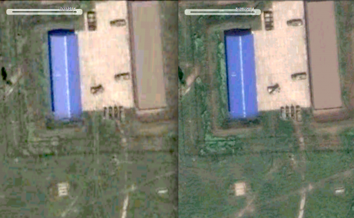
All the cloud patterns match exactly, so this image directly from the DigitalGlobe catalog (id 1030010034CD4700, taken July 2, by the WoldView2 satellite) seems indeed to be the image that GoogleEarth used for their July 2 history of this area.
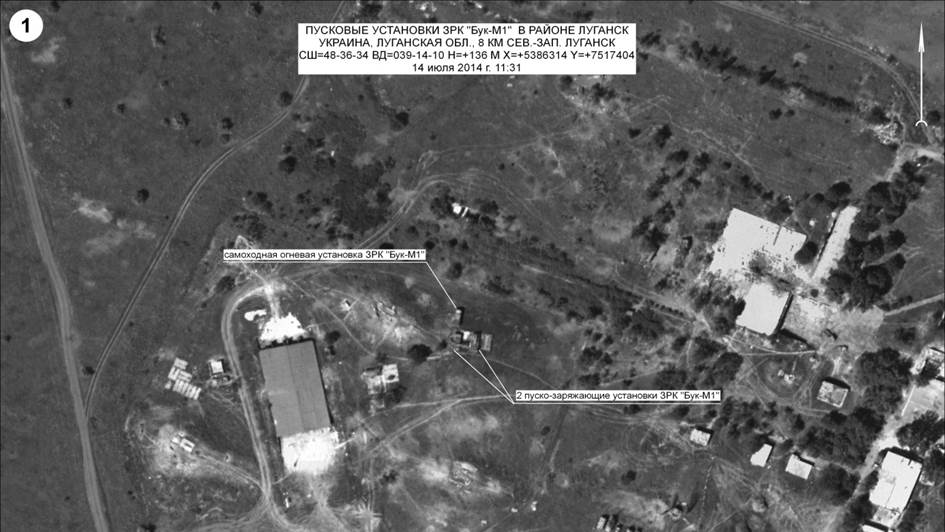
You can do the same thing for the other images (May 30, June 19) that Bellingcat used in their analysis that shows the Russian Defense Ministry's satellite pictures of airbase A-1428 were clearly taken in June and decidedly NOT on July 14 and July 17.
So, GoogleEarth history dates are correct, as verified with the DigitalGlobe's image catalogue.
Thus Bellincat is right, and the Russian Defense Ministry lied about the dates on their own satellite pictures.
Simple as that.
The low resolution preview of the DigitalGlobe catalog: id 1030010034CD4700, labeled 2014 July 2 and taken by the WoldView2 satellite shows not only the same cloud distribution as Google Earth at July 2 but indeed also the removed "woodland" at the left can be already seen.
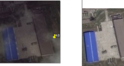
Here's a slightly higher res preview (selected max. available resolution in popup) & cropped to the area of the airbase.
At the right is a crop from Google Earth July 2 of the same area and zoom level.
As for the metadata according to
https://www.digitalglobe.com/sites/default/files/ISD_External.pdf
"Band Info: Pan_MS1_MS2":
"Pan - Sharpened" = Processed used to colorize imagery by fusing multispectral and panchromatic bands"
"Panchromatic" = A wide spectral band which is comprised of reflected light in the visible spectrum (blue, green, red and NIR). It is displayed as a black and white image. "
"MS1" = First 4 bands (Near-Infrared,Red,Green,Blue)
"MS2" = Second 4 bands (NIR2,RedEdge,Yellow,Coastal)
"Acq Date: Jul 2, 2014":
This is still of a problem, potentially. These image products can also be
sets of images with different acquisition times, according to the mentioned guide and as well a cursory search on Google revealed. Which one would be used to date the
whole product? The earliest of a range between 2014-07-02 and eg 2014-07-24? (Note: there's no 07-21 date in the product catalog, while Google Earth
does show the date...and Bellingcat uses that date freely in their report
without any verified metadata to back it up!)
It's a bit remarkable to me how people can
conclude so many things without having one single original or source in hand! As we don't have the DigitalGlobe item yet with all the included files, structure and metadata at hand, is there any other way to know?
In my opinion the shown differences in the Bellingcat analyses of the images of the 2nd and the 21st of July are are highly questionable. With Google's 21st
not even existing in the DigitalGlobe search results! And if the date of 2014-07-02 couldn't be verified either as actual photo acquisition date, there would be not much of a case left of the Bellingcat analysis of MoD picture #3 and #4.
So I retain my position that the whole analysis of satellite imagery appears to hinge on
one particular dating of Google Earth and a product catalog search result of the image provider. There's not one piece of evidence yet given to illustrate that these package dates are precise while one used date at Bellingcat/Google is not traceable at all. And there's still some anecdotal evidence in the various product forums and image blogs warning from experience
not to trust these single dates within applications. Enough reasons to remain skeptical!
