Herman Aven
Member
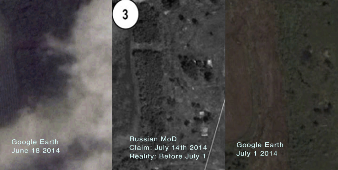
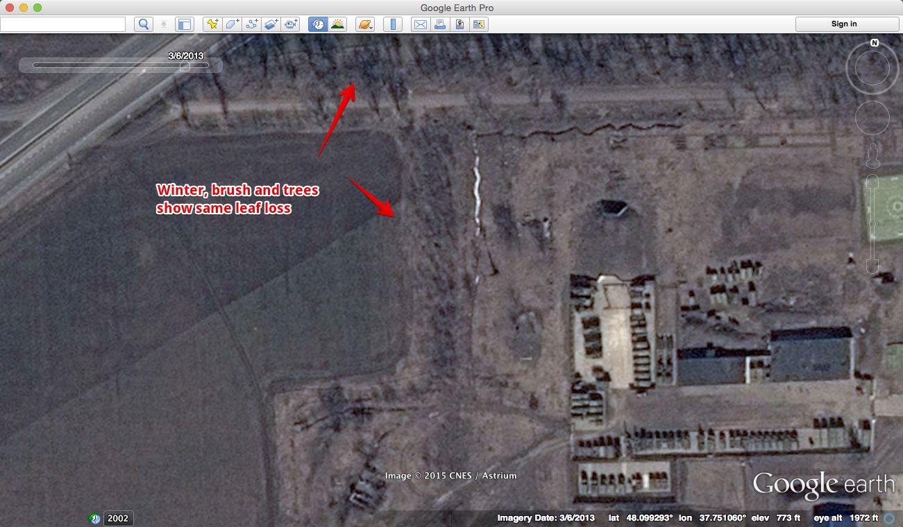
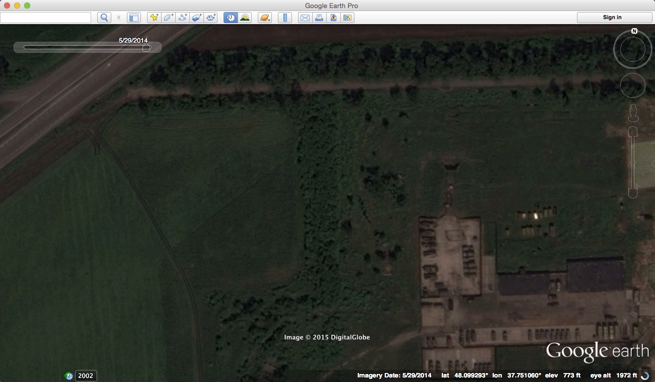
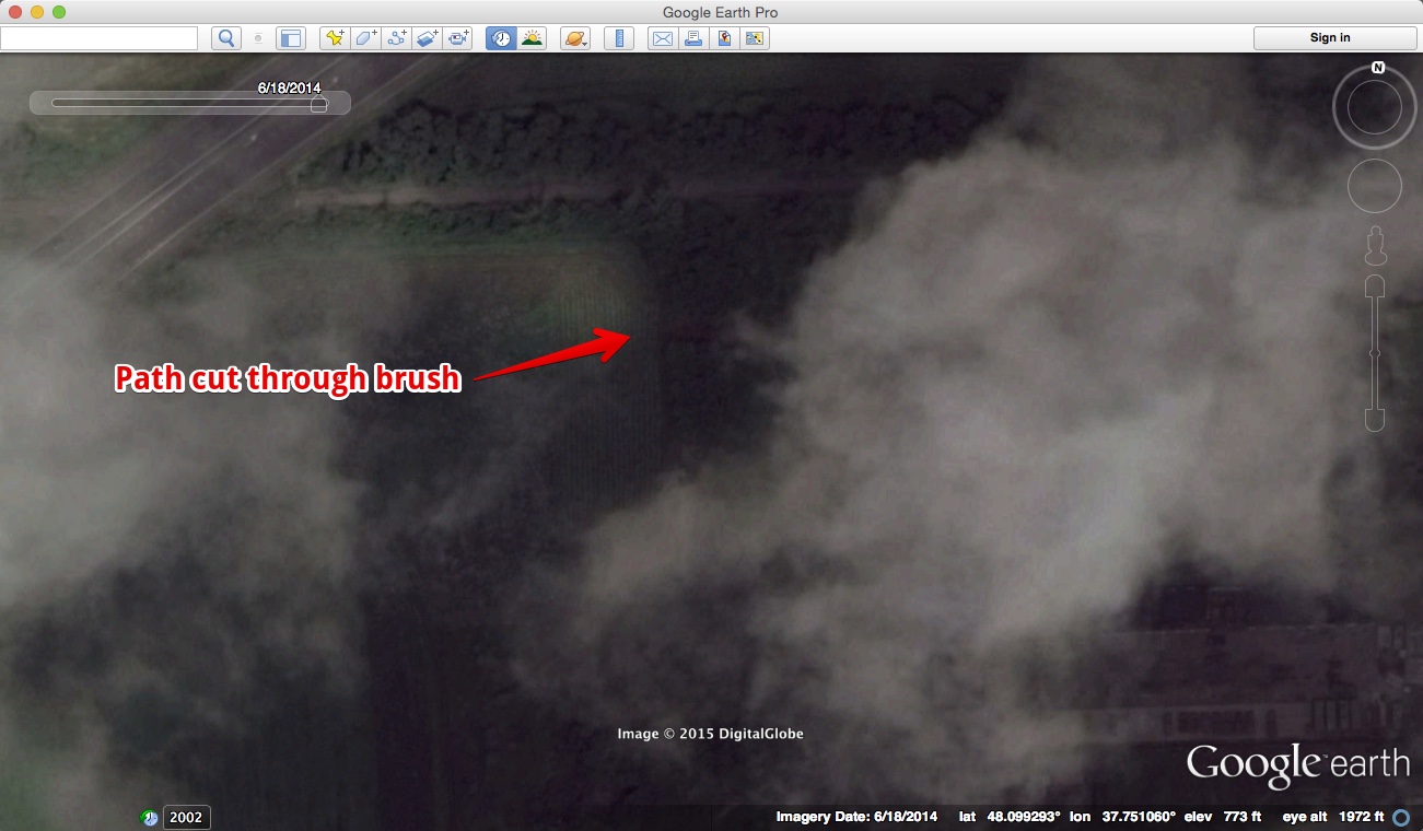
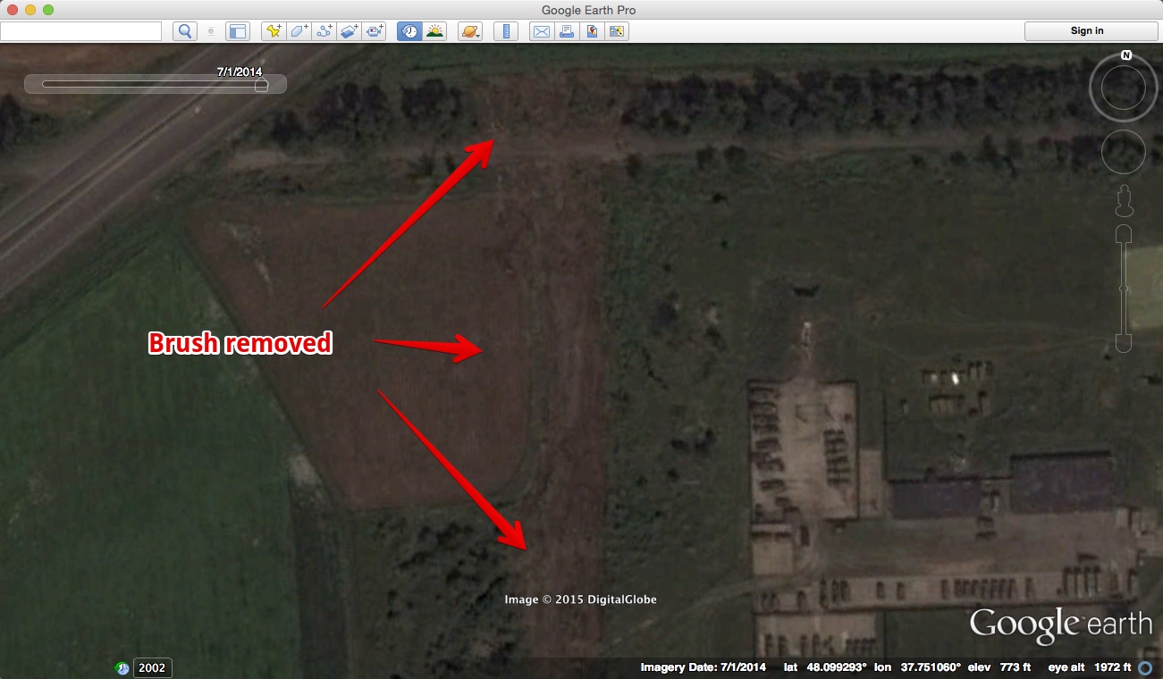
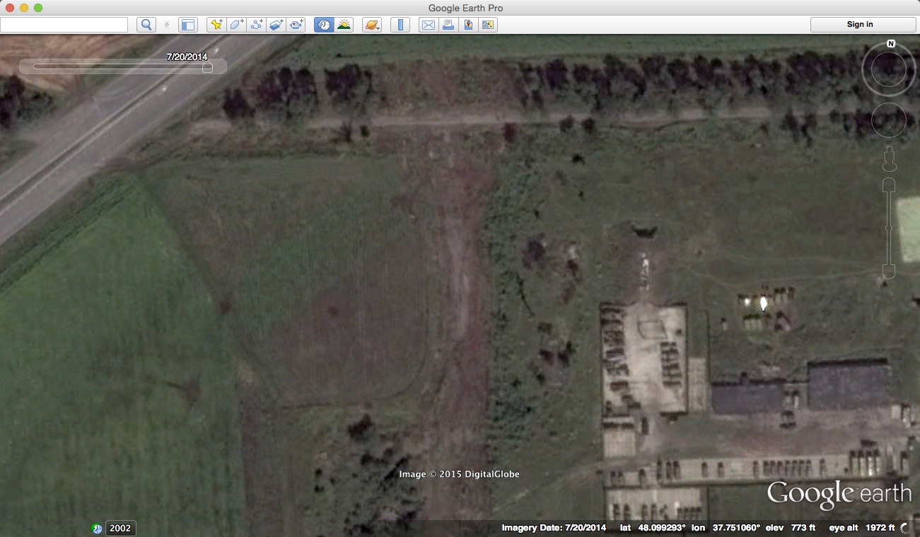
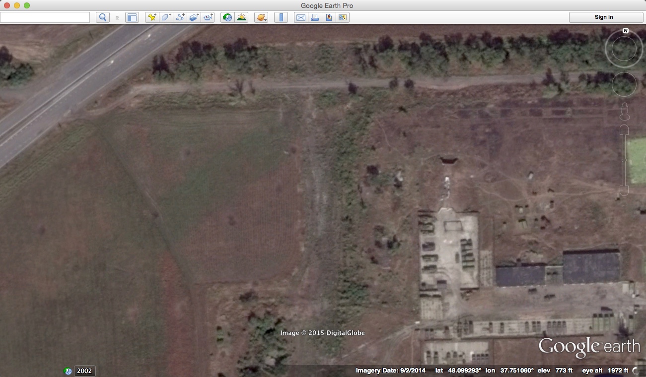
[Edit by @Mick West] The original post here suggested that comparisons of images of vegetation vs. no vegetation might be explained by difference in the type of imaging, and could actually show little or no change. However inspection of the chronological sequence of satellite images shows beyond all doubt that the change in vegetation is real, hence the claim is marked as "confirmed".
Location: 48.099246°, 37.750438°
For details see:
https://www.metabunk.org/confirmed-...wing-changes-in-vegetation.t6430/#post-156990
-----------------------------------------------------------------------------------
Original Post Follows:
-----------------------------------------------------------------------------------
Already a for a while I've been wondering about a couple of specific claims made in Bellingcat's article New July 17th Satellite Imagery Confirms Russia Produced Fake MH17 Evidence. This is not about the "missing BUK" issue but about the following claims which seem intended as some kind of important circumstantial evidence.


This might be related to specification. The Russian "Persona-2", which is the suggested satellite, is claimed to have 0.33 meter max ground resolution using panchromatic (source). Compare this to Worldview-2 with 0.46-0.50 for panchromatic and 1.84-2.4 for multi-spectral. This means the two satellites might disagree on the presence and coloration of certain details which will be most problematic when it comes to soil structure, smaller relief and vegetation because of the finer textures and mixed compositions.
What is also interesting and possible relevant is the change in shadows: the observation zenits and azimuth angles of both satellites. Here's a sample of image 2 to check the shadows. The MoD is the image to the right with short, high-contrasted shadows pointing north-west. WV2 at the lest appears to have a more north-east oriented shading here but in the other images way less so.


Now the most stunning example in the research article: the "changes in vegetation". First the original from the article:


Now what I ask here is to let go for a moment of the concept of looking at "tree tops" but instead look for some of the terrain features. With some hesitation I made a quick attempt and also corrected the vertical alignment (just focus on the main "knob" feature halfway the "passage"). It's just for orientation and the realization that we'd might be looking at a bunch of different colorations, different elevation levels perhaps, some shadows and/or higher contrast added to some shadows at 10 o'clock. So it's certainly possible we don't have "changes in vegetation" at all! Or at least we just don't have the resolution here to know for sure if it's all a matter of just vegetation or rugged terrain features! Keep in mind that many smaller features below 0.5m might become erroneously defined or colored.


Note that if Bellingcat's claim for changed vegetation would be invalid, the Russian analysis claiming the "tree belt" being "deliberately distorted" in the Ukrainian image (which probably also was taken as well by WV2) would also become invalid.
One other interesting issue is the following news:
"DigitalGlobe Inc. on Wednesday secured approval from U.S. regulators to sell satellite images of objects as small as a shoebox to overseas and commercial clients " 2014-06-11 Wall Street Journal
"During June 2014 DigitalGlobe received permission from the US Department of Commerce to collect and sell imagery at the best available resolutions" Satellite Imaging Corporation
This is possibly a factor when comparing old and new DigitalGlobe imagery for example through Google Earth, which appears to have indeed way higher detail since July 2014. Keep in mind that the color details are provided by merging multi-spectral images with a resolution between 1.84m and 2.4 m, meaning that finer features will receive a calculated hue when the multi-spectral is merged with the high-res panchromatic. In other words (and this can be easily seen browsing through GE history) one easily gets too way much green in an area or if we tune some parameters or use higher resolutions, we'll now get earth toned colored features!
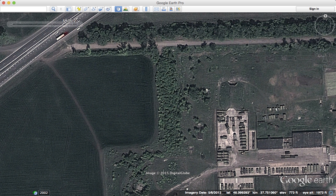
My conclusion however is not that there were no changes in landscape at all or that one party claims a wrong date and the other not. But the claim of "changes in vegetation" is not convincing based purely on comparing a high-res panchromatic of one satellite with generated pan-sharpened, probably slightly less high-res image from another satellite and angle. The most clear demonstration can be seen with interactive photo 5 with the claimed "changes in the field". It just takes a bit of careful looking to see the same field lines are present in both images but only in the MoD version extremely faint. This is a good example of misreading landscape features based on various wrong assumptions.
The Bellingcat claims about the landscape appear therefore to be largely unsubstantiated but it would be great if other views and critiques could be presented here.
Location: 48.099246°, 37.750438°
For details see:
https://www.metabunk.org/confirmed-...wing-changes-in-vegetation.t6430/#post-156990
-----------------------------------------------------------------------------------
Original Post Follows:
-----------------------------------------------------------------------------------
Already a for a while I've been wondering about a couple of specific claims made in Bellingcat's article New July 17th Satellite Imagery Confirms Russia Produced Fake MH17 Evidence. This is not about the "missing BUK" issue but about the following claims which seem intended as some kind of important circumstantial evidence.
- interactive photo 2. "note the changes in terrain, vegetation"
- interactive photo 3. "note the changes in the terrain"
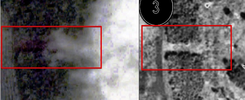
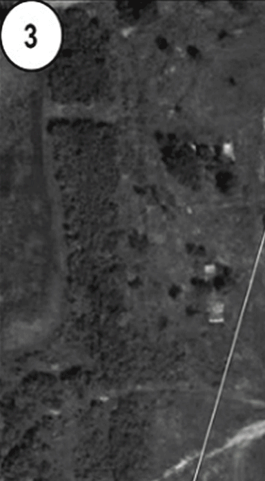
- interactive photo 4: "note the changes in vegetation"
- interactive photo 5: "note the changes in the field"
This might be related to specification. The Russian "Persona-2", which is the suggested satellite, is claimed to have 0.33 meter max ground resolution using panchromatic (source). Compare this to Worldview-2 with 0.46-0.50 for panchromatic and 1.84-2.4 for multi-spectral. This means the two satellites might disagree on the presence and coloration of certain details which will be most problematic when it comes to soil structure, smaller relief and vegetation because of the finer textures and mixed compositions.
What is also interesting and possible relevant is the change in shadows: the observation zenits and azimuth angles of both satellites. Here's a sample of image 2 to check the shadows. The MoD is the image to the right with short, high-contrasted shadows pointing north-west. WV2 at the lest appears to have a more north-east oriented shading here but in the other images way less so.
Now the most stunning example in the research article: the "changes in vegetation". First the original from the article:
Now what I ask here is to let go for a moment of the concept of looking at "tree tops" but instead look for some of the terrain features. With some hesitation I made a quick attempt and also corrected the vertical alignment (just focus on the main "knob" feature halfway the "passage"). It's just for orientation and the realization that we'd might be looking at a bunch of different colorations, different elevation levels perhaps, some shadows and/or higher contrast added to some shadows at 10 o'clock. So it's certainly possible we don't have "changes in vegetation" at all! Or at least we just don't have the resolution here to know for sure if it's all a matter of just vegetation or rugged terrain features! Keep in mind that many smaller features below 0.5m might become erroneously defined or colored.
Note that if Bellingcat's claim for changed vegetation would be invalid, the Russian analysis claiming the "tree belt" being "deliberately distorted" in the Ukrainian image (which probably also was taken as well by WV2) would also become invalid.
One other interesting issue is the following news:
"DigitalGlobe Inc. on Wednesday secured approval from U.S. regulators to sell satellite images of objects as small as a shoebox to overseas and commercial clients " 2014-06-11 Wall Street Journal
"During June 2014 DigitalGlobe received permission from the US Department of Commerce to collect and sell imagery at the best available resolutions" Satellite Imaging Corporation
This is possibly a factor when comparing old and new DigitalGlobe imagery for example through Google Earth, which appears to have indeed way higher detail since July 2014. Keep in mind that the color details are provided by merging multi-spectral images with a resolution between 1.84m and 2.4 m, meaning that finer features will receive a calculated hue when the multi-spectral is merged with the high-res panchromatic. In other words (and this can be easily seen browsing through GE history) one easily gets too way much green in an area or if we tune some parameters or use higher resolutions, we'll now get earth toned colored features!
My conclusion however is not that there were no changes in landscape at all or that one party claims a wrong date and the other not. But the claim of "changes in vegetation" is not convincing based purely on comparing a high-res panchromatic of one satellite with generated pan-sharpened, probably slightly less high-res image from another satellite and angle. The most clear demonstration can be seen with interactive photo 5 with the claimed "changes in the field". It just takes a bit of careful looking to see the same field lines are present in both images but only in the MoD version extremely faint. This is a good example of misreading landscape features based on various wrong assumptions.
The Bellingcat claims about the landscape appear therefore to be largely unsubstantiated but it would be great if other views and critiques could be presented here.
Last edited by a moderator:
") Please keep in mind the obvious fact that any Google "green land" doesn't render dark at all on the MoD images like the many roads which appear so much brighter: they certainly appear to render certain types of soil lighter, where WV2 at times almost obscures the same features.
Please keep in mind the obvious fact that any Google "green land" doesn't render dark at all on the MoD images like the many roads which appear so much brighter: they certainly appear to render certain types of soil lighter, where WV2 at times almost obscures the same features.