Debunked: HAARP rings/scalar squares, etc. validated in paper from Stanford

Now he's making this claim:

4/26/2012 -- No NWS warnings for WV, VA, OH, NC, SC.. BE ALERT = tornadoes, hail, damaging winds

http://www.youtube.com/watch?v=v8-sV...feature=relmfu


He's claiming that the NWS is failing to identify severe weather or possibly deliberately fail to warn people about severe weather. Fact is, none of the storms reached criteria to be classified as severe. Some were "strong" but the criteria for issuing a severe thunderstorm warning is pretty specific and those criteria were not met.

Also, no tornadoes occurred or were detected by radar. TITAN mis-identified that storm.

Sorry, gonna have to correct ya on this one. It just so happens that about an hour before dutch made that vid, severe thunderstorm watch 188 was issued, which is the one he points out in the vid covering srn IL, swrn IN and nwrn KY. That system developed into a severe line of storms a few hours later as it moved SE while the storm system dutch focused on was less severe overall and dissipated over that time. At the time ww188 was issued there were also active severe thunderstorm warnings in exactly the areas dutch hightlights but claims no warnings were issued. Yes, they were...see HERE. For whatever reason they didn't show up on Intellicast, or may have expired by the time he made his vid as those storms were weakening, but dutch doesn't bother to go to the SPC current convective watches page to verify anything. He just yammers on about the pretty pictures on a glitchy, free radar display product but can't be bothered to check the website of the very agency he accuses of not doing their jobs in issuing weather alerts. The SPC was all over the weather that night and by all indications that I can see issued all the appropriate watches and warnings.

I've gotten so beyond annoyed with Dutch I can hardly speak. I have been suggesting that people google "NEXRAD hoax", click through all the links and think about how the same story Dutch is telling now was told and debunked 10 years ago. His response? He asked how the stories can be that old because they didn't start until 2008 and implying I would not research "HAARP ring confirmation". The first is just laughable. The second? It produced a lot of hits.....all of which led directly back to him. Imagine the mindset that thinks his own "work" is confirmation of his theories. Ah, the wonder of an education grounded in YouTube.

I hear ya. After that vid accusing the NWS of not issuing warnings, while the developing system he ignored wound up producing the strongest storms, I wrote to the SPC in case there's anything they can do like slapping him with wreckless endangerment or something. He claims to be "saving lives" but the sad reality is he's endangering the lives of those who believe his nonsense. Just for good measure I wrote to Intellicast to alert them of dutch's copyright infringements.
 
"His confirmation that the 7.9 earthquake in Mexico was man-made because their was and earthquake drill at the epicenter the day of the quake."

The epicentre was at the border of two states. The drill was another state away - minimu distance about 300 miles.
 
Ditchsense will continue lying, scamming and accusing faceless people of murder until he is slapped down by the law. He has enough sheep now that the money must be trickling in.

And his flock will ensure that any serious threat to his income is flagged away.

Youtube stand by and let it happen. Worse, they take down factual videos without reviewing them and allow no recourse to arbitration or review of their decision.

One thing that is missing from the arsenal against Ditchsense is a definitive explanation of the square compositing artifacts. It is easy enough for anyone with an ounce of common sense to understand what they are, but until and unless a definitive explanation appears from NWS, Accuweather, Intellicast or somesuch, then the sheep will follow the crook.
 
I have been commenting on Dutch's videos for a while now, and I'm surprised how long I've gone pointing out the flaws in his videos without getting banned. I think the most violent reaction I got out of him was a "foaming at the mouth" response. He just published a new video on these circular sweeps/saw-tooth signatures. I'm looking at it now and seeing what big flaws I can catch.
 
Wow, on his latest video...

http://www.youtube.com/watch?v=WpZeSjPMs0c&feature=g-all-u

Take a look at the comments...it just shows you how delusional this poor guy is. Someone says "you've been debunked," and of course, he goes flying off the handle. And then his fellow sheep who jump in and say "the whole country has been debunked." These guys have reached a level of lunacy beyond comprehension.
 
Sorry, gonna have to correct ya on this one. It just so happens that about an hour before dutch made that vid, severe thunderstorm watch 188 was issued, which is the one he points out in the vid covering srn IL, swrn IN and nwrn KY. That system developed into a severe line of storms a few hours later as it moved SE while the storm system dutch focused on was less severe overall and dissipated over that time. At the time ww188 was issued there were also active severe thunderstorm warnings in exactly the areas dutch hightlights but claims no warnings were issued. Yes, they were...see HERE. For whatever reason they didn't show up on Intellicast, or may have expired by the time he made his vid as those storms were weakening, but dutch doesn't bother to go to the SPC current convective watches page to verify anything. He just yammers on about the pretty pictures on a glitchy, free radar display product but can't be bothered to check the website of the very agency he accuses of not doing their jobs in issuing weather alerts. The SPC was all over the weather that night and by all indications that I can see issued all the appropriate watches and warnings.


I hear ya. After that vid accusing the NWS of not issuing warnings, while the developing system he ignored wound up producing the strongest storms, I wrote to the SPC in case there's anything they can do like slapping him with wreckless endangerment or something. He claims to be "saving lives" but the sad reality is he's endangering the lives of those who believe his nonsense. Just for good measure I wrote to Intellicast to alert them of dutch's copyright infringements.

Thanks for the correction/clarification. I saw his initial claim of:

"""Current States with NO WARNINGS from the NWS that we need to Watch..Ohio, Tennessee, West Virginia, Virginia, North Carolina, and South Carolina... also possibly Georgia.""""

regarding the first MCS as it moved through SW VA. I looked at the products out of the Blacksburg NWS office and was primarily focussed on that claim. I wasn't looking at that system upstream so my critique of his video was not complete. I did notice in the area forecast discussion and HWO from NWS RNK that they were watching that upstream system in KY and they ended up issuing a t-storm watch for their southern counties.
 
Ditchsense will continue lying, scamming and accusing faceless people of murder until he is slapped down by the law. He has enough sheep now that the money must be trickling in.

And his flock will ensure that any serious threat to his income is flagged away.

Youtube stand by and let it happen. Worse, they take down factual videos without reviewing them and allow no recourse to arbitration or review of their decision.

One thing that is missing from the arsenal against Ditchsense is a definitive explanation of the square compositing artifacts. It is easy enough for anyone with an ounce of common sense to understand what they are, but until and unless a definitive explanation appears from NWS, Accuweather, Intellicast or somesuch, then the sheep will follow the crook.

I think the squares are peculiar to Intellicast. Intellicast has a brief explanation of how it renders mosaics in "panels" and missing or bad data may result in deletion of the entire panel from the image resulting in a square hole. The composite might result in multiple layers with multiple over-laid panels to you can get partial deletion of one or several panels which gives you Dutch's "sawtooth" pattern. I've seen that with virga and ground clutter since 1998. Radar detects a broad areas of light precip. The precip doesn't verify on the ground and it the panel gets chopped. But a comprehensive explanation would help. The bad thing about a definitive explanation from NWS, Accuweather, Intellicast, etc... about any anomaly on the radar display is that it is automatically dismissed as "dis-info" by PCT crowd. I've seen this when providing solid explanations of spokes, ground clutter, and anomalous propagation.

Radar operations center: http://www.roc.noaa.gov/WSR88D/ has a wealth of information in their NEXRAD NOW newsletter. They often discuss display and data collection issues.
 
Well, no turning back for them now. Dutch makes the ultimate proclamation - he claims he has found the solid proof of HAARP forming a storm. He shows in the following video a flash on the NEXRAD station and then a storm pops out of nowhere. I must admit, nature gave him some good timing, but this is quite explainable if you stop and think about the environmental conditions that existed over Kansas that evening. And he makes several bad claims along the way.

1.) Storm is moving at 80-100 miles per hour. Wrong, sorry. If you look at the various warnings on this storm from Dodge City, you'll see how fast the storm was actually going. This was issued 8 minutes after the storm formed:

AT 1142 PM CDT...NATIONAL WEATHER SERVICE DOPPLER RADAR INDICATED A
LINE OF SEVERE THUNDERSTORMS CAPABLE OF PRODUCING PING PONG BALL SIZE HAIL...AND DAMAGING WINDS IN EXCESS OF 60 MPH. THESE STORMS WERE LOCATED ALONG A LINE EXTENDING FROM ISABEL TO WILMORE...AND MOVING NORTHEAST AT 35 MPH.

35 mph...and the next warning, out about an hour later, has it even slower - 20 mph. So no, this storm isn't moving nearly that fast.

Secondly, when you look at the weather maps, you'll notice CAPE values are rather high in that area - between 2500-3000 J/kg. When instability is that high, "explosive" thunderstorm development can occur. That is exactly what happened in Dodge City, and if you look closely enough, you can see the storm beginning to form precipitation before the so called "frequency flash." The storm popped rather quickly, catching Dodge City off guard, so they quickly switched over to precipitation mode. The storm blew up from there. Nothing fueled the storm other than the unstable atmosphere over Kansas that evening.

http://www.youtube.com/watch?v=EwzLjIT1Xog&feature=g-all-u

Your smoking gun has been extinguished. Next move, please.
 
Just got around to viewing that video from 4 May. It is also notable that the storm is about equidistant between adjacent radar sites and not near the center of the "flash".

I see his several of his commenters claim that natural storms can never appear in the 15 minute interval between radar sweeps. That is simply incorrect. Break through a weak mid level warm cap with sufficient CAPE and it is like uncorking a shaken up champaign bottle. I see storms blow up like that all the time down here in Florida during our wet season.

I notice too that he got the tip from Bethanyhome7. He pretty much drove her to a nervous breakdown awhile back. I feel sorry for her.

http://www.youtube.com/watch?v=bqj9ySQCtxY&feature=channel&list=UL
 
Just got around to viewing that video from 4 May. It is also notable that the storm is about equidistant between adjacent radar sites and not near the center of the "flash".

I see his several of his commenters claim that natural storms can never appear in the 15 minute interval between radar sweeps. That is simply incorrect. Break through a weak mid level warm cap with sufficient CAPE and it is like uncorking a shaken up champaign bottle. I see storms blow up like that all the time down here in Florida during out wet season.

I notice that he got the tip from Bethanyhome7. He pretty much drove her to a nervous breakdown awhile back.

http://www.youtube.com/watch?v=bqj9ySQCtxY&feature=channel&list=UL
Yep, they can certainly appear quickly, especially summertime air mass thunderstorms. Any storm has to go from no return to something at some point.
 
Dutch often looks at ground clutter and refers to it as something like:

"""10/15/2011 -- Large cluster of 'HAARP rings' (VLF / UHF) -- South and Southeast USA """


http://www.youtube.com/watch?v=BzROem1Jc9k


What was going on in that particular video was that birds were making their southerly migration on northwest winds behind a cold front. Large flocks of birds migrate at night high in the sky above calm surface winds up where they can get tail winds. Radars pick up birds quite well. Raw data look like a big blob surrounding the radar site. Intellicast and Accuweather attempt to suppress the clutter and end up displaying rings associated with multiple sweeps of differing radii. Bird watchers actually documented the migration event that dutch called ULF and VLF HAARP rings.

http://www.nabirding.com/2011/10/21...at-ibsp-hawkwatch-friday’s-week-6-oct-14-2011/


The the night before we noticed on the radar that the backside of the cold front (note the rain in Michigan and Indiana, and also south in Georgia) showed birds were getting up and migrating over night. All those green circular blobs outined in blue are radar indications of migrating birds – by the thousands.
If the raptors followed suit Friday, we were in for quite a show.
I was up at 530am, out the door before 6am, and at Sandpond just before 7am for Greater Scaup and Gadwell.


In the following video skip to the 8:36 mark and watch the nocturnal "flashes" progress from the plains states toward the Gulf Coast and southeast behind a cold front. Radar clutter associated with birds typically follows cold fronts in the fall when winds are out of the north. Radar clutter associated with bird migration runs ahead of cold fronts in April and May because the birds migrate on the southerly winds ahead of fronts in the spring.

http://www.youtube.com/watch?v=D13pthfl0bM&feature=g-all-s

So dutch's ultra-low frequency spike is just birds flying in this particular case (in a lot of cases in his spring and fall videos actually).


He tried to claim that weather that occurred in the southeast over 72 hours later was cause by these "spikes" and "rings". Fact is, the weather was all that severe. Nor did it occur near at the "ring centers".

http://www.youtube.com/watch?v=OT2WCUFQeec&feature=channel&list=UL

Plus, it is absurd to think that the clutter on the radar caused by the signal bouncing off of birds is really a radar detecting frequencies that it is physically incapable of detecting.

I will note that "rings" associated with migrating bird clutter are most intense in southerly winds ahead of cold fronts in the spring. Weather associated with the frontal passage is likely within a short time after the birds show on the radars; working well for dutch's 24-48 hours. However, such "rings" are always centered on the radars that are detecting the birds which, as you can see in the year long time lapse if you watch April and May (3:27 to 3:29 mark for example), often extend through multiple states. These serve no predictive purpose for what area along the front will get severe weather or if the weather will be at all severe.

In the fall with this type of clutter caused "ring or flash" return following the cold fronts, it is not unusual for high pressure to build in after the flashes and the weather be fair for 4 or 5 days. This has happened to dutch's predictions numerous times in the fall such that he started extending his predictions to 72 hours. He ended up deleting a lot of comments in the fall when weather would be sunny for a week or more in his "warned" areas.

A final note: This is just one source of non-precipitation returns that dutch has attributed to HAARP activity. Though it is one of the more common.
 
"""5/17/2012 -- Circle sweep outbreak -- CO, ND, SD, MN, NE, KS, MO, OK, TX, AR, TN, KY, WV """

http://www.youtube.com/watch?v=oe3zgGfBwtE&feature=channel&list=UL


Again claiming the ground clutter on weather radar due to birds migrating past the radar is "them" manipulating the weather.


Here are some bird watchers using NWS radar to track the spring migration:

http://www.woodcreeper.com/


[h=2]Migration continues up through the Plains and along the East Coast where southerly flow is strongest[/h]Posted on 5/17/2012 by David La Puma
[h=2]National Overview[/h]The east sides of both a warm front stretching down across the Great Plains and a cold front running down the East Coast represented the main transit lines for northbound migrants last night. Birds continue to move north out of the Gulf states, as well, with Circum-Gulf migration into Texas apparent on the radar last night.
 
He claims in the comments:

"""" and even IF noaa called for each general area (which they haven't).. im saying a 100% occurrence will hit each ring epicenter .. each town.. but let be frank.. noaa doesn't forecast for specific towns to be hit.. they generalize for whole areas.. and if the flash is "clear air mode' then "clear air mode" is causing storms to appear within two days.I personally would say the flash is a flash."""""

This has never occurred for any of his "predictions". Why are people so bamboozled when he puts up his "confirmation" videos and claims 100% success when the weather either isn't even severe or is not actually hitting the towns he named or is both not actually severe and isn't hitting the actual ring centers? Why don't they demand that he take a still of all the "flashes" and then overlay the severe weather reports for the next 2 or three days and prove that 100% of the towns, counties, and states that he names were hit?
 

Attachments

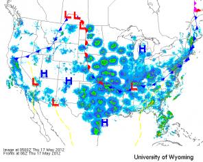
  • 17May12_0500.jpg
    17May12_0500.jpg
    20.3 KB · Views: 596
6/3/2012 -- New Meteorology discovery? DORMANT VOLCANOES STEAMING worldwide

http://www.youtube.com/watch?v=CtR2hkLqSbg&list=FLHE92x768p8h-fMrqhsnE1Q&index=0&feature=plcp


Dutch is claiming here that he is seeing diurnal volcanic activity on satellite because big plumes appear over various areas as the sun passes overhead. He proposes "magma tides", saying that steam or something is coming out of the ground and causing thunderstorms.

Is any more debunking needed than to point out that buoyancy driven convection is caused by the sun and that is why these storms have a diurnal pattern with peak activity around 2pm on average? How about the fact that most of the "plumes" are not near dormant volcanoes, drilling sites, or mines?

A good portion of the video is focussed on Mexico about which he says:

Several volcanic areas -- steaming -- daily -- worldwide. Producing hail and damaging winds ... which disappear as quickly as they start.

.... Mexico has been doing this for OVER two weeks.. Texas started in earnest this past week (last week of May 2012).

The convection occurring over Mexico is normal. It is the start of the North American Monsoon. The monsoon begins in Mexico in May and spreads northward. Convection associated with the Monsoon is enhanced by orographic lift in the mountains. Moisture from remnant tropical cyclones and tropical waves can enhance the thunderstorm activity.

http://www.wrh.noaa.gov/twc/monsoon/monsoon_NA.php

The only unusual thing is that it is a couple of weeks early but so was the tropical cyclone season and the onset of the wet season here in Florida.


Oh, and on Florida. When this high pressure moves out and out wet season pattern returns here in Florida, will he declare that Florida is going volcanic? He says that storms popping up and dieing soon after is not normal. Well, our typical wet season thunderstorms occur between 2 and 6pm with a peak frequency around 4pm which corresponds to daytime heating maximum and the time of day when the east and west coast seabreezes typically collide. The storms collapse once they use up the available CAPE. That restabilizes the atmosphere until the sun comes out the next day to start the cycle all over again. Florida storms blow up and die out with a pattern very much like what he is showing over supposed volcanic sites.
 
That is downright laughable, not to mention the fact that he confused a "meteorological" discovery to a "geological" discovery. Last I checked, volcanoes are not a big focus in the meteorology field.
 
Interesting. He moved the "New Meteorology Theory" video from his main Dutchsinse channel to his secondary Dutchsince channel.
 
http://www.youtube.com/watch?v=Qcoxgd5geoc&list=UUHE92x768p8h-fMrqhsnE1Q&index=1&feature=plcp

I find it mildly amusing that Dutch essentially debunked his own claim without even realizing it.

Large steaming events still occurring at roughly the same spots each day.. some are erupting fast enough to produce hail and damaging winds EACH DAY ... Central to North Mexico.. along the border of Texas.. extending north into the western portion of Texas near Chinati hot springs.

Correct me if I'm wrong, but I've never heard of steam eruptions contributed to strong to severe convective activity. Thunderstorms, however...
Once again, a complete failure to understand (or even bother to research) meteorological phenomenon, coupled with Intellicast's horrendous storm tracking, have contributed to a bogus video.

And while we're on the topic of Intellicast, did any of you see his video where he accuses Intellicast of "toning down" the color table to make storms look less severe than they really are?

http://www.youtube.com/watch?v=ul9HKW156V8&list=UUHE92x768p8h-fMrqhsnE1Q&index=6&feature=plcp

Downright laughable. If people are relying on Intellicast for their severe weather alerts (which by the way, show NWS alerts - I don't know if people are oblivious to them or just take the TITAN storm tracking more seriously), then they deserve a Darwin award.
 
6/3/2012 -- New Meteorology discovery? DORMANT VOLCANOES STEAMING worldwide

http://www.youtube.com/watch?v=CtR2hkLqSbg&list=FLHE92x768p8h-fMrqhsnE1Q&index=0&feature=plcp


Well he had moved this to his alternative channel to be forgotten since it was almost self-debunking. But and an many others that are blocked from his main channel weren't blocked from the alternative so wecommented extensively. He deleted the majority of my comments, particularly those that were receiving a lot of "thumbs up". I guess I should have saved them. Many commenting are impolite crazies. I did not take that tack but he has deleted me anyway. It's funny how he leaves the comments that are inflamatory but lack substance but deletes those that are substantive.

Toward the end of the video he goes back to his old Pisgah Crater "plume". It shows up on as a weak return on radar in clear air mode. He says it is a gas that is reflective of the radar but not visible on satellite and that's why there is a return on radar but not the satellite. I pointed out that the plume originated at the "Marine Corps Air Ground Combat Center (MCAGCC) Twentynine Palms" area and was likely just dust blowing down range during live fire operations. Dust that would not be particularly thick and the same color as the surrounding terrain and therefore not obvious on visible satellite but would reflect radar.

He responded by private message:

anything with a reflectivity (particulate) from a dust storm, to insects.. to large clouds from fires... even large clouds of gasses.. such as a large CO2 release or SO2 release... or natural gas.. if its reflective.. it will show on radar.. and this cloud appears to be concentrated... IF it was a dust storm.. wed see it on visible.. but its a clear day .. so we know its coming from a volcanic area on a clear day producing a return on radar..

scrom.. you do realize you deny everything !! lol

Of course he blocked me so I cannot reply. I reply here. Gases are transparent to radar. It is correct that particulates are reflective of radar. Even fine particulates, those that constitute visible smog, do not show up on radar. If C02 or S02 were visible on radar then radar wouldn't work because it would be blinded by the atmosphere. Particulates that reflect the radar are often invisible on satellite. Birds and insects are examples. It takes a big dust storm to show on satellite and that is not the type of radar signature in this video. This "cloud" is not concentrated but is diffuse and showing a weak return. If dust it would be very unlikely to show up on satellite. The existance of this live-fire range at the genesis of his "Pisgah" plumes has been pointed out to him in multiple videos over the years. He is actively hiding that fact from his subscribers.
 
http://www.youtube.com/watch?v=Qcoxgd5geoc&list=UUHE92x768p8h-fMrqhsnE1Q&index=1&feature=plcp

I find it mildly amusing that Dutch essentially debunked his own claim without even realizing it.

I find it particularly funny that at the 5:57 mark he points out the wildfires in New Mexico to distinguish the wildfires from his "plumes" (which are all natural buoyancy driven convection, some being the type of "dry lightning storms" that start new fires). Notice that the smoke from the wild fires in that visible satellite loop is not visible for the first half of the day. The smoke seems to "erupt" after noon at about the same time that the thunderstorms to the east of the fire pop up. That is typical fire behavior for the fire to flair in the afternoon when relative humidities reach their daily minimum and dispersion indicies peak. But, that is also behavior that he said in previous videos was proof that the smoke plumes could not be fire:

https://www.metabunk.org/threads/46...d-Seismic-Zone-2-9M-quake-follows-more-coming


or a fairly well timed wildfire EACH DAY .. which then magically goes out overnight and half the day..


Of course his subscribers have long forgotten the details of those videos to remember that dutch said that fires should not behave as the New Mexico fire here, laying down at night and then flaring in the PM. No, if the New Mexico fires weren't all over the news he'd likely be calling those "volcanic plumes" as well.
 
Last edited by a moderator:
In typical dutchsinse fashion he banned critics en-masse a few days ago on his secondary channel after getting a lot more critical comments than praise over that latest plume vid.

Here's a vid where he claims to see "ghost storms" on nexrad.

www.youtube.com/watch?v=ygL94gN6d5o

The description he wrote for the vid is beyond ridiculous:

Seen as a flash into extremely high RF -- multiple systems show the flash and the "storm" produced on a clear day....

Seen on College of dupage, and NEXRAD as well.. PLUS on Intellicast returning as strong cell thunderstorms , and damaging winds !

http://weather.cod.edu/satrad/index.php

http://www.intellicast.com/Local/WxMapFull.aspx

http://weather.cod.edu/analysis_old/paulradar.pl?VBX

however on infrared and water vapor (plus visible now).. NOTHING there at all in real life.. clear day at the location!

Which means we are seeing a frequency storm (what I call a "ghost storm") .. that is to say a storm that appears on RADAR but no to the naked eye... possibly plasma of some kind.. or an electromagnetic phenomenon that occurs when this amount of frequency in injected into a certain part of the atmosphere for a certain amount of time.

Nevertheless.. in real life.. it it showing on other weather systems as REAL STORMS with REAL DAMAGING WINDS... which I do not doubt.. at least the damaging winds are most likely being produced.

I would assume using high frequency to heat the atmosphere would indeed produce strong winds (vortex rotation mixing of hot and cold air aloft).. thus returning a storm when none is actually there!

Where to begin? First of all, the claim that it was a clear day is total bunk. I checked web cams on Weather Underground for the Santa Barbara/SLO town area on the morning of 6/10 and they were pretty well socked in with dense fog associated with a layer of marine stratus pushing inland.

Webcam loop for that date and location here: http://www.wunderground.com/webcams/K6LCM/1/video.html?month=06&year=2012&filename=20120610.mp4

Fog and marine stratus doesn't show up very well on early morning satellite images in either visible or IR. Water vapor imagery is only valid for the upper third of the troposphere, like higher than 20,000', and is primarily used to visualize upper level winds anyway. Water vapor imagery tells us nothing about moisture in the lower part of the troposphere. There was also a low pressure offshore to the nw with a trough right along a dry line in the same position as the line of returns offshore (dutch's "ghost storm") which was probably just virga. The intense return immediately surrounding the radar station at the beginning of the loop was probably due to the dense fog. He states this alleged "ghost storm" shows up on "multiple systems". Well all of those internet radar display providers get their radar data from a single source, the NWS Nexrad network so of course it's going to show up on "multiple systems".

cheers
 
His latest "scalar square haarp ring forecast" is likely destined for an epic fail.

www.youtube.com/watch?v=fgaJA1uF-90

Published on Jun 20, 2012 by dutchsinse
Watch just west of Austin Texas.. SW to San Antonio Texas for the next 48-72 hours for possible tornadoes, excessive damaging winds, and large hail.

The vid was made at 11:11 pm central time on June 20. No reports of even so much as a raindrop in the "danger zone" after nearly 36 hours. If the NWS forecast is accurate, which it appears to be, there won't be any rain in south TX until the middle of next week.

DISCUSSION...
TWO SIGNIFICANT EVENTS ARE LINING UP OVER THE NEXT 7 DAYS...THE FIRST
BEING A STRONG HIGH PRESSURE RIDGE ALREADY BUILDING OVER TX...AND
THE SECOND BEING A TROPICAL DISTURBANCE THAT MODELS SHOW AN
INCREASING POTENTIAL TO IMPACT SOUTH TX NEXT WEEK.

In the vid he whines about scalar squares not showing up very often lately because Intellicast has "adjusted the feed to quality control this out. They have changed their system so that we cannot see these anymore," implying that they're onto him and have taken steps to hide the evidence in some sort of vast conspiracy against him. LOL He also whines about the NWS not issuing any watches/warnings across the central plains where there was a line of rain and thundershowers. He claims radar was showing a line of "strong cell thunderstorms" (notice how he just makes up his own terminology as if it's official or something) producing hail and damaging winds (as indicated by Titan storm tracking on Intellicast) for which the NWS "doesn't appear to have many alerts issued". That's because those storms were relatively weak and no alerts were necessary which is confirmed by a lack of storm reports for those areas.

A few critical comments on the vid before he disappears them:

"All right, Dude, if there is a tornado in Austin before Sunday, you are the MAN. Of course, if there is not a tornado in Austin, you are the paranoid fearmonger."

"In one sentence, he distrusts one system, then relies on that system to "report" ???? This is so entertaining."

"OMG, as a programmer of these types of systems, oft we have to contend with "dirty data". The limbic system sees what it wants to see."

"I highly doubt they changed their radar just because of these "HAARP Rings." Every website has to change and upgrade."

"This dude is such an amazing douchebag."

cheers
 
In that Texas vid he only showed the heavily filtered Intellicast display with its "Scalar Square". That scalar square is simply the Intellicast computers trying to eliminate non-precipitation returns from the display and since intellicast renders its mosaics in square panels you get sqare gaps in the display.

Given the time stamp on the display he used, the non-precipitation returns around the Austin, TX area were bats emerging around sunset. It would be easier to determine if he had used a different display. The bat signature is quite distinct in unfiltered data. Bats have freaked out his subscribers in the past. I commented heavily on the following video and suprisingly didn't get blocked or deleted. It has good examples the scale of non-precipitation returns that occur when the bats (mostly Mexican free tailed bats) are emerging in that region:

http://www.youtube.com/watch?v=3sX6C7_U_FE
 
Funny he whines about "scalar squares" not showing up as often. They are most common with virga. Virga is most common with overrunning precip ahead of warm fronts during the winter and early spring. Thus the Intellicast filter garbage that he calls "scalar squares" are less common in summer.

Ground clutter is also very common at night during spring and fall bird migrations. It is not uncommon for a veritable "cloud" of clutter returns to appear around many stations covering entire regions ahead of fronts in the spring and behind fronts in the fall. Intellicast often sees the non-precipitation returns and then deletes the sqare panel immediately over the affected radars so that you see green "doughnuts" with square center holes. Dutch knows this and deletes all such explanations in comments. I can only conclude that he is perpetrating a deliberate deception.

As for the clutter around Austin that resulted in an Intellicast square for Dutch's latest. It was bat clutter that Intellicast was trying to filter out. Check out:

http://vortex.plymouth.edu/nids.html

You can input EWX for the radar nearest Austin. Select the 0.5 degree 124 NM radar. Select June 21 at 3Z and 0 minutes and the Java loop. At 0153Z (2053 central daylight time) you see the first bat colony emerging just west of the radar and the return is pretty impressive by 0203Z. The resolution isn't great but you can see a bunch of other colonies in the area emerging. By 0237Z the radar is filled with ground clutter (bats and the insects that they are out to eat). It's that clutter that Intellicast filtering is making a mess of with its "scalar square". You can see this bat emergence almost daily in the evenings well into the fall on nights when there isn't precip in the area. They come out earlier or later depending on temperature and bug abundance.
 
Yeah, he relies almost exclusively on Intellicast's glitchy filtering and woefully inaccurate storm tracking as the foundation of his fearmongering narrative. He only uses other providers when something he can weave into that narrative happens to show up, like the recent "ghost storm" vid. Yet he doesn't compare Intellicast to the others in order to verify it's not just an Intellicast thing. Funny, that. And he whines about how Intellicast allegedly downgraded their color scale allegedly making storms appear weaker than they actually are, while ironically the storm tracking marks storms with damaging wind/hail when in fact it's just a common thundershower.

Watching the bats on radar is a nice little unintended bonus in those WSR-88D's. Thanks for the links.

I commented heavily on the following video and suprisingly didn't get blocked or deleted. It has good examples the scale of non-precipitation returns that occur when the bats (mostly Mexican free tailed bats) are emerging in that region:

http://www.youtube.com/watch?v=3sX6C7_U_FE

I think bethanyhome7 finally figured out the sun spike thing, yet she still calls them "terminator beams". She is paranoid beyond all hope, it seems.

I noticed waronerror voluntarily removed her channel. Perhaps she finally realized that she was participating in a scam.
 
www.youtube.com/watch?v=fgaJA1uF-90

Published on Jun 20, 2012 by dutchsinse
"Watch just west of Austin Texas.. SW to San Antonio Texas for the next 48-72 hours for possible tornadoes, excessive damaging winds, and large hail."

The vid was made at 11:11 pm central time on June 20.

How does that compare to the NWS forecast issued before Michael made his vid? (BTW, dutch claims his forecasts are more specific than the NWS...LOL)

AREA FORECAST DISCUSSION
NATIONAL WEATHER SERVICE AUSTIN/SAN ANTONIO TX
857 PM CDT WED JUN 20 2012

DISCUSSION...
THE FIRST OFFICIAL DAY OF SUMMER HAS ENDED UP BEING MORE SPRING-
LIKE WITH SCATTERED SHOWERS AND THUNDERSTORMS ACROSS EASTERN
PORTIONS OF THE CWA...AND SUNNY AND WARM ACROSS WESTERN PORTIONS
OF THE REGION. THE SHOWERS AND THUNDERSTORMS WILL CONTINUE THROUGH
THIS EVENING AND GRADUALLY TAPER OFF BEFORE MIDNIGHT. THE BEST
CHANCES FOR MEASURABLE PRECIPITATION WILL BE ACROSS AREAS GENERALLY
EAST OF HWY 281 WHERE MOISTURE DEPTH IS BEST. A LULL IN ACTIVITY
IS EXPECTED OVERNIGHT...WITH ONLY A FEW SHOWERS/STORMS ACROSS THE
COASTAL PLAINS. ANOTHER ROUND OF DIURNAL CONVECTION IS EXPECTED ON
THURSDAY AS WE WILL REMAIN WEDGED BETWEEN 500MB RIDGES TO OUR EAST
AND TO OUR SOUTHWEST...AS WELL AS THE SFC RIDGE ACROSS THE GULF.
TEMPERATURES ON THURSDAY WILL BE SIMILAR TO TODAY.

A WARMING AND DRYING TREND WILL BEGIN ON FRIDAY AS THE UPPER
RIDGE ACROSS THE DESERT SOUTHWEST BUILDS NORTHEASTWARD. THE CENTER
OF THE RIDGE WILL BECOME STATIONED ACROSS THE SOUTHERN PLAINS OVER
THE WEEKEND...RESULTING IN HIGHS CLIMBING INTO THE UPPER 90S TO
JUST ABOVE 100 BY SATURDAY. THE BEGINNING OF NEXT WEEK WILL
DEFINITELY FEEL LIKE SUMMER AS RIDGING ALOFT AND SUBSIDENCE
THROUGH THE MID-LEVELS KEEPS US IN A HOT AND DRY PATTERN. WHILE
TEMPERATURES WILL BE ABOUT 5 TO 8 DEGREES ABOVE AVERAGE FOR LATE
JUNE...RECORD HIGHS ARE NOT ANTICIPATED AT THIS TIME.

It's been over 72 hours, duchsinse failed while the NWS was pretty much spot on. Curious to see how he reacts to that failed "haarp ring forecast" just before the release of "FreQ Weather".

cheers
 
Oh, this is just pure hilarity. On his Facebook page, Dutch is infering that the "scalar square" is drawing Debby westward...contrary to the latest forecast tracks. Funnily enough, one of his viewers noticed this and decided that in fact, the scalar square was not going to turn Debby west, but push it away from Texas. Funny.

He also insists Debby is man-made. From Facebook:

this storm is evil by the definition .. quote webster "Profoundly immoral and malevolent".... and since the storm is man made.. and coming towards land .. and will cause for certain animal deaths.. and possibly human deaths.. therefore I would say that meets the minimum definition of immoral and malevolent = this storm is indeed evil.

Also not counting the oil spill still out there.... that DOUBLES the malevolence of creating a storm in the area.. or maybe even triples it (IMO).. heck.. it makes any possible landfall TEN TIMES worse than just a regular landfall.
 
He commented about Debby on that Austin scalar square vid. (Hey dutch, that's Debby with a Y, not ie.)

tropical storm debbie forecast official track heading directly towards the center area inbetween San antonio, Austin, Houston!!!! its been about 70 hours since the frequency pulse ... and now we're seeing a tropical storm head right towards it... will watch to see if indeed TS debbie hits this area... be alert in south texas!
dutchsinse 19 hours ago in playlist

Debby took a turn in the opposite direction from TX not long after he made that comment. Too funny. So instead of admitting he was wrong, he just changes the narrative from a "scalar square" causing tornadoes to a "frequency pulse" attracting a tropical storm instead. However that's already backfired 'cause Debby turned her head and walked away...she won't be doing Dallas.

Oh, and he claims there was severe weather in the NW yesterday. Not so fast there dutchie boy, I live in Oregon.

6/23/2012 -- Tropical Storm Debby in Gulf -- Severe in Midwest, NW, and SW USA

Here's a comment from one of his fans who apparently lives in my neck of the woods.

heh dutch we actually have thunderheads coming up the valley in Oregon Willamette valley

Over exaggeration seems to be a trait of that bunch. I grew up in Indiana, I've seen plenty of thunderheads but what I saw yesterday from our place in the Willamette valley could barely be classified as cumulonimbus, much less thunderheads. No severe weather whatsoever in Oregon, or anywhere else in the NW afaik, with nothing more than a rumble or two of thunder, maybe a little pea sized hail, brief heavy rain and moderate wind gusts, mostly over the Cascades in a handful of locales but that's about as bad as it was.
 
Goalpost shifting is the only way that crackpot "theories" can survive. In spring 2011 it was tornadoes within 24-48 hours after rings. Most of his rings were actually nocturnal bird migrations ahead of cold fronts so weather did tend to follow within 48 hours of the appearance of such ground clutter. It didn't matter to him then or now that the weather actually has absolutely no correllation to his ring centers. Just that weather occurs in the vicinity allowed(s) him to shoehorn storms to the "rings". Then fall rolls around and the bird associated "rings" are occurring behind fronts as the birds are seeking northerly winds for migration. He starts out with 24-48 hours as a prediction but realized that was just not happening as weather is fair for at least three days following a frontal passage, even in progressive weather patterns. He then extended the "warning" to 48-72hrs and will claim a successful prediction even if the subsequent weather occurs 4 or 5 days following his predicion. No matter what follows his prediction he will generally change the narrative to shoehorn the results into his story.

This may be biggest goal post shift yet. No matter what Debby does he will claim to have detected the "frequency" that caused it.
 
Now he's getting desperate in trying to explain away his failed "scalar square" forecast for Austin:

now the storm moves directly to the jacksonville FL and W. Tennessee flash rings that appeared.. trumping the scalar square? im watching intensely trying to figure out whats going on..
they are shutting off the low dB signals out ahead of this storm.. showing on COD now.. literally they pulled the storm NE using these flashes..
wondering if the scalar square created the convection needed to form this storm.. once formed it was tracked to go DIRECTLY over TX.. then FLASH and now its going NE
dutchsince in reply to dutchsinse (Show the comment) 18 hours ago in playlist

"im watching intensely trying to figure out whats going on.."

Translation: "I'm trying to come up with a story that will be convincing to my ignorant flock so I can continue this charade and keep the donations rolling in or else I might have to get a real job."

"they are shutting off the low dB signals out ahead of this storm"

Translation: "Good thing my flock knows even less about weather radar than I do. As precipitation moved into the range of each radar station, those stations switched from clear air mode, with a sensitivity all the way down to -30 dBZ, into precipitation mode, with less sensitivity only down to +5 dBZ, so I'll make up some gibberish about shutting off low dB signals. Genius."

"wondering if the scalar square created the convection needed to form this storm"

Translation: "I gotta come up with something to explain why my scalar square forecast for Austin was an utter failure."

Wiki has a pretty good overview on the origins of Debby: http://en.wikipedia.org/wiki/Tropical_Storm_Debby_(2012)

In mid-June 2012, a low pressure developed in the central Caribbean Sea from the remnants of a surface trough that also spawned Hurricane Chris. Initially, the system remained disorganized due to unfavorable conditions.[1] By June 21, the system crossed the Yucatán Peninsula.

Debunking this guy is like shooting fish in a barrel.
 
Wanted to add a link to a paper on tracking bats with radar. It dates to 1995. It actually shows insects and emerging bats as ground clutter. These are signatures commonly attributed to HAARP by Dutch and his followers.

http://www.batcon.org/index.php/media-and-info/bats-archives.html?task=viewArticle&magArticleID=766

[h=3]VOLUME 14, NO. 3 Fall 1996
Bats Aloft: A Study of High-Altitude Feeding
[/h]An ongoing research project is demonstrating that Mexican free-tailed bats go to great heights to intercept some of North America's most costly agricultural pests . . .
McCracken, Gary F.
[h=4]An ongoing research project is demonstrating that Mexican free-tailed bats go to great heights to intercept some of North America's most costly agricultural pests . . [/h]There are three images with the study that illustrate biological ground clutter well. Here are the captions:

In the image on the left, the large triangular shape shows the bats first beginning to leave Frio Cave. The "doughnut hole" in the center roughly indicates the area around the mouth of the cave, where the radar cannot pick up the lowest flying bats that are just emerging. The scattered spots on the right are caused by large insect populations.

In the middle image, 13 minutes later, several colonies have begun to emerge. The bats from Bracken Cave show up in a doughnut formation. Also apparent is the emergence from nearby Ney Cave, the third largest bat cave in the area.
In the last image, 22 minutes later, other small bat colonies, including the one from Austin's Congress Avenue bridge, have also set out for the night. All the bats are traveling southeast toward the concentrations of insects over croplands.


Funny thing, I was not aware that such research had occurred was ongoing when I first saw a video calling these radar signatures "frequency bubbles" or some such. I deduced that it was bats based on my knowledge of weather radar, the time stamps on the images, and knowledge that there are big bat colonies in that region. Tooks me about 5 minutes using a still of the radar and Google Earth to locate several caves and the Congress Avenue bridge (didn't know about that colony). Then a quick literature search confirmed my hypothesis and opened up a neat branch of research that I was previously unaware of.
 
Big scaler square isle royal national park in northern wisconsin. 1135pm central time

QUOTE=solrey;7650]Dutchsinse has stumbled on a paper that in his words:


Dutchsinse video HERE.

Stanford paper HERE.

Specifically, the ".PDF paper from Stanford University" :confused: is a paper detailing research conducted by two graduate students and the Director of STAR lab, which is a research group within the Department of Electrical Engineering at Stanford University. The paper was published in Geophysical Research Letters in 2008. I've known about this research for a couple of years and I'm not surprised that dutchsinse has once again totally misinterpreted something he isn't even close to understanding. I think all he does is make up stories to match the pretty pictures (radar/satellite displays) he sees like a toddler that can't read yet.

Their research does not in any way, shape or form "fully cover the phenomenon that (dutch et al. have) been documenting since last year".

Dutchsinse claims:


A critical point here is that HAARP is not just a "ground based HF station heater", it's a phased array. A phased array specifically is necessary to produce the ELV/VLF "antenna" in the ionosphere which is the goal of the research.

All weather occurs in the troposphere, except in the case of strong convection in supercell storms where cloud tops punch through the tropopause into the lower stratosphere. The troposphere, where all weather occurs, extends from the ground to an altitude of between ~ 11 to 17 km. HAARP excites (heats) electrons in the lower ionosphere at an altitude of between ~ 70 to 100 km. It's important to note at this point that NEXRAD WSR-88D weather radar only extends to less than ~ 20 km in altitude. Weather radar transmits/receives at ~ 3 GHz whereas the HAARP array in this research transmitted at 3.25 MHz to produce an ELF/VLF "antenna" in the ionosphere that transmits at frequencies between 1 kHz and 6.25 kHz.

As you can see, the radio frequencies and operational altitudes between HAARP and NEXRAD are completely different such that they are totally incompatible.

HAARP transmits at a specific frequency in order to excite (heat) electrons in the ionosphere. When electrons are excited/heated, they emit electromagnetic radiation at specific frequencies. HAARP's phased array configuration allows them to rapidly, in a manner of seconds, excite/heat electrons in a pattern across a relatively small patch of the ionosphere above the HAARP facility. The phased array excites/heats the patch of electrons in the ionosphere with one of three specific patterns to produce ELF/VLF transmissions in the range of 1 - 6.25 kHz, which were received by very sensitive specialized equipment in three locations, two of which were ~ 700 km away. Nothing transmitted/produced by HAARP has any effect on weather whatsoever. The research in the paper in question is focused on communications and nowhere in the paper do they mention weather or weather radar.

Dutchsinse has interpreted this as verification that ionospheric heaters are responsible for weather modification and are producing, as he puts it:


If those patterns of electron heating in the ionosphere could be detected by weather radar don't you think they would have utilized one in order to visually confirm and study their ELF/VLF "antenna" in the ionosphere? Of course they would, but they didn't because they can't.

Regardless, ELF/VLF radio transmissions can't affect the weather or produce earthquakes for the same reasons that radio waves don't produce wind or rattle your windows. If heating the ionosphere with HAARP affects the weather, why is the weather not totally out of whack in the vicinity of Gakona, Alaska?

The energy imparted into the ionosphere by HAARP is less than the diurnal fluctuations in the ionosphere caused by energy received from the sun.

I'm sure Dutch doesn't understand the inverse square law regarding radio transmission either.

And if he thinks NEXRAD weather radar are also covert ionospheric heaters, well I'll just say that a weather radar station is not a phased array by any stretch of the imagination, and a phased array is required to produce those patterns of heated electrons in the ionosphere.

cheers[/QUOTE]
 
Not a Dutch video, but probably one of the most ridiculous ones I have seen in the last several days. It's only 46 seconds, but the video itself (and the comments which Dutch is a major part of) are pure debunking gold. Let the games begin.

http://www.youtube.com/watch?v=v-EaMTWpRpc&feature=g-all-f

"I was informed that NOAA was kind of giving HAARP...forecasts."
Prime (maker of the video) provides the link to the SPC Day 2 Outlook in the video (spc.noaa.gov/products/outlook/day2otlk.html). These aren't HAARP forecasts - are they assuming SPC just started copying them? It's a convective outlook, forecasts that the Storm Prediction Center has been doing for at least the last 25-30 years.

"They're calling them...derechos? What the f*** is a derecho?!"
This has been discussed on another thread - you can view it at https://www.metabunk.org/threads/627-Debunked-Freq-Weather. SPC has been forecasting these events for a while - the earliest documented High Risk day for a major derecho event was back in 1995. The earliest documented derecho ever in the United States was in 1969.

And no, genius...the forecasts aren't called derechos.

Let's move to Dutch's comments, and a few others:

to me.. this appears to be a "normal" forecast for a out of control weather pattern!!darecho .. lol.. I feel you on that.. last year was "haboobs".. this year .. darechos..we were only supposed to have one a year .. make that two or three.. or four now..As for Forecasting HAARP rings.. since intellicast LITERALLY changed their feed to omit such signatures.. (by lowering all returns to be abnormally low ... red now = yellow? lol)..That removed the lower signals that were just high freq..

Error #1: Can't even spell correctly. It's a derecho, not a darecho.
Error #2: Haboob has been a common meteorological term for years, especially in the desert Southwest.
Error #3: Who said anything about the frequency of derechos? They can happen anytime of the year, although they are most common during the summer - hence, not a surprise.

So id say.. this is not a haarp ring forecast by any means.. since they don't name any towns !! and don't say 100% this place will be hit.thats the key to a haarp ring forecast.. name the town AND make the 100% call for severe to hit within 48-72 hours.Of course "they" have access to all the un-quality controlled feeds.. which means "they" could do the forecasting we were doing..but they straight up smacked us down by cutting the feeds..

Error #1: SPC's job is not to forecast exact towns that will be hit - just the general regions. However, by looking at that page and toggling "cities," you can see what towns have the highest likelihood of experiencing severe weather.
Error #2: SPC is smart enough to not flat out say "it's going to happen." Every good meteorologist knows the weather is not 100% predictable and can throw a fastball at you at anytime. However...a moderate risk of severe thunderstorms indicates SPC has DECENT confidence that this severe weather event will occur for those areas.
Error #3: "They" cut the feeds and they could be doing the forecasts. How narrow-minded of Dutch to assume ALL severe weather forecasts are done by HAARP. Breaking news: there are much more accurate ways to forecast convective activity.

one final thing.. notice the super large areas.. and vague descriptions given for "unidirectionals" and "uncertainties"... which to me is funny... since I really do believe each storm system is now controlled..
unidirectional .. totally.. any way U want !

Error #1: Tomorrow is a large-scale event, hence the large areas. Rarely do all convective outlooks have this large of a risk area.
Error #2: I'm fairly sure Dutch has limited knowledge to what unidirectional and uncertainties mean - let me clarify.
SPC: Unidirectional wind profiles. Translation: wind moving in one direction at nearly all levels of the atmosphere. Favorable for damaging wind events.
SPC: Uncertainty over where the front will ultimately anchor. Self-explanatory. And regarding uncertainty - no forecast is going to have 100% confidence - there is always going to be some uncertainty, again because we don't completely understand the weather 100%.

And finally, one little thing about 2012Truthers comment:

He got the suggestion from me. So, you are saying that NOAA has always predicted these Derechos from the start? The last one hit and nobody had a clue... Now they are warning us? Don't you think that is a little suspicious? In our opinion Derecho's = HAARP... So that's where he got that NOAA was forecasting HAARP. Also, please note that intellicast was not even mentioned here... except by you... or haarp rings for that matter...
Error #1: NOAA has always been predicting derechos - it is a severe weather event, after all. Refer back to the first High Risk day for a derecho in 1995.
Error #2: Nobody had a clue - wrong. SPC did mention the possibility of widespread damaging winds earlier in the day but refrained from upgrading to moderate risk due to uncertainly. They did after the derecho formed and got the warning out to everybody downstream very quickly.
Error #3: Derechos = HAARP. No comment on this...really, they think everything nowadays is controlled. Refer to this entire thread for more controlled weather nonsense.
Error #4: NOAA is forecasting HAARP - no, NOAA is forecasting severe thunderstorm events, of which a derecho is one.

Rant done.
 
Last edited by a moderator:
Critique of your critique:

Error #1: SPC's job is not to forecast exact towns that will be hit - just the general regions. However, by looking at that page and toggling "cities," you can see what towns have the highest likelihood of experiencing severe weather.

They would if they could. As it is, their likelihood forecast are superior to Dutch's make-believe.

Dutch's error is that he claims since they don't name any towns !! and don't say 100% this place will be hit.thats the key to a haarp ring forecast.. name the town AND make the 100% call for severe to hit within 48-72 hours.

Yeah, he names towns and claims 100% certainty that they'll be hit. Fact is, the severe weather rarely directly hits his named towns or ring centers. He is like a bad cold reading psychic with a horrible success rate but total confirmation bias among his true believers. Much of the time severe weather does not even occur in the region where his "forecasts" are located. That is where he falls flat on this point.


As for Forecasting HAARP rings.. since intellicast LITERALLY changed their feed to omit such signatures.. (by lowering all returns to be abnormally low ... red now = yellow? lol)..That removed the lower signals that were just high freq


Intellicast did improve their clutter control to better omit non-precipitation return. You can still see what Dutch calls HAARP rings on the Intellicast feed though. It is just that the types of non-precipitation returns that generate the rings are a lot less common in mid summer. One of the biggest sources of nocturnal clutter that causes Intellicast's radar display to have "rings" and "scalar" squares are migrating birds. Mid-March through mid to late May and then mid-September through early November are prime time for these. See my posts #51 and 52 in this thread for examples.

Regarding cutting the feed. Intellicast is a private company selling a "refined" product. The feed to them was not cut. They just don't want to waste viewers time with non-precipitation returns. Less filtered radar data are still freely available from places like College of Dupage.

Oh, and yes. Intellicast did change the color scale. They were famous among weather enthusiasts for their radar display "over-hyping" precipitation intensity. Anybody that follows the weather knows that yellow on Intellicast indicated much lighter precipitation than yellow on any other provider's depiction. Green on Intellicast was often not even reaching the ground. The scale still shows the full dbz range that the radar detects, they just altered the color pallet.
 
I know the conspiracy crowd will claim that the following is just fake material to cover up their new discovery but derecho events have been studied for awhile. The Storm Prediction Center in Norman maintains a bibliography of studies on the topic:

http://www.spc.noaa.gov/misc/AbtDerechos/derechopubs.htm

Most of the studies of derechose mesoscale convective systems coincide with the development of modern weather radar as. Some studies on the page predate all the HAARP and Chemtrail hoaxes:

Such as:
Przybylinski, R. W., and D. M. DeCaire, 1985: Radar signatures associated with the derecho, a type of mesoscale convective system. Preprints, 14th Conf. on Severe Local Storms, Indianapolis, IN, Amer. Meteor. Soc., 228-231.

So there is a ton of material regarding derecho that predates this summer so anyone claiming that the term is new and totally made up is just wrong.

At the bottom of the SPC bibliography:

[SIZE=+2]Origin of the terms "Bow Echo" and "Derecho[/SIZE][SIZE=+2]"[/SIZE]
Fujita, 1978: Manual of downburst identification for project NIMROD. Satellite and Mesometeorology Res. Pap. No. 156, University of Chicago, Dept. of Geophysical Sciences, pp. 104.

Hinrichs, G., 1888: Tornadoes and derechos. Amer. Meteor. J., 5, 306-317, 341-349
 
^ Are these the same thing as "straight line winds" and/or downbursts? As a kid growing up in MN we often had storm damaged attributed to "straight line winds" and not a tornado...

..and wasn't it a downburst that caused Delta flt 191 to crash in Dallas in 1985?

Or is a derecho a much bigger event...?
 
Back
Top