I'm going to throw another spanner in the works. I think I have identified the tree line seen in the foreground. When I looked at the original distance 1.4km it just didn't feel right. The woods to the right were too blurry and the row of trees (specifically that "christmas tree") seemed too in focus in comparison. As someone who runs about with a camera in my spare time, it just felt odd. So I've gone back to everyone's agreed line of sight. I looked at the closest street view footage of that farm. In the middle of our line of sight.
Yes, it is at a much lower elevation to the poles and cable identified by
@Mick West @flarkey @Trailblazer an others. So of course you assume you would be able to see over it. And the trees I identified looking very similar to that Christmas tree and the funny shaped ones (the one virtually on the street out in front of the Coppy farm). But yes, they are indeed at a lower elevation and, I forget who it was, but a forum member found that green barn roof to help clear that up. So it wasn't that one.
However, looking at our agreed line of sight, there is a group of trees right behind Coppy Farm that are also exactly in our line of sight (stick with me, there will be some science coming) the above image shows the elevation of the farm (bottom right hand corner of the image shows 129m elevation) measurement taken between that furthest left pond/body of water and the tree line. And even this distance, from Nathan's vantage point he
would be able to see over it. Well over it and on to Flakey/Mick/Trailblazers identified expanse of cable.
However, I checked street view to see what trees were there and noticed a group of trees that looked similar - A few funny shaped trees and some Christmas tree looking ones. Not particularly scientific, I know, and we've found trees that look similar before and seemingly failed.
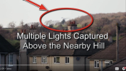
But what you'll notice from this image (google street view 2013) is that the trees appear to be raised. And the elevation is 142m. Quite a bit taller than the original Santa tree I'd found earlier in front of Coppy farm. Directly in Nathan's line of sight. A LOS we have all now fully agreed with.
As you can see from this google earth image showing (above) the elevation in the bottom right of the image identified just at the point the raised treelike meets the yellow line (our LOS) it's 142m.
Now maths like this are a bit much for me at this time of night after a very long day, school runs, dinner cooking and bedtime routine with the kinds, so I have utilised ChatGPT 5.1 to do the sums. This is the prompt:
"I am analysing a line-of-sight geometry problem. A power line cable is mounted 7–9 metres above ground on a pole situated at a terrain elevation of 170 m, giving the cable an approximate elevation of 177–179 m. My camera is located at an elevation of 115 m, with an additional 2 m for the viewing height from a first-storey window (total camera height ≈117 m). Between the camera and the pole, there is an intermediate hill with a ground elevation of 140 m and trees approximately 10 m tall, giving a total obstruction height of about 150 m. This hill is 715 m from the camera, while the pole is 1.4 km away. Given these elevations and distances, will the hill and trees obstruct the line of sight to the cable?"
The response was very long and too much text to share here, so I asked for a shortened summary and this is the response:
Yes. With your numbers, the hill + 10 m trees rise to
≈150 m, while the camera-to-cable line of sight passes over that point at only
≈148 m.
So the obstruction is
1–2 m higher than the line of sight, meaning the view of the cable is
blocked.
Without the trees (hill at 140 m), the cable
would be visible.
I pasted my prompt showing my math, so feel free to run it through your favourite LLM, or do it the old fashioned way if you think it's wrong and let me know where, but from what I can establish we cannot see those LV cables from Nathan's bedroom window.
Now I know some people might argue that the trees might not be that tall, but even is we halve them, we still have a problem with the second pole and the 45m expanse of cable identified by
@flarkey.
Only the first pole identified near the water tank is 170 m elevation. The second pole, next, down to towards the road, is 165 m elevation, so 7 meters too low for our line of sight.