Do contrails form around low level clouds? [Generally not]

Would it be evidence if the trails were shown at lower cloud level of 6,500ft in warm air?
It would be curious and atypical for contrails - so if you had accurate observations that established this, it would be evidence of a sort. However you'd also have to eliminate all of the simpler explanations that weren't chemtrails first.
 
Would it be evidence if the trails were shown at lower cloud level of 6,500ft in warm air?
Even if there were video of chemicals being prepared and loaded, I still don't think it would be believed and accepted by the majority if not shown in the mainstream. Most would remain unaware if it wasn't mainstream.

There isn't much point to musing what would happed IF certain evidence was shown, since it HASN'T been shown. Ever.
 
I have recorded and observed a lot of cloud and trail movement, I repeatedly observe lighter colored clouds moving and breaking apart faster than darker clouds.

I am at somewhat of a loss to understand what you meant by "lighter" and "darker" clouds....in terms of cloud appearance, the "darkness" of a cloud can be the result of its density, and also shadow effects. (Sunlight shadowing, is what I refer to). This perception is often entirely subjective, as well.

One of my favorite ways to understand clouds is with "fast" video. Or, more commonly called "time-lapse". This has been used for years, in MANY types of films (for other purposes) when the sky was the "background", but here are just two actual examples, where the clouds (and sky) were the focus:


The above video will show, in the time-lapse, some contrails too. Non-persistent, in this case. Contrail persistence varies, of course. Per differing conditions.

One more (no soundtrack):


The "point" here is about perception. Time-lapse video can show us examples that "normal" Human perception can never convey.
 
Last edited:
A bit off topic, but it is a large part of why I don't think plane trails are always condensation. There are numerous video's of white circular appearing ufo's flying in and around many trails, as if investigating and sampling them. My gf and I also saw this happen in person, a white ufo followed the trail of a plane moments before. It was similar if not exact to ufo's in this video.
 
A bit off topic, but it is a large part of why I don't think plane trails are always condensation.

They are ALWAYS mere condensation. Always.

Video #1 above is useless.
Video #2 above...more uselessness.

Sorry.

HOWEVER, each video is an example that will be thoroughly debunked, shortly. I promise you on this!
 
A bit off topic, but it is a large part of why I don't think plane trails are always condensation. There are numerous video's of white circular appearing ufo's flying in and around many trails, as if investigating and sampling them. My gf and I also saw this happen in person, a white ufo followed the trail of a plane moments before. It was similar if not exact to ufo's in this video.

Circular UFO's are almost certainly just out of focus birds, insects, plastic bags or other ordinary stuff in the air - see https://www.metabunk.org/threads/orbs-something-the-metajunk-shills-just-cant-debunk.1976/ - there's links to other threads in the 2nd message :)
 
I have shot and analyzed hundreds of hours of sky video, and I have seen these in person. They are certainly no publicly known species of bird or insect. I have also studied lens glare to rule that out as well. These ufo's are definately interested in the trails, I haven't seen them around high contrails.
 
I have shot and analyzed hundreds of hours of sky video, and I have seen these in person. They are certainly no publicly known species of bird or insect. I have also studied lens glare to rule that out as well. These ufo's are definately interested in the trails, I haven't seen them around high contrails.

Well, you might want to pick your best UFO and start a thread in Skydentify, as it's a bit off-topic here
https://www.metabunk.org/forums/Skydentify/
 
Here is a trail which seems to get larger as it enters a low cloud, I am guessing around 6,500ft. It doesn't seem to leave an exit trail.
How on earth are you coming up with these heights? These aren't low clouds. Do you think they are low because they look relatively close to the horizon?

I'm curious: what type of cloud do you think that is? And at what altitude do such clouds typically form?
 
Last edited:
Here is a trail which seems to get larger as it enters a low cloud, I am guessing around 6,500ft. It doesn't seem to leave an exit trail.

I think you are falling for the illusion that closer to the horizon means the same as lower. It does not. It means far away.

These contrails are all parallel to the ground and at about the same height:


These lines are all at exactly the same height:
 
I think you are falling for the illusion that closer to the horizon means the same as lower. It does not. It means far away.

These contrails are all parallel to the ground and at about the same height:


These lines are all at exactly the same height:

I am judging distance by clarity. I can see the different angles of low level clouds at 6,500 ft.
 
I am judging distance by clarity. I can see the different angles of low level clouds at 6,500 ft.

I think you are seeing something that is not there. There's nothing in the photo you posted to indicate the altitude of the clouds. There's no reason why you can't clearly see clouds at 35,000 feet. They will just look smaller.
 
I have shot and analyzed hundreds of hours of sky video, and I have seen these in person. They are certainly no publicly known species of bird or insect. I have also studied lens glare to rule that out as well. These ufo's are definately interested in the trails, I haven't seen them around high contrails.

do you have any examinable evidence for any of these claims, or is this an argument from incredulity?
 
I would say that is an honest description of your method of estimating altitude.

Many video's of objects flying at 7,000 ft. show large cloud coverage well below them around 6,500ft. Lower level cloud height is also noted by many scientific sources.
 
do you have any examinable evidence for any of these claims, or is this an argument from incredulity?

There are numerous youtube video's, but they have probably been posted already. When there are ufo's on video, it takes video of proven objects or lens glare in order to debunk them. I don't consider an opinion without objective supporting proof to be a scientific debunking.
 
There are numerous youtube video's, but they have probably been posted already. When there are ufo's on video, it takes video of proven objects or lens glare in order to debunk them. I don't consider an opinion without objective supporting proof to be a scientific debunking.

no it doesn't require proven objects to debunk them - they are claimed as some sort of craft with no evidence at all, so they can be dismissed as something reasonable with no evidence at all as well.

Showing that there is no evidence to support a particular claim is enough to debunk it as a fact.

If you are claiming that they are something specific then YOU are the one that needs to back up your claim - saying others have to disprove it is called argument from ignorance for a reason.

ETA: you might want to review your understanding of what debunking is - I recommend starting here - https://www.metabunk.org/threads/a-guide-to-debunking.1886/
 
Last edited:
WeedWacker's second video was a great illustration of trails forming a "ladder" when they are moved by the wind.
 
I am guessing around 6,500ft.
Which method are you using?

Here's some tips for estimating cloud height.

A rule of thumb for estimating the lowest cloud base is based on the temperature and dewpoint at the surface. Find the dewpoint depression in degrees F and then double it. Add two zeros to the result.

For example, assume the temperature at the surface is 59°F and the dewpoint is 57°F. The dewpoint depression (temperature - dewpoint) is 2°F. Doubling this leads to a 4 and adding two zeros leads to an estimate for the cloud bases of 400 feet AGL. https://avwxworkshops.com/forum/read.php?8,163
Content from External Source
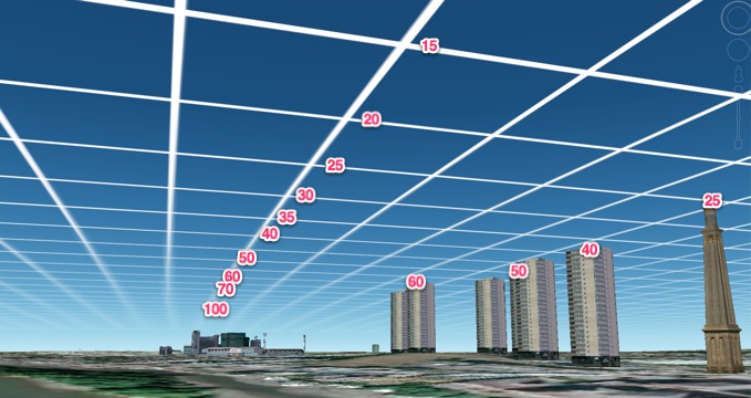
For operational purposes, the National Weather Service uses the information from radiosondes in conjunction with equations in a computer model to determine the "convective condensation level" (CCL) - the height at which convective clouds like cumulus will form from buoyant lifting of the air (caused by parcels of air warmed by the Sun's heating of the ground), or the "lifting condensation level" (LCL) - the height at which status clouds will form resulting from mechanical lifting of the air.

A simple estimate of the LCL can be calculated from the following equation (found in Wikipedia):

LCL P = 120 (T-Td),

where P is the pressure at the height of the cloud base, T is the surface air temperature (in degrees F) and Td is the surface dewpoint (in degrees F).

CCL P > LCL P

The CCL is usually higher than the LCL because warm parcels of air that rise convectively are always warmer than their surroundings and therefore do not cool to saturation until above the height at which the temperature of the surrounding air equals the dewpoint. In other words, convective air parcels overshoot the LCL.

The height at which the LCL P occurs could be determined with the US or International "standard atmophere", but that will not always be very accurate, as the structure of the atmosphere is rarely just like the standard atmosphere, which is a reflection of average conditions. You can find standard atmosphere calculators on the Internet. http://www.newton.dep.anl.gov/askasci/wea00/wea00331.htm
Content from External Source
 
I am judging distance by clarity. I can see the different angles of low level clouds at 6,500 ft.
But the photo you posted clearly showed rather distant clouds, given the amount of atmospheric haze obscuring them. There is no way those clouds were at 6,500 feet.

Also, different cloud types form at different altitudes. If you see a cirrus cloud, you know it's at a high altitude.

I just took this photo. How high do you reckon those clouds are? Using the rule of thumb that a fist at arm's length spans about 10 degrees, they are no more than about 15 degrees above the horizon, and clearly visible with no haze, yet I know they must be very high. And the slightly darker cloud at the right-hand edge, which looks "higher" in the sky, is much lower and closer, as can be seen by observing its movement.

image.jpg

As for the speed at which clouds (and therefore contrails) can move across the sky and still "hold together", here is a time lapse of six photos taken out of my window. The time from first to last shot is just 55 seconds. Notice that the "darker" clouds are lower than the "lighter" ones.

output_YyvCbQ.gif
 
Last edited:
http://www.crh.noaa.gov/lmk/?n=cloud_classification

According to this and many other sites, cloud height can be accurately measured with observation alone.

That site does not make that claim at all.

However it is true that clouds types generally form in specific height banks as indicated, so it is something that can be implied from what it does say.

I thought you were referring to contrail clouds - sorry for the misunderstanding.

The clouds form specific repeated patterns at specific altitudes.

Right - so if you see something that looks white and fluffy then it is likely to be a particular type and you an possibly pick a likely altitude band - but some of those bands are very broad - for example stratus can be anywhere from 2-3,00 feet to 20,000 feet, "thunderstorm" clouds anything from 1000 to 40,000!!

I am guessing the higher clouds are thinner because the air is thinner.

I don't think so - it is because of the amount of moisture that has precipitated out - cumulonimbus "thunderstorm" clouds at 35,000 feet can be very dense because there is a lot of moisture there - it is constantly churning and being bought up from lower levels, even though the air is thin.

cirrus, on the other hand, is thin because it is formed solely from the moisture that was in the air at high altitude - and because the air is thin it does not hold much moisture - so cloud formed from it is thin.

but none of that speaks to any reason why you would think contrails form at low altitude - knowing how they form means that you must conclude that they are al at high altitude - because THAT is the band they form at (normally)
 
Last edited:
We have also REPEATEDLY looked at perspective, where something may APPEAR to be the same height as something else but the perspective skews that.
is this lady REALLY holding the flags, or are they giant flags a lot further back?
 

Attachments

  • IMGP5797.JPG
    IMGP5797.JPG
    264.5 KB · Views: 285
It does not say that at all. If you want to claim something says something,then q ttp://www.crh.noaa.gov/lmk/?note what it says.

Different types of clouds form at different ranges of altitudes, but then lots of clouds look pretty similar, and the ranges are quite large

It does not say that at all. If you want to claim something says something, then quote what it says.

Different types of clouds form at different ranges of altitudes, but then lots of clouds look pretty similar, and the ranges are quite large

I didn't write that the site said it, but this picture implies it. The only thick one it shows reaching 6 km is cumulonimbus. It looks very distinct from all the other clouds. The others seem to thin out at 6km and up.
 
I didn't write that the site said it, but this picture implies it. The only thick one it shows reaching 6 km is cumulonimbus. It looks very distinct from all the other clouds. The others seem to thin out at 6km and up.

But these clouds you posted, and said were at 6500ft


look like cirrostratus clouds, which form above 30,000 feet.

So do you have any other evidence of a low level contrail?
 
That site does not make that claim at all.

However it is true that clouds types generally form in specific height banks as indicated, so it is something that can be implied from what it does say.

I thought you were referring to contrail clouds - sorry for the misunderstanding.


Right - so if you see something that looks white and fluffy then it is likely to be a particular type and you an possibly pick a likely altitude band - but some of those bands are very broad - for example stratus can be anywhere from 2-3,00 feet to 20,000 feet, "thunderstorm" clouds anything from 1000 to 40,000!!


I don't think so - it is because of het amount of moisture that has precipitated out - cumulonimbus "thunderstorm" clouds at 35,000 feet can be very dense because there is a lot of moisture there - it is constantly churning and being bought up from lower levels, even thought the air is thin.

cirrus, on the other hand, is thin because it is formed solely from the moisture that was in the air at high altitude - and because het air is thin it does not hold much moisture - so cloud formed from it is thin.

but none of that speaks to any reason why you would think contrails form at low altitude - knowing how they form means that you must conclude that they are al at high altitude - because THAT is the band they form at (normally)

I am interested in comparing cloud and contrail altitude.
If there are repeated contrails seen below or mixed with low level clouds, this provides evidence they may be something else. If all contrails I see are at or above 30,000+ ft clouds, I will accept they are nothing more.
 
I am interested in comparing cloud and contrail altitude.
If there are repeated contrails seen below or mixed with low level clouds, this provides evidence they may be something else. If all contrails I see are at or above 30,000+ ft clouds, I will accept they are nothing more.

Indeed - the problem is in using a guess for the altitude of clouds.

the types of clouds given in the picture of the page you linked to were only very generic, and designed to look different from each other - in fact there are dozens and dozens of cloud types officially recognised, and you can have thick, thin, scattered or solid clouds at any altitude:

 
But these clouds you posted, and said were at 6500ft


look like cirrostratus clouds, which form above 30,000 feet.

So do you have any other evidence of a low level contrail?

It looks much more like a stratocumulos to me, the cirro looks much thinner and holier.
But these clouds you posted, and said were at 6500ft


look like cirrostratus clouds, which form above 30,000 feet.

So do you have any other evidence of a low level contrail?


20141018_121148.jpg

20141018_122438.jpg

More plane trails mixing with natural low level clouds according to the chart posted. 20141018_122430.jpg
 
How are those photos evidence of a low level contrail??:confused:

I only see contrail in het 1st and 2nd pictures - and I cant' tell whether it is above or below the cloud there.
 
I believe they are plane trails mixed with nimbostratus or stratus clouds. The clouds show impressions as if planes flew directly into them leaving trails.

No, there are no nimbostratus clouds in that photo. The very word "nimbo" refers to the root "nimbus".


A nimbus cloud is a cloud that produces precipitation. Usually the precipitation reaches the ground as rain, hail, snow, or sleet. Falling precipitation may evaporate as virga. Rain comes out of nimbus clouds and this is called precipitation.

Since nimbus clouds are dense with water, they appear darker than other clouds.
Content from External Source
Images of NimboStratus.
 
I am interested in comparing cloud and contrail altitude.
If there are repeated contrails seen below or mixed with low level clouds, this provides evidence they may be something else. If all contrails I see are at or above 30,000+ ft clouds, I will accept they are nothing more.
That's commendable, but you really need to refine your observations first to a commonly accepted method so that when you say 'this cloud is at this height', it can be generally agreed on.
 
Would you agree that it has been demonstrated repeatedly that your estimate of 6,500 feet is incorrect?
 
Back
Top