Woody's observations of contrails in MN

Florida is not Minnesota

So?

Florida does tend to have excellent visibility due to the maritime subtropical airmass being very clear.

JRBid's picture is in an atmosphere with quite a lot of low level particulates and it still demonstrates viewing distance of upper troposphere clouds quite well.
 
One cannot identify these specific trails by watching the planes trails, through pictures or even video, only through observation over time, and this also requires being mobile.

Mobile?

Does driving along I-4 from Tampa to Daytona count? How about crossing the peninsula from Weeki Wachee to Deland? I've followed trails all the way across the state before.
 
Its impossible to see the skies from ground level with any clarity at a distance of 100 miles ... We have tracked the distance a visible contrail can be viewed, on a very clear day the distance is about 30 miles.

Doesn't matter if you are in Floirda or outer Mongolia. If it is a "very clear day" you can see a cloud at the tropopause from a lot further than 30 miles.
 
2 1/2 hour trail is not normal

Yes, it is.

They observed and sampled them over 40yrs ago:

External Quote:
It is often observed that contrails spread considerably...Under favorable conditions, a lateral spread of kilometers is observed...If sufficient air traffic exists, and entire overcast of contrail cirrus may develop and persist for hours with rapid growth in the ice budget of individual contrails
http://ciresweb.colorado.edu/science/groups/pielke/classes/atoc7500/knollenberg72.pdf

Lots more examples of contrails lasting for hours dating back decades here:

http://contrailscience.com/persisting-and-spreading-contrails/
 
Doesn't matter if you are in Floirda or outer Mongolia. If it is a "very clear day" you can see a cloud at the tropopause from a lot further than 30 miles.
Is there a way to prove this through an exercise?
I'm thinking maybe a fresh satellite photo that shows an identifiable cloud a certain distance away and some outside observation?
 
Yes, it is.

They observed and sampled them over 40yrs ago:

External Quote:
It is often observed that contrails spread considerably...Under favorable conditions, a lateral spread of kilometers is observed...If sufficient air traffic exists, and entire overcast of contrail cirrus may develop and persist for hours with rapid growth in the ice budget of individual contrails
http://ciresweb.colorado.edu/science/groups/pielke/classes/atoc7500/knollenberg72.pdf

Lots more examples of contrails lasting for hours dating back decades here:

http://contrailscience.com/persisting-and-spreading-contrails/
According to the paper you submitted that you should read again, 12 - 18 minutes before dispersion on sustained trails. No where do I find that 180 minute contrail on a daily basis is considered "Normal." We must also remember, Con-Trails have been around since we could get up high enough. We have also been actively engaged in weather modification since the 1940's so its no surprise to find photos of trails that may have been attempting to create rain clouds. There is one fact, there is no way today to be able to verify this, but it can be confirmed today!
 
Is there a way to prove this through an exercise?
I'm thinking maybe a fresh satellite photo that shows an identifiable cloud a certain distance away and some outside observation?
upload_2013-10-7_18-9-49.jpeg
Try to identify this flight, directly above St. Cloud heading from NW to SE at 4:05pm Central Time, this will give us a clue.
 
Mobile?

Does driving along I-4 from Tampa to Daytona count? How about crossing the peninsula from Weeki Wachee to Deland? I've followed trails all the way across the state before.
By standing outside and stationary observance, only a limited amount of clouds can be observed over time, they are moving we must remember. The amount of time on average is about 1 hour, varies on wind speed, from horizon to horizon before they disappear into the horizon. If you don't go mobile, you will not be able to determine the length of time they remain. At a distance of 40 miles the planes and trails become too small and obscured to see with any accuracy.
 
Woody, Ross has made a very important observation that demonstrates keen application of logic. It's pretty plain to see that you didn't photograph this plane passing over, and didn't document your claim that it didn't appear on Flightaware. What is also clear is that if the ordinary clouds made of water accompanying the contrail can persist along with it, you can't conclude that the contrail is any different. Like I asked you a long time ago, you need to document your case far better before you can make conclusions that what you see is anything out of the ordinary. Try again and pay attention to detail, documenting the whole event including the Flightaware screen shots as the plane passes over, time, lat/long, cardinal direction of the shot(use a compass away from metal) and let us see the whole thing. You can even order the FAA flight data for the event which would prove your case of unidentifiablility if true. Until you do all of this, you are wasting time.
I don't really care, and you all take great effort in distracting yourselves from the real question, please let me know if it is normal to find contrails remaining for over 180 minutes and supply your research and evidence to support or deny this as a common or normal occurrence.
 
When I'm driving to the beach I can see Connecticut but when I am ON the beach I can only see a sliver or it. That has nothing to do with anything, though, because contrails are not on he horizon, are they?


I showed you two photos that are obviously the same contrails, from at least 100 miles apart. You put your fingers in your ears and denied it. And you call people names? Ha.


Why not, because you said so? Come on, now, you've just handwaved everything said here.[/quote
Cloud seeding is in NO way related to contrails.
I agree with one exception, they appear as if they are a contrail and persist. Check out this video and you will see the steam in not a con trail, but a chemical mixture of silver iodine to help produce additional rain, and if enough was expelled it would appear as a persistent contrail. One element necessary I have found, Water Vapor, this is why they excel in front of storms and areas high in water vapor. Minnesota has a great deal of this.
 
According to the paper you submitted that you should read again, 12 - 18 minutes before dispersion on sustained trails. No where do I find that 180 minute contrail on a daily basis is considered "Normal." We must also remember, Con-Trails have been around since we could get up high enough. We have also been actively engaged in weather modification since the 1940's so its no surprise to find photos of trails that may have been attempting to create rain clouds. There is one fact, there is no way today to be able to verify this, but it can be confirmed today!

Not true- read the "experimental results and analysis" where is says:

External Quote:
The entire contrails and generated virga were visible for almost an hour
Nevermind that the opening paragraph of the paper clearly states that contrail cirrus may persist for hours...

Nevermind all the decades of observation and research on contrail formation and persistence which clearly shows how and why "normal" contrails can persist for hours...

Nevermind that basic physics that shows how in ice saturated conditions contrails cannot dissipate...

Here is a study where they watched contrails for several hours- and matched them to specific flights...(there is plenty more of this out there should you care to look)

External Quote:
Many of the contrails were visible ... for at least 3 to 4 hours before dissipating


https://ams.confex.com/ams/13ac10av/techprogram/paper_39764.htm

and another where they studied contrails for over 2hrs and identified the flights whence they came:

http://journals.ametsoc.org/doi/abs/10.1175/JAM2325.1

Also- it doesn't happen "on a daily basis" in MN. I used to live there, still have family there, and go back at least 2 times year...I have seen plenty of contrail free days in MN (although I do remember long persisting contrails in the sky when I was a kid growing up in MN some decades ago.)
 
Woody, Ross has made a very important observation that demonstrates keen application of logic. It's pretty plain to see that you didn't photograph this plane passing over, and didn't document your claim that it didn't appear on Flightaware. What is also clear is that if the ordinary clouds made of water accompanying the contrail can persist along with it, you can't conclude that the contrail is any different. Like I asked you a long time ago, you need to document your case far better before you can make conclusions that what you see is anything out of the ordinary. Try again and pay attention to detail, documenting the whole event including the Flightaware screen shots as the plane passes over, time, lat/long, cardinal direction of the shot(use a compass away from metal) and let us see the whole thing. You can even order the FAA flight data for the event which would prove your case of unidentifiablility if true. Until you do all of this, you are wasting time.
Not true- read the "experimental results and analysis" where is says:

External Quote:
The entire contrails and generated virga were visible for almost an hour
Nevermind that the opening paragraph of the paper clearly states that contrail cirrus may persist for hours...

Nevermind all the decades of observation and research on contrail formation and persistence which clearly shows how and why "normal" contrails can persist for hours...

Nevermind that basic physics that shows how in ice saturated conditions contrails cannot dissipate...

Here is a study where they watched contrails for several hours- and matched them to specific flights...(there is plenty more of this out there should you care to look)

External Quote:
Many of the contrails were visible ... for at least 3 to 4 hours before dissipating
https://ams.confex.com/ams/13ac10av/techprogram/paper_39764.htm

and another where they studied contrails for over 2hrs and identified the flights whence they came:

http://journals.ametsoc.org/doi/abs/10.1175/JAM2325.1

Also- it doesn't happen "on a daily basis" in MN. I used to live there, still have family there, and go back at least 2 times year...I have seen plenty of contrail free days in MN (although I do remember long persisting contrails in the sky when I was a kid growing up in MN some decades ago.)

So, you believe this is a daily norm today, the papers specifically identify dates where they were optimum, so you still have not answer my question, you believe this is still normal daily or just as the papers say, under ideal conditions?
 
Not true- read the "experimental results and analysis" where is says:

External Quote:
The entire contrails and generated virga were visible for almost an hour
Nevermind that the opening paragraph of the paper clearly states that contrail cirrus may persist for hours...

Nevermind all the decades of observation and research on contrail formation and persistence which clearly shows how and why "normal" contrails can persist for hours...

Nevermind that basic physics that shows how in ice saturated conditions contrails cannot dissipate...

Here is a study where they watched contrails for several hours- and matched them to specific flights...(there is plenty more of this out there should you care to look)

External Quote:
Many of the contrails were visible ... for at least 3 to 4 hours before dissipating
https://ams.confex.com/ams/13ac10av/techprogram/paper_39764.htm

and another where they studied contrails for over 2hrs and identified the flights whence they came:

http://journals.ametsoc.org/doi/abs/10.1175/JAM2325.1

Also- it doesn't happen "on a daily basis" in MN. I used to live there, still have family there, and go back at least 2 times year...I have seen plenty of contrail free days in MN (although I do remember long persisting contrails in the sky when I was a kid growing up in MN some decades ago.)
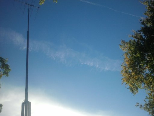
How do you know it is not daily, have you been here daily the past couple years driving around the state observing them? As I stated before, this is daily around the state and began around 2009/2010 to the degree we see them today. I am still waiting on flight id on the above pic. October 9, 2000 is not even comparable to daily, esp when the next day they were gone and only appeared on 2 days out of the days they observed.
 
Check out this video and you will see the steam in not a con trail, but a chemical mixture of silver iodine to help produce additional rain, and if enough was expelled it would appear as a persistent contrail.

But that's a small plane. It's not a jet at high altitude like what people say spray chemtrails.
 
Look people, as I said before, Minnesota is filled with them, and I am personally inviting anyone who wishes to observe them with me and try to explain them, you too will be baffled by their sheer numbers and formations, far more than anywhere else in the nation we have observed.
 
This video is the closest thing I have found that can offer a reasonable and scientific explanation that doesn't use the excuse, "Its alterations in the Atmosphere causing it." If we are making clouds and cooling the planet, then whats the big deal about chemtrail activists and those so entrenched in disproving it? I'm sure the chemtrail activists have subjected themselves to far greater respiratory threats throughout their life. We must expect alterations, but if we can alter them to our benefit, then we do expect our government to do something about it.
 
View attachment 4393Try to identify this flight, directly above St. Cloud heading from NW to SE at 4:05pm Central Time, this will give us a clue.
A likely candidate is this flight from Winnipeg to Orlando, which passed right over St. Cloud at 35,000 ft at about 4:10 pm (taking into account the 5 minute delay for FAA data). At 4:05 it would have been easily visible in the sky, about 40 miles to the NW and heading in your direction.
StCloudFlight.jpg
 
A likely candidate is this flight from Winnipeg to Orlando, which passed right over St. Cloud at 35,000 ft at about 4:10 pm (taking into account the 5 minute delay for FAA data). At 4:05 it would have been easily visible in the sky, about 40 miles to the NW and heading in your direction.
View attachment 4395
This is too far south by at least 10 miles. On my way home I saw at least 4 contrails on the west side of 94 as this one demonstrates you supplied the last 6 miles on 94 from Hwy 8 to Hwy 75, it was probably one of these or one that followed as this is a typical flight path we observe daily here. Usually the flights are visible in the western and southern skies. To give you a more exact location of the flight, and as you can see by the pic, its directly over this location circled and trajectory was estimated for research. Unless you have a way to view unidentified flights, I do not think you will find this one, as I find none of them and at least 70% are indentified.
upload_2013-10-8_3-38-33.jpeg
 
Here is another view of the course and trajectory from Downtown, you can also view what appears as a "Dump" in the back ground, the same thing we see from crop dusting planes close to the ground, and the end just like a crop duster who ran out of his supply and has to return and reload. Same type of disbursement, with contrail ONLY showing after the dump, this is not atmospheric as the following photos will display,
 
15 minutes later the cloud appears over the tree tops of my home, second picture demonstrates the continuation path of the flight with no trails present, only the dump section remains. Time, 16:22 CST
upload_2013-10-8_3-51-8.jpeg
upload_2013-10-8_3-52-41.jpeg
 
At 16:48, this is what it looked like 43 minutes later. Contrails today were huge, and if you had binoculars I am sure they were remaining for at least 5 minutes. None remained except from those planes that do not show up on any flight tracking, indicating either a private or military fight. You can also research another flight, the one at the top of the pic.
upload_2013-10-8_3-57-33.jpeg
 
This other flight ran in the same trajectory only in the opposing direction as the flight above, it caught me off guard as I was now at the store up the block and was not watching that area of the sky. Estimated time overhead would have been approx 16:38
upload_2013-10-8_4-2-23.jpeg
 

Attachments

  • upload_2013-10-8_4-1-34.jpeg
    upload_2013-10-8_4-1-34.jpeg
    1.5 MB · Views: 404
Or a civil flight without ADSB fitted. Plenty of those.
Yes, but that accounts for 30%, explain 100% of these specific cloud formations coming from ONLY unidentified craft. If you see and document as I have, soon you find the probabilities way too disproportionate. I was at 0 :: 21, now we are way above 0 :: +100 as unidentified.
 
This one is the second flight taken at 17:15 CST, over 1/2 hour later. Another unidentified craft with only a section of the trail remaining. This cloud was created via specific aircraft and did not leave anything before the trail began, indicating once again, a dump of some kind.
upload_2013-10-8_4-11-36.jpeg
 
Why don't you get some proper equipment then? I haven't seen any plane on one of your pictures, you do know it is easily to get a much better ID, so you easily read the ID on the plane itself? If this is so important why don't you try to make a picture like this:
http://images.extremespotting.com/PHOTOS/3542/L
LOL, you are too funny, seriously, you think I am going to spend that kind of money? Have you ever tried to hold a camera still and take a stable picture of a plane from the distance of of 5 miles? You need a tripod with a super fast shutter, because its moving, and remove trigger to maintain stability. I run my own business and I do want to upgrade to digital here, but I don't have an extra 10k for the Avigilan system I want, but donations are being accepted :) I have other priorities, and as I said, I am here to discuss this, I could care less and you all seem to care more, but either way, no one has came up with anything except "Atmospheric conditions" Its a good excuse, for a while, until it becomes worn out.
 
Back
Top