
DavidB66
Senior Member.
Re: accessibility of the Old Bedford River.
There shouldn't be any problem about accessibility of the end points, as these are public road bridges.
The 'midway' marker is not quite so straightforward. There doesn't seem to be any proper footpath along the north-west bank of the river, which is where Wallace put his marker, but the south-east bank should be equally good for the purpose. Google Earth shows a clear path or track on that side of the river, which is probably used by the vehicles of the waterway authority. I wasn't sure whether there is general public access to this track, but I see that it is recommended as part of a circular walk around the wetland nature reserve between the Old and New Bedford Rivers, so there must be some public access. For the experiment there also needs to be access to the water level itself. From photographs the banks can be steep and clogged with vegetation in places, but the Old Bedford River is used by anglers, so there must be at least some access points. There are some images at an angling website here www.welneyanglingclub.co.uk/theoldbedfordriver.htm
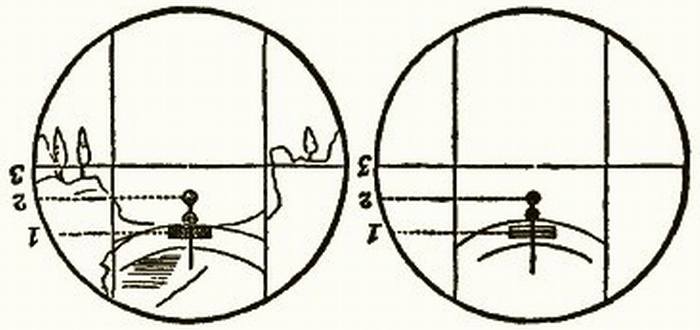
") The problem, as always, is how slight the curvature of the earth is compared to the scale of human perception, and even long railway lines.
The problem, as always, is how slight the curvature of the earth is compared to the scale of human perception, and even long railway lines.