A classic demonstration of the curvature of the Earth was performed by Alfred Russel Wallace in 1870:
http://blogs.scientificamerican.com...modern-biology-got-suckered-by-flat-earthers/

(Original source is Wallace's "My Life", Page 364-376)
Put more simply, we have:
A) A telescope (which we would replace with a digital camera with powerful zoom lens)
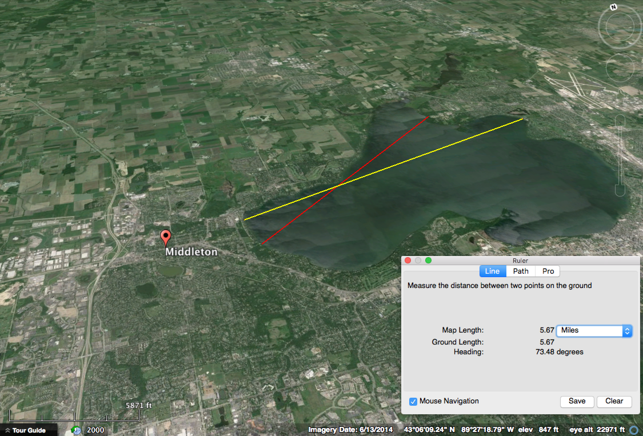
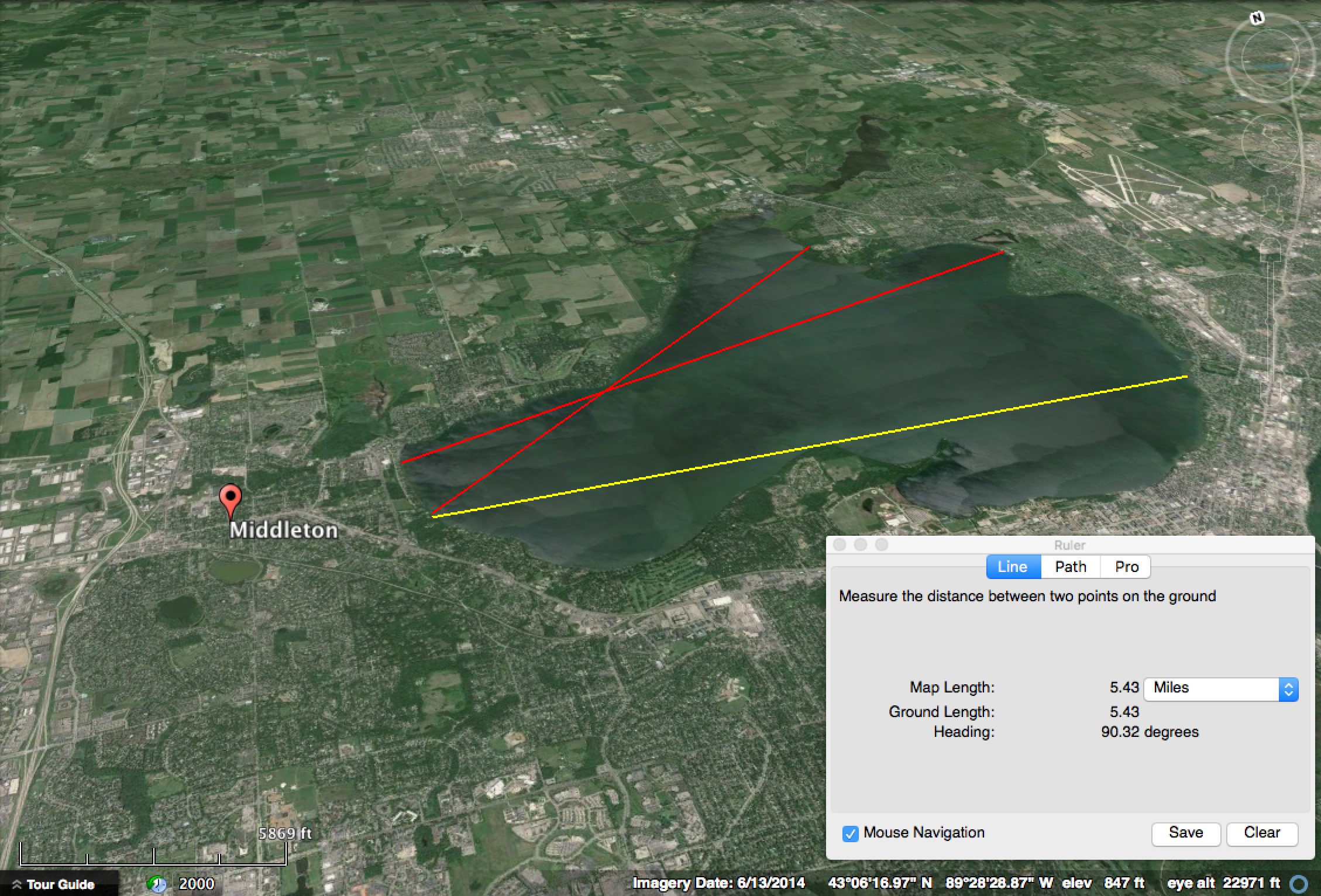
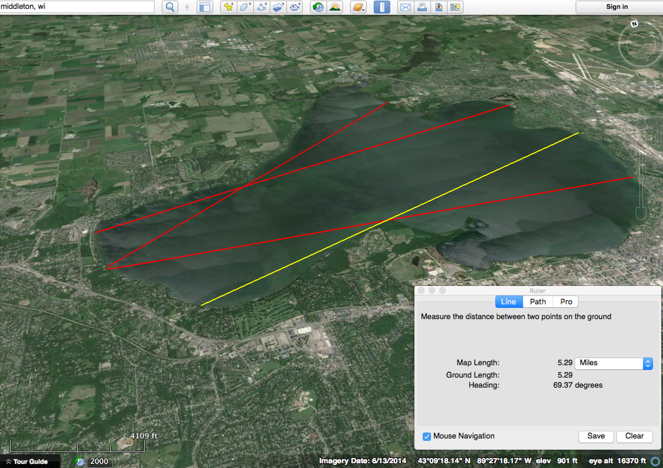
B) A target 3 miles away
C) A target 6 miles away, in line with A and B.
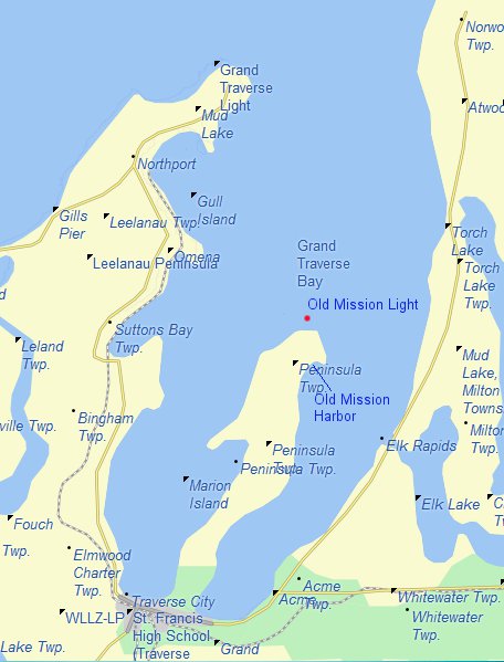
A,B, and C are all the same height above the waterline. So you just look from A towards B and C, and if B is visually higher than C then the water surface is curved up in the middle.
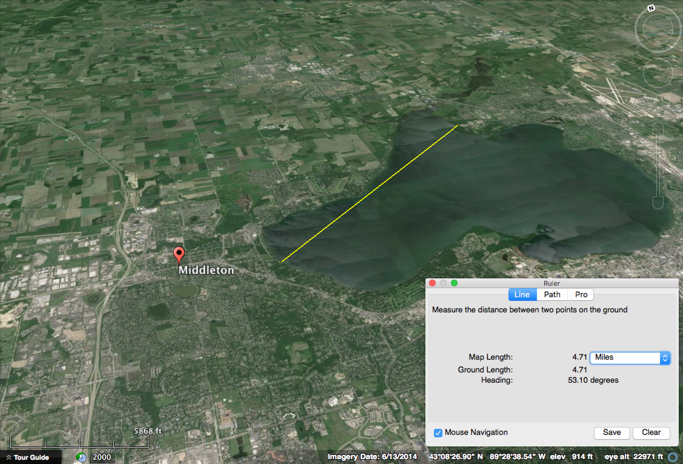
Rather surprisingly I can't find any well documented recreations of this experiment. It seems like it would be an ideal science project. There are significant difficulties though as you need a suitable stretch of water, the targets are 12 feet above the water, and the six mile distance makes it difficult to coordinate.
But it's really a very straightforward demonstration. So what I'd like to do in this thread is discuss places where the experiment might best be carried out, and what procedures could be used to make the execution of the experiment as straightforward and foolproof as possible.
http://blogs.scientificamerican.com...modern-biology-got-suckered-by-flat-earthers/
The iron parapet of Welney bridge was thirteen feet three inches above the water of the canal. The Old Bedford bridge, about six miles off, was of brick and somewhat higher. On this bridge I fixed a large sheet of white calico, six feet long and three feet deep, with a thick black band along the centre, the lower edge of which was the same height from the water as the parapet of Welney bridge; so that the centre of it would be as high as the line of sight of the large six-inch telescope I had brought with me. At the centre point, about three miles from each bridge, I fixed up a long pole with two red discs on it, the upper one having its centre the same height above the water as the centre of the black band and of the telescope, while the second disc was four feet lower down. It is evident that if the surface of the water is a perfectly straight line for the six miles, then the three objects—the telescope, the top disc, and the black band—being all exactly the same height above the water, the disc would be seen in the telescope projected upon the black band; whereas, if the six-mile surface of the water is convexly curved, then the top disc would appear to be decidedly higher than the black band, the amount due to the known size of the earth being five feet eight inches, which amount will be reduced a little by refraction to perhaps about five feet.
(Original source is Wallace's "My Life", Page 364-376)
Put more simply, we have:
A) A telescope (which we would replace with a digital camera with powerful zoom lens)
B) A target 3 miles away
C) A target 6 miles away, in line with A and B.
A,B, and C are all the same height above the waterline. So you just look from A towards B and C, and if B is visually higher than C then the water surface is curved up in the middle.
Rather surprisingly I can't find any well documented recreations of this experiment. It seems like it would be an ideal science project. There are significant difficulties though as you need a suitable stretch of water, the targets are 12 feet above the water, and the six mile distance makes it difficult to coordinate.
But it's really a very straightforward demonstration. So what I'd like to do in this thread is discuss places where the experiment might best be carried out, and what procedures could be used to make the execution of the experiment as straightforward and foolproof as possible.
Last edited:

")