Skinwalker Ranch S4 E11 Claims of "Wormhole" from LIDAR Scan with Gap

Sorry; that is the correct attribution.
Silly of me; I've made several similar images of my own, and I could have used one of those.

Don't be sorry, I was just showing that it's a common illustration and is even used on the Wiki page. It's not unique to SWR.
 
If we look at all the shadows from the scan, they all intersect at the center of the black spot, which would happen if the drone is stationary and rotating while scanning. It actually also suggests that it was at a fairly low altitude if you look at the tree on the right which casts a long shadow. I don't know if it would create this highly reflective circle at a low altitude, but it would be interesting to see the results if someone has an identical system and has the opportunity to test it out.

shadows.jpg

They are using the DJI Terra program which suggests that they are using a DJI drone. From what I can tell they are using the DJI Zenmuse L1 LiDAR sensor on a DJI Matrice 300 RTK drone.

Drone.jpg

Thank you Beck,

Your adding the directions of the shadows is very useful for understanding this data set. The drone did not move while collecting the data, it did not move horizontally or vertically, if it had the shadows would not exist. Someone with the inclination to do so could probably determine the exact altitude the drone was at by the differences in the length of the shadows. Lines drawn from the tip of the shadows through the top of the obstacle creating that shadow would intersect at the location of the drone.

As far as the black void the answer is that the lidar was never pointed directly down. The exact shape of the void may say something about the field of view of the lidar and how it was mounted, but that is probably not very important or interesting. It is possible, but seems unlikely, that the software generating the image was told to ignore points within a short distance from the lidar. No idea why would do that, except to make the image "more interesting".
 
Here's one I made myself.
wormhole.png
The point is, the wormhole as depicted is a diagrammatic visualisation of the true geometry, which would require four dimensions to depict accurately, and the vertical component of this diagram is entirely arbitrary in extent. The distance between these two mouths could be a few metres, or light-years.
 
Thank you Beck,

Your adding the directions of the shadows is very useful for understanding this data set. The drone did not move while collecting the data, it did not move horizontally or vertically, if it had the shadows would not exist. Someone with the inclination to do so could probably determine the exact altitude the drone was at by the differences in the length of the shadows. Lines drawn from the tip of the shadows through the top of the obstacle creating that shadow would intersect at the location of the drone.

As far as the black void the answer is that the lidar was never pointed directly down. The exact shape of the void may say something about the field of view of the lidar and how it was mounted, but that is probably not very important or interesting. It is possible, but seems unlikely, that the software generating the image was told to ignore points within a short distance from the lidar. No idea why would do that, except to make the image "more interesting".
I actually just noticed a couple of interesting things from one of @LeastWeasel earlier posts where we see the live feed from the drone with altitude data. Notice that the recording is not started yet on the first image at 12.5 ft but is recording on the second image at 35.4 ft. So the drone is in fact at a low altitude.

IMG_1837.pngIMG_1838.png
On the second image we also see how the LiDAR is much brighter in the middle, suggesting that the sensor has a higher output around it's center (since it is set to show reflectivity). This is important since that would account for why we see the red circle around the black spot.
So, if we rotate a stationary drone while outputing more towards the center it would create a circle of higher reflectivity which is what we see. So the red circle is the center of where the drone is "looking" while rotating or panning its sensor.
Now based on all this I'm sure someone could do all the math to validate the angles, FOV of the sensor and so on, based on the distance from the center, the altitude of the drone etc. but I'm not qualified for that, so I'll leave the math to someone else. But that is the gist of it. I hope it makes somewhat sense.
 
IMG_1840.jpeg

I can’t see what’s causing this shadow?
So the place they are at is apparently called the Skinwalker Ranch Triangle (of course it is) and is actually West of the homestead not East, around 40°15'24.98" N 109°53'34.61" W -- there's a landmark for it in Google Earth. From the Reflectivity and RGB views it appears that area is in shadow cast by the trees closer to the drone on the right of it. The elevation profile in Google Earth for that spot also shows there's a depression behind the trees that's ~20ft lower.
 
I think @Beck had a few pictures that show it pretty good. Here is the drone sitting on an old piece of OSB:


Shown here in relation to the cars and EZ-ups with a setting sun:


As Mick said:

The void is the same in both mode, as are the shadows. So this is simply a region that the LIDAR did not look at.

The shape of the void looks like it is composed of arcs, which suggests a combination of rotating the drone and rotating the camera on the gimbal. They just did not look down, as they were not actually trying to make a map - but rather trying to observe the rocket launch on LIDAR.

So, they launched the drone in what is the center of the "anomoly" and then rotated it or it's LiDAR camera with the LiDAR pointed out at maybe a 20-40 degree angle, leaving the area directly below the drone NOT scanned:


Their wormhole is just the unscanned area directly below the drone. There isn't a passage to a different space/time at the center of it, just an old 4'x8' sheet of OSB:


I guess the question would be, where they aware of this? "Dragon" maybe not so much:


But one would think Taylor would be.
 
So, let's apply some logic.

• We know the software shows "no data" as black.
• The drone was fairly stationary, creating "no data" shadows behind large objects such as trees.
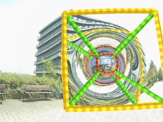
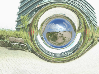
• We can determine the drone position from the "shadows", and it's the very center:
• There is a black "no data" spot below the drone because the Lidar never looked straight down.
• The black spot has circular arcs because the drone or the Lidar sensor rotated.
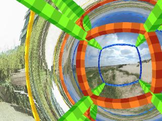
• The reflectivity diagram shows a red semicircle of high reflectivity, also centered on the drone position.
• The RGB diagram does not show that circle, and satellite images of the area don't, either.
• The drone operators did not see anything unusual at the time.

Inferences:
• If this was a circular feature, the circle would not be incomplete.
• If there was an invisible feature in the area, it would be highly unlikely that the drone was centered on it by chance.
Imagine throwing a dart at a dart board: how hard is it to hit the bullseye exactly? Now do it with an invisible dartboard (that you don't know is there)! If that circle exists in reality, flying the drone to its exact center is basically impossible.
• Therefore, the circular arc was caused by the drone.
• Its shape is circular because the lidar rotated in place.
• It's possible that the red data represents some sort of equipment error in the Lidar.

If this was a real wormhole, flying the drone to its exact center would've made it vanish, as it traveled the universe.

There was no wormhole there.
 
Does anybody know what modern physics predicts for the area around a wormhole? Should be there measurable physical phenomena that can be measured without actually getting in the wormhole and ending up across the universe?
The best visual simulation of a wormhole that I know is the simulation by Tübingen University, which shows a region of acute optical distortion around the mouth. See this page by Corvin Zahn
https://www.spacetimetravel.org/wurmlochflug
Note that Zahn has added coloured cubical frameworks to the wormhole to demonstrate how spacetime distorts as you pass through the 'hole; these would presumably not normally be present.
In order to clearly show the properties of the curved space (that itself is invisible), a cubic lattice of 12 yellow rods has been built around the wormhole. The rods follow geodesics, i.e. lines that are as straight as possible. The visible distortions, especially of the rods behind the wormhole, come from light deflection in the curved space.
Eight green rods point radially inwards from the corners of the yellow cube. They approach each other and in flat space they would meet in the middle. In the curved space of the wormhole they do not.
At the throat, the interface between the two universes connected by the wormhole, the diagonal rods meet the corners of a red cube the edges of which are also geodesics. The diagonal rods continue straight-lined into the other universe. There, they move apart and meet the edges of the third, blue cube from the inside. The blue cube has the same size as the yellow one.


With the coloured framework removed, the wormhole is still clearly visible


-----------------------
In short, a wormhole should be easily visible to the naked eye due to the space-time distortions around the throat.
 
Last edited:
Dragon (Bryant Arnold) is actually one of the more sensible people there.

I guess I don't watch enough of the show. The bits that I have watched, I got that he was the "big dumb guy" character. Not that he is, but that's his character. He may not understand what Dr. Taylor is talking about, but he's the guy you want with you when the 7' werewolves appear.

Maybe I'll have to watch a bit more of the show :(
 
Their wormhole is just the unscanned area directly below the drone.
Reminds me of the "hole into the center of the hollow Earth" which believers in that say shows up in satellite images -- made by creating a mosaic from satellites which can't image the polar regions.

Same mistake, new mistakers...

essa 7 hole pole hollow earth.png

orbitdisplay.png
 
Have not seen the Skinwalker Ranch videos (don't subscribe to any of the services needed to access them) so I am not sure exactly what they intended to do with the Lidar data. But, there is a huge and obvious flaw in what they seem to have done.

If you intend to create a lidar data set for an area you do not have your lidar sensor sit in one place and just scan from that one spot. That is how you get the black ground shadows, which are simply places the sensor cannot see from that particular location. You would have your drone carrying the lidar move around the area, circling around the point of interest, or do a zig-zag pattern around the area. This would give the lidar the ability to see, at some point in its flight, all of the ground surface in the area.

Lidar data is usually collected from moving platforms, not stationary ones. As the aircraft carrying the lidar moves along the sensor is sending out vast number of pulses and receiving back reflections, some from the ground and some from buildings and vegetation. Then the data can be filtered, for example finding the lowest elevation data point in a very small area, and using that filtered data set to define the ground surface. That's how you can use lidar data to make a topographic map.

The data set being displayed with the black hole in the middle was not made from a moving platform but rather from a stationary one. Anyone claiming that the void in the data means anything other than "the lidar did not see that area" is either totally ignorant of what it means or is being deliberately deceptive.
 
Then the data can be filtered, for example finding the lowest elevation data point in a very small area, and using that filtered data set to define the ground surface. That's how you can use lidar data to make a topographic map.
Thank you! I always wondered how Lidar could "see through the trees".
 
The drone operators did not see anything unusual at the time.
The operators stated in the command center that this phenomenon has never happened before. I’m confused why OmniTeq and other “experts” have appeared on the show and LARP. I guess the thrill of seeing yourself on TV is very enticing.
 
The visible light (RGB) image is perhaps the simplest way of looking at it:

There's a big hole in the image. It's a composite image. The only way you'd get a big hole in the image is if you didn't point the camera at those bits of the ground. It's bigger than the LIDAR hole, so it's not just missing LIDAR data. The RGB camera never saw those bits of the ground.

There was another drone above that region, looking right through the "wormhole" region. It could see the ground just fine. There's no wormhole.

2023-07-15_12-51-46.jpg

The LIDAR used 905nm light, that's near infrared, invisible to the naked eye. However it will travel though spacetime in the same way visible light will. Warped spacetime, like with gravitational lensing, does not affect different wavelengths differently. If there's no distortion in visible light then where will be no distortion in LIDAR imaging.
 
The operators stated in the command center that this phenomenon has never happened before. I’m confused why OmniTeq and other “experts” have appeared on the show and LARP. I guess the thrill of seeing yourself on TV is very enticing.
It might have been related to their new association with Brandon Fugal, which was announced after the episode aired.

I really don't know why they thought it was a good idea though.

2023-07-15_12-59-56.jpg
 
There's no wormhole.
As well as the LIDAR evidence (and I'm using the term loosely) for a wormhole, there's the evidence provided by the behaviours of those involved.
If a team of scientists- or a group of non-scientists interested in paranormal phenomena, for that matter- discovered a wormhole a few metres from where they were working, I don't think it's too much of a supposition to expect them to stay there and monitor it. And contact other groups/ institutions (off the top of my head, local authorities, NASA, universities, Department of Energy labs at Los Alamos, etc.)

You might expect the "discoverers" to re-run their observations, and methodically check to see if their findings do indeed justify their extraordinary claim of finding a wormhole.
If there were any real indications of a wormhole (or any similar or related phenomenon) being found on or near the Earth's surface, I think we might reasonably expect to see a camp of researchers nearby, working 24/7.

I wouldn't expect the discoverers, if they had any interest or background in science, to go home at the end of the day's filming and start discussing the arrangements for their next TV show.
It's almost as if the Skinwalker Ranch team- and their associates- don't really believe that they've made perhaps the most astonishing scientific discovery of recent times.
 
The operators stated in the command center that this phenomenon has never happened before.

Was that an OmniTeq employee that said that? OmniTeq claims to be an AI and data analysis complany:

OUR MISSION

By combining artificial intelligence and machine learning with human intelligence, we can address our greatest challenges. This powerful combination provides decision-makers with information on events before they happen, enabling them to predict and prepare for potential scenarios, rather than merely reacting to them. This proactive approach can help us to tackle the most significant issues of our time, and mitigate risks before they become crises.

Our approach provides valuable insights into events before they happen, enabling decision-makers to make proactive decisions instead of reactive ones. With this powerful combination of technologies, we can predict events with greater accuracy and take the necessary actions to mitigate potential risks.
Content from External Source
https://www.omniteq.com/about


Custom Artificial Intelligence & Machine Learning Solutions​

OmniTeq offers custom AI/ML services to both commercial and government customers, providing them with an innovative platform designed to process and analyze all types of data. Our proprietary Artificial Thought Engine Networked Architecture (AThENA) combines data analytics with AI models and algorithms to match the appropriate data science method to the problem at hand. This allows users to visualize data through a customizable interface, ranging from dashboards to holographic 3D graphics.

Our AI/ML services include natural language processing, predictive analytics, and deep learning algorithms, enabling customers to automate processes, identify patterns, and make informed decisions. By using OmniTeq's AI/ML services, customers can gain a competitive edge in today's fast-paced global environment.
Content from External Source
https://www.omniteq.com/solutions

They don't come out and say they are LiDAR experts, but they do mention 3D point clouds, so I guess they do LiDAR?

The 3D point clouds and real-time data analysis provide a comprehensive view of energy consumption, waste management, security monitoring, mobility improvements, and infrastructure management. The solution allows for efficient urban planning processes, reducing potential issues and optimizing building performance resulting in improved sustainability and cost savings. The integration of IoT connections provides real-time data analysis for a better understanding of the building's energy usage, waste production, and key metrics, providing recommendations on how to optimize the building's performance.
Content from External Source
https://www.omniteq.com/copy-of-solution

If I'm going to be slightly cynical, I might think that after saying this "phenomenon has never happened before" it was followed up with something like "what numnuts leaves an area unscanned when doing a LiDAR survey? Do they not know what they're doing?" Of course, the 2nd part would be cut out.
 
Just to chime in, I agree that the evidence supports the idea that the black hole is just a shadow of where the sensors didn't point. If the RGB camera is mounted differently, such as above the LIDAR, it would see a different shadow. What concerns me more is the ring. Coincidently, there are optical reasons for such rings, such as a moon halo. I'd be interested to compute the height of the drone and then see if the ring is at 22 degrees. That's the angle of a moon halo.
I'd also like to compare this LIDAR to the one made in a previous season. There was never any gap like that. S2.E4 talked about a black mass at Homestead 2. I need to see a map to know how close that is to the triangle. It's possible they are contradicting themselves with a LIDAR made of the same area previously. Note that LIDAR is not the same as photogrammetry, which does not need a laser and relies solely on image processing of normal pictures (as was done as well).
https://www.imdb.com/title/tt14469504/mediaviewer/rm1179633409/?ref_=tt_md_2
 
What concerns me more is the ring. Coincidently, there are optical reasons for such rings, such as a moon halo. I'd be interested to compute the height of the drone and then see if the ring is at 22 degrees. That's the angle of a moon halo.
Moon halos (and solar halos) are at 22 degrees due to the hexagonal shape and refractive index of ice crystals. There's no ice involved here.

I'd suspect something more like a retroreflective property of the dry sandy ground. Perhaps at certain incident angles it reflects more light directly back to the camera than when looking more straight down.
 
I really don't know why they thought it was a good idea though.
The old saying is "The only bad publicity is an obituary." Related to "write anything about me you want, just spell my name right."
I'd suspect something more like a retroreflective property of the dry sandy ground. Perhaps at certain incident angles it reflects more light directly back to the camera than when looking more straight down.
Would that then be yet another consequence of not moving the LIDAR gear around like you're supposed to do?
 
Moon halos (and solar halos) are at 22 degrees due to the hexagonal shape and refractive index of ice crystals. There's no ice involved here.

I'd suspect something more like a retroreflective property of the dry sandy ground. Perhaps at certain incident angles it reflects more light directly back to the camera than when looking more straight down.
I'm sorry, I probably wasn't clear. This is what I'm saying; there's some kind of retrorefractive property. Again, coincidently, quartz has the same hexagonal crystal shape as ice does.

I searched for aerial views of sand dunes, but didn't see any kind of brightness. Bear in mind the LIDAR laser is probably IR as well, this might be a factor.
 
The old saying is "The only bad publicity is an obituary." Related to "write anything about me you want, just spell my name right."

Would that then be yet another consequence of not moving the LIDAR gear around like you're supposed to do?
If the LIDAR moved around, so would the ring, unless the ring relied on the properties of something reflecting on the ground only in certain areas. In any case, I doubt there would be a perfect ring anymore, just an overall brighter spot where such proposed material lies. In other words, what caused the ring artefact would end up being spread around and evened out.
 
In other words, what caused the ring artefact would end up being spread around and evened out.
That's what I was wondering. Would "leave it in one place and make a ring" be something that a LIDAR-savvy preson would expect to happen? In other words, if I WNATED a ring for looking-cool-on-tv purposes, would I know to do what they seem to have done, and leave the unit in one place? If that is getting to speculative, somebody tell me to cut it out! ^_^
 
Wormholes are subject to gravity, just like everything else. So the idea that one would get a wormhole just hanging there in space is just palpable nonsense. It would no more hang there in space than an elephant would.

On top of that, relativistic wormholes are not stable and could be collapsed by a single photon ( such as one from the LIDAR system ). You need exotic negative energy matter....which nobody has any idea how to produce....to hold a wormhole open. And that needs to be a continuous process. Not only would the exotic matter be extremely evident but one would require a constant source of it injected at the mouth of the wormhole. Which would likely demolish half of Utah as keeping a wormhole from collapsing would require large amounts of energy.

Of course...they don't tell you any of that on the show. They just make out like a wormhole is some trivial thing.
 
It was Jim Royston, the CEO of OmniTeq, and the guy who was operating the drone.

Wow! The CEO of OmniTeq, an AI and data predictive analysis company, with multiple government contracts, is farting around at SWR with a LiDAR drone and doesn't appear to know how to make decent scan?

I just don't get it. A dumb, s*&t-for-brains like me can see with a few photos that they just didn't scan the area below the drone. Nothing too complicated. Maybe any publicity is good publicity?

I can't find too much info on these guys. Royston may or may not have been president of Astrotech before being removed in a reorg back in 2010:

James Royston's termination comes as Astrotech Corp. performs a review and realignment of its operations.
Content from External Source
https://www.bizjournals.com/houston/morning_call/2010/07/astrotech_ousts_president.html

Any more than that is paywalled.

He may have gone on to run CASIS. Not sure if it's a government organization or what:

1689473944731.png

https://www.commerce.senate.gov/services/files/85704FD6-9970-4CF4-940A-2F2D341D29D3

There is no LinkedIn for him or others at OmniTeq.
 
The old saying is "The only bad publicity is an obituary." Related to "write anything about me you want, just spell my name right."

Would that then be yet another consequence of not moving the LIDAR gear around like you're supposed to do?
Looking at the RGB image it appears that the soil in that area directly under the drone may be a bit different than adjacent areas, and the soil moisture level might be different also based on the grass versus brush over much of the rest of the area.

IF the drone had been moved around while collecting data to provide complete coverage of the area (no shadows) then my guess is the entire area inside the red ring would be a large patch of similar reflectivity. The doughnut hole effect is because the drone never moved while collecting data.
 
I'd suspect something more like a retroreflective property of the dry sandy ground. Perhaps at certain incident angles it reflects more light directly back to the camera than when looking more straight down.

I'm beginning to think it is an artifact of the LiDAR system itself. The lasers emitted by the drone are emitted in all directions, and are reflected back towards the sensor; this sensor is presumably also on the drone, so the light should be reflected back towards the sensor in a relatively even fashion. But then the data that comes back as reflections is then flattened out to become a landscape, using the distance data obtained from the laser beams. This landscape includes shadows where the laser beams do not reach, and the data becomes increasingly patchy according to the distance from the drone to the landscape. At the same time the brightness of the landscape (in the LiDAR image) becomes increasingly dark with distance, due to shadowing and the inverse-square law.

I don't know why the centre of the image was black, but I suspect that the LiDAR system simply could not reach that location, perhaps due to the way the sensors are mounted on the drone. So, a black area of no data, and a brighter ring of high reflectance almost directly under the drone. Maybe the design of the drone means that it simply receives less data in one direction, and it was rotated to scan the landscape in all directions.
 
@Mick West , so the Omniteq people (who, if they are indeed technically trained, should know better) would seem to be a fake company acting on behalf of the Skinwalker show. If that's not the case, one is forced to conclude that they are incompetent at what they claim to be doing, and it seems unlikely that a legitimate company would expose its own shortcomings so blatantly and publicly.
 
Mick,

Sometimes it pays to be nice and not insult people for the sake of making allies instead of turning people off the message you're trying to send. But if "inept" doesn't apply in this case to those folks, when would it apply?

How on earth did no one there think of this possibility? It defies credulity.

I think there's a combination of things going on. Some just going along with the show, some not understanding, and some just accepting what they are told. Some in combination.
 
I think there's a combination of things going on. Some just going along with the show, some not understanding, and some just accepting what they are told. Some in combination.
Well I think it goes without saying that the word "inept" would only apply to the individuals who should know better. I don't expect the security chief of the ranch named "Dragon" to know anything about this, so calling him inept wouldn't be fair since he's just a normal dude listening to so called experts make these kinds of claims. But Travis Taylor and Erik Bard are held to a higher standard. I want to hope that the kind of hypothesizing on display in this show is just for the cameras and not characteristic of the way Travis would have gone about doing his investigations during his time at the UAP task force, but if this is how he does "science" then, yikes.
 
Wormholes are subject to gravity, just like everything else. So the idea that one would get a wormhole just hanging there in space is just palpable nonsense. It would no more hang there in space than an elephant would.
300781074_10160199431744390_7962505953751745593_n.png
 
But Travis Taylor and Erik Bard are held to a higher standard. I want to hope that the kind of hypothesizing on display in this show is just for the cameras and not characteristic of the way Travis would have gone about doing his investigations during his time at the UAP task force, but if this is how he does "science" then, yikes.

It's puzzling. Apparently Taylor was a lot more skeptical before he went to work on the show. He's not an idiot, but seems to rush towards conclusions without checking all his assumptions or data. He also has a tendency to roll out physics buzzwords ("Fraunhofer diffraction" being a favorite). I feel that he'd got used to snowing people at the Pentagon with technical jargon, and never really got called on it. But now he does it in public. It seems impossible he's serious with the wormhole stuff, but I would not entirely discount the possibility.

Bard, I don't know. Seems more like a tinkerer/engineer than a scientist. But maybe that's the show. I've never communicated with him.
 
Back
Top