
You are using an out of date browser. It may not display this or other websites correctly.
You should upgrade or use an alternative browser.
You should upgrade or use an alternative browser.
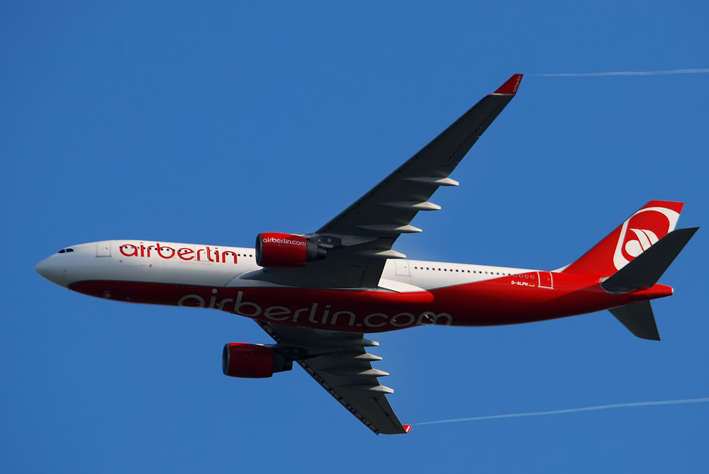
Photos of Planes and Contrails (That you took yourself)
- Thread starter Mick West
- Start date
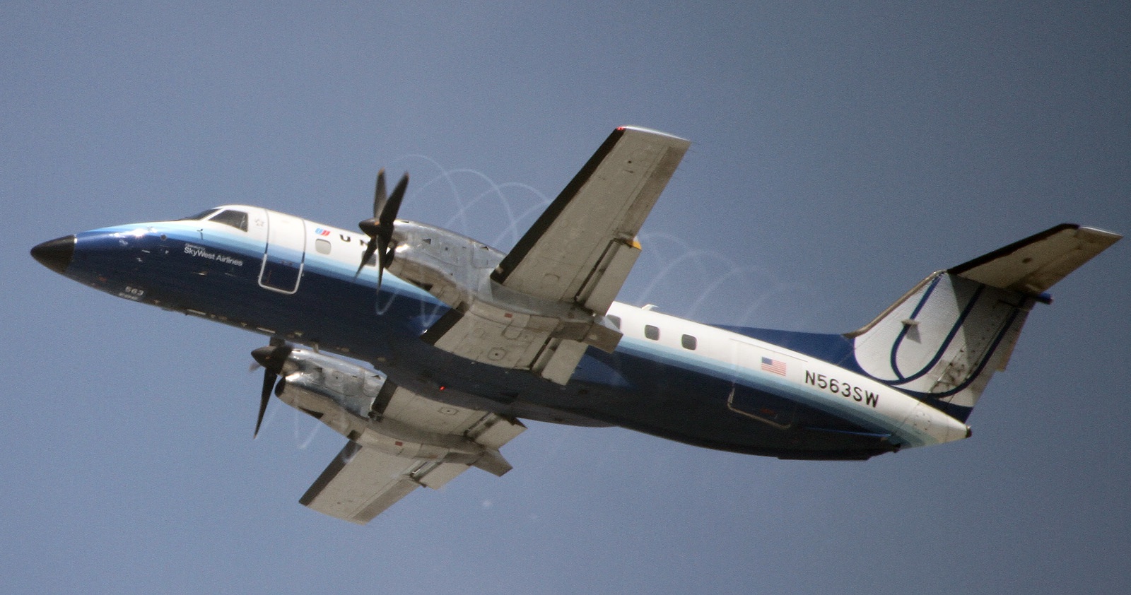
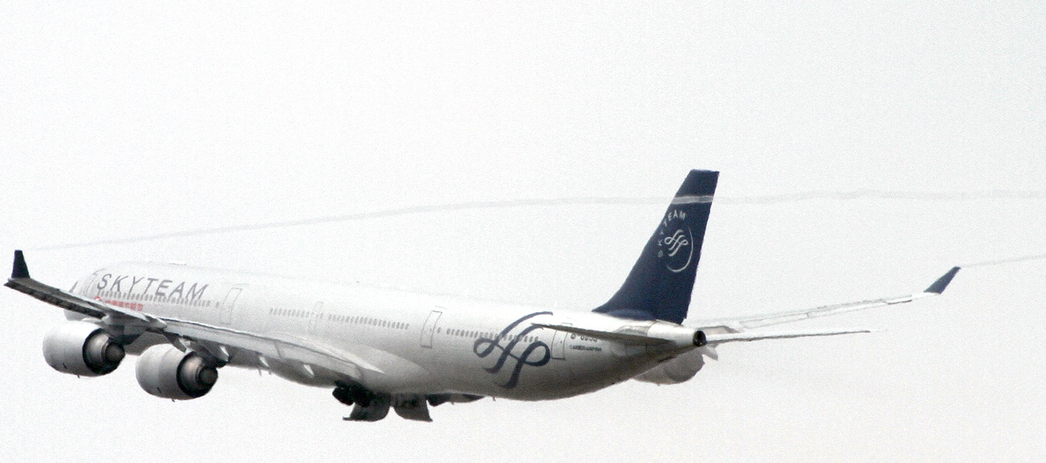
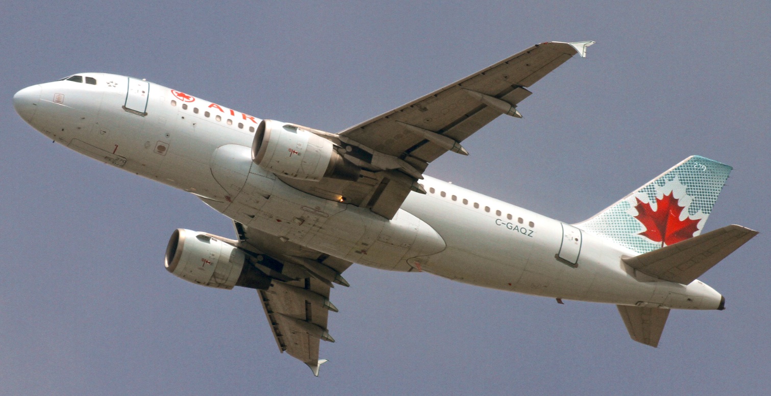
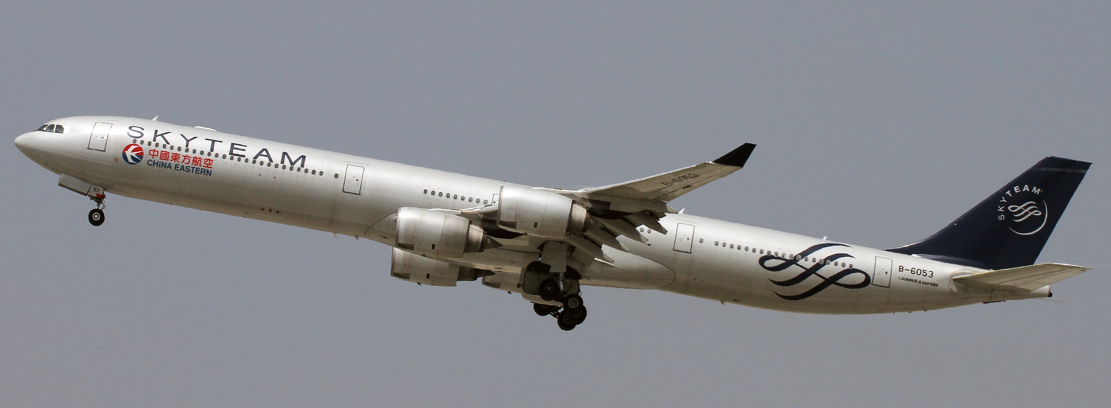
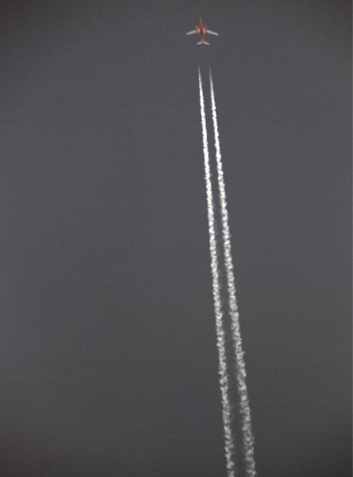
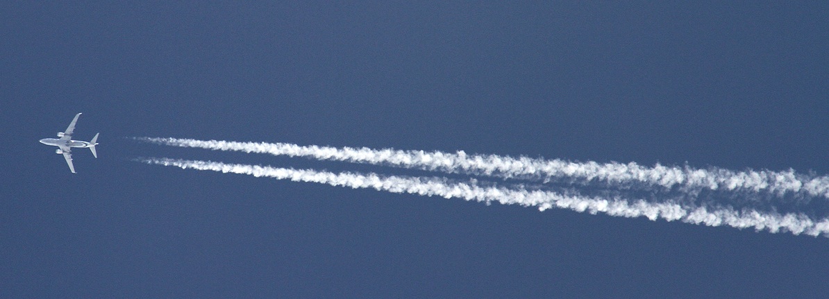
That 340 is sure gorgeous. That 320 isn't pretty though.
Yes the 320 is a rather un-sleek looking plane.
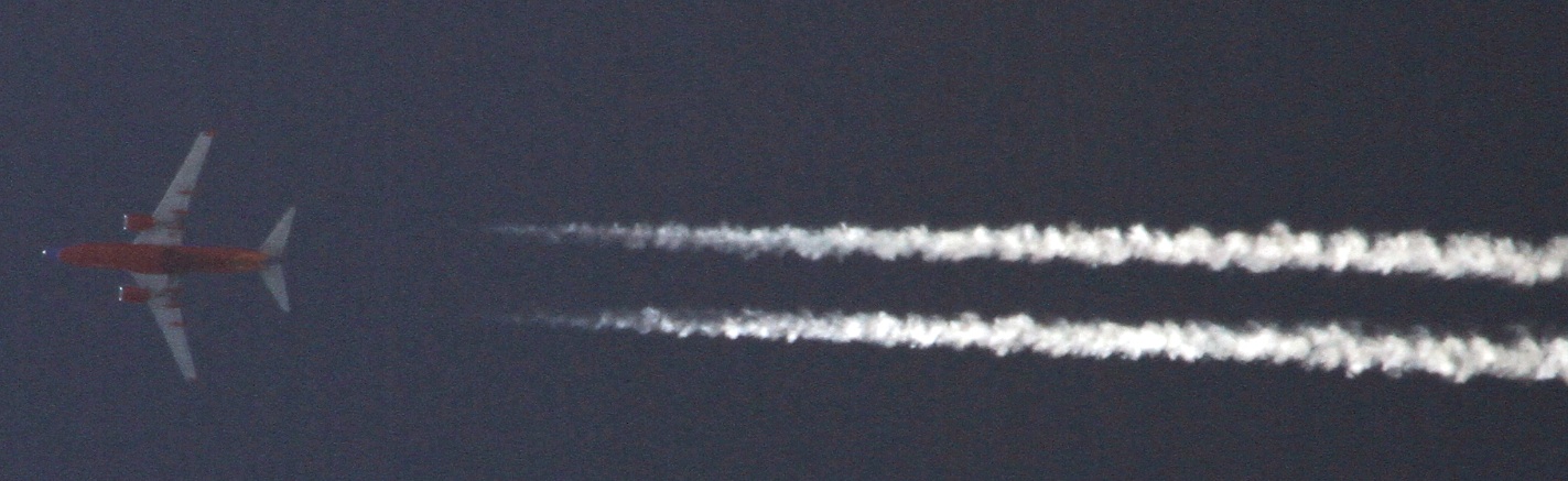
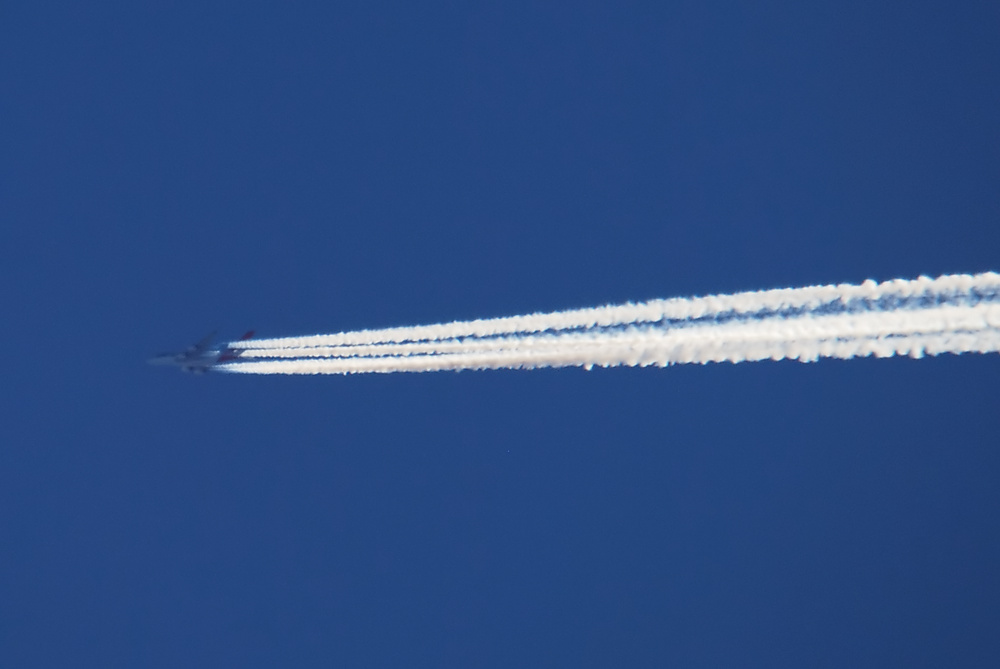
Here's another shot of that 340, about 15 seconds earlier.
Last edited:
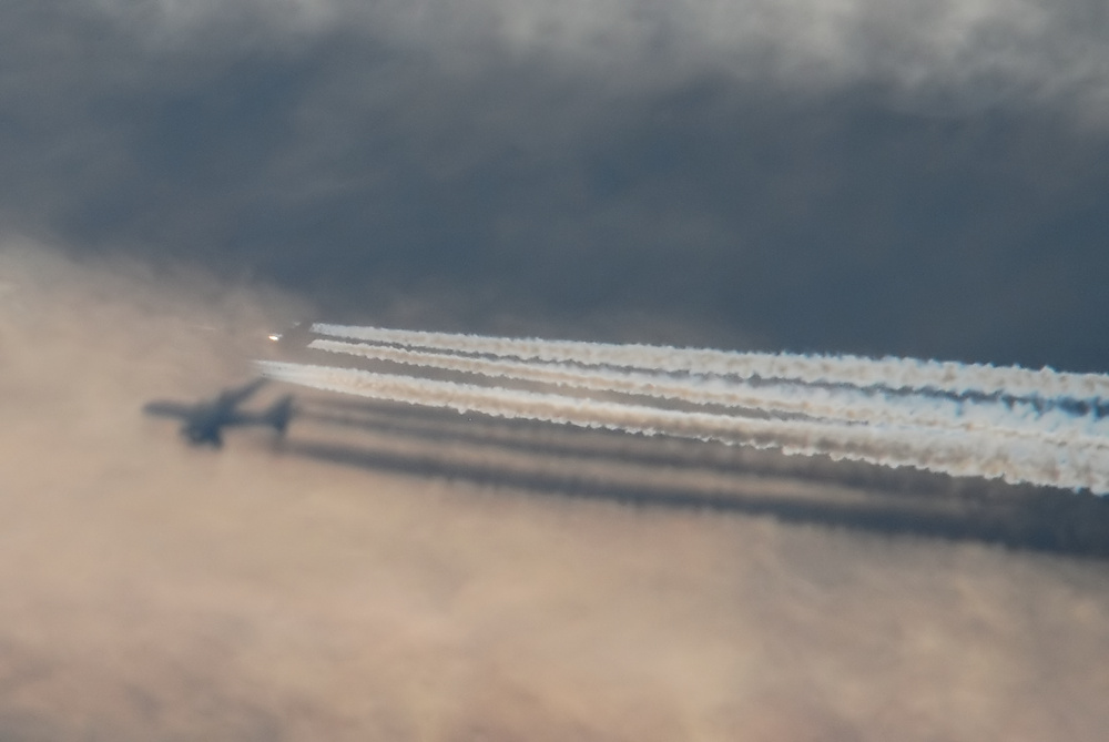
New lens is a little fiddly to use, but finally figured out you need pause for a faction of a second after focussing to allow the Image Stabilization to kick in.
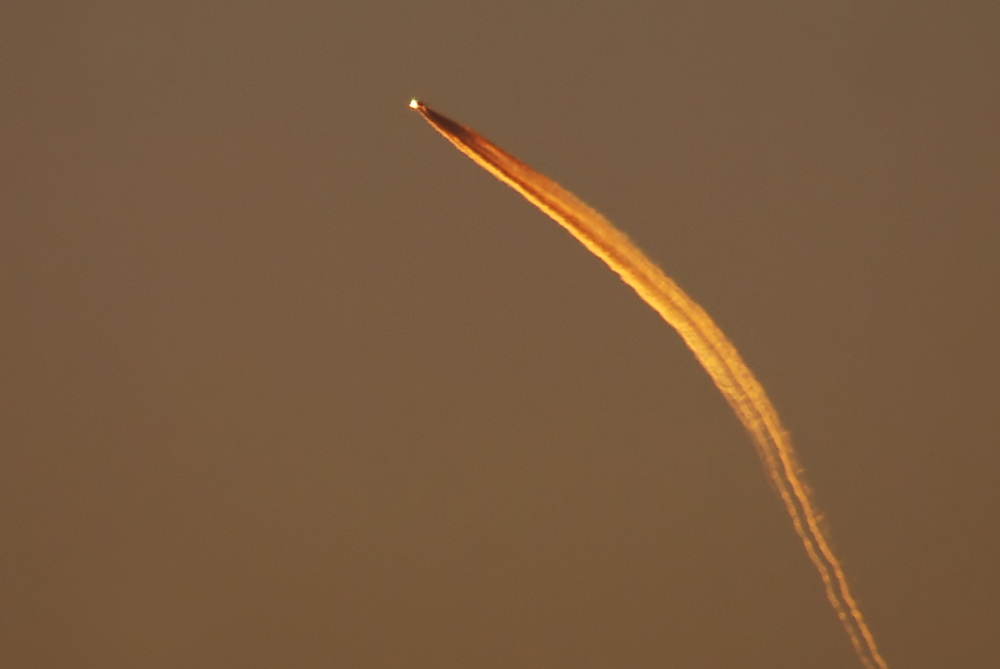
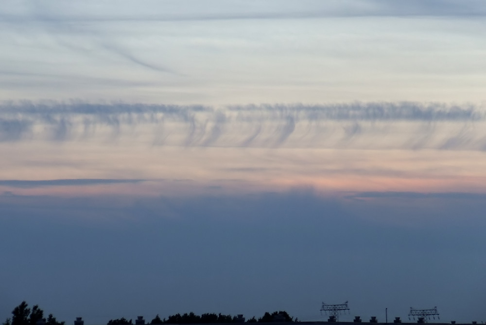
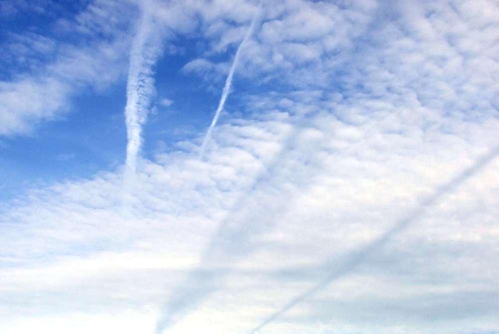
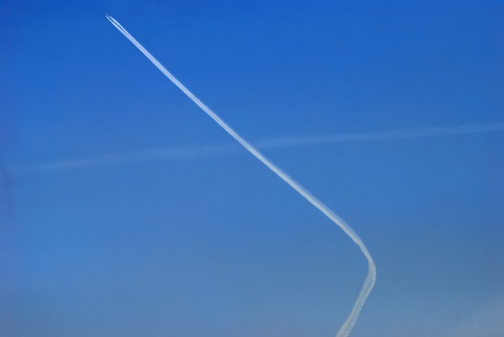
Contrail altitude planes come out a bit hazy, due to atmospheric conditions here at the coast.
Contrail altitude planes come out a bit hazy, due to atmospheric conditions here at the coast.
Last edited:
Cairenn
Senior Member.
I am thinking I need to start carrying my camera. The other day I noted some persistent contrails, with cirrus moving in. If one had not noticed them, they might have easily thought the contrails spread to cover the sky. I was driving in a direction that allowed me to watch them merge up.
That is a good example of seeing things you are looking for. I wouldn't have noticed that before I started posting here.
That is a good example of seeing things you are looking for. I wouldn't have noticed that before I started posting here.
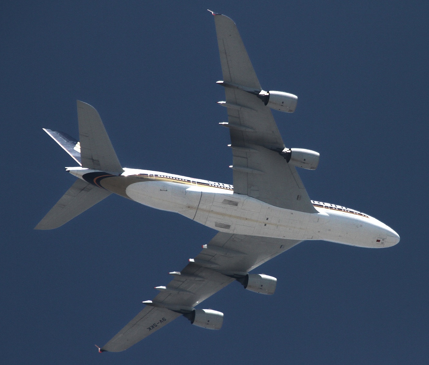
A380
Senior Member.
Last edited by a moderator:
A380
Senior Member.
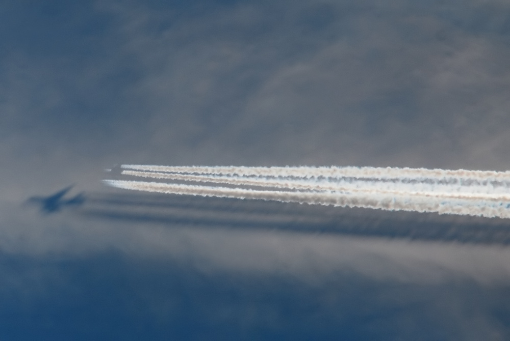
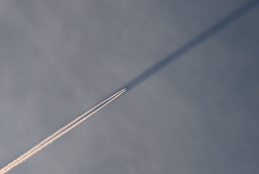
Wow. Is that shadow shot from below or above?
Thanks - it’s from below with 500 mm and circumcised.
Thanks - it’s from below with 500 mm and circumcised.
Circumcised? Hmm, you mean cropped?
A380
Senior Member.
Circumcised? Hmm, you mean cropped?
Yes.
A380
Senior Member.
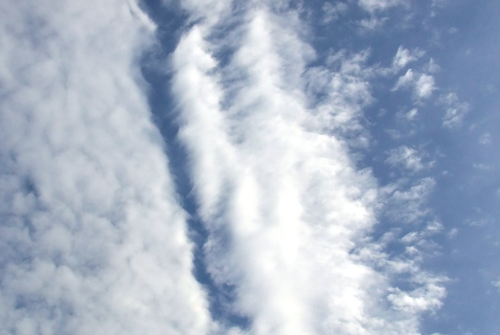
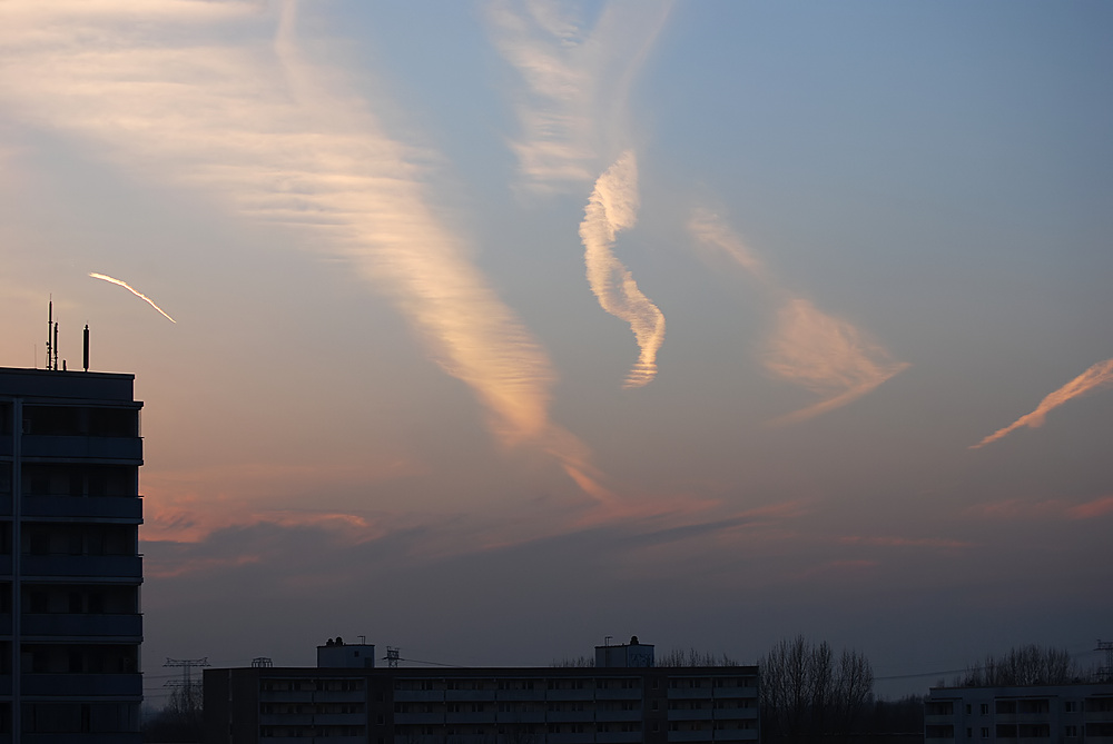
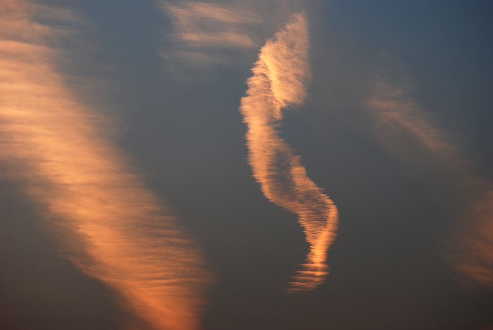
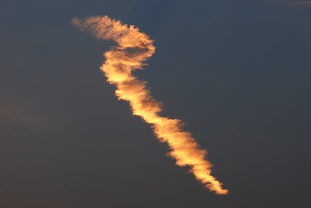
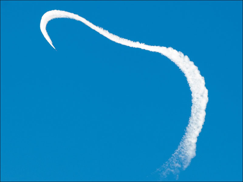
In Germany we have a citizens' initiative of chemmies. She don't know the following clouds and says "Achter" (English "Eighter"?):
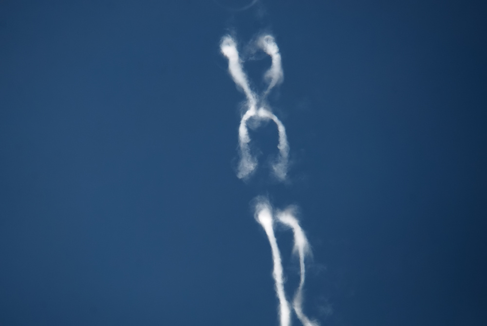
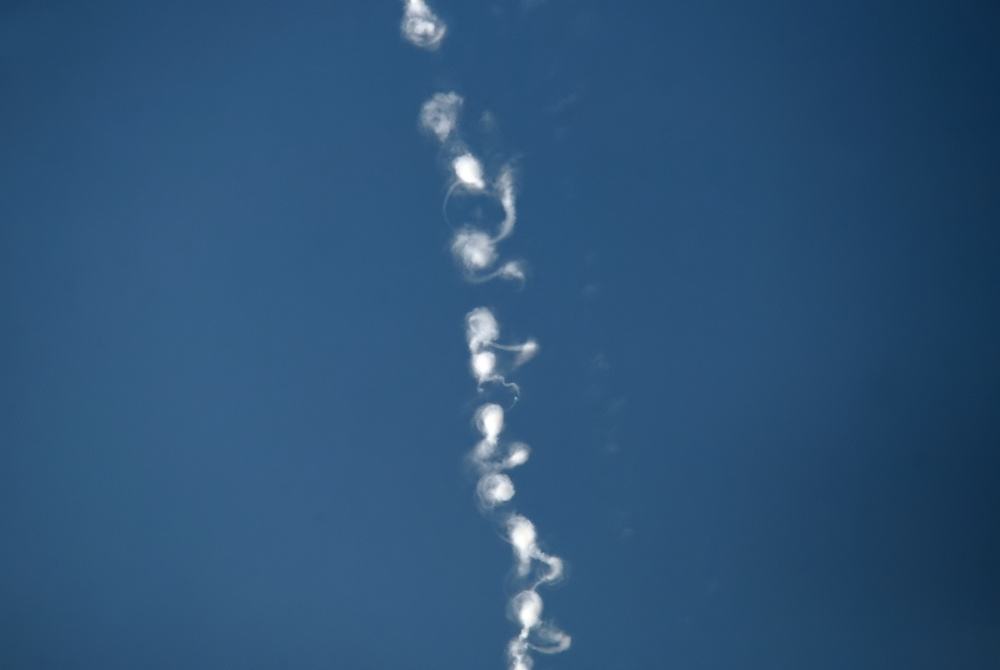
We know, it's the Crow Instability, in this case from a Boeing 747. Here is one from the A380:
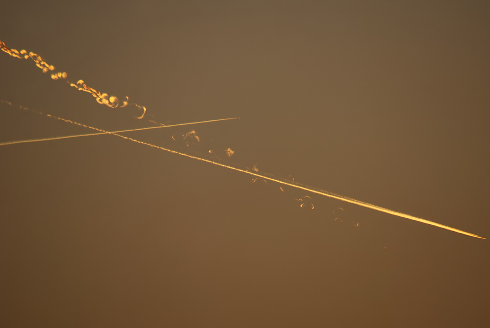
And "signs" at sunset:
We know, it's the Crow Instability, in this case from a Boeing 747. Here is one from the A380:
And "signs" at sunset:
Last edited by a moderator:
GregMc
Senior Member.
These are some pics I took in Namibia last year working on Fury Road. The greenish location is Mt Etjo, home to lions, cheetas, rhino, giraffes, elephant etc and some antelope including springbok are evident. I have a vid of the same setting with giraffe and the same contrail. The dusk setting is the coastal Namib desert, one of the most scarcely populated regions on earth. The dunes in the pic are hundreds of feet high.
I think these pics convincingly contradict any claims that trails only form over western countries with high populations.


I think these pics convincingly contradict any claims that trails only form over western countries with high populations.
A380
Senior Member.
I think these pics convincingly contradict any claims that trails only form over western countries with high populations.
Even with breaks in the contrails.
")
A380
Senior Member.
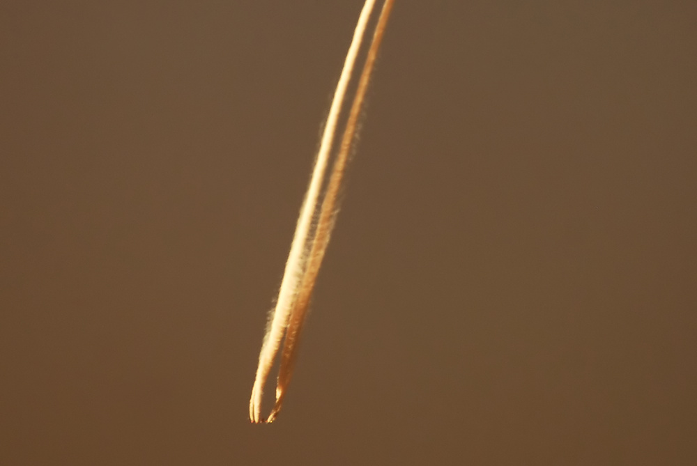
Virga from a contrail:
Downwash - a plane has pressed dry air from above and has so dissolved the cloud in this region:
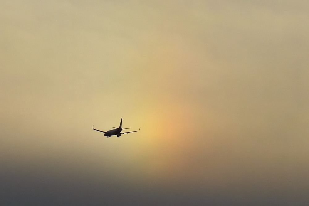
A Boeing 737 in front of the left sun dog:
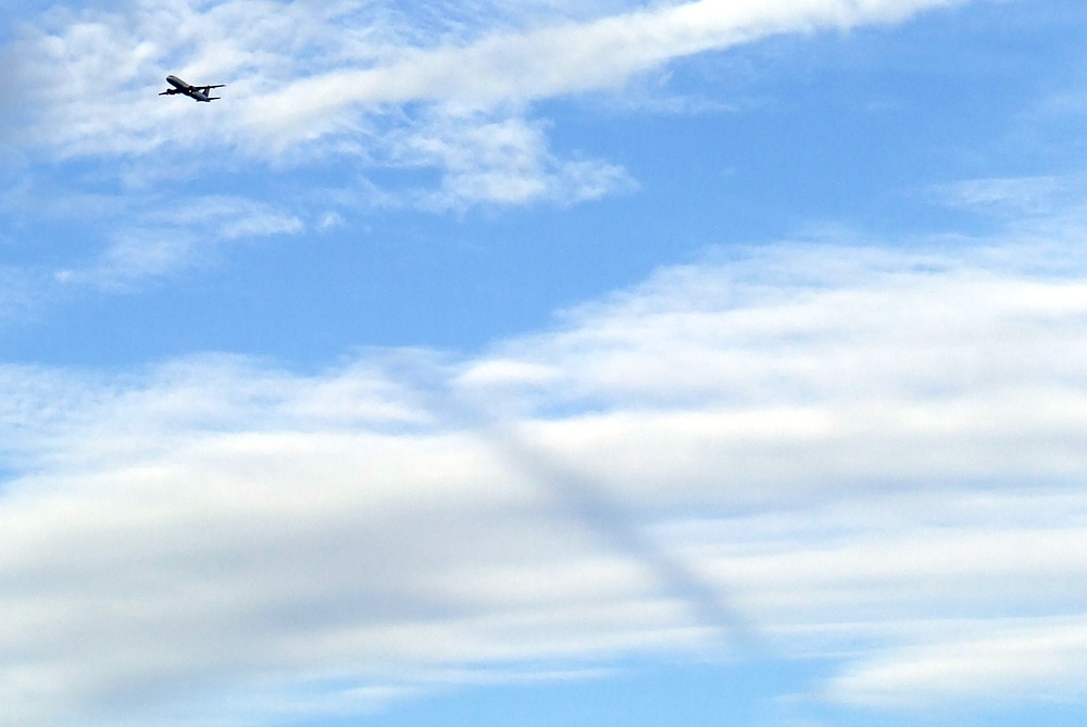
The shadow is from a contrail (right, not in the picture) and has nothing to do with the plane in the picture:
Shadows:
Iridescent clouds:
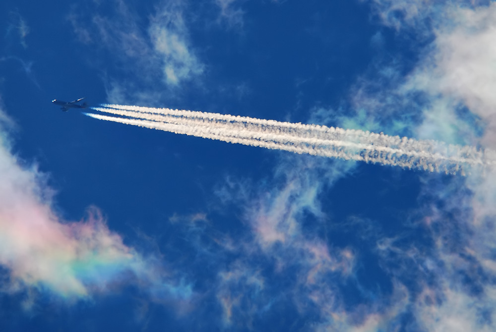
Downwash - a plane has pressed dry air from above and has so dissolved the cloud in this region:
A Boeing 737 in front of the left sun dog:
The shadow is from a contrail (right, not in the picture) and has nothing to do with the plane in the picture:
Shadows:
Iridescent clouds:
Last edited by a moderator:
Another shadow:
This time two volumetric shadows, one from the wing, and one from the tail stabilizers.
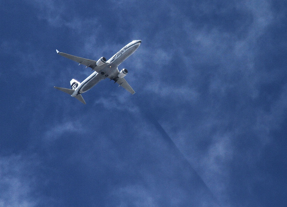
And more specifically it's just from the plane's port (left) wing (on the right of the photo), as it's just the part in line with the shadow (and hence the sun.)
This time two volumetric shadows, one from the wing, and one from the tail stabilizers.
And more specifically it's just from the plane's port (left) wing (on the right of the photo), as it's just the part in line with the shadow (and hence the sun.)
Last edited:
I've moved the crow/hybrid/pendule discussion to:
https://www.metabunk.org/threads/1571-Crow-instability-hybrid-contrails-and-pendules
As this thread is for posting your own photos of planes and contrails.
https://www.metabunk.org/threads/1571-Crow-instability-hybrid-contrails-and-pendules
As this thread is for posting your own photos of planes and contrails.
Last edited:
.JPG")
.JPG")


A380
Senior Member.
Notice the slight curve in the contrail in the view eastwards that is also shown on the fliht-tracker!
Yes, they fly from waypoint to waypoint, have requestet "directs", fly around certain weather conditions, have instructions from ATC, etc. There are various reasons. Here it is regularly AirBridge Cargo Airlines:
My Avatar is also RU/ABW, VP-BIG:
Last edited by a moderator:

GregMc
Senior Member.
Here are a bunch of recent pictures I took over the remote South Australian desert between Coober Pedy and Oodnadatta (http://en.wikipedia.org/wiki/Coober_Pedy) . Again a tiny human population in a vast desert. The crow instability was noticeable and this contrail persisted at least an hour.


TEEJ
Senior Member.
Two RAF Eurofighter Typhoons at 41,000 feet over Low Flying Area 7 in Snowdonia, Wales, UK. Noted on the radio reporting height and discussing descent to run through the low
level mountainous area. Due to lack of fuel they cancelled the low level run and continued transit back to base.
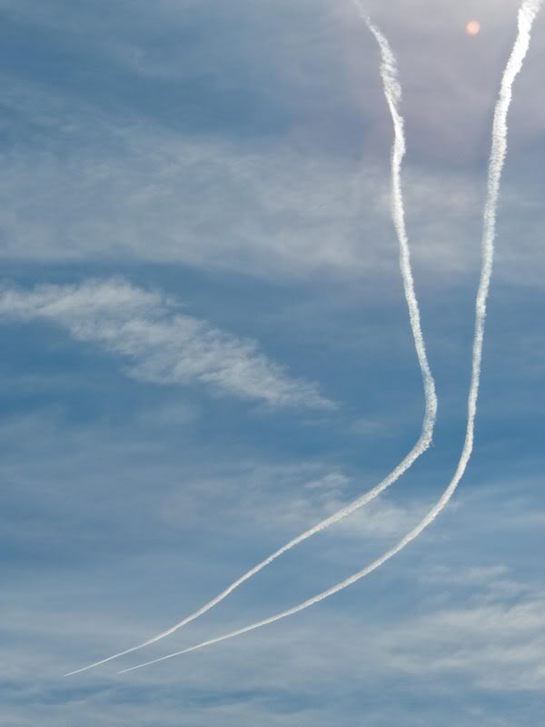
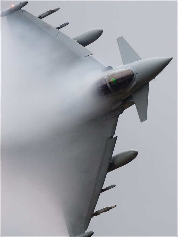
RAF Eurofighter Typhoon producing aerodynamic trails during a low level run in LFA7, Snowdonia, Wales, UK.
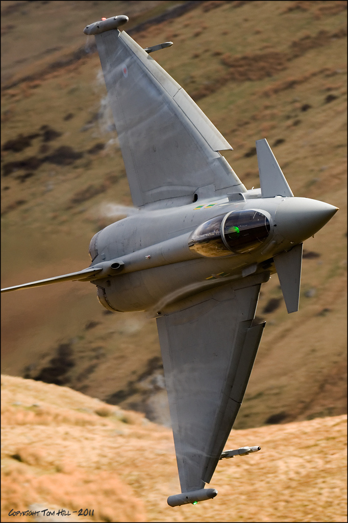
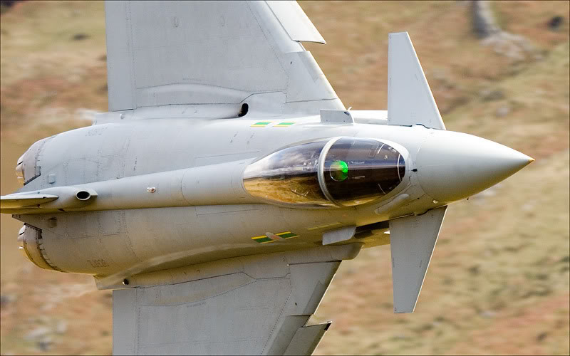
RAF Eurofighter Typhoon running through the low level area on a particularly wet day.
level mountainous area. Due to lack of fuel they cancelled the low level run and continued transit back to base.
RAF Eurofighter Typhoon producing aerodynamic trails during a low level run in LFA7, Snowdonia, Wales, UK.
RAF Eurofighter Typhoon running through the low level area on a particularly wet day.
Last edited by a moderator:
A380
Senior Member.
The crow instability was noticeable and this contrail persisted at least an hour.
In Pic #2 it is good to see how wake vortices descend. These are very nice photos.
Is your avatar an AWB-747? Not an A380?
No, its a 747. On the A380, the strips are almost parallel at the beginning:
Last edited by a moderator:
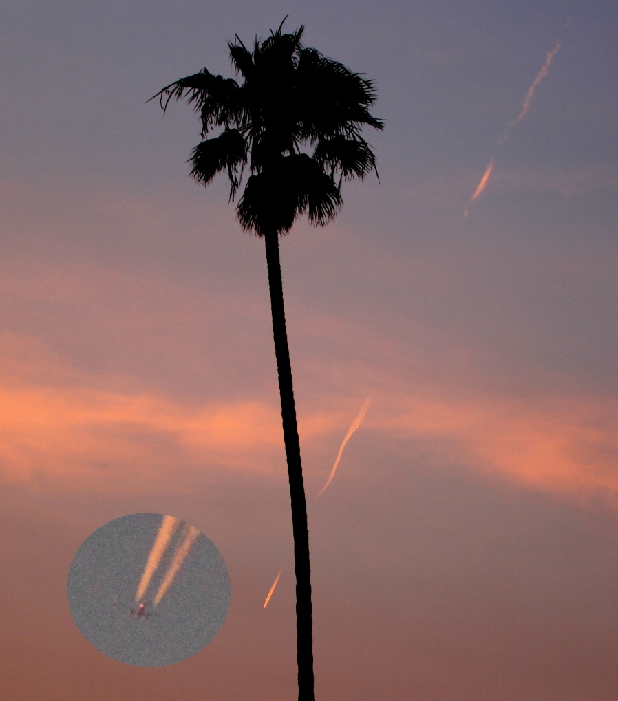
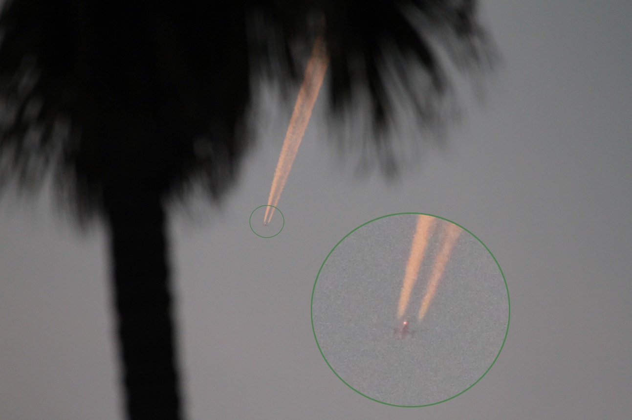
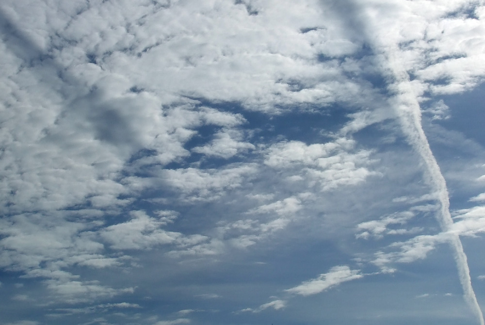
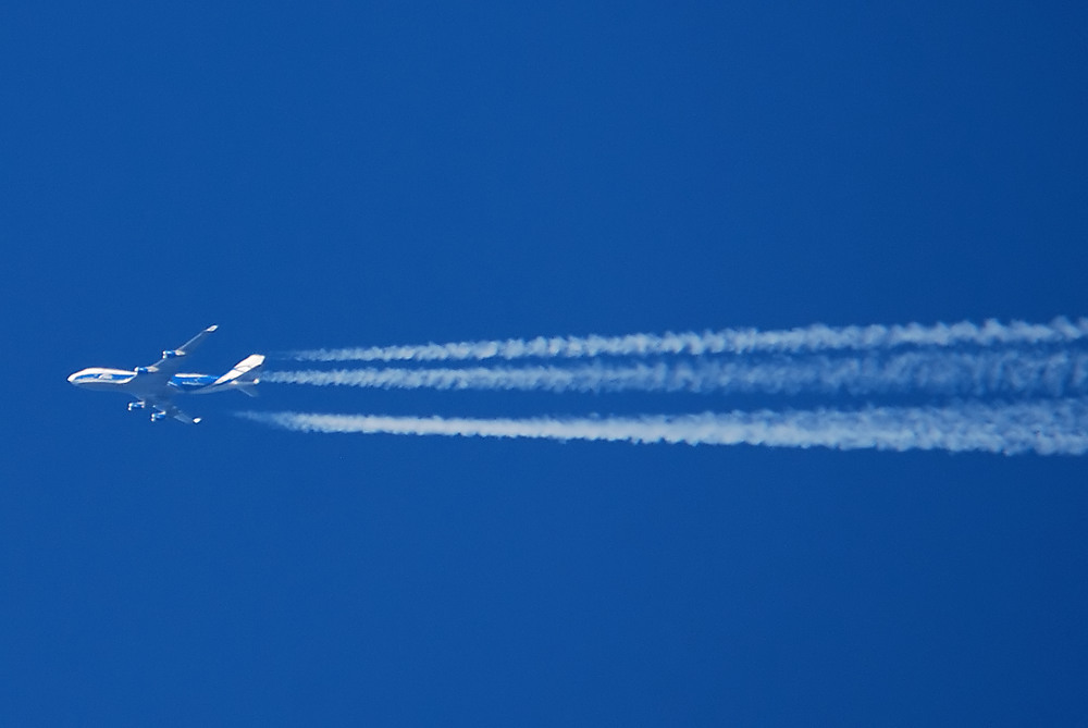
We have very boring contrails over Los Angles compared to many places. Mostly A320 and 737 sized aircraft as they are relatively short flights, mostly to/from San Diego from/to up the coast.
So most of the contrails here are smallish two-engine types, and mostly Southwest and Alaska
So most of the contrails here are smallish two-engine types, and mostly Southwest and Alaska
Last edited:
Jan-61
Member
Two RAF Eurofighter Typhoons at 41,000 feet over Low Flying Area 7 in Snowdonia, Wales, UK. Noted on the radio reporting height and discussing descent to run through the low
level mountainous area. Due to lack of fuel they cancelled the low level run and continued transit back to base.
RAF Eurofighter Typhoon producing aerodynamic trails during a low level run in LFA7, Snowdonia, Wales, UK.
RAF Eurofighter Typhoon running through the low level area on a particularly wet day.
Nice pics!
I saw the pairs of contrails coming from small 1-engine planes also more often above Holland past years, not able to identify them (militairy, so not on any flight-tracker).
So You use a radiosignal to get track of them?
Jan.
Last edited by a moderator:
Two RAF Eurofighter Typhoons at 41,000 feet over Low Flying Area 7 in Snowdonia, Wales, UK. Noted on the radio reporting height and discussing descent to run through the low
level mountainous area. Due to lack of fuel they cancelled the low level run and continued transit back to base.
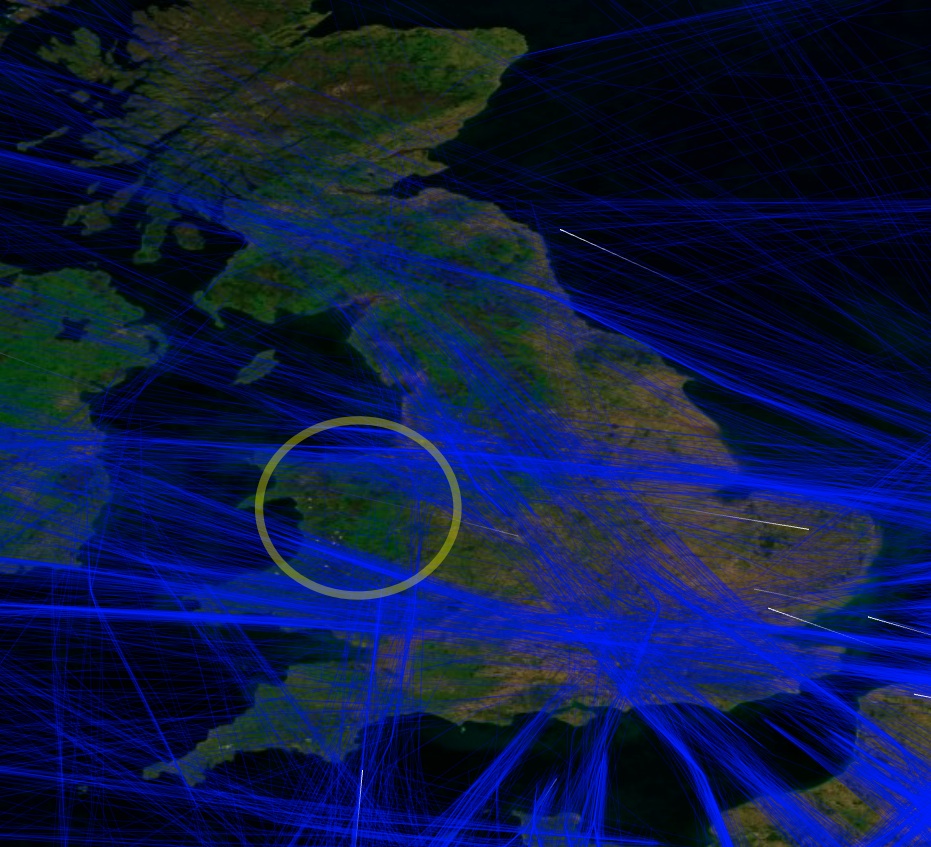
You can see how regular traffic is routed around that area on the contrail map:
http://contrailscience.com/map/
Last edited:
Nice,
But could you see the EXIF-info of TEEJ's pics in order to derive the data for the accessory CS-map?
ExifViewer for Firefox doesn't show it here.
Jan.
He said it was Snowdonia, which is in the left half of that circle.
Jan-61
Member
He said it was Snowdonia, which is in the left half of that circle.
True. But the time-data are still unknown.
We don't know if these conditions are permanent, isn't it?
Jan.
True. But the time-data are still unknown.
We don't know if these conditions are permanent, isn't it?
Jan.
The contrail map just uses a 24 hour snapshot from last year.
Pete Tar
Senior Member.
Two RAF Eurofighter Typhoons at 41,000 feet over Low Flying Area 7 in Snowdonia, Wales, UK.
Phwoar!
Similar threads
- Replies
- 12
- Views
- 2K
- Replies
- 18
- Views
- 2K
- Replies
- 9
- Views
- 2K