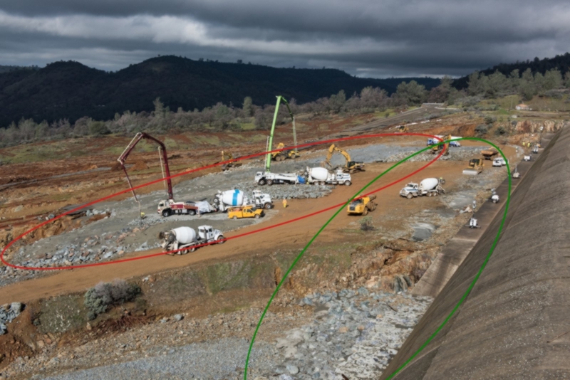
View attachment 25043 View attachment 25042 To Scott Gates --
There's a couple good reasons why the weir might not be well attached to the bedrock:
1) The dam operators had reason to believe that the weir would fail within 60 minutes of when they gave their evacuation order. This would indicate that they were observing headwater cutting from surface water or a boil that they considered unstoppable.
"Sunday at 4:42 p.m., when DWR issued this tweet: "EMERGENCY EVACUATION: Auxiliary spillway at Oroville Dam predicted to fail within the next hour. Oroville residents evacuate northward."
http://www.sacbee.com/news/state/california/water-and-drought/article132361619.html
2) DWR officials were concerned about a boil (water flowing under the weir and coming out of the ground like a spring) coming under the weir.
"DWR officials also hope to reduce the water level by another 50 feet in order to take pressure off the emergency spillway. The level needs to be below the level of emergency spillway in case their is a boil in the weir that is allowing water to leak into the gouge."
http://www.kcra.com/article/evacuation-orders-issued-for-low-levels-of-oroville/8735215
"I understand that is not true," said Ted Thomas, chief spokesperson for the
California Department of Water Resources (DWR).
http://www.abc10.com/news/local/verify-are-there-boils-on-the-oroville-emergency-spillway/408761367
3) On the evening of the 12th there was one
View attachment 25039 View attachment 25041 stream running muddy while all the others were running clear. It was the ravine immediately south of the ravine that had cut to near the big weir/parking lot weir interface. See three screenshots from various news videos (photos 2, 3, and 4).
(photos in reverse-order, not sure hot to re-sequence them)
4) Obviously, there was no boil, since all erosion stopped when the water stopped coming over the weir. But, that they were worried about a boil indicates that they had limited confidence in the weir footing.
5) The bedrock has vertical weak spots, like this photo shows (pic 1), from immediately below the first section of washed out access road. This weak spot is vertically oriented, and is more than 10' deep. If the engineers in the 1960s cut 10 feet below the surface bedrock to find structural material in this location, they didn't cut deep enough. That slot in the bedrock is at least 15' deep, and appears to have rubble in the bottom.
If this slot was to propagate upstream, it could undercut the weir.
6) If the weir gets undercut, the water coming out the bottom has 60 vertical feet of hydraulic pressure on it. That's much more powerful than the surface water that etched out that weak spot in the first place, and even if the blue bedrock is holding up well to surface runoff and surface pounding, the pressure from 60 vertical feet of water would do more damage than anything that has occurred thus far. Such as etch out laterally at the base of the weir and cause a section of the weir to topple over, thus creating a 30 to 60 foot tall wall of water.
If you figure that the engineers that gave the "60 minutes until uncontrolled release" warning and evacuated 200,000 people had some inside info, then there is a basis for a weak attachment between the weir and the bedrock, and that some observations made late in the day on the 12th would have led them to conclude that weir collapse was very possible. From what I see in the screenshots, it could have been the muddy water emerging from a ravine where all other ravines were issuing clear water, or it could have been the bedrock etching plainly deeper than 10' from the bedrock surface.
I guess I'm saying that I think those engineers in the 1960s were great guys and all, but shortcuts get made sometimes that have negative results down the line.
BTW, why does the northern half of the weir have an apron on it, and the southern half not? Haven't heard anyone discuss this. Seems that the designers were more worried about surface erosion on the northern part of the weir...
1.) There was no boil. When first notices the erosions was moving fairly rapidly, back cutting toward the weir. That said numerous media reports identified the authorities quickly noting, just after the evac order was given, thet the back cutting had slowed significantly or stopped - which is totally consistent with scour of weak weathered surface materials.
The "60 minutes" claim was based on original observed scour progression, which as noted quickly slowed or stopped once the weak surface material was gone.
2.) ... about the claim there being boils on the dam's emergency spillway... from your link:
External Quote:
"I understand that is not true," said Ted Thomas, chief spokesperson for the
California Department of Water Resources (DWR). A boil would have to leak through bedrock in order to occur.
"I don't think it should be possible," said Jay Lund, Director at the Center for Watershed Sciences at UC Davis."
"If a boil did somehow occur on the spillway, crews would have to build a dike around the spillway or lower the water on the lake. However, this would only be a temporary solution.
A more permanent fix would be to build a grout curtain, which is a barrier which protects or strengthens the foundation of a dam from seepage.
A review of plans shows there already was a grout curtain.
3.) A review of the numerous photos before, during and after shows the bench had several areas of simple dirt soils, mostly in surface areas. Initial scour would cause these ares to run muddy as the surface fines were washed free. These SAME areas are shown running clean after the initial scour. And "after" photos show the erosion did not ultimately advance firther towards the base of the weir nor was there any evidence of interaction with the base of the weir, let alone a boil drawing soil from below or behind the weir.
4.) That there was no boil reflects nothing on their confidence level. It simply reflects there observations at the time - observations that occurred in the context of the belief there was a serious risk of failure, which they quickly realized was overstated.
5.) The land - both current and originally - slopes DOWN from the weir. The cut you note is well down slope from the weir and in the general vicinity of or the access road - which was built using standard compacted rock fill, which in the face of a widespread 12,000 cfs flow was expected to be sacrificial. A spot of weathered rock down slope a distance and elevation from the weir, which well could represent close to the then existing weathered surface rock when construction of the weir was completed, is not indicative of the foundation bedrock below the weir.
And the fact the engineers specifically noted overcutting and backfilling with concrete to insure good bedrock should be considered a clear representation that good bedrock underlies the weir. This idea they didn't know what they were doing, or somehow shirked their responsibility, because of a cut a significant distance from the weir base is not supported by any fact.
Last there is zero evidence, even if this back cut progressd to the weir - that it would in any way be able to back cut thru the bedrock base of the weir.
6.) There is NO POINT on the weir where there is "60 vertical feet of hydraulic pressure on it" ... first the back cut would have to cut thru competent bedrock to have any chance of any hydraulic pressure. Next it would have to cut upward thru many feet of material on the reservoir side of the weir to come in any contact with any water.
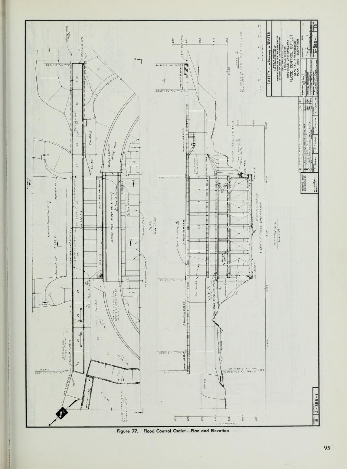
At the main spillway end the base of the weir is at least 11' underground, which puts bedrock foundation at appx 836. On the reservoir side existing grade is appx 875 - meaning just the top 26 feet are exposed in any hydraulic water pressure ... 39 feet is BELOW GRADE. In order to compromise anything a back cut would have to cut 11' feet down to the weir base, and then cut thru appx 64 feet of competent bedrock foundation including a grout curtain and heavy rubber membrane, just to get to back of the weir.
It would then have to backcut more than 39' to the surface of existing grade to reach the water.
At the parking lot end a backcut would have to cut up to the weir, again at least 10+ feet deep, back cut thru the bedrock and then cut first upward to within about 10 feet of the top of the weir to reach water column and then 400-500 feet into the reservoir to reach deeper water. And the depth of the base of the weir is nowhere near 60'.
And then, even IF a backcut pulled off this near miraculous task ... it would have to dramatically widen the cut in the bedrock foundation - far enough that the heavy concrete weir collapsed or toppled. Which is completely unsupported by the facts.
We know how the blue green bedrock performs under significant scour pressure. We can see it firsthand observing the concentrated spillway down the hillside - where all that water did nominal if any cutting to the bedrock at all.
The officials who made these decisions - the Sheriff actually - made them in the heat of battle - working in uncharted territory, where the risk of being wrong was enormous. They acted, under extreme pressure, on a very limited set of data and facts, that the cut appeared to be advancing rapidly toward the weir ... and IF it made it there, and IF it somehow cut thru the bedrock foundation, and IF is cut thru the many feet up to the surface grade, and if it then cut through 400-500 feet horizontally to reach deeper water, it might spill thru a 30' breach.
A position which the data showed them very quickly was highly unlikely, when the seemingly rapid backcut toward the spillway all but stopped - nearly as fast is it started.
One more time - the orig topos show existing grade was appx 900 at main spillway end of the weir. And was appx 880 through the rest of the length of the 900' weir. A the location of the 'deep' cut you are focused on - down slope from the weir, the existing grade was appx 825 elevation ... not remotely surprising rock between as much as 75' below the orig grade of the spillway location would be near the surface and weathered.
As to the southern part of the weir, the construction plans posted here multiple times, clearly show a 12' apron on the weir ... and that it was located at 840 elevation ... at least 5 feet below current finished grade at that spot.

")