Source: https://www.youtube.com/watch?v=MCQM9dCtQ2I
This rather long (1 hour 40 minutes) video from "Dr John D." documents some observations he made from the end of Worthing Pier to Brighton, 9.6 miles away. It's particularly interesting as Brighton now has a very distinct marker in the form of the i360 observation tower ride, a 450 foot high tower with a viewing pod that slides up and down.
John used an interesting contraption to aim the camera and protect it from the water - a PVC pipe mounted on wooden footers, which he installed seemingly near the low tide point at the end of the pier. Here's the second setup (00:38:08). The first one is in a similar location a bit around the corner (0:09:40)
Here's a shot from the first observation:
The i360 tower is on the right. The tall building is the Sussex Heights apartment building, behind the Hilton Hotel.
An important part of understanding what we are looking at here is that we are not viewing perpendicular to the beach, but at an angle
Quite a bit of an angle.
Now the immediate observation here is that the beach is missing. There's a chunk of the view cut off by the horizon - globe Earth proved!
However, John goes through a series of calculation, eventually concluding (1:39:12)
How did he get there? It seems to be largely based on the visibility of the traffic lights (the height of which above the actual water he seems to have miscalculated), and the assertion that there can be no refraction over the water in the evening.
I commented
To which John replied with a long email demainding I send him meThis is a great viewing location, with the i360 there so you know exactly where you are looking. You are getting refraction though, and you can prove this by looking at the aspect ratios of the buildings. They get more vertically compressed as you get closer to the horizon. Any observations that are really close to the water are going to have refraction issues (think back to the Bedford Level). So to do over-water obscuration tests you really need over 20 miles.
Now the second one is obviously an impossibility, as I can neither easily go to Brighton, nor go back in time. But it's an interesting request as the important temperature gradient is going to be in the middle. (or really the average over the distance, but out to sea is not going to be the same as in 2 inches of water at the shoreline.)
1) The detailed analysis of stills you did from the video footage that clearly show beyond reasonable doubt (to anyone) that the buildings become more vertically compressed as you get closer to the horizon /ground, which is your claimed proof that downward refraction is occurring.
2) A dated video of a range of temperature readings taken at 1 metre intervals between 0 – 15 metres at Worthing and / or Brighton, taken on the evening of Wednesday 23rd October. This will prove the existence of a temperature gradient, that could cause refraction (in a downward direction)
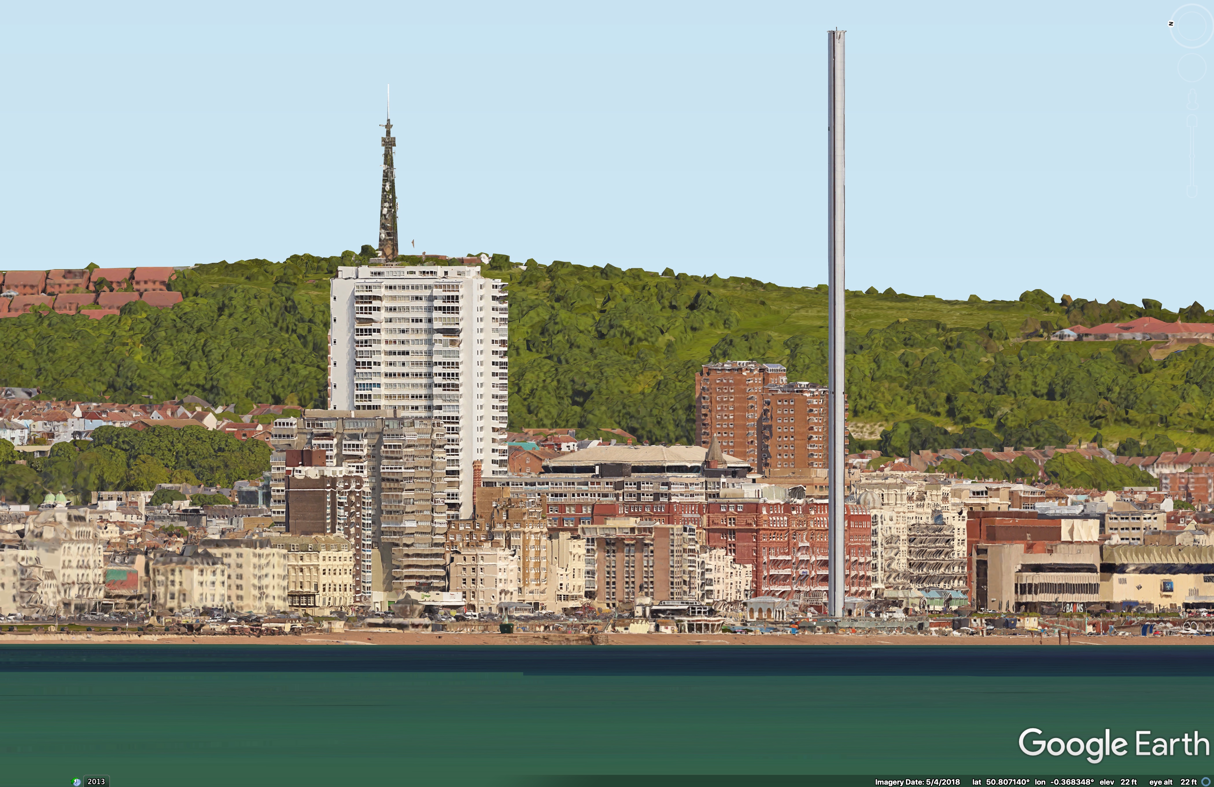
But to the first one. What I like to do in cases like this is create a "pseudo flat earth" view from Google Earth, basically just raising up the viewpoint a few feet, until you can see the beach. Here's an HD image from Google Earth of the "pseduo flat-earth view".

And here's a comparison (drag slider)
[compare]
[/compare]
We can see faily obviously that the horizon is obscuring a goodly chunk of the view. we can also see that the lower part of the image is slightly compressed, this is quite a subtle effect, and you see it best when looking at the enrtire image. The image has been aligned with the top left corner of Sussex Heights, and then scaled so the other building line up. If there was not atmospheric refraction then everything would line up vertically, but as it is there's a very slight rise of a few feet of the very lowest visible points.
It does not seem to be hugely more than standard refraction though (refraction based on a standard larpse rate). To investigate this more I dropped in this view as the default in the Metabunk Refraction simulator
https://www.metabunk.org/mirage/
I invite people to try it, it's interesting how little of a temperature gradient it takes to make things be visible.
Last edited:
