Need help debunking FE video

ki_cz

Member
Hi all,

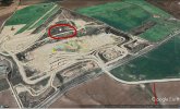
I've been linked this FE "proof" video and am having trouble debunking the visibility of the mine in the distance:


Source: https://www.youtube.com/watch?v=r0Lc5nBXXSY


Using curvature calculators that take refraction into account, I can't seem to get the mine to be visible without some absurd refraction values. I'm wondering if I'm missing something regarding what the actual atmospheric refraction values would be, or perhaps somebody can spot something that I'm missing in the video?

Any help would be appreciated, as discussing this with an FEer has proven to be immensely frustrating.

Some additional details from the video:

- observer height: 300ft (@1:23 of video)
- target height: 227ft (@2:54 of video)
- distance 49.7 miles (@3:20 of video)
 
Last edited:
First thing I would do is double-check the elevation for the observer location: that method of finding it using Google Earth can be quite inaccurate. Also double check the target height.

As a side note, given that Flat Earth appears well on the wane and that there are so many good debunks and explanations out there, anyone still adhering to it at this stage is probably going to be quite a challenge to discuss with.

Good luck. :)
 
Last edited:
Inversions are not that absurd. Walter Bissin's calculator shows that the mine's visible when dT/dh>0.03 C/m.

Does your interlocutor know that as the target is below the observer, were this on a flat earth there would be more flat earth visible behind the mine, and it wouldn't stand proud of the horizon like it does. I.e. his video disproves the flat earth model.
 
If the stated locations are accurate, it does seem to require unusual refraction. On a quick look at Google Earth, I see that there is higher ground - up to at least 190 meters - quite close to the stated observation point and in almost the same line of sight to the mine. From that height there would be no great problem with the observation. I wouldn't automatically accept that stated locations in a flat earth video are reliable.
 
If the stated locations are accurate, it does seem to require unusual refraction. On a quick look at Google Earth, I see that there is higher ground - up to at least 190 meters - quite close to the stated observation point and in almost the same line of sight to the mine. From that height there would be no great problem with the observation. I wouldn't automatically accept that stated locations in a flat earth video are reliable.

That's a good point: my first thought was "gee, that looks higher than 300 feet" - though obviously I wouldn't put much stock in my eyeball impression.
 
That's a good point: my first thought was "gee, that looks higher than 300 feet" - though obviously I wouldn't put much stock in my eyeball impression.
I had the exact same reaction. Looks much higher. But also I don't have calibrated eyes.
 
First thing I would do is double-check the elevation for the observer location: that method of finding it using Google Earth can be quite inaccurate.

Seems about right. I checked a more accurate source and got 93m (305 feet) - then there'd be the addition of camera height.

I suppose it wouldn't be too difficult to use Google Earth to see whether that really was the viewpoint or not.

(PS Viewpoint coordinates for easy copy-and-paste: -34.799786, 138.665292)
 
That's a good point: my first thought was "gee, that looks higher than 300 feet" - though obviously I wouldn't put much stock in my eyeball impression.
i ran some line of sight lines and at most his viewing alt would be 5 feet higher (if google earth si correct), but he is off by like 20 feet on the mine top.

34°47'59.4"S 138°39'55.0"E
 
this isnt water? this is 15 feet higher than the path, i went up because the water strip (if thats what im seeing) is thinner closer to the sign.

i dont see anywhere else he could be unless they cut down some trees or he is in a house second floor window.
1627321061988.png
 
Hmm, it's hard to know for sure, but that does look like it could be a water line, it still doesn't really look like the same angle to me though?

I've brightened the start of the video which might give some more clues to where it was actually taken from:

screenshot.jpg
 
it still doesn't really look like the same angle to me though?
yea, and thats the google car with a camera on its top. ive never had a mega zoom camera though, so its kinda hard to judge if that tiny strip could look like the vid with massive zoom in.

I'm really leaning toward a fairly accurate location only because when i line the play equipment up, im not really seeing any other ideal locations. i also have no idea what kind of zoom you would need to see the play towers that well.
 
I tried using Water Bislin's simulator with the stated values and then adjusting for refraction. While playing around with it I did get a positive result for 'severe' refraction, but then lost it and couldn't find it again! Someone more familiar with the simulator might be able to work out just how strong refraction would need to be.
 
I've been trying to get a direction from the sunset; the video was posted September 8th 2019, and the sun would set at 276° (see https://www.timeanddate.com/sun/australia/adelaide?month=9&year=2019 ) but the video sunset is actually much further North, implying that the video was taken some months prior to that (why?).
Adelaide.jpg


You can see in that video, as well as in a prior time lapse on the same channel, that the sun sets right-to-left, exactly the other way around from the Northern hemisphere. That is only possible on Flat Earth if the sun isn't where we see it.
If you get an explanation along that line, you know that the person has been talked into no longer believing their own eyes.

Source: https://www.youtube.com/watch?v=SSsGBrk0xnU
 
According to a current map, that Adrossan mine hill is actually 107m = 351 feet high.
Adrossan.jpg
Source: https://en-au.topographic-map.com/maps/jvq2/Adelaide/

going by Walter Bislin's calculator, the 300 ft (100m) observer height makes the top of that hill coincide exactly with the horizon, so any slight rise in observer elevation wold make that hill visible with standard refraction. Adjusting dT/dh to make it visible via refraction no longer requires an inversion.
My setup: http://walter.bislins.ch/bloge/inde...40.16939436-1~0.0065-12-11001.2946-114.35-9-4

That 230m mountain near Maitland is actually twice as high as the Adrossan mine hill; and only about 20 km further inland. On Flat Earth, this mountain should be visible in the photograph, and appear significantly higher than the Adrossan hill; on the globe, it tops out slightly below the Adrossan hill.

So that's two ways (the sunset and the invisible mountain) that this video proves the globe.
 
Last edited:
351 feet high.
that's a hundered foot difference from google earth, but...this mound behind the quarry/mine is about 350 feet so we should see it in the vid. maybe we do.. or maybe what we are seeing is just a cloud.

7-26-2021 6-36-37 PM.jpg
 

Attachments

  • 1627339302457.png
    1627339302457.png
    59.4 KB · Views: 259
Hmm, it's hard to know for sure, but that does look like it could be a water line, it still doesn't really look like the same angle to me though?

I've brightened the start of the video which might give some more clues to where it was actually taken from:

screenshot.jpg
I've cropped a bit off https://flickr.com/photos/ryanthescooterguy/50957656348/in/photostream/
(by Ryan Smith, CC BY-NC-SA 2.0, thank you @Rory ) to correspond to your screenshot:
Cordoba Avenue Reserve - Ryan Smith_cropped.png
Enlarging the interesting bit:
Cordoba Avenue Reserve - Ryan Smith_croped_resized.jpg

I'd say the observer location seems plausible.
 
Hmm, that does appear very similar, but it's facing a different direction from what they marked in their video. Could that potentially be the issue here?
 
I just double checked, that's not the angle shown in the video, the playground tower is where they marked it, northwest of the shooting location.
 
Thanks again all for the help, I think I figured it out.

Thanks to the flickr images I managed to extend the angle of the vantage point backwards to see if there were any other places where this viewing could take place, coincidentally, there was a hill on the same line, with an elevation of ~525ft, which would make the mine easily visible under normal refraction conditions.

claimed.jpg

The problem with this is that it appears as though the angles of the trees and buildings shot from the "claimed location" seem to match with the video, you would assume that with the change in elevation, the same trees wouldn't be covering the same parts of the buildings, so I guess I haven't quite solved it ...
 
so I guess I haven't quite solved it ...
since we are not seeing the hill directly behind it and very slightly to our right, my guess is we are actually seeing that hill which is 100 feet higher. because where did that high hill go?

7-26-2021 6-36-37 PM.jpg


note: there is something called the "heights observatory" (if i recall it is like 500 feet up...add its 544 feet), located juat to the right of our camera guy's said location. i didnt see if i could line up the playground towers with it though because his given location seems ok to me.
 
Last edited:
since we are not seeing the hill directly behind it and very slightly to our right, my guess is we are actually seeing that hill which is 100 feet higher. because where did that high hill go?

7-26-2021 6-36-37 PM.jpg


note: there is something called the "heights observatory" (if i recall it is like 500 feet up...add its 544 feet), located juat to the right of our camera guy's said location. i didnt see if i could line up the playground towers with it though because his given location seems ok to me.

Yeah, with the hill at 340ft like in your image I'm still not getting it to be visible with standard refraction, at the same time, if I use the higher observatory, then I'd expect the angles of the trees relative to the buildings to be different, but in the flickr images compared to the video, they appear to be both from the Cordoba park, but I could obviously be wrong.
 
I think the stated location is right, based on the photo Mendel posted, though I think he might have been a little higher than 300 feet, perhaps ~320 feet. This is based on a ground height of 305 feet, plus cameraman, plus perhaps being elevated by maybe standing on a children's play thing or being at a higher spot of the playground.

Not that this would make a massive amount of difference to the hidden amount though. Seems like refraction has more to do with that.
 
Thanks again all for the help, I think I figured it out.

Thanks to the flickr images I managed to extend the angle of the vantage point backwards to see if there were any other places where this viewing could take place, coincidentally, there was a hill on the same line, with an elevation of ~525ft, which would make the mine easily visible under normal refraction conditions.

claimed.jpg

The problem with this is that it appears as though the angles of the trees and buildings shot from the "claimed location" seem to match with the video, you would assume that with the change in elevation, the same trees wouldn't be covering the same parts of the buildings, so I guess I haven't quite solved it ...
I had a look at that from Streetview, and it seemed to me that there's too much land visible from that vantage point -- the perspective fits exactly with my photos: comparing the height of one of the "tent houses" to the distance from its tip to the horizon is 1:5 in the photo and in the video. I don't think you get that close of a fit from the greater height?
 
Last edited:
You can see in that video, as well as in a prior time lapse on the same channel, that the sun sets right-to-left, exactly the other way around from the Northern hemisphere. That is only possible on Flat Earth if the sun isn't where we see it.
Or in other words, a top right to bottom left sunset is impossible on a flat earth.
 
instead of all this fannying about with elevations and equations, just, um, where does the sun go then?

I like it: Metabunk 2.0, where every claim of evidence for something is just met with a flat out refutation of the 'theory' as a whole

Claim: 9/11 something something girders gravity passport own footprint CNN
Refutation: It wasn't an inside job, Arabs did it. Get over it

Claim: Blurry blob lots of miles away is maybe aliens
Refutation: They always turn out to be planes or birds or insects or something normal, fuggedaboudit

Claim: Et cetera et cetera
Refutation: See above
 
Or in other words, a top right to bottom left sunset is impossible on a flat earth.
Well, the die-hard FEers will say something about perspective and refraction (and some have even used a model animation by Walter Bislins without attribution to show how light rays would need to be bent, as proof that they could be), which behind all the pseudoscience means the sun is really in a completely different place in the sky than where we see it.

I've been bringing up the sunset here despite it not strictly adressing the claim because a) the video featured this kind of sunset, and b) the same youtuber had an even clearer example of it.
The problem is that when the sun is setting it is coincident with the horizon. So if the sun is not where it looks to be then neither is the horizon and the flat earthers demand that the horizon is at eye level as it would be on a flat earth. So the sun has to be at eye level too which means it is either infinitely far away or actually touching the flat earth. It just plain doesn’t work.
 
The problem is that when the sun is setting it is coincident with the horizon.
That's a minor problem. The atmosphere refracts vertically, and you can actually see stuff near the horizon disappear under the right conditions.

The major problem isn't the elevation, it's the azimuth. The sun does not set in the right direction. Like, not at all if you're in Australia, Africa, or South America in the summer (like December), and slightly off almost everywhere else. The light needs to bend sideways for Flat Earth, and it basically never does, because there's no reason for that. FEers can get their followers confused about what we should and shouldn't see vertically, but they stay away from adressing the sideways problem because they know the jig is up once anyone starts questioning that: the only out is to stop believing what you see, and that reeks of brainwashing.
 
Back
Top