Jellyfish UFO - The Second Part - South Facing Footage

Mick West

Administrator
Staff member


Can we figure out where this is? Supposedly later in the same video, but I don't immediately see a match.

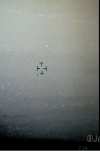
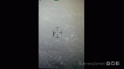
Looks like the same type of camera, but the UI is green, whereas the earlier one is yellow
2024-01-11_16-09-41.jpg


The object is moving from left to right, seemingly in the opposite direction.

The heading and range are hard to read, but look like 172° (possibly 272°) and 6.8 to 6.7km

2024-01-11_16-15-16.jpg


172 is to the south, over land. Matching a different balloon in prevailing winds travelling west.

There's one wide shot:


2024-01-11_16-30-13.jpg


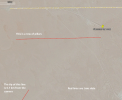
One obvious road, and another, seeming parallel above it, with a faint one inbetween.

Assuming this is another camera on the aerostat that covers the south approach (UI color is so you know which you are looking at), there's a bunch of roads down there. Can't find a good fit.

2024-01-11_16-35-14.jpg


Working attached (KMZ)
 

Attachments

Last edited:
  • Like
Reactions: dBm
The object is moving from left to right, seemingly in the opposite direction.
If my sailboat days memories serve, that would indicate it may be on a path to pass on the other side of the camera balloon, if it is taken from the same surveillance aerostat and we're dealing with the same wind carrying it past.

Can't help with location, sorry.

Does not look like the same object at all -- of course where there is one lost bunch of balloons, there may be another.
 
Dang! That thread just had too many posts :), let me quote that here:

Great Work! Can you now do the same for the second portion of the video that Corbel claims is showing the object over water. Based on the info it is at 172 degrees and 6.7KM slant from the camera. This all assumes it is the same balloon doing the capture but my estimates match up with what I see in Google maps. You can make out roads.

Looking south from over base.
View attachment 65079

Tracking to that spot to show roads.
View attachment 65080

Portion of video with roads.
View attachment 65082

Video showing 6.7km slope and 172 degree angle.
View attachment 65083

Funny it's almost exactly what I did. Sorry @JAFO.
 
In the zoomed out shot, you can just make out pylons - I had a quick look in GE and couldn't see them initially, but the 12/2018 photos were nice and had contrast, plus the sun angle meant the pylons cast a long shadow so were easier to see.

Might help with a more precise location.
1705024312474.png
 
Dang! That thread just had too many posts :), let me quote that here:


Funny it's almost exactly what I did. Sorry @JAFO.
@Mick West - No worries. Glad this can get some traction now. It does make sense that it should have its own thread. I was initially seeking clarification/conformation since it was yet another claim by Corbell that appeared false; showing the object over water. I have doubts this is even the same object.
 
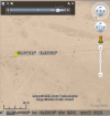
Success, I found the uniformly spaced tall pillars on those roads. You can see them in satellite images taken with a low sun angle, note the dates in the images below. I followed 173 degrees bearing and 6.7 km distance on flat land (rather than slant range) from the same position of the known PTDS aerostat. The first road is about 8.8 km away from the camera

Camera at known position of the PTDS aerostat
33°19'26.73"N
43°36'28.12"E


If you look around this area on images from October 13, 2016 and December 14, 2018 you can see lots of these poles around the roads. So they were there in 2017.
Second video ~173 bearing.png
 
Last edited:
That is not over water. It is over flat open desert spotted with occasional clumps of grass and small shrubs. Those are what some are seeing as wave tops. Vegetation has different heat retention properties than the desert surface, that why it stands out.

The portion of the video where the wide-shot is is continuous with the leading and trailing zoomed in shots, you can see a tall object to the right of the center of the wide-shot, and when it shifts back to the zoomed-in view that object passes across the scene.
 
33°14'19.96"N
43°36'40.40"E
I am wondering if the pillars in that location may be a bit to far distant from the Blimp. If this video uses the same blimp location those pillars are approx 9.4km distant from it.

The closest pillars to the blimp that i have seen so far are about 7.2km to its SE.
33.271219° 43.650610°
iraq_jellyfish_poles_1.png

They appear to be an extension of a line of pillars near the ones you found. However I don't feel like the landscape features in that area match as well to the video, and 7.2km seems to far as well.

How strict is that 6.7km radius from the blimp?
 
I am wondering if the pillars in that location may be a bit to far distant from the Blimp. If this video uses the same blimp location those pillars are approx 9.4km distant from it.

The closest pillars to the blimp that i have seen so far are about 7.2km to its SE.
33.271219° 43.650610°
View attachment 65207

They appear to be an extension of a line of pillars near the ones you found. However I don't feel like the landscape features in that area match as well to the video, and 7.2km seems to far as well.

How strict is that 6.7km radius from the blimp?
6.7 km is the line-of-sight distance from the camera to ground that the reticle is pointing at. So anything above the reticle can be farther away. The images in my comment above are the further of two roads I saw in that area. There are lines of tall pillars all over the area if you look closely. I'm assuming they are utility poles, and they don't really follow the roads.

The coordinates of the camera aren't exact. The aerostat the camera is on has an area it can float around from the anchor. I chose a rough spot near the anchor and shadow of the floating aerostat.

I'll include the .kmz file so you can reference it. Keep in mind there are more lines of pillars you can find in this small area.

Looking for pillars.png
 

Attachments

Can we figure out where this is? Supposedly later in the same video, but I don't immediately see a match.

Looks like the same type of camera, but the UI is green, whereas the earlier one is yellow

The UI in the MX turret is configurable for each different camera in the system, ie IR might be green but EON could be yellow. As there is only one IR camera in the MX-20 then there are two options to explain this difference:

1) Its a different MX-20 turret on a different Aerostat
2) The operator changed the colour between recording the first jellyfish and the second one.

@sgreenstreet - did I read that the Aersostat operator said the balloon was taken down for maintenance? Was it replaced by a spare with perhaps a different MX-20 ?
The object is moving from left to right, seemingly in the opposite direction.

The heading and range are hard to read, but look like 172° (possibly 272°) and 6.8 to 6.7km

172 is to the south, over land. Matching a different balloon in prevailing winds travelling west.

There's one wide shot:


Assuming this is another camera on the aerostat that covers the south approach (UI color is so you know which you are looking at), there's a bunch of roads down there. Can't find a good fit.
I think its a different object too, probably drifting on the same course but further south.
 
Last edited:
I've added the positions of the 'pillars' that I think are electricity or telegraph poles. There seems to be a pretty good match here.

Centre of the image on the left is 33.243315 43.617559 (edit: fixed typo)

1705058139587.png
1705058175235.png
 

Attachments

Last edited:
  • Like
Reactions: dBm
That is not over water.
The object looks to me very like a single object drifting just above a still water surface and reflected in it. Otherwise, it could be a combination of two objects, of similar size and shape, held together by 'string' of some kind. Either way, it doesn't look much like the object(s) seen in the first part of the video.

If it is over water, there seem to be a lot of small objects scattered either on or just under the surface. In fact they look to me very like floating ice, but that would rule out Iraq! Maybe coral? Small rocks? Salt deposits in an arid lake? If the objects are under the surface, the water must be very shallow. I think a specific lake has been mentioned somewhere, so its depth could be checked.
 
The object looks to me very like a single object drifting just above a still water surface and reflected in it.
Please read the thread, we know exactly where it is. It's not over water, and the white things are vegetation that shows up as white in IR.
 
The UI in the MX turret is configurable for each different camera in the system, ie IR might be green but EON could be yellow. As there is only one IR camera in the MX-20 then there are two options to explain this difference:

1) Its a different MX-20 turret on a different Aerostat
2) The operator changed the colour between recording the first jellyfish and the second one.
I suggested a third option - a different MX-20 on the same Aerostat, because on Newsnation the image they show appeared to have mutliple mounting points.
2024-01-12_05-11-17.jpg
 
on Newsnation the image they show appeared to have mutliple mounting points.
Although it's quite possible that was a random image they pulled up. When I look for PTDS blimps, they seem to have one MX-20 style camera.
2024-01-12_05-20-13.jpg


I wonder if the UI gets changed on the a daily basis, like bread tags,

2024-01-12_05-23-34.jpg

so you can quickly differentiate footage from different days.

The location does seem to match (?) The blimp would presumably be a bit the the west to the tether point.
 
I wonder if the UI gets changed on the a daily basis, like bread tags,
The manual for the MX-15i only shows the option from 100=white to 0=black, and "reverse text" where the text is swapped from white to black or vice versa while a block of the opposite color surrounds it.

reverse text.png


The brochure for the MX-20 camera only shows black/white grayscale, or a green text option. So I imagine it's the operator's choice and not some daily bread tagging scheme.

MX-20 camera possibilities.png


Though, I will say it's noteworthy that the videos released so far are tightly cropped, because the full video would have a ton of information just contained within the heads-up display. Like GPS tracking of the aircraft carrying the camera including current heading and altitude fits neatly in the bottom left.

heads up display.png


If the target bearing kept moving in one direction while the aircraft heading was facing the other, and the aircraft coordinates were changing, it would be very easy to determine if a parallax effect was happening. I suspect that might be why the original (the first part) video is cropped so tightly.
 
Last edited:
Centre of the image on the left is 33.243315 43.617559
That location is approximately 9km from the aerostat. In that part of the video with the wide view (the part that includes the poles and roads) the UI showing distance is cutoff. Are we still assuming a 6.7-6.8km radius?
 
Last edited:
That location is approximately 9km from the aerostat. In that part of the video with the wide view (the part that includes the poles and roads) the UI showing distance is cutoff. Are we still assuming a 6.7-6.8km radius?
I think the 9km is correct. There's a definite 'cut' in the video at 0m23s that brings it back to 6.9km, not sure if that is before or after the section

Also I have noticed that the background is the same in the video at 0m0s and 0m14s

1705072246336.png


Some landmarks are discernible from the video & google earth..

1705073259595.png
 

Attachments

  • 1705071772877.png
    1705071772877.png
    615.7 KB · Views: 46
Last edited:
Please read the thread, we know exactly where it is. It's not over water, and the white things are vegetation that shows up as white in IR.
Sorry if I'm not keeping up, but I thought it was established that the base was next to a lake (Habbaniyah Lake), which is visible in some of the photos above (e.g. at #5). At least one so-called witness also talks about the object going over the lake in the full (~17 min) video. So I thought it was reasonable to point out that the 'split' appearance of the object looks like a reflection. If this is ruled out by the geo-location*, that leaves the question why the object looks like the way it does, and whether it could have 'evolved' out of the object in the first part of the video.

*the geolocation makes use of features (roads and posts) which are only visible during a short part of the video (around 0:10 to 0:13) when the object itself isn't visible, as far as I can see. Could this section have been interpolated?
 
*the geolocation makes use of features (roads and posts) which are only visible during a short part of the video (around 0:10 to 0:13) when the object itself isn't visible, as far as I can see. Could this section have been interpolated?
The posts are visible in the zoom in, one at 17 seconds. We can use that to overlay the zoomed in sections that immediate follow:
2024-01-12_07-59-04.jpg
2024-01-12_07-59-24.jpg


PSD of the overlay attached.
 

Attachments

Sorry if I'm not keeping up, but I thought it was established that the base was next to a lake (Habbaniyah Lake), which is visible in some of the photos above (e.g. at #5). At least one so-called witness also talks about the object going over the lake in the full (~17 min) video. So I thought it was reasonable to point out that the 'split' appearance of the object looks like a reflection. If this is ruled out by the geo-location*, that leaves the question why the object looks like the way it does, and whether it could have 'evolved' out of the object in the first part of the video.

*the geolocation makes use of features (roads and posts) which are only visible during a short part of the video (around 0:10 to 0:13) when the object itself isn't visible, as far as I can see. Could this section have been interpolated?
The elevation indicated on the video shows 71M. The lake is below 50M. The video depicts land.
 
Though, I will say it's noteworthy that the videos released so far are tightly cropped, because the full video would have a ton of information just contained within the heads-up display.
They are indeed very cropped and do not seem to have the full resolution the MX-20 is capable of. Whether that is my accident or design is another question. Below is a still from a MX-20 corporate video showing all the data that would help us! :mad:
Screenshot 2024-01-12 at 15.57.56.png


This screenshot came from this video (which is quite interesting as it shows off what the MX-20 is capable of, but I'm not sure it adds anything to the analysis)


Source: https://youtu.be/jtYaejwd1Y0?si=G-b9hK7XRyqyTxXn
 
The elevation indicated on the video shows 71M. The lake is below 50M. The video depicts land.
Thanks. That settles it. (Assuming that the 71M figure on the screen relates to the elevation of the ground under the object.)
 
The overlay above does not cover the entire clip, as there are sections that are from a different time (you see the image get wider), Presumably there's a "part 2" video from which they mashed together this.
 
Otherwise, it could be a combination of two objects, of similar size and shape, held together by 'string' of some kind. Either way, it doesn't look much like the object(s) seen in the first part of the video.
If it is a bunch of balloons, it may have separated into two distinct bunches. Some people have suggested that the dangling portions are decorative elements, like tinsel or tassels; these may have slipped down further, and formed into a separate bunch of non-buoyant material.
 
but they confirmed that we actually had multiple recordings of the "Jellyfish UAP" with different durations.
Looks like the same type of camera, but the UI is green, whereas the earlier one is yellow
If the 'UI' is different colours, then these two clips may represent 'multiple recordings of the "Jellyfish UAP" with different durations'.

It may be the case that one, or both, clips exist in longer versions; but the fact that the header is displayed in different colours suggests that something substantial is different between these two clips. A different camera - or just different settings?
 
If it is a bunch of balloons, it may have separated into two distinct bunches.
Or this one may just be two balloons, perhaps tied to the same string. I know it has been claimed that this is more footage of the same object from the first part of the Corbel video... I'd like to see some evidence of that before buying it. They don't look the same.
 
these may have slipped down further, and formed into a separate bunch of non-buoyant material.
They seem to separate as this video progresses. Makes me wonder about fire lantern balloons, one of which is running out of fuel first maybe? Or yeah, the heavier stuff is starting to fall away...
 
I think the 9km is correct. There's a definite 'cut' in the video at 0m23s that brings it back to 6.9km, not sure if that is before or after the section

Also I have noticed that the background is the same in the video at 0m0s and 0m14s

View attachment 65245

Some landmarks are discernible from the video & google earth..

View attachment 65246

I believe from 0:10 - 0:23 (in the spliced together video in this thread) it is one continuous section and I'm pretty sure 0:02-0:10 picks up right after 0:23. I attached a gif showing the last frame of 0:23 and the first of 0:02, I noticed the UI is starting to creep in and the crosshair is roughly the same, also there are many sensor dots that align perfectly. There's a little movement difference in the object so it there might be 1-2 seconds missing between the frames.

So to my eye, the clip timeline begins at 0:10-0:23 and continues at 0:02-0:10. The hard cut at 0:23 could be before or after. I'd say after since in this new order, the UI slowly comes more and more into view and the hard cut at 0:23 has the most UI. Also at 0:10 the slant range barely comes into frame and is a 7, the 0:23 hard cut slant range is 6.7km so I'd say it's at the end.
 

Attachments

  • endOf23StartOf02.gif
    endOf23StartOf02.gif
    359 KB · Views: 55
Makes me wonder about fire lantern balloons, one of which is running out of fuel first maybe?
Curiously enough, one night I saw a fire lantern balloon descending after it had run out of fuel. The lantern was slowly drifting downwards and was tilted sideways, so it looked for all the world like a light grey box jellyfish.
Something like this, but without the tentacles.
Cubozoas.JPG
 
Back
Top