Grimsby contrails

MikeC

Closed Account
Spotted on ATS today:


They appear to have some of the characteristics of a holding pattern - regular circular end and straight sides, the other end is not contrailing.

Comments on the Grimsby.UK website favour Tornado II's

I couldn't see anything obvious on FR24 for the morning of the 14th tho.
 
I am from Hull just over the estuary from Grimsby (admittedly not living there now). About 20 miles further north there was a bombing range in the North Sea off Hornsea. We used to take walks out of Hull and you could watch A10's flying down to start a run. Grimsby is in Lincolnshire which is home to a shedload of RAF bases.
 
I'm 40 minutes south of that photograph.

It's worth commenting on that youtube vid too, since it's not a believer posting it, the comments won't be instantly deleted.
 
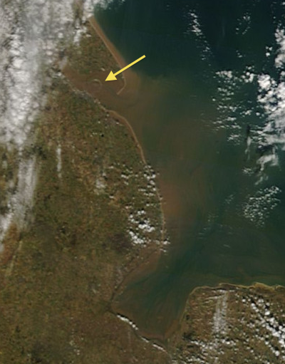
There seems to be a small circular trail in the terra satellite image taken at about the same time (10:50 UTC) as the video.

Grimsby circular trail.png

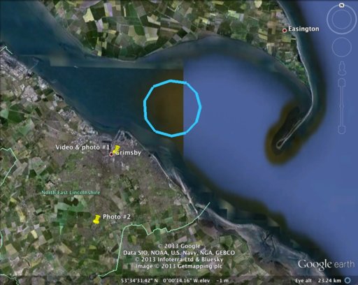
I have located on Google Streetview the place where the video had been taken: 71-73 Pasture St, Grimsby DN32 9AB. The circle appears to be in the right direction from this place. The diameter of the trail is about 3 miles, too small for the AWACS or tanker on station. The most likely it was a fighter jet.
 
I have downloaded KMZ file for the above satellite image and mapped the circular trail on Google Earth:

Grimsby contrails.jpg

I also have marked the points where the video and photos of these trails had been taken (as in the second link in OP). The second point, in Waltham, is a bit further south from the trails, which look from there being slightly compressed vertically compared to the first point. Actually, the differences between the two images are as they should be for the horizontal trails. The estimated altitude of the trails from these differences and the ground distances is about 5-6 miles, that is, in the range expected for the aircraft contrails.
 
Back
Top