Debunked: Pilot Forgets To Turn Off CHEMTRAILS while landing [Aerodynamic Contrail, Wake Vortex]

Balance

Senior Member.
This video has been shared on social media and retitled as "pilot forgetting to turn off the chemtrails".
Original video description from MrJI12
External Quote:

Cathay Pacific Airways Boeing 777-367(ER) [B-KPN] landing at LAX
Published on Feb 6, 2013

This has got to be one of my favorite landings of all time! Just look at those vortices!
Landed at about 7:50 PM Date filmed: 1/26/2013
[Admin update: It's an aerodynamic contrail from the wing surface and in the wake vortices, due to the high humidity - as seen by the fog]

Wikipedia Explains:
https://en.wikipedia.org/wiki/Contrail#Condensation_from_decreases_in_pressure
External Quote:
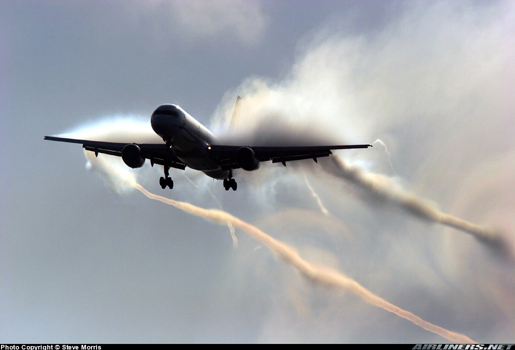
As a wing generates lift, it causes a vortex to form at each wingtip, and sometimes also at the tip of each wing flap. These wingtip vortices persist in the atmosphere long after the aircraft has passed. The reduction in pressure and temperature across each vortex can cause water to condense and make the cores of the wingtip vortices visible. This effect is more common on humid days. Wingtip vortices can sometimes be seen behind the wing flaps of airliners during takeoff and landing
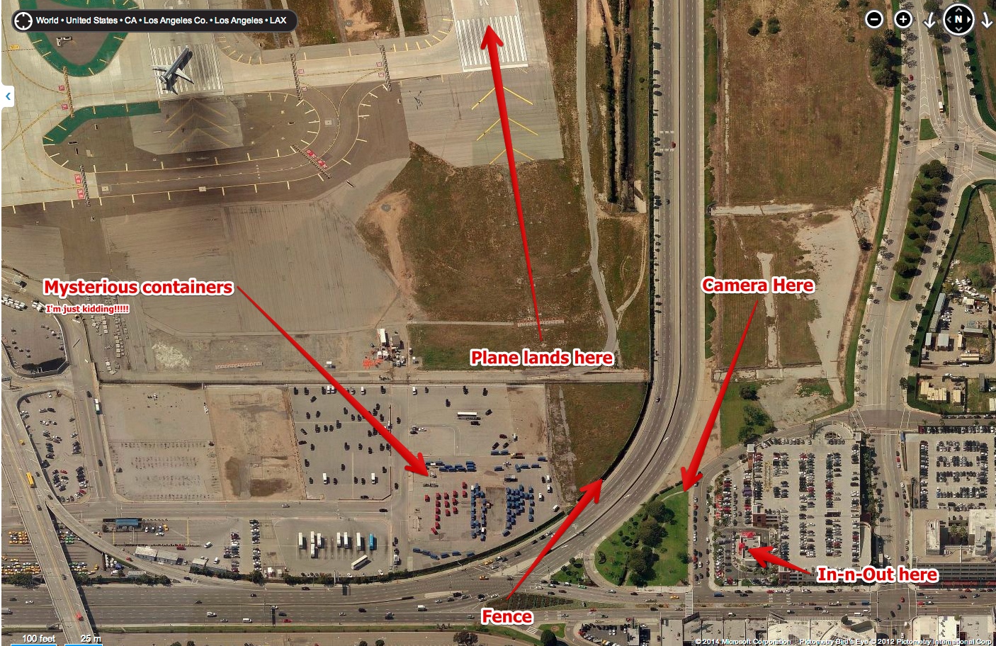
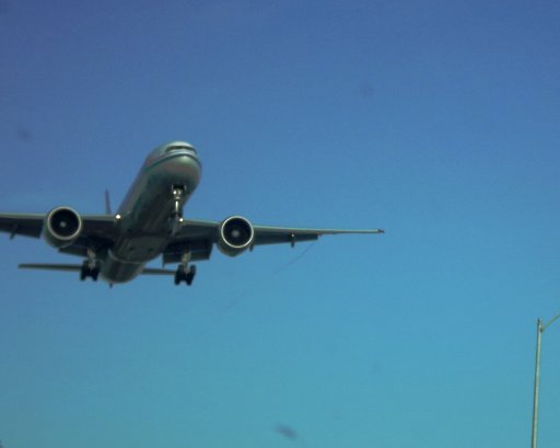
Here's almost the exact same shot in the daytime (from the famous In-n-Out spot at Lincoln and Sepulveda]


More examples:

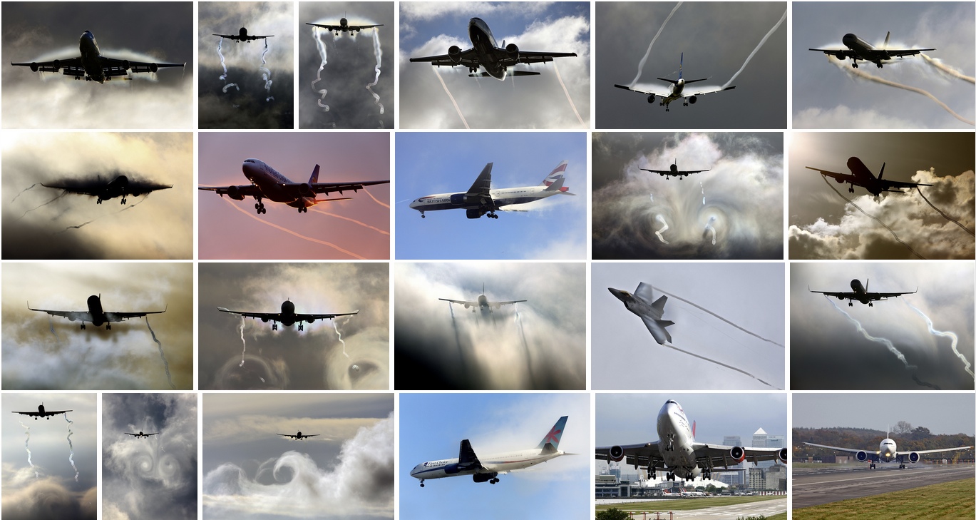
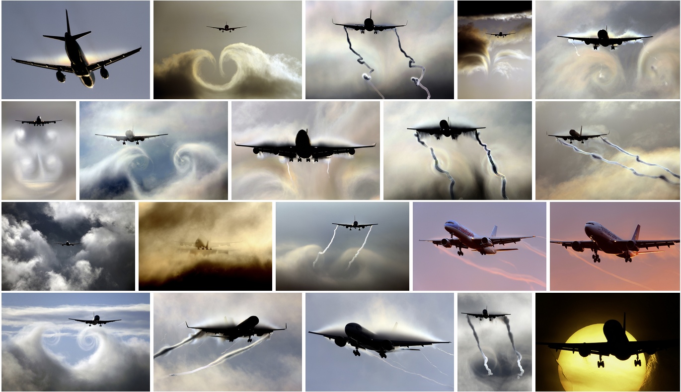
Steve Morris has a great collection of photos of similar events, with dramatic lighting:
https://www.flickr.com/photos/16699423@N02/sets/72157627508873002/
Flickr_Steve_Morris_Aviations_Photostream_20140428_133717_20140428_133723.jpg

Flickr_Steve_Morris_Aviations_Photostream_20140428_133542_20140428_133549.jpg


https://www.alpa.org/portals/alpa/magazine/2007/May2007_WakeTurbulenceThreat.pdf
d8b994188f54921fd0105d662e595e6a.jpg


http://www.airliners.net/photo/Qantas/Boeing-737-476/0887624/L/
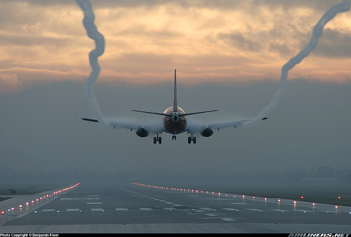
ea6262c45b220d26c556e4848c4cab2e.jpg


http://www.owenzupp.com/_blog/Owen_...Down!_An_Aviation_Image_by_Andrew_McLaughlin/
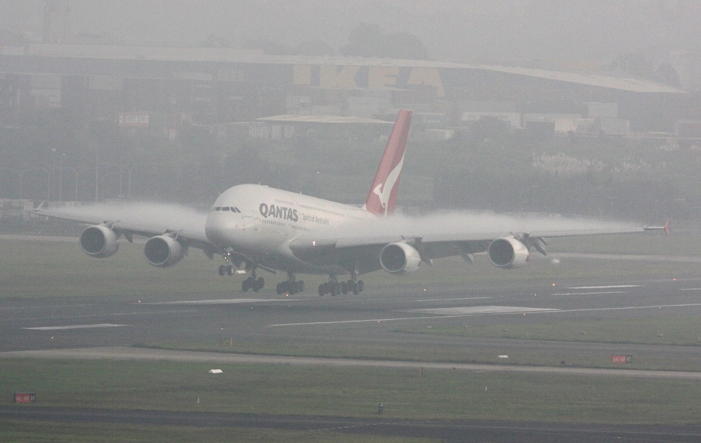
aba266fcfdc6c82d7cc288b40f343d5d.jpg


http://www.airliners.net/photo/Boeing-757-2.../0060641/
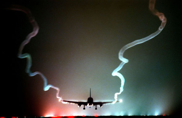
68590d522c1a16cfb8034000b1d7a1de.jpg


http://www.airliners.net/photo/Lufthansa-Cargo/McDonnell-Douglas-MD-11(F)/2017937/M/
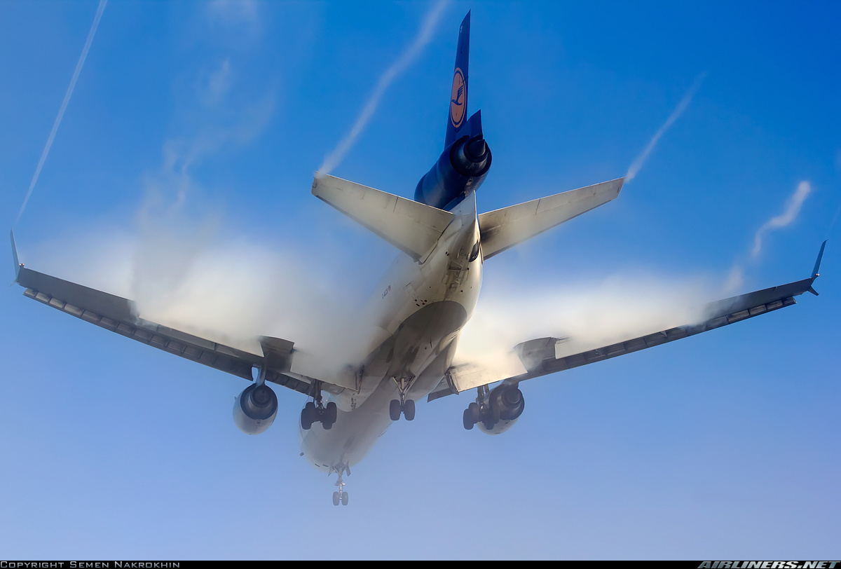
39cd1bd137f8451bfdadbf27e22e6560.jpg


And a great compilation:


The original video comes from MrJI12, who has a great collection of similar videos, mostly taken from the same spot:
https://www.youtube.com/user/MrJI12/videos?flow=grid&live_view=500&view=0&sort=dd
 
Last edited by a moderator:
Wake vortices. Beautiful, aren't they?

Airplane wakes...wingtip vortices:

http://www.faa.gov/air_traffic/publications/notices/

There is more, than the above ( ^^^ ) I could drone on and on.....

http://www.faa.gov/nextgen/snapshots/stories/?slide=18

AND, this one example from YT:

Why does NASA even do a test on wing vortices? Whats the point of testing for these and wasting money on it? Right? This is the kind of stuff the CT's probably use to propogate their malarchy because it seems senseless to test for something like this. Right?
 
Why does NASA even do a test on wing vortices? Whats the point of testing for these and wasting money on it? Right? This is the kind of stuff the CT's probably use to propogate their malarchy because it seems senseless to test for something like this. Right?
.....to understand the safe distance at which a rear plane can fly behind a front plane.
Wing (wake) vortices can cause the rear plane to mishandle, or crash.
 
Wake vortices have been the cause of several accidents and crashes. Most pilots are taught to understand them, so that they can avoid them. Air Traffic Controllers generally give a bit of separation between aircraft taking off or landing behind heavier aircraft to avoid wake vortices.
 
.....to understand the safe distance at which a rear plane can fly behind a front plane.
Wing (wake) vortices can cause the rear plane to mishandle, or crash.

Correct: Aircraft are assigned a wake turbulence category and there are hard limits on the distance/time you can be behind another aircraft on approach or on takeoff if they have a higher wake turbulence category than your own. There were three categories: Light, medium and heavy until the A380 went into service. It has its own category; Super. If you listen to ATC in the US you can hear aircraft with a Heavy or above category including the word in their callsign readbacks.
 
Not sure what this is called, created off the wing, probably some disruptor like a flap or brake or perhaps on fire? Air is obviously heavy with vapour and there's a nice twist to it also. Unusual and the pilot must've been pressing his face against the screen trying to see the ground lol

Not that unusual, depending on your local climate. Much more common in wetter climes like Manchester, UK, and Seattle, than at LAX - although we still get them because of proximity to the ocean.

The video is not a wingtip vortex though, it's coming from the end of the flaps. Wingtip vortex would come from the wingtip, like:
IMG_7041.JPG__25_RGB8__20140427_090316_20140427_090323.jpg

(Photo mine, plane is taking off into the Marine layer at LAX)

There's some discussion of the distinction here:
https://www.metabunk.org/threads/donut-chemtrail-why-pendules-and-crow-instability.1220/
 
Turns out the OP was at LAX. I've edited the OP to include the original video (with non-bunk description), and added some other examples. This one is particularly nice:
 
They forgot to mention the FEMA camp right below where the plane lands...

Oh dear. This is in Inglewood, California! They might not appreciate being called a "FEMA camp"! (Teasing...of course?)

https://www.google.com/maps/place/I...m2!3m1!1s0x80c2b656274bdd8d:0x727b30fdcae3170

(When you look at the diagram for LAX, Runway 24R is the northernmost. And, Runway 24L just south of it. Then, the Terminal area in the center, and two more Runways, 25R and 25L make up the "South Complex"....at LAX)
 
Oh dear. This is in Inglewood, California! They might not appreciate being called a "FEMA camp"! (Teasing...of course?)

https://www.google.com/maps/place/Inglewood, CA/@33.9518665,-118.3708397,14z/data=!4m2!3m1!1s0x80c2b656274bdd8d:0x727b30fdcae3170

(When you look at the diagram for LAX, Runway 24R is the northernmost. And, Runway 24L just south of it. Then, the Terminal area in the center, and two more Runways, 25R and 25L make up the "South Complex"....at LAX)
I figured maybe the NWO was practicing for how they would chemtrail people once they are in the FEMA camps... :p (joking of course)
 
And more precisely: (and I think it's Westchester, not Inglewood, right there)...

Well....sidebar....in my boredom of "retirement", I am now working at the Home Depot on La Cienega ("West Inglewood"), just under the approach to Runway 24R. But yes, the exact boundaries of the various L.A. suburbs can be a puzzle, at times.
 
Oh dear. This is in Inglewood, California! They might not appreciate being called a "FEMA camp"! (Teasing...of course?)

https://www.google.com/maps/place/Inglewood, CA/@33.9518665,-118.3708397,14z/data=!4m2!3m1!1s0x80c2b656274bdd8d:0x727b30fdcae3170

(When you look at the diagram for LAX, Runway 24R is the northernmost. And, Runway 24L just south of it. Then, the Terminal area in the center, and two more Runways, 25R and 25L make up the "South Complex"....at LAX)
Is the any proof these are real airplanes and not a holographic false flag campaign to get us prepared for the actual chemtrail planes and FEMA camps?
 
Is the [sic] any proof...

Is "there" any proof? ;)

Yeah. Come visit, and camp out with me....we'll make a day of it! (kidding...).

But despite the kidding, if ONLY these people who post videos such as this would actually devote some time to the science, and personal observations? Then maybe it would make a dent in the un-scientific clap-trap that IS the "chem"trail HOAX and MYTH and Urban Legend?
 
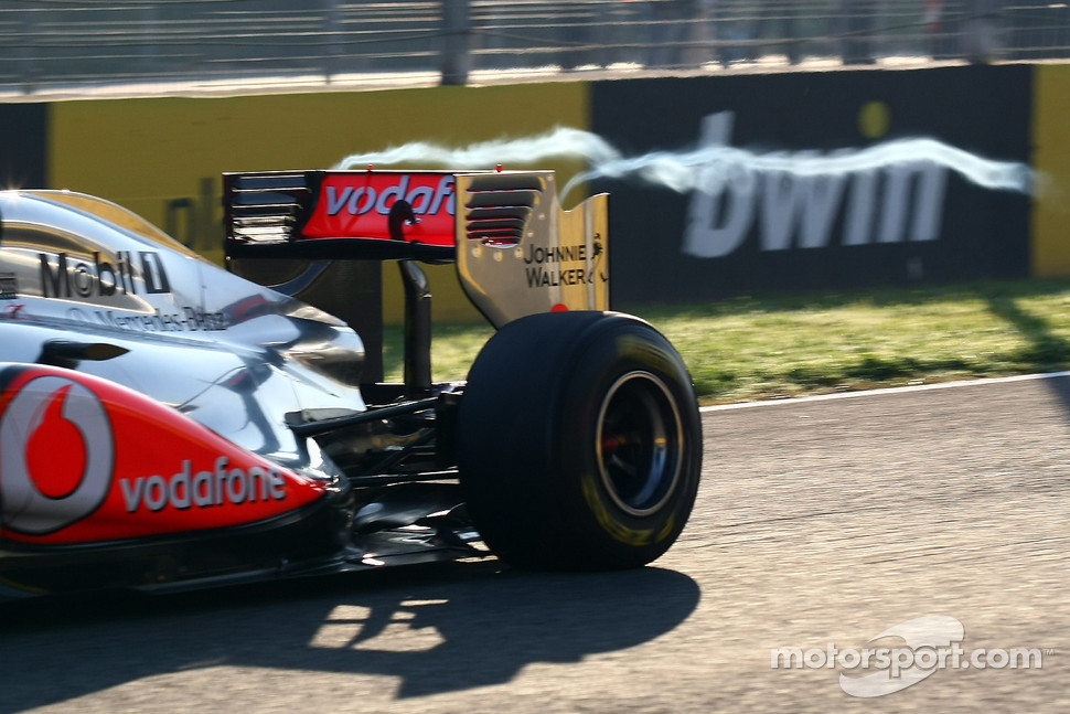
Similar type of vortex on a race car:
s1_1.jpg


These are typically short because cars are smaller and slower - but also because you don't often see cars go full speed in wet conditions - and when you do the spray will obscure the contrail.
 
Yeah. Come visit, and camp out with me....we'll make a day of it! (kidding...).

But despite the kidding, if ONLY these people who post videos such as this would actually devote some time to the science, and personal observations? Then maybe it would make a dent in the un-scientific clap-trap that IS the "chem"trail HOAX and MYTH and Urban Legend?
Only if you come and visit all the FEMA coffins in Georgia.
 
Similar type of vortex on a race car:
s1_1.jpg


These are typically short because cars are smaller and slower - but also because you don't often see cars go full speed in wet conditions - and when you do the spray will obscure the contrail.

THAT is way cool! (No pun)

Oh wait, searching for VERRRRY cold weather low-altitude AIRPLANE engine contrails, I found this!!:


AGAIN, it is perfectly obvious to those who care to pay attention, that CONTRAILS are produced by the engines.

Aerodynamic formations due to localized pressure differentials CAN make some pretty patterns, but they are NOT contrails.
 
AGAIN, it is perfectly obvious to those who care to pay attention, that CONTRAILS are produced by the engines.

Aerodynamic formations due to localized pressure differentials CAN make some pretty patterns, but they are NOT contrails.

Technically though they are. The word contrail is used to refer both to aerodynamic contrails and exhaust contrails, which is a great source of confusion.
 
Technically though they are. The word contrail is used to refer both to aerodynamic contrails and exhaust contrails, which is a great source of confusion.

True, that.

Some less than accurate word usage, perhaps. But, whenever I refer to them, a contrail is defined by the usual sources:

Wikipedia

External Quote:
....are long, thin artificial (man-made) clouds that sometimes form behind aircraft. Their formation is most often triggered by the water vapor in the exhaust of aircraft engines, but can also be triggered by the changes in air pressure in wingtip vortices or in the air over the entire wing surface.
So, yes....hence the 'confusion' at times. AND the importance of this thread, to differentiate.

But, for clarity when the topic of the MYTH of "chem"trails is raised, this refers to high-altitude contrails, generally. Notwithstanding the one-off topic of this thread.
 
Now they realize it is bogus, they claim that A) it's deliberate disinfo, and B) proved contrails can't persist except at 100% RH.
http://chemtrailsplanet.net/2014/04...forgets-to-turn-off-chemtrails-while-landing/
External Quote:
Conclusion: The hypothesis of Aerosol Geoengineering (aka Chemtrails) is supported when current and historic data show relative humidity above 30,000 feet almost NEVER climbs to near saturation of 100%.*
Which is wrong, because that's saturation with respect to water, when persistence just requires saturatons with respect to ice, which is about 60% of the water saturation.


From the link:

"Although no data is presented to support high RH, the video reveals very humid conditions on the runway."

Oxymoron much?
 
Now they realize it is bogus, they claim that A) it's deliberate disinfo, and B) proved contrails can't persist except at 100% RH.
http://chemtrailsplanet.net/2014/04...forgets-to-turn-off-chemtrails-while-landing/
External Quote:
Conclusion: The hypothesis of Aerosol Geoengineering (aka Chemtrails) is supported when current and historic data show relative humidity above 30,000 feet almost NEVER climbs to near saturation of 100%.*
Which is wrong, because that's saturation with respect to water, when persistence just requires saturatons with respect to ice, which is about 60% of the water saturation.
Mick, I must have missed this info presented in a direct fashion (60% of water saturation) in an authoritative quote. Could you point me to it? Would love to use it if it is clear enough for most people to understand.
 
Mick, I must have missed this info presented in a direct fashion (60% of water saturation) in an authoritative quote. Could you point me to it? Would love to use it if it is clear enough for most people to understand.

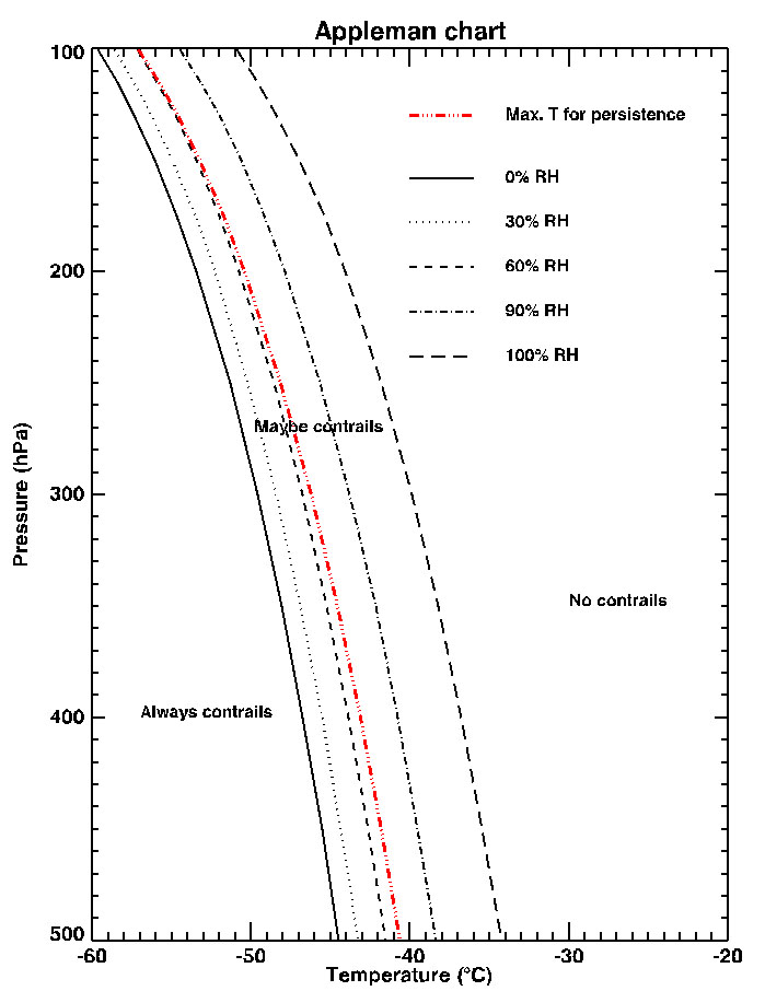
Unfortunately it's a little complicated. But the key point is that the air needs to be ice saturated, not water saturated. To convert from RHw to RHi is a function of temperature and pressure. I've been meaning to do a calculator to demonstrate this. The actual value of RHw for 100% RHi varies between about 60% and 70%, so you see both figures given, depending on if they want to do an upper or lower bound.

Some references:
4582c96c64c451f9172488d9ddf0411f.jpg


Note the red line. That's the "Max Temp for Persistence". Note how at the bottom it's about 70%, and at the top it's about 60% (the red line is between the 60% RH and 90% RH lines, the RH is not on the axes). The top is low pressure, high altitude, and there you see the red line is right on the 60% line

Wikipedia:
https://en.wikipedia.org/wiki/Contrail
External Quote:
Contrails only occur at very high altitudes; usually above 8,000 m (26,000 ft), where the air temperature is below −40 °C (−40 °F), and the relative humidity is over 60%.[3]
Which references:
http://science-edu.larc.nasa.gov/contrail-edu/science.php
Which does not give the 60% figure directly, but it's in the chart, and mentioned in the linked page:
http://science-edu.larc.nasa.gov/contrail-edu/resources-activities-appleman_student.php
External Quote:
The relative humidity at the altitudes where airplanes fly can sometimes be as high as 90%. Surprisingly, at cold temperatures ice clouds (including contrails) can form and persist at humidities lower than 100%. The red line (dash-double dot line) in the Appleman chart shows at what humidities contrails can persist (usually between 60% and 70% relative humidity). Thus, if the air is moist enough, and colder than (temperature profile is to the left of the red line), then the Appleman chart indicates that persistent contrails can form.
I usually say "About 60%" or "about 60-70%". It depends on the context. Above 60% RHw contrails CAN persist, but the plane needs to be in high cold air - that's when you get a few lone contrails. Above 70% RHw, contrails will persist over a much wider range of altitudes - and that's when you get the criss-crossed skies.

Notice on the chart there is no humidity level at which contrails will not form. You can get a contrail in 0% RHw if it's cold enough.
 
Last edited:
Unfortunately it's a little complicated. But the key point is that the air needs to be ice saturated, not water saturated. To convert from RHw to RHi is a function of temperature and pressure. I've been meaning to do a calculator to demonstrate this. The actual value of RHw for 100% RHi varies between about 60% and 70%, so you see both figures given, depending on if they want to do an upper or lower bound.

Some references:
4582c96c64c451f9172488d9ddf0411f.jpg


Note the red line. That's the "Max Temp for Persistence". Note how at the bottom it's about 70%, and at the top it's about 60% (the red line is between the 60% RH and 90% RH lines, the RH is not on the axes). The top is low pressure, high altitude, and there you see the red line is right on the 60% line

Wikipedia:
https://en.wikipedia.org/wiki/Contrail
External Quote:
Contrails only occur at very high altitudes; usually above 8,000 m (26,000 ft), where the air temperature is below −40 °C (−40 °F), and the relative humidity is over 60%.[3]
Which references:
http://science-edu.larc.nasa.gov/contrail-edu/science.php
Which does not give the 60% figure directly, but it's in the chart, and mentioned in the linked page:
http://science-edu.larc.nasa.gov/contrail-edu/resources-activities-appleman_student.php
External Quote:
The relative humidity at the altitudes where airplanes fly can sometimes be as high as 90%. Surprisingly, at cold temperatures ice clouds (including contrails) can form and persist at humidities lower than 100%. The red line (dash-double dot line) in the Appleman chart shows at what humidities contrails can persist (usually between 60% and 70% relative humidity). Thus, if the air is moist enough, and colder than (temperature profile is to the left of the red line), then the Appleman chart indicates that persistent contrails can form.
I usually say "About 60%" or "about 60-70%". It depends on the context. Above 60% RHw contrails CAN persist, but the plane needs to be in high cold air - that's when you get a few lone contrails. Above 70% RHw, contrails will persist over a much wider range of altitudes - and that's when you get the criss-crossed skies.

Notice on the chart there is no humidity level at which contrails will not form. You can get a contrail in 0% RHw if it's cold enough.
Thanks Mick. I was afraid of just what you presented. That is part of the problem, I think, with the whole Chemtrail Conspiracy debate. The experts and the information are too complicated and intricate for the regular person to wrap their brain around when they see a simple yet distorted explanation presented to them. They must rely on the experts, who by nature, they don't trust to explain to them the science behind the persistent contrails.
 
Last edited by a moderator:
Thanks Mick. I was afraid of just what you presented. That is part of the problem, I think, with the whole Chemtrail Conspiracy debate. The experts and the information are too complicated and intricate for the regular person to wrap their brain around when they see a simple yet distorted explanation presented to them. They must rely on the experts, who by nature, they don't trust to explain to them the science behind the persistent contrails.

Yes. It took me quite a while to fully understand the physics of contrail formation as they relate to humidity. I know it's not at all intuitive.

And that Appleman chart is hard to read, and a source of confusion itself.
 
Note the red line. That's the "Max Temp for Persistence". Note how at the bottom it's about 70°F, and at the top it's about 60°F (the red line is between the 60% RH and 90% RH lines, the RH is not on the axes). The top is low pressure, high altitude, and there you see the red line is right on the 60°F

% maybe?
 
Yes. It took me quite a while to fully understand the physics of contrail formation as they relate to humidity. I know it's not at all intuitive.

And that Appleman chart is hard to read, and a source of confusion itself.
Wonder if NASA or FAA, etc. would take on such a task. Formulating an explanation of why persistent contrails form when clouds don't. Making it as direct and simple as possible so one could cite it as an authoritative source. Maybe we (Contrail Science/Metabunk) could write such a blurb and ask Dr Minnis to publish it?
 
Thanks Mick. I was afraid of just what you presented. That is part of the problem, I think, with the whole Chemtrail Conspiracy debate. The experts and the information are too complicated and intricate for the regular person to wrap their brain around when they see a simple yet distorted explanation presented to them. They must rely on the experts, who by nature, they don't trust to explain to them the science behind the persistent contrails.

It was exactly like that with the "Planet X" story. The real astronomy was too hard for a lot of people to understand, but they were willing to accept the scientific SOUNDING crap that came from the like of Nancy Lieder, because she spelled it all out for them and told them what to believe.
 
Back
Top