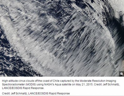
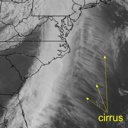
Claim: Satellite imagery showing 'sheet' of contrails

ki_cz

Member
At the beginning of the following video there is a satellite image of what appears to be tens (if not more) contrails spreading out to the east of Florida.

The date that the imagery was taken was on January 28th, 2017 which is beyond what I'm able to find on Instantweathermaps.com . The relevant portion of the video if you can't watch the whole thing is from 0:00 - 0:33 .
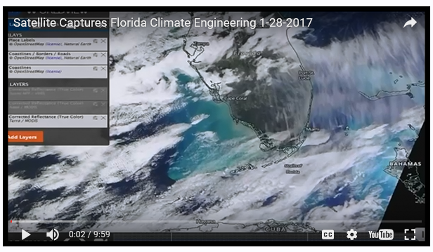
upload_2017-2-13_7-35-38.png


Source: https://www.youtube.com/watch?v=xTYR1oxia5c


I was hoping to find the potential flights associated with these trails as well as the atmospheric conditions at the time, as the video claims that this is an "unmistakable aerosol operation", whereas I believe that these are simply contrails from normal flights. The claim is that these are now "Large Volume Aerosol Plumes" being intentionally dumped over certain areas.

Any help would be appreciated, thanks.
 
Last edited by a moderator:
I see, it looks as if the storm or precipitation from the south is what is generating the cirrus that is blowing to the north? I'll try to find the weather for the region on that day.
 
I see, it looks as if the storm or precipitation from the south is what is generating the cirrus that is blowing to the north? I'll try to find the weather for the region on that day.
https://www.wunderground.com/histor...statename=&reqdb.zip=&reqdb.magic=&reqdb.wmo=

but yea as far as upper atmosphere, i dont know where you look without a subscription to: "Instant weather maps".

you can check area news channels and scroll through to see if they have weather forecasts uploaded
ex:

Source: https://www.youtube.com/watch?v=eUnhYhqStww


although you can see the weather in your OP pic :)

a later forecast you can see a bit of the cirrusy stuff there
upload_2017-2-13_13-16-43.png
 
Last edited:
Younger contrails are easily identifiable but older ones are pretty much indistinguishable from natural cirrus after they spread out.

upload_2017-2-13_20-9-25.png

Some fraction of the cirrus cover originates from the contrails, but most of it is probably natural in this case.
 
Yes, it's just an area of cirrus with some contrails. Someone was sharing it on Chemtrails Global Skywatch on Facebook and I looked up the weather conditions.

You can use https://earth.nullschool.net/ to check past conditions. (Click the double back arrows next to the "Control" tab to go back a day at a time, then the single arrows to adjust the time in 3hr increments.)

Assuming roughly midday local time (which I think is when the MODIS satellites pass over), that is about 17:00 UTC.

This is the 250mb relative humidity plot for 18:00 UTC:

upload_2017-2-13_21-20-48.png


250 millibars is the pressure at an altitude of around 34,000 feet, which is pretty much in the middle of airliner cruising range. The area of high humidity matches the area of cirrus and contrails very well.
 
And from skyvector.com, here are the flight paths around Florida. Note the numerous parallel routes to the east of the peninsula, and north to south over the peninsula itself.

upload_2017-2-13_21-25-20.png


The majority of the parallel linear cloud formations are just cirrus, though. Cirrus often forms these sort of structures naturally.
 
Back
Top