A DIY Theodolite for Measuring the Dip of the Horizon

How can one accurately measure the angle of dip without an accurate third point for reference?

A vintage theodolite used in geodetic surveying. The wheels are marked in degrees. Is this what you would consider the third point for reference?

 
Last edited:
As I understand it, using the interactive image on the curve calculator, the "eye level" line would be the perpendicular level line from earth's radius. Shouldn't the eye level line be 12 ft above the horizon?
The the only measurable and relevant way to measure the dip of the horizon is with degrees.
The calculator gives the dip in degrees, it's not a lot from 6 feet - very difficult to spot at all. The eye level IS 12 ft above the ocean horizon (at the horizon, 3 miles away), which in that image is exactly the same as being at the horizon or 6 feet above it, or 12 feet below it.

Metabunk 2018-06-04 08-57-50.jpg

You can verify this angle. The un-refracted math is given if you click on "Advanced"

It's arcsin(a/(r+h)), or arcsin(15838.00/(20903520.00+6.00)) = 0.00075767 radians, *180/PI = 0.04341137 degrees
Content from External Source
You can work it out perhaps more intuitively as arctan(12 feet/3 miles) = arctan(12/3/5280) in degrees = 0.043 degrees. It's a very long skinny triangle.

Since the vertical field of view is about 40 degrees there, then 0.043 pixels is 1/1000th of the height of the image.

Unless I'm really missing something, which is quite possible.
I'd recommend drawing a diagram with suitable notation to explain what you have so far expressed in words. It might become clearer to you.
 
How can one accurately measure the angle of dip without an accurate third point for reference?

You are used to getting angles from lengths and distances. But consider a protractor


It measures the angle directly. No lengths are involved.

Or go back to my original idea:


The markings there allow you to read the angle of the horizon relative to the edge of the level. Of course there's a potential error from the accuracy of the level - but it all depends on what you mean by "accurately".
 
The DIY theodolite described in this thread is a relative of the astrolabe, the theodolite and the sextant. They all measure in degrees. Yes, there's an error involved, but it's a DIY device. The error isn't very large. What Mick was trying to do here is give FE Believers a tool and method to see for themselves. On a budget!


Persian astronomer Muḥammad ibn Aḥmad Al-Bīrūnī found the circimference of the earth using this method. He used an astrolabe. An ancestor of the sextant.


(Al-Bīrūnī didn't know about Snell's law.)


How a sextant works:


Even from the low elevation of the deck of a ship there is a gap between the astronomical horizon and the true horizon. A sextant is accurate enough that the dip of the horizon has to be corrected for, by using a table such as this example from 1836: http://archive.org/stream/acompletesetnau00norigoog#page/n198/mode/1up

 
Last edited:
A vintage theodolite used in geodetic surveying. The wheels are marked in degrees. Is this what you would consider the third point for reference?


As I understand it the third point of reference would indeed be line of sight through the theodolite. I also understand this would show the angle of that line and the line straight to the horizon.

That angle I'm sure would be accurate enough I guess to show what we need it to show, but as previously shown, even with the most accurate of spirit levels that line of sight from the theodolite, the astronomical horizon, would still be + or - 6'.

I used minutes this time instead of 18 inches over three miles to show that I do understand we're discussing degrees and not necessarily height, but I do think 6 minutes in three miles and roughly 18 inches are the same thing. At least in my mind. And is a significant amount of error.

Grant it my mind, while intelligent, it doesn't have all the mathematical education that many of you have.
 
I'm just the most amateur of amateur astronomers and only know the basics.

I think where you're getting confused is in scale. A brick wall that's out of level by 18 inches would be a horrible bit of work.

But think about scale. Eighteen inches across three miles is a tiny error in proportion.
 
Last edited:
I'm just the most amateur of amateur astronomers and only know the basics.

I think where you're getting confused is in scale. A brick wall that's out of level by 18 inches would be a horrible bit of work.

But think about scale. Eighteen inches across three miles is a tiny error in proportion.


Nope, I understand scale.

+- 18 inches at a distance of three miles where earths' drop is 72 inches from where we're doing our observations is significant.

Unless I'm totally mistaken that 72 inch drop in three miles is measured from the astronomical horizon/perpendicular line from earths' radius at sea level is it not?

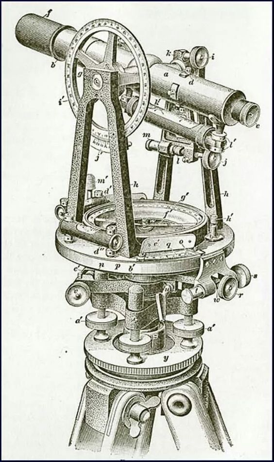
Please understand, I'm not trying to argue just for arguments sake. As I've said, I'm sure a theodolite is very accurate in measuring angles in surveying at shorter distances than the horizon, and even in longer distances like in astronomy when you have three specific points. Such as your position and two stars. I'm sure the measured angle is pretty accurate.

But in measuring the dip of the horizon, the line of sight/astronomical horizon is dependant upon the accuracy of how level the theodolite is.

We can get a fairly close measurement, but not as accurate as we would be with three exact points.

Again, these are just my thoughts. I completely acknowledge that I could most likely be wrong.

I only have a high school education. Highest math I've had is Algebra 2 and Geometry 1. So when it comes to the math I'm at your mercy.

But I'm not ignorant. Have been tested and IQ is in the 99th percentile.

I understand IQ means little, does not mean that I'm smarter than others in the lower percentiles of IQ, but it does mean I'm able to grasp ideas possibly easier than most.

I haven't mentioned this to brag because I understand that you guys are smarter than I in this. I'm just trying to grasp whether a 6 minute error in three miles is significant or not. To my mind it is and effects accuracy. Though I acknowledge the error might be miniscule for the objective.
 
The stated accuracy of Wolfie6020's Dumpy level is 2mm per. km. He does not seem to have used it much, but then he has lots of other toys.
https://www.metabunk.org/posts/217674/

Just wondering, let's say the level is out 2mm in a km. How far off would that be in three miles or about 4.7km? I would guess that just as drop increases per mile that the inaccuracy of the level would increase also.

I doubt one can just multiply 4.7 by 2, surely the further one goes the error increases.

I could probably find the calculation somewhere, but.........
 
Just wondering, let's say the level is out 2mm in a km. How far off would that be in three miles or about 4.7km? I would guess that just as drop increases per mile that the inaccuracy of the level would increase also.

I doubt one can just multiply 4.7 by 2, surely the further one goes the error increases.

I can see how a builder would think that way. For our purposes, no. For our purposes, the only measurement is in degrees. The measurement in degrees doesn't change, so the error doesn't change. You've got to stop thinking as a builder, and start thinking as a navigator/astronomer/geodesist. I have no more shots left in my locker.

I like the water in the tubes method. The water level establishes the FE Believer's idea of "eye level" and shows that the distant true horizon is visibly below that. No measurements involved at all. FE Believers tend to have a one-mental-step thought process. Seeing should be believing, according to their "Zetetic" philosophy:

-Trust only your own observations and senses.

Sadly, if they see something which is not in line with FE theory, they typically then go onto rationalization. They explain how the thing they themselves see is deceiving. Thus violating their philosophy.
 
Last edited:
You've got to stop thinking as a builder, and start thinking as a navigator/astronomer/geodesist.


I appreciate the advice.


FE Believers tend to have a one-mental-step thought process. Seeing should be believing, according to their "Zetetic" philosophy:


Which is the main reason that I joined this site. A good friend of mine, an electrical engineer who's had college physics, trig., calculus etc. fell for the FE theory a couple years ago.

Has really hurt our friendship. Water flowing downhill on a sphere, pulled by gravity is easy for me to conceptualize.

Off topic but he's also fallen for the cool moonlight ......

Why he refuses to acknowledge that when the "sun sets" that we are actually moving into the earths' shadow, exposed to the cold of space, and open areas will lose the heat that earth absorbed throughout the day quicker than covered areas such as under trees, I have no clue.

I told him to do his moonlight temperature experiment at about 5am to allow more time for the warmth of the covered areas to dissipate but I'm sure he won't.

Oh well.
 
Also, in the Malibu water level video it looks like the level is roughly 6 ft above sea level.
The questions you pursue in this post are all based on this statement, above, "...it looks like the level is roughly 6 ft above sea level."

Source: https://youtu.be/NqOQ_BCtqUI?t=13

In the video, the rig is supported on a picnic table, held steady by one hand, while the video is taken by the other hand. The rig wobbles left and right, but not fore and aft, which is okay. The apparatus water level there at 13 + seconds (press "play" above, it's set to play at t=13 sec), taken from the beach at Malibu, appears to hover at the horizon slightly above the ocean, but how much is very debatable. At that distance, which would be several miles, the height above sea level could be 6 feet, or it could be 12 feet, or it could be 48 feet (or perhaps something in between). We can't say for sure, with no reference scale or monument to compare it to.

The video title frame I see in the picture above (before I press "play") shows the guy holding his rig supported by rocks, with the horizon in the distance and it sure looks to me like that is about 1000 feet above sea level where the two red water lines are pointing in the distance beyond. It's nowhere near "6 feet," but it's taken from later in the video, where he says he's taking that video at 1,200 ft., near Malibu. That would be somewhere in the Santa Monica mountains, perhaps near Kanan Dune Road. One could find what island that is at the horizon, and see what its highest elevation is, because the apparatus is showing a level higher than the top of the island's peaks. It would be interesting if the peaks are close to 1,200 ft, because there would already be a drop showing below a level line of sight from 1,200 ft. in Malibu.
 
Last edited:
Just wondering, what did you expect to see? If you were at 14,500 ft looking out over land that's 5,000 ft, wouldn't one expect the level to be in the clouds?
Separate topic, separate post!

When I took that builder's level to the top of Mt. Whitney, it was for the purpose of finding out what I see using it up there. I had expectation that I would see something higher than the apparent horizon, but I wasn't sure how MUCH higher it would actually be. But I was climbing the mountain anyway, and figured that it wouldn't be all that much extra effort to carry the level scope too. I ended up using the scope in many places to test my instinct for what point on nearby cliffs was the same elevation as where I was standing. It was a good test of my perception. I found I was generally pretty close, but I also found that without a reliable instrument that identifies level line of sight, it's impossible to be sure whether your instinct is correct or incorrect.

Therefore, when I arrived at the summit of Mt. Whitney, 14,500 ft. amsl., I just stood there for a while looking at the view. I looked all around and tried to anticipate where a level line of sight would be in every direction. This was not a study that I would later report on, so I did not take any notes. And in those days there was no digital photography so I had no way of taking a picture of what my scope was going to show me.

After I couldn't stand the suspense anymore, I set up the level and started to take sightings. In every case, the level turned out to indicate a line that was higher up than what I had predicted just a few minutes before. In general, I was surprised to see how much OFF I had been! Therefore, I learned that it is quite natural to THINK that where you are looking and thinking "this is a level line of sight" is simply an illusion. It is quite natural to look into the distance and PRESUME that you are looking in a level line, only to find when you check it with an instrument that you had been CASTING YOUR EYES DOWN SOME SMALL AMOUNT. It's not a deliberate bias. It is simply a normal automatic human bias. You can have every intention of doing the right thing, but without a level scope, you really have no idea what you are doing, even when you have had years of experience judging level lines of sight.

There was something else up there to learn that I had no clue about beforehand:
Even experienced surveyors, scientists and geologists are prone to let their sense of pride interfere with accuracy. And I can tell you why I say that, but maybe nobody is reading this, so I'll wait for someone to ask. Plus I don't want to be scolded for being "off topic." Maybe there is another thread somewhere that discusses this subject. I can't find one.
 
Here's a video of someone using the liquid level at various elevations (sea level, 1200 feet, and 5600 feet):


On the plus side, it shows exactly what we would expect - that the level of the liquid is somewhat higher than the horizon:

horizon level liquid test.jpg

On the negative, he neither used a tripod for the camera, nor a stable base/frame for his level.

This video shot at Malibu and Mt. Wilson (CA) is taken from a Metabunk member's much longer video shown here. That thread has been exiled to the "Rambles" sub-forum so it doesn't appear on the main index page.
 
There was something else up there to learn that I had no clue about beforehand:
Even experienced surveyors, scientists and geologists are prone to let their sense of pride interfere with accuracy. And I can tell you why I say that, but maybe nobody is reading this, so I'll wait for someone to ask. Plus I don't want to be scolded for being "off topic." Maybe there is another thread somewhere that discusses this subject. I can't find one.

Yes, yes ~ please enlighten me...
 
Flat earth Youtuber Antonio Subirats has devised a method for disproving or proving the globe using the horizon dip or lack thereof. The idea is to point one end of a tube at the horizon and see where the other end points

A nice practical method. And also something that you can probably do on land, given a sufficiently high viewpoint.

An interesting addition might be to use a mirror to show both views at the same time. You could put it at the end of the tube, halfway across.
 
Something like:
Metabunk 2019-01-08 07-30-27.jpg

Metabunk 2019-01-08 07-33-36.jpg

You'd need a large enough mirror that you can see the horizon around the camera (I could probably use this one if I positioned it horizontally, and without my head being in the way).

But this suggests an interesting variant with just a mirror, no level:

  1. Position the camera on a tripod, zoomed in on the horizon (i.e. the horizon is in the middle of the image.
  2. Place a mirror 50 feet away, so it covers half the frame, to the left or right
  3. Adjust the mirror so the camera is vertically centered on the non-reflected horizon
  4. The reflected horizon will now show you the dip
Step 3 is the fiddly bit, but with a camera like the P900 you can use an iPhone to connect to it via WiFi, so you don't need to run back and forth. You could also fold out the screen and use binoculars.

Metabunk 2019-01-08 07-47-16.jpg
 
Another variant would be to use two cameras both with screens out (so you can see the screen from the front of the camera).
 
I gave it a go, despite my lack of a horizon here. I used the top of a low wall. I can see I'm going to need a bigger mirror, as I can't really see past the camera.

I'm using the remote P900 app on the iPhone, which makes it fairly easy to adjust.
Metabunk 2019-01-08 08-41-28.jpg
 
With a bigger mirror (like this ordinary bathroom hand mirror), I think think this will work quite well.

The larger mirror is much easier to adjust.

Here the "horizon" (the top of the wall) is centered in the camera's frame. So if the horizon were always at "eye level" then in the reflection the opposite horizon would run through the middle of the camera lens. We can't see a horizon here, but in reality, the opposite horizon (i.e. the one you can see in the mirror) will be below the camera.

Metabunk 2019-01-08 10-05-45.jpg
Metabunk 2019-01-08 10-06-09.jpg
Metabunk 2019-01-08 10-04-36.jpg

Given the long baseline here, it should be quite a bit below, and possibly even detectable at relatively low elevations where you can see both horizons.
 
Last edited:
If you have a view of opposite horizons, set a thread across the far end of the tube and align it with the horizon in front of you. On a globe, this angle deviates down from level, and increases with altitude. Fix another crosshair on the near end of the tube that lines up with the other thread and the horizon to fix the tube at this angle. Then look through the other end with the threads aligned and see if the horizon behind rises up to meet you. It won't.
 
I've been thinking about trying one of these except using a clear rubber tube with colored water and a sight-length of 57.3 inches instead of cm for better accuracy. (Even 57 & 1/4 inches would be fine if one can't find the 1/3rd mark on their ruler.)

While the resolution would not be as good as a theodolite, still, the difference between a curved and flat earth for a mountain 75 miles away is nearly half a degree - and that'd be clearly obvious at one inch per degree.

And such a DIY theodolite can be tested easily: Let's say your mountain in question is 75 miles away and 2 miles high, you can set up a mark on a wall that's 75 feet away and 2 feet high and confirm that it's working correctly.

After all, a rise of 2 over a distance of 75 should give the same degrees regardless of whether it's feet, inches, or miles.

A note on using liquids for level measurement: On a bubble level, if one end is warmer, the bubble migrates to that end. On a tube level, the water rises higher on the warm end. So try to keep the sun off the bubble level because if one end gets hot from more sunshine, it'll distort your reading.

I learned this with the bubble level on my Pentax theodolite. Even just the warmth of my finger or the light from a flashlight on one end would cause the bubble to move drastically.
 
Hi, I found what should be a pretty quick and dirty test to see the horizon drop using this app for the iphone, I'm sure there are Android equivalents. Its essentially a hand held theodolite!

https://apps.apple.com/ca/app/sightleveler/id1412688582
Metabunk 2019-12-02 12-32-05.jpg
And a plane ride.

See attached model using CAD and according to CAD there will be a 18KM drop at aprox 30K feet (9KM), this will be seen easily I imagine.

If anyone has an idea of how I can actually measure the drop, I'm open to that for sure. Maybe need some sort of angle differential measurement?

I have a flight scheduled this week, fingers crossed that i get a reasonably clear day.

Thanks to all for creating such an awesome forum!

-Rick

Screen Shot 2019-12-02 at 10.32.10.png
 
Last edited by a moderator:
See attached model using CAD and according to CAD there will be a 18KM drop at aprox 30K feet (9KM), this will be seen easily I imagine.

You can't give drop as a length unless you included the distance, as the angular size that you actually see.

At typical fight levels (around 35,000 feet) the horizon drops about 3° from horizontal. That's about six times the diameter of the moon. While that sounds like it's "easy to see" it's not really unless you've got a good reference point, and the horizon is clear.

If anyone has an idea of how I can actually measure the drop, I'm open to that for sure. Maybe need some sort of angle differential measurement?
There's plenty of theodolite apps that have you the angle. Just point them at the horizon. The problem is ensuring they are calibrated.

Here's an example (iPhone "Theodolite" app) pointing down 0.4°, and still above the horizon (which is probably even lower, as it's hidden by clouds)
 
I think maybe the best way to show horizon drop from an airliner is a piece of clear tubing in a circle filled exactly half way with water. With the tubing spliced together at the top you don't have to worry about spills. You can take it on the plane dry and then fill it with drinking water or hand wash water from the lavatory. If you also take a mirror then you might be able to point the camera at the level and the horizon out one window and simultaneously show the horizon drop out the opposite side of the airplane in the same image frame. Even simpler than a tube water level is just a half full water bottle tilted on its side. Make sure you practice filming before you leave so you know how to get things like field of view, depth of field, and water surface/camera alignment right.
 
Back
Top