
You are using an out of date browser. It may not display this or other websites correctly.
You should upgrade or use an alternative browser.
You should upgrade or use an alternative browser.
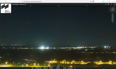
Copenhagen airport closure due to reported drone activity
- Thread starter Kyle Ferriter
- Start date
gargamel
Senior Member
The tanker that was boarded off France has been let go, but the Chinese captain is supposed to show up in a French court next year because of "failure to comply", whatever that means.
https://www.lefigaro.fr/internation...mandant-et-son-second-ramenes-a-bord-20251003
And apparently the whole thing boils down to some flag issue.
https://www.leparisien.fr/faits-div...gee-02-10-2025-IOMPAG4R6FFEJER3FQNIWW4DQQ.php
Makes me wonder if the drone connection was just a media thing. They're all riling each other up.
https://www.lefigaro.fr/internation...mandant-et-son-second-ramenes-a-bord-20251003
And apparently the whole thing boils down to some flag issue.
https://www.leparisien.fr/faits-div...gee-02-10-2025-IOMPAG4R6FFEJER3FQNIWW4DQQ.php
Le parquet de Brest avait ouvert une enquête pour « défaut de justification de la nationalité du navire/pavillon » et « refus d'obtempérer », puis placé en garde à vue « le capitaine et son second, tous deux de nationalité chinoise ». Le parquet a finalement « décidé d'engager des poursuites à l'encontre du seul commandant » qui s'est vu remettre « une convocation à comparaître devant le tribunal correctionnel de Brest », le second ayant été « laissé libre de se retirer »
Makes me wonder if the drone connection was just a media thing. They're all riling each other up.
TinFoilHat
Member
https://www.euronews.com/2025/10/03...-military-base-in-eastern-belgium-reports-say
Fifteen unidentified drones were spotted flying over a military base in eastern Belgium overnight into Friday, according to domestic media reports.
The drones were detected by chance during a routine test of surveillance equipment at around 1:45 am on Friday over the Elsenborn military base.
The base, located within the German-speaking Community of Belgium, covers 28 square kilometres and is primarily used as an army training camp.
Where the drones came from and who was controlling them is not yet clear, although some local outlets said they had reportedly flown over the border from neighbouring Germany.
Munich Airport in Germany was forced to suspend operations on Thursday night after "several drone sightings" were reported, leading to the cancellation of 17 flights.
In recent weeks, airports in Denmark, Norway and Poland similarly suspended flights due to unidentified drone activity.
Airspace violations were also reported in Estonia and Romania.
Those incursions have fuelled a debate among European leaders over the feasibility of a so-called drone wall to protect the eastern edge of the continent against drone incursions believed to be from Russia.
Moscow has dismissed claims that it was responsible for any of the airspace violations, calling them "unfounded accusations."
This is a developing story and our journalists are working on further updates.
https://www.aviation24.be/military-...training-ground-belgian-defence-investigates/
Lots of planes flew directly over Elsenborn and they orbited near Düren before landing at Cologne Airport around the time of the drone sighting.
https://globe.adsbexchange.com/?ica....634&lon=6.385&zoom=10.4&showTrace=2025-10-02

Fifteen drones spotted over Elsenborn military training ground: Belgian Defence investigates
By Bart Noëth- 3 October 20250115
In the early hours of Friday, no fewer than 15 drones were detected flying over the military domain of Elsenborn, located in Belgium's East Cantons. The unusual incident is now under investigation by Belgian Defence, according to information obtained by VRT NWS.
Defence Minister Theo Francken (N-VA) confirmed the report but stressed there is currently no evidence linking the incident to Russia.
Around 1:45 UTC +2, local police in the German city of Düren reportedly observed the drones entering German airspace from the Belgian side. "They originated above the Elsenborn training ground before crossing into German territory," explained defence expert Jens Franssen. "Germany informed Belgian Defence, but according to my sources, the information may not have been passed along the chain of command within Defence."
A Belgian detection system confirmed the presence of 15 drones, which were spotted on both sides of the border and at various altitudes. Their origin and operators remain unknown.
Franssen described the incident as highly unusual. "There is little of strategic interest to spy on at Elsenborn. If espionage were the goal, a location such as Kleine-Brogel Air Base—where U.S. nuclear weapons are stored—would be a more obvious target. Until we know where the drones came from or who controlled them, it's difficult to assess the motives. What this does highlight, however, is the urgent need for effective systems to detect, track, and identify small drones."
Belgian Defence has not provided further details at this stage, but the investigation is ongoing.
Lots of planes flew directly over Elsenborn and they orbited near Düren before landing at Cologne Airport around the time of the drone sighting.
https://globe.adsbexchange.com/?ica....634&lon=6.385&zoom=10.4&showTrace=2025-10-02
gargamel
Senior Member
Regarding the Munich thing, after eyeing through flight data I get the impression that some initial drone reports (whatever the nature of these were) made them stop in and outgoing flights, then a helicopter arrived and started circling over the airport (looking for drones?), and then that helicopter contributed to subsequent drone reports.
jarlrmai
Senior Member.
I'm not buying a Belgian system detected 15 drones but also somehow didn't know about it? Is this a translation issue?External Quote:
Germany informed Belgian Defence, but according to my sources, the information may not have been passed along the chain of command within Defence."
A Belgian detection system confirmed the presence of 15 drones, which were spotted on both sides of the border and at various altitudes. Their origin and operators remain unknown.
The report is based on police visual sightings, why not the initial alert on the drone detection system? Nothing adds up here apart from a flap being used to bolster budget for anti-drone systems.
A serious journalist needs to be asking for evidence of these drones and their detection be made public, I'm sure it runs in "capability reveal" issue though.
Last edited:
gargamel
Senior Member
Was contacted by a journalist today. There might be an article in the states media tomorrow")
In Danish state media, or the media of the "States" (US)?
jarlrmai
Senior Member.
They are Danish so probably some sort of Danish mediaIn Danish state media, or the media of the "States" (US)?
jarlrmai
Senior Member.
Flap moved into the armchair witness phase
Source: https://old.reddit.com/r/UFOs/comments/1nx2mdu/incredible_pictures_of_munich_drones_from_hidef/
It's just a helicopter
https://www.metabunk.org/sitrec/?cu...ws.com/11433/Munic panomax/20251003_165316.js
Source: https://old.reddit.com/r/UFOs/comments/1nx2mdu/incredible_pictures_of_munich_drones_from_hidef/
It's just a helicopter
https://www.metabunk.org/sitrec/?cu...ws.com/11433/Munic panomax/20251003_165316.js
Kyle Ferriter
Senior Member.
Flap moved into the armchair witness phase
Source: https://old.reddit.com/r/UFOs/comments/1nx2mdu/incredible_pictures_of_munich_drones_from_hidef/
It's just a helicopter
https://www.metabunk.org/sitrec/?custom=https://sitrec.s3.us-west-2.amazonaws.com/11433/Munic panomax/20251003_165316.js
Yeah it looks like a couple moving blinking lights captured in a relatively long exposure. A 140kts helicopter will move ~59ft in 250ms, for example.
And this is again a lot like New Jersey last year. People started pulling up live "beach cams" at Island Beach State Park, and seeing air traffic (mostly northbound to NYC/long island), and thinking it was the drones supposedly coming in from over the ocean, or UFOs coming from the ocean, etc.
already debunked here ...
Source: https://x.com/flarkey/status/1974050600674336792?t=QR0qgOmJcyT-Zgzln6wMGw&s=19
Source: https://x.com/flarkey/status/1974050600674336792?t=QR0qgOmJcyT-Zgzln6wMGw&s=19
jarlrmai
Senior Member.
already debunked here ...
Source: https://x.com/flarkey/status/1974050600674336792?t=QR0qgOmJcyT-Zgzln6wMGw&s=19
So is that the OP and the Reddit guy is just copying their X post or is Reddit guy currently arguing with me the same guy?
Yeah Danish media.In Danish state media, or the media of the "States" (US)?
gargamel
Senior Member
Hoppas du är förberedd på dumma frågor, kära granne.Yeah Danish media.
Let's stick to english, ellers er der ingen der fatter hvad vi skriverHoppas du är förberedd på dumma frågor, kära granne.

No stupid questions, she was quite critical herself. They're not interviewing med, she just wanted to know how I found out about these things, I mentioned this forum
") They talked to an "expert" and he mentioned my video
They talked to an "expert" and he mentioned my video After my little foto session, I'm 100% sure the mystery video was shot from this window ..or maybe the window before.
It also looks like a window that opens inwards in the top.
But I really can't match it with the little famous plane, not even in the early "pass" 15 min. before.
I would guess the window height to be 8-9 meters?
You who made the polygons for Sitrec, how heigh did you make the building in the middle? I would say it should be about 9m
https://www.metabunk.org/sitrec/?cu.../17922/CPH Drone 2nd video/20251003_182901.js
It doesn't match anything.
Kyle Ferriter
Senior Member.
It looks like the holding pattern cleared by 23:42UTC. Maybe 1:45 UTC+2 is an approximation, or when they finally placed the call to Belgian Defense, not when the police first saw things? This holding pattern was kind of S/E/SE of Duren though, not S/SW which would be more towards Elsenborn.https://www.aviation24.be/military-...training-ground-belgian-defence-investigates/
Lots of planes flew directly over Elsenborn and they orbited near Düren before landing at Cologne Airport around the time of the drone sighting.External Quote:[...]
Around 1:45 UTC +2, local police in the German city of Düren reportedly observed the drones entering German airspace from the Belgian side. "They originated above the Elsenborn training ground before crossing into German territory," explained defence expert Jens Franssen. "Germany informed Belgian Defence, but according to my sources, the information may not have been passed along the chain of command within Defence."
A Belgian detection system confirmed the presence of 15 drones, which were spotted on both sides of the border and at various altitudes. Their origin and operators remain unknown.
[...]
https://globe.adsbexchange.com/?ica....634&lon=6.385&zoom=10.4&showTrace=2025-10-02
View attachment 84681
Belgium's drone airspace map tool linked below.Is it actually illegal to fly drones at Elsenborn and Düren?
https://apps.geocortex.com/webviewer/?app=1062438763fd493699b4857b9872c6c4&locale=en
Elsenborn is within a larger military airspace, e.g. the blocky blue-green region below, and for that it looks like according to this you don't need authorization under 35ft AGL but do need prior authorization (8 days in advance) for over 35ft.
Within those red regions you need prior authorization for all drone flights. The irregular shape by Elsenborn is labeled as military, and the two red circles, one near Elsenborn and one over Büllingen, are specifically for airports. The small circle near Elsenborn is for the airport on the military base.
For a sense of scale, the larger circle over Büllingen is ~4.5 miles across.
For Düren, part of it is falls within the Nörvenich airbase's ATC-controlled airspace, but much of the town and surrounding area is not inside that.
https://maptool-dipul.dfs.de/geozones/@6.6668713,50.8344087?language=en&zoom=11.0
So most of the area in and around Düren is not restricted and it is legal to fly drones (assuming you follow laws around flying over private property). For the possibility that they did actually see a consumer quadcopter drone, the "15 drones" types of phrasing can be misleading, as it's not clear if they actually saw 15 distinct objects, like at the same time, or whether there could be some overlap, and whether it was more like they saw 1 or 2 objects at a time, at different points in time, which added up to around 15.
I would hope police living and working near a fairly busy airport would not get confused by airplanes, but it does happen.
Not to beat the New Jersey dead horse here but there is some resemblance to New Jersey in December 2024, specifically the highly reported-on US Coast Guard incident in which it was reported that 50 drones were seen flying over the ocean, which was quite likely between one and a dozen planes being seen at a time, which over time added up to about 50.
https://www.metabunk.org/threads/drones-over-new-jersey.13770/page-18#post-350669
And resemblance to the time where Senator Andy Kim from NJ went out with a NJ local police patrol which was trying to track down the drones they thought were flying overhead, and the police pointed out what they thought were drones, which actually were probably all airplanes. Senator Kim in this thread also highlighted that the problem is contributed to by different government agencies not communicating and sharing information. The FAA has people who could have explained what he was seeing in realtime, and explained it to the local police department, if they had a mandate to and the time/resources to.
Source: https://x.com/AndyKimNJ/status/1868034879931433387
Kyle Ferriter
Senior Member.
Posted 2025-10-03 21:00 UTC.
Not sure when airport officially closed or diversions began.
Maybe unrelated, but people continue to spread the images from the panoramic sky cam discussed earlier in this thread, blissfully unaware that they show normal planes/helicopters, not drones. I imagine there are people watching the live stream this evening, and seeing more of these artifacts.
Source: https://x.com/flightradar24/status/1974218093158138165
Last edited:
https://www.dr.dk/nyheder/indland/m...ingen-har-afkraeftet-flere-droneobservationer
Nothing new, other than that DR is discovering that the police don't really know a damn thing.
Nothing new, other than that DR is discovering that the police don't really know a damn thing.
Mendel
Senior Member.
that's a good sign, thoughhttps://www.dr.dk/nyheder/indland/m...ingen-har-afkraeftet-flere-droneobservationer
Nothing new, other than that DR is discovering that the police don't really know a damn thing.
Z.W. Wolf
Senior Member.
Posted 2025-10-03 21:00 UTC.
Not sure when airport officially closed or diversions began.
Maybe unrelated, but people continue to spread the images from the panoramic sky cam discussed earlier in this thread, blissfully unaware that they show normal planes/helicopters, not drones. I imagine there are people watching the live stream this evening, and seeing more of these artifacts.
Source: https://x.com/flightradar24/status/1974218093158138165
This follows the tradition of looking at weather/sky cams first set in 2020 during the Great Colorado Mystery Drone Flap of 2019/2020. The claim is that the lights in the sky are Mystery Drones.
It's really a very odd mind set. Everything in the sky is supposed to be a Mystery Drone? Why would you think that? It seems to be an entirely unconscious assumption without any sober reflection about what the sky would normally look like on any random day.
https://www.denver7.com/news/local-...yn2HU-YT0hxKXDsng5tRl9hK6LQUyOVC8hvF3wK5r_QYM
LAKEWOOD, Colo. -- There's a mystery in the skies in northeastern Colorado. A pack of drones flying in formation have been lighting up the night sky for weeks and now have the attention of Homeland Security.
"FBI, DOD, FAA, the list goes on," said Kevin McElyea, the Director of Colorado's Information Analysis Center (CIAC), a division of Homeland Security now on the case. "We're all concerned."
New video from Viaero Wireless weather cameras across Colorado, including in New Raymer on New Year's Eve, show what appears to be the drones flying in packs.
"Flashing lights moving across the sky," said McElyea. "What I think attracts a lot of attention is not only the quantity, but the ability for them to be flying together in packs."
McElyea said they have forensic analysts going through videos and reviewing witness accounts, but who's flying the drones is still anyone's guess.
Last edited:
jarlrmai
Senior Member.
Source: https://old.reddit.com/r/UFOs/comments/1nxnuvk/again_munich_airport_drones/
At least the German police are flying with transponders on
https://www.jetphotos.com/photo/6338664
https://www.metabunk.org/sitrec/?custom=https://sitrec.s3.us-west-2.amazonaws.com/11433/Munic Panomax Police Heli/20251004_085632.js
The helo was flying loops, possibly looking for drones and became a "drone", it's visible in multiple pano times
Sitrec is so good for this kind of thing.
Last edited:
jarlrmai
Senior Member.
Source: https://x.com/ushouldbeontv/status/1974232589524234503
https://messe-muenchen.panomax.com?t=2025-10-03+21-20-00&r=36&z=270&tl=1028
This one is a plane
https://www.planespotters.net/photo/1614682/tc-jvn-turkish-airlines-boeing-737-8f2-wl
https://www.metabunk.org/sitrec/?custom=https://sitrec.s3.us-west-2.amazonaws.com/11433/Twitter Munich 03_10_25_2120/20251004_104323.js
This panomax webcam is becoming very popular for sharing aircraft as "drones/UAP" over Munich on Reddit and X, they are very easy to show as aircraft in sitrec as the metadata is all known, but its like whack-a-mole because of how many aircraft it picks up. Another nice thing is the long exposure also shows up brighter stars which makes alignment sometimes really easy.
One thing I have noticed is the tracks and the times are slightly out the time on the webcam page (which shows a new image every 10 minutes on the 10 minute mark) is up to a minute later than than tracking data shows, likely because the camera has to do a 360 view and take a 2-3 second exposures (at night) then stitch and process them.
This is probably the camera used
https://www.panomax.com/en/solutions/hardware/cameras-hd-webcam.html
It's mounted on this tower
https://maps.app.goo.gl/bZYQtQg1dP3v8mL59
Probably here near the top
The camera shows this view of it's support structure
Last edited:
Godfred Juhl
Member
One could say that the OY-CDT incident has been mentioned for the first time, in Danish media. It has not previously been reported in both nationwide state media and local media, here almost 2 weeks after the incident, it must be said to be "Danish" news.https://www.dr.dk/nyheder/indland/m...ingen-har-afkraeftet-flere-droneobservationer
Nothing new, other than that DR is discovering that the police don't really know a damn thing.
The "news" about OY-CDT comes the same day that the Danish Minister of Defense changes the narrative from "drone observations" to "aerial observations". It re-establishes my distrust that authorities, politicians and journalists coordinate the narrative. Why was I told by a journalist that I should keep the information he gave me, "in complete confidence", that is, that OY-CDT maneuvers over the runways in Kastrup were agreed training flights, the airline had told him. Why, it is an incident that was closely related to the "drone observations", and it is publicly available information and it creates a natural interest, why should it be hushed up?
Turn off the sound, start the video clip in this article and enjoy the expressions on the journalists' faces at the press conference yesterday with Minister of Defense Troels Lund Poulsen and Chief of the Defense Intelligence Service Thomas Ahrenkiel.
https://www.dr.dk/nyheder/indland/f...ritisk-infrastruktur-nu-kalder-ministeren-det
Reminds me of a funny article from a journalist who once worked for the large Danish state media DR: "Rumors in the media industry say that during the Cold War – and perhaps even to this day – there was always ONE journalist in every editorial office in Denmark who was directly connected to PET or FE, and who was willing to pick up the phone and call headquarters if something embarrassing was brewing – or to write articles that sent the rest of the press in a different direction. In these times, I would probably recommend that those of my colleagues who dance on the edge of 109 look over their shoulders and think a little about who in the office is always unusually well-oriented and who seems to be immune to firing rounds and reassignments.
And then we won't talk about it anymore – there are probably others who will."
(PET=Police Intelligence Service / FE= Military Intelligence Service, 109 is a law: treason)
(The interest in this article is probably mostly for Danish readers)
https://radar.dk/artikel/kh-kjaerul...krater-og-den-dybe-interesse-spiontjenesterne
But the article you linked to has gone straight into my top 10 of amazing articles, it's almost like a poem; smile Thomas, you're in it
Last edited:
According to DR, Denmark's minister of defense has announced the alleged drone sightings are now considered "aerial observations."
https://www.dr.dk/nyheder/indland/f...ritisk-infrastruktur-nu-kalder-ministeren-det
https://www.dr.dk/nyheder/indland/f...ritisk-infrastruktur-nu-kalder-ministeren-det
Kyle Ferriter
Senior Member.
Yeah this sky panorama cam is really cool but I think for the last couple days it is generating a lot of false positive reports. I was looking at a few images in detail yesterday and was also finding this time offset thing. I think I'm finding that the images vary in time a little bit, up to at least 45 seconds before, perhaps up to 1m30s before, the minute they are shown as on the site. I am also finding a bit of vertical+horizontal offset variation between what the camera shows and what Sitrec shows in some images, but I think this may be due to distortion due to the super wide angle lens the camera is using.This panomax webcam is becoming very popular for sharing aircraft as "drones/UAP" over Munich on Reddit and X, they are very easy to show as aircraft in sitrec as the metadata is all known, but its like whack-a-mole because of how many aircraft it picks up. Another nice thing is the long exposure also shows up brighter stars which makes alignment sometimes really easy.
One thing I have noticed is the tracks and the times are slightly out the time on the webcam page (which shows a new image every 10 minutes on the 10 minute mark) is up to a minute later than than tracking data shows, likely because the camera has to do a 360 view and take a 2-3 second exposures (at night) then stitch and process them.
I was looking at this stream from 2025-10-03 at 18:40UTC particularly because it has some identifiable landmarks that very precise headings can be obtained from. The bright star right under the 30º mark along the top of the UI is Capella.
The stars in Sitrec can be matched up to the view from the panorama cam. I was hoping to determine how long the exposure time on the camera is. And also when the panoramacam site says the image is for "20:40", was the image all actually taken at 20:40, or was it taken maybe a bit before or after that and then just stamped as 20:40. If I go to 20:40 localtime (UTC+2) in Sitrec, it doesn't match, however if I rewind to 20:39:13, I get several close matches. But it's not exact. I'm trying to think of why that might be. I am thinking one factor is distortion from the wide angle panorama lens. You can see a lot of distortion on the ground, for example. It's also possible that each photo that is then stitched together for the panorama is taken at a slightly different time (which would help explain why the plane offsets from the streaks are not all consistent in this first image below).
https://www.metabunk.org/sitrec/?cu...panoramacam_20251003T2040Z/20251004_063644.js
Overlaid:
These 2 streaks have 1 and 2 candidate planes near them. But according to Sitrec I can't get a match with them exactly.
Another point for the time for the 20:40 panorama actually being taken around 20:39:13 is that it also creates a good match for 3 other planes and the overlay can be aligned with 4 towers on the ground, and while it is very close there is still some deviation.
Planes aligned to the end of their streaks but appearing slightly higher:
I have also seen this view posted, looking ~20º north recorded as 2025-10-02 22:20 localtime (UTC+2).
This one I think best lines up with plane D-AIZN on flight DLH5UH. The only issue is that in this panorama stitching, the time it looks to line up best is even more in advance, more like 22:18:10. But it's hard to say, because it really depends on how much stretching/distortion there is due to the camera. There are 3 stars visible in the top left if you brighten it, and the tower in the skyline is a tower at (48.2506,11.7509)
https://www.metabunk.org/sitrec/?cu...macam_20251002T2020Z_north/20251004_074414.js
Attachments

jarlrmai
Senior Member.
The panomax YouTube promo for the camera seems to indicate it's a series of 1080p images stitched together
Source: https://youtu.be/v0YUrI4ZKRg?si=V68DRY0aiYPShebx
Source: https://youtu.be/v0YUrI4ZKRg?si=V68DRY0aiYPShebx
One could say that the OY-CDT incident has been mentioned for the first time, in Danish media. It has not previously been reported in both nationwide state media and local media, here almost 2 weeks after the incident, it must be said to be "Danish" news.
The "news" about OY-CDT comes the same day that the Danish Minister of Defense changes the narrative from "drone observations" to "aerial observations". It re-establishes my distrust that authorities, politicians and journalists coordinate the narrative. Why was I told by a journalist that I should keep the information he gave me, "in complete confidence", that is, that OY-CDT maneuvers over the runways in Kastrup were agreed training flights, the airline had told him. Why, it is an incident that was closely related to the "drone observations", and it is publicly available information and it creates a natural interest, why should it be hushed up?
Turn off the sound, start the video clip in this article and enjoy the expressions on the journalists' faces at the press conference yesterday with Minister of Defense Troels Lund Poulsen and Chief of the Defense Intelligence Service Thomas Ahrenkiel.
https://www.dr.dk/nyheder/indland/f...ritisk-infrastruktur-nu-kalder-ministeren-det
Reminds me of a funny article from a journalist who once worked for the large Danish state media DR: "Rumors in the media industry say that during the Cold War – and perhaps even to this day – there was always ONE journalist in every editorial office in Denmark who was directly connected to PET or FE, and who was willing to pick up the phone and call headquarters if something embarrassing was brewing – or to write articles that sent the rest of the press in a different direction. In these times, I would probably recommend that those of my colleagues who dance on the edge of 109 look over their shoulders and think a little about who in the office is always unusually well-oriented and who seems to be immune to firing rounds and reassignments.
And then we won't talk about it anymore – there are probably others who will."
(PET=Police Intelligence Service / FE= Military Intelligence Service, 109 is a law: treason)
(The interest in this article is probably mostly for Danish readers)
https://radar.dk/artikel/kh-kjaerul...krater-og-den-dybe-interesse-spiontjenesterne
But the article you linked to has gone straight into my top 10 of amazing articles, it's almost like a poem; smile Thomas, you're in it
It's very clear that the journalists know something.
You can say many things about DR, but they usually don't write that kind of critical article just based on guesses or "conspiracies."
I'm thinking they may have spoken with some police officers who, off the record, said they didn't see a damn thing during the four hours they were standing there.
The journalist I was talking to via Twitter has published his article, on the French news site Libération.
It's only available to subscribers unfortunately (I paid €1 for a 3-month trial), and as he was helpful with this I don't want to give away his work for free.
Link: https://www.liberation.fr/checknews...s-drones-20251004_HBG4R36SPVGVHBN55VY7PL6YIM/
1) The NRK videos taken from onboard the Norwegian flight were filmed at 22:14 and 22:17 local time. This coincides with the timing reported elsewhere of the arrival of the helicopter (22:15).
2) The video filmed outside Terminal 2 which was shared as a drone (screenshot below) was filmed at 00:02 local time by a Danish journalist, who confirmed that it showed a helicopter, not a drone. He also shared another video, timed at 00:35, of the helicopter leaving the area just as the airport was about to reopen. (The first flight to land after the closure landed at 00:38).

3) OY-CDT carried out a very similar flight two days later, including two passes over the runway, just as it did on Sept 22. In fact on this occasion it actually performed two "touch-and-go" landings: https://www.flightradar24.com/data/aircraft/oy-cdt#3c5bcbfd

It's only available to subscribers unfortunately (I paid €1 for a 3-month trial), and as he was helpful with this I don't want to give away his work for free.
Link: https://www.liberation.fr/checknews...s-drones-20251004_HBG4R36SPVGVHBN55VY7PL6YIM/
However, a couple of salient points to share:External Quote:
CheckNews
Copenhagen Airport Temporary Closure: Did the Videos Really Show Drones?
Reserved for subscribers
Several images purporting to document the presence of drones over the Danish airport on the night of September 22 likely show other aircraft.
1) The NRK videos taken from onboard the Norwegian flight were filmed at 22:14 and 22:17 local time. This coincides with the timing reported elsewhere of the arrival of the helicopter (22:15).
2) The video filmed outside Terminal 2 which was shared as a drone (screenshot below) was filmed at 00:02 local time by a Danish journalist, who confirmed that it showed a helicopter, not a drone. He also shared another video, timed at 00:35, of the helicopter leaving the area just as the airport was about to reopen. (The first flight to land after the closure landed at 00:38).
3) OY-CDT carried out a very similar flight two days later, including two passes over the runway, just as it did on Sept 22. In fact on this occasion it actually performed two "touch-and-go" landings: https://www.flightradar24.com/data/aircraft/oy-cdt#3c5bcbfd
Interesting!!! So someone did get the time where the green "drone" was filmed?The journalist I was talking to via Twitter has published his article, on the French news site Libération.
It's only available to subscribers unfortunately (I paid €1 for a 3-month trial), and as he was helpful with this I don't want to give away his work for free.
Link: https://www.liberation.fr/checknews...s-drones-20251004_HBG4R36SPVGVHBN55VY7PL6YIM/
However, a couple of salient points to share:External Quote:
CheckNews
Copenhagen Airport Temporary Closure: Did the Videos Really Show Drones?
Reserved for subscribers
Several images purporting to document the presence of drones over the Danish airport on the night of September 22 likely show other aircraft.
1) The NRK videos taken from onboard the Norwegian flight were filmed at 22:14 and 22:17 local time. This coincides with the timing reported elsewhere of the arrival of the helicopter (22:15).
2) The video filmed outside Terminal 2 which was shared as a drone (screenshot below) was filmed at 00:02 local time by a Danish journalist, who confirmed that it showed a helicopter, not a drone. He also shared another video, timed at 00:35, of the helicopter leaving the area just as the airport was about to reopen. (The first flight to land after the closure landed at 00:38).
View attachment 84746
3) OY-CDT carried out a very similar flight two days later, including two passes over the runway, just as it did on Sept 22. In fact on this occasion it actually performed two "touch-and-go" landings: https://www.flightradar24.com/data/aircraft/oy-cdt#3c5bcbfd
View attachment 84747
Also quite telling, that the only "drone" the journalists were able to film in 4 hours, was the police helikopter leaving
gargamel
Senior Member
This is a recurring thing.Interesting!!! So someone did get the time where the green "drone" was filmed?
Also quite telling, that the only "drone" the journalists were able to film in 4 hours, was the police helikopter leaving
Correct - and it was just before the 11-minute window I thought, which means the easyJet plane must have been just out of camera shot on the adjacent taxiway.Interesting!!! So someone did get the time where the green "drone" was filmed?
Kyle Ferriter
Senior Member.
This one I referred to also has a close match to a helicopter (D-HTMI) around 22:19:15, as @flarkey and @jarlrmai identified earlier. And I think that is what it is. It's closer to the streak and more in line with the other images suggesting a 30-50 second lead time relative to the 10 minute timestamps the website puts on them. I was getting mixed up because the KML I originally downloaded from adsbx omitted this earlier portion of D-HTMI flight.This one I think best lines up with plane D-AIZN on flight DLH5UH. The only issue is that in this panorama stitching, the time it looks to line up best is even more in advance, more like 22:18:10. But it's hard to say, because it really depends on how much stretching/distortion there is due to the camera. There are 3 stars visible in the top left if you brighten it, and the tower in the skyline is a tower at (48.2506,11.7509)
I have been able to reproduce this issue on adsbx. I think it arises because D-HTMI made a brief landing at ~20:26UTC, tracking stopped, and then it took off again with a new track at ~20:28UTC. I downloaded KML which spanned up to ~20:30, and adsbx only gave me this last ~2min track (much of which was on the ground and/or out of sight of the camera), totally omitting the earlier portion of the D-HTMI flight up to 20:26UTC. I've attached the 20:19-20:25, 20:28-20:32 and 20:19-20:32 KML from adsbx to show this issue. The 20:19-20:32 KML omits the 20:19-20:25 marks. I guess this is something to keep in mind in the future.
Attachments
Godfred Juhl
Member
The journalist I was talking to via Twitter has published his article, on the French news site Libération.
It's only available to subscribers unfortunately (I paid €1 for a 3-month trial), and as he was helpful with this I don't want to give away his work for free.
Link: https://www.liberation.fr/checknews...s-drones-20251004_HBG4R36SPVGVHBN55VY7PL6YIM/
However, a couple of salient points to share:External Quote:
CheckNews
Copenhagen Airport Temporary Closure: Did the Videos Really Show Drones?
Reserved for subscribers
Several images purporting to document the presence of drones over the Danish airport on the night of September 22 likely show other aircraft.
1) The NRK videos taken from onboard the Norwegian flight were filmed at 22:14 and 22:17 local time. This coincides with the timing reported elsewhere of the arrival of the helicopter (22:15).
2) The video filmed outside Terminal 2 which was shared as a drone (screenshot below) was filmed at 00:02 local time by a Danish journalist, who confirmed that it showed a helicopter, not a drone. He also shared another video, timed at 00:35, of the helicopter leaving the area just as the airport was about to reopen. (The first flight to land after the closure landed at 00:38).
View attachment 84746
3) OY-CDT carried out a very similar flight two days later, including two passes over the runway, just as it did on Sept 22. In fact on this occasion it actually performed two "touch-and-go" landings: https://www.flightradar24.com/data/aircraft/oy-cdt#3c5bcbfd
View attachment 84747
Here is an informative twitter thread from the journalist who wrote the article:
Source: https://x.com/BriceLeBorgne/status/1974499303033868302
Who actually saw the drone(s) over Copenhagen Airport on September 22? Analysis of videos, flight data, and witness accounts suggest that several videos, supposedly showing a drone, potentially showed, actually, other aircraft.
An #Osint thread
Kyle Ferriter
Senior Member.
Thanks for taking these images that are higher quality and current. This helps confirm the current layout with the new construction and the new stairs there. I think the lower set of windows was probably already ruled out but this also rules those out conclusively.View attachment 84689
View attachment 84690
View attachment 84691
After my little foto session, I'm 100% sure the mystery video was shot from this window ..or maybe the window before.
It also looks like a window that opens inwards in the top.
But I really can't match it with the little famous plane, not even in the early "pass" 15 min. before.
I would guess the window height to be 8-9 meters?
You who made the polygons for Sitrec, how heigh did you make the building in the middle? I would say it should be about 9m
https://www.metabunk.org/sitrec/?custom=https://sitrec.s3.us-west-2.amazonaws.com/17922/CPH Drone 2nd video/20251003_182901.js
It doesn't match anything.
I agree that it's probably the 2nd or 3rd (from left) top window there. I used a flat Google Earth polygon to estimate the vertical span of those windows to be approximately 8.3m to 9m AGL but there's probably a more precise method of doing guess-and-check on the window coordinates directly. Google Earth just doesn't make this easy to do, you have to edit the KML outside Google Earth and then load it in.
Kyle Ferriter
Senior Member.
It's not a "drone", but:
Explanation: https://claude.ai/share/10dac320-655a-4a97-bf94-9311e6888fc9
Source: https://ans.lt/en/notamsExternal Quote:A5289/25 NOTAMR A5288/25
Q) EYVL/QFALC/IV/NBO/A /000/999/5438N02517E005
A) EYVI B) 2510042328 C) 2510050130
E) AERODROME CLOSED DUE TO METEO BALLOONS ON THE NORTH SIDE OF THE
AIRFIELD
Explanation: https://claude.ai/share/10dac320-655a-4a97-bf94-9311e6888fc9
External Quote:Header Information:
A5289/25 - NOTAM identifier (5289th NOTAM of 2025)
NOTAMR A5288/25 - This NOTAM replaces (R) the previous NOTAM A5288/25
Q-Line (Coded section):
EYVL - FIR (Flight Information Region) - Vilnius
QFALC - Subject code meaning aerodrome facilities (FAL) with complete closure (C)
IV - NOTAM affects IFR and VFR traffic
NBO - Bottom of range (no restriction) to top (no restriction)
A - Applies to the aerodrome level
000/999 - Altitude range (surface to unlimited)
5438N02517E005 - Center point coordinates and radius (54°38'N 025°17'E, 5 NM radius)
Details:
A) EYVI - Vilnius International Airport (the affected location)
B) 2510042328 - Effective from October 4, 2025 at 23:28 UTC
C) 2510050130 - Valid until October 5, 2025 at 01:30 UTC
E) - Plain language: The aerodrome is closed due to meteorological balloon operations on the north side of the airfield
Last edited:
Kyle Ferriter
Senior Member.
Alleged video of these balloons at Vilnius airport below. 00:25 local time (UTC+3) is 2025-10-04 21:25 UTC, which precedes the above NOTAM by 2h3m. Assuming that NOTAM was published in UTC time.
Source: https://x.com/FaytuksNetwork/status/1974593992814887336
Source: https://x.com/FaytuksNetwork/status/1974593992814887336
Kyle Ferriter
Senior Member.
This post contains a screenshot of the NOTAM A5288/25 which was superceded by A5289/25 in https://www.metabunk.org/threads/co...-to-reported-drone-activity.14455/post-353949
Source: https://x.com/sentdefender/status/1974613528083304608
Source: https://x.com/sentdefender/status/1974613528083304608
The start time on this NOTAM (2025-10-04 21:44) precedes the current A5289/25 by 1h44m. And the alleged balloon video from 2025-10-04 21:25 UTC actually precedes this NOTAM A5288/25 by 19 minutes. Possibly a causal relationship.External Quote:A5288/25 NOTAMN
Q) EYVL/QFALC/IV/NBO/A /000/999/5438N02517E005
A) EYVI B) 2510042144 C) 2510042330
E) AERODROME CLOSED DUE TO METEO BALLOONS ON THE NORTH SIDE OF THE AIRFIELD
Similar threads
- Replies
- 48
- Views
- 5K
- Replies
- 5
- Views
- 1K
- Replies
- 2
- Views
- 989
- Replies
- 2
- Views
- 951
Trending content
-

-

-
-

-
Thread 'Avi Loeb announced to lead new "UAP Science Advisory Council" for White House'
- MonkeeSage
Replies: 3