Patrick Gonzalez
New Member
This is the first time I create a thread on this site. I've read the posting guidelines as required and I'm doing all I can to stay within those guidelines.
https://svs.gsfc.nasa.gov/12698


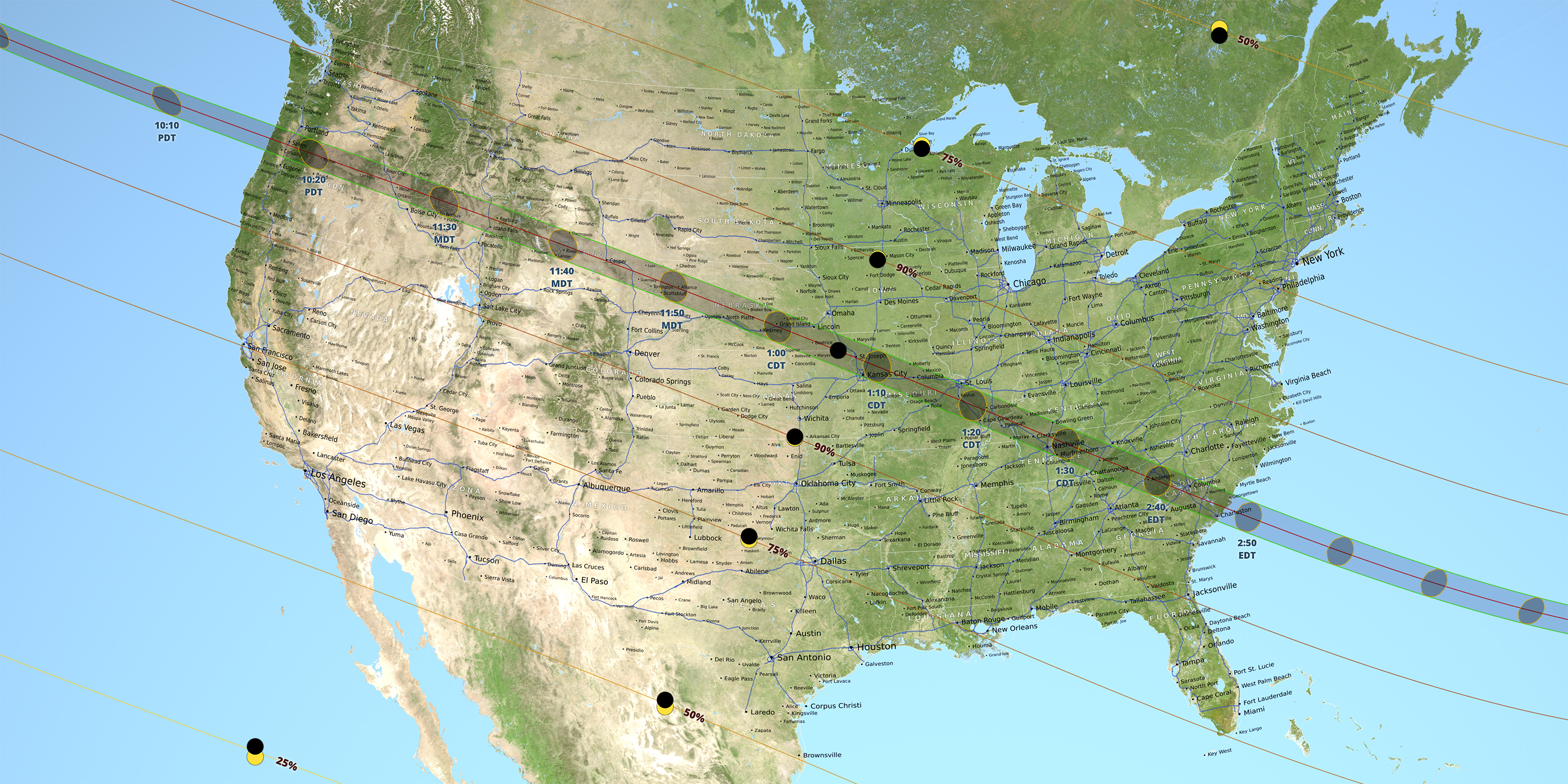
As seen from NOAA's DSCOVR and GOES-16 and NASA's LRO, the shadow seems to be the size of the entire continental United States while in ISS and high-altitude balloon footage it seems to be just the umbra. I vaguely remember a flat-Earther using this footage as "proof" that NASA was faking footage from those satellites (even though both DSCOVR and GOES are from NOAA) but that was months ago and I don't remember which YouTube channel was it.
My guess is that the images from DSCOVR and GOES are darker while the ISS and high-altitude balloon images have a higher exposure and different color settings. This could definitely be the case for the LRO images as it's designed to take pictures of the Moon (i.e. gray and dark imagery). As I know very little about photography I don't know. Would some of you please help me with this? Thanks. :^)
https://svs.gsfc.nasa.gov/12698
External Quote:: NASA and its partner's satellites had a unique vantage point to watch the eclipse. Several Sun-watching satellites were in a position to see the Moon cross in front of the Sun, while many Earth-observing satellites – and NASA's Lunar Reconnaissance Orbiter, which typically images the Moon's landscape – captured images of the Moon's shadow on Earth's surface.
As seen from NOAA's DSCOVR and GOES-16 and NASA's LRO, the shadow seems to be the size of the entire continental United States while in ISS and high-altitude balloon footage it seems to be just the umbra. I vaguely remember a flat-Earther using this footage as "proof" that NASA was faking footage from those satellites (even though both DSCOVR and GOES are from NOAA) but that was months ago and I don't remember which YouTube channel was it.
My guess is that the images from DSCOVR and GOES are darker while the ISS and high-altitude balloon images have a higher exposure and different color settings. This could definitely be the case for the LRO images as it's designed to take pictures of the Moon (i.e. gray and dark imagery). As I know very little about photography I don't know. Would some of you please help me with this? Thanks. :^)
Last edited by a moderator: