(My first post - please be gentle)
That geologic feature can be seen in this picture. I've drawn an oval where the V-shape from the USGS map can be clearly seen as a ravine.
Welcome Lurajane.
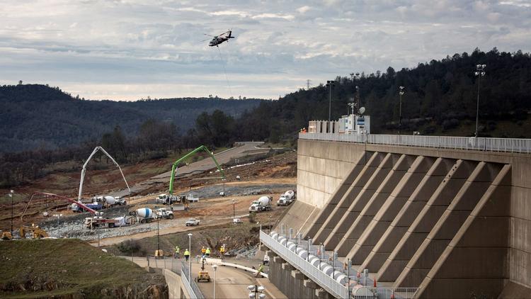
Your image, and the vantage point it contains, helps make the situation a little more clear. I have added some additional annotation.
The red oval with dark red center is located at about the point of initial spillway failure. Since that time the spillway has eroded to include much of the area inside the yellow oblong. The dotted red arrow pointing down to the river overlays an area through which the spillway flow has carved a new erosion outlet.
These features align with the erosion channel you highlighted. I suspect the erosion channel sits where it does because water descending the slope has exploited a weakness in the underlying rock and, over time, created the erosion channel. It is possible, but not yet fully established, that this zone of weakness may have played a role in the original spillway failure. And, once the spillway failed, the unconstrained water further exploited the same zone and carved a new side channel leading to the Feather River.
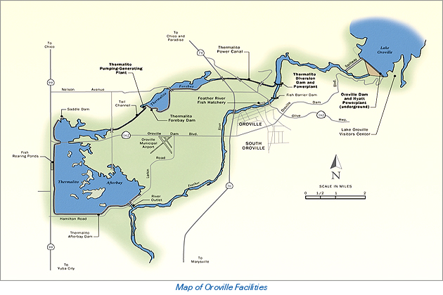
The overlay in the up-thread post:
https://www.metabunk.org/oroville-dam-spillway-failure.t8381/page-31#post-201689
lies flat against the topography shown on the map. In the real world the subsurface rock is composed of layers which I believe are called bedding planes. These bedding planes may be tilted at angles to the visible surface, and may extend deep below the surface.
The problem with this geographical location is the rock appears to be very mixed. The area around the dam is composed of rock which once formed part of the ocean bed and this rock has been "smooshed" together by later volcanic activity such as that which created Sutter Buttes to the south and Mount Lassen to the north. This unique geologic history is responsible for the gold deposits and placer gold mining activity which gave Oroville its name. It also makes for a geology which is heterogeneous and extremely hard to understand and interpret. This report basically states exactly that:
http://earth.geology.yale.edu/~ajs/1980/ajs_280A_1.pdf/329.pdf
(Thanks to Rock Whisperer for the original link)
In a prior post someone asked for their information to be reviewed by
"the experts." Dierdre, one of the site moderators, responded with the question
"What experts?" I think that pretty well sums it up. Given the unexpected nature of this event, the unknown geologic factors, and all the people whose welfare depends on this set of structures, there are no experts. In fact I don't think you will find a better source of information on this event than what you will find here on Metabunk and all of the contributors to the site. I have been totally amazed at the quality of information found here and would like to thank Mick and Dierdre and whomever else is responsible.
And thanks for your image. It helps clarify the issue I was attempting to describe.

") they must have moved it as i dont see anything in the water on the 17th eitehr
they must have moved it as i dont see anything in the water on the 17th eitehr