JCL
New Member
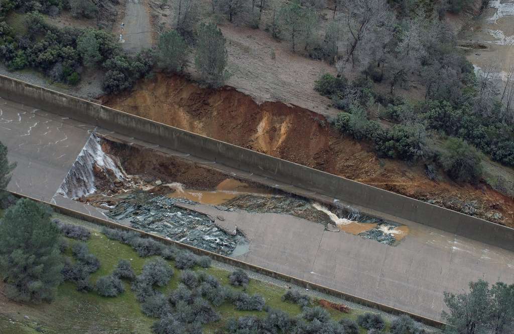
Thank you, Eric. That makes sense. I have yet to find a detailed modeling for a worst case scenario and what the flow would look like with a complete breach. Researching the St. Francis Dam and the flow traveled 54 miles and hearing Oroville has 600x more water behind it, I am curious how far a true breach would flow and how outstretched across the valley it could go? Could it go around the Buttes into Williams or would it dive down the 70 corridor into Sacramento?I tend to doubt that very much. The gradient of the river valley itself is much flatter than the slope of the emergency spillway. Once the water reaches the base of the river valley, the volume of flow will of course be the same, but the depth of the water will be greater and the speed of the water will be less. Because of the reduced speed, the ability of the water to carry large, dense objects would be much less as well. There might be something I'm overlooking regarding the working cross section of the river channel downstream which would negate the effect I mention here, but there's a big difference between water flowing down a mountain side and water flowing along a much flatter river bed, so for now, that's my perception of things.
*Grew up in Gridley and now based in Pennsylvania.
")