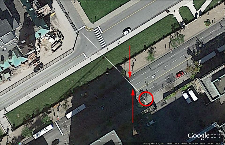
The image attached here, (the white line in the image especially), simulates the shadow cast by the lamp post -- the base of which is on the southeast side of Wellington Street -- the shadow of that lamp post is falling across the street, towards the northwest. The two red lines indicate the points on Wellington Street where the shadow crosses Wellington Street and those points are accurate to less than one foot, less than 12 inches, which is less than 1 degree on the compass, which is accurate to within 4 minutes when using shadow direction for time of day stamp.
Those points on Wellington Street are defined the endpoint of one white street marker line and its adjacent street marker line, the starting point of the adjacent, white, street marker line.
When we go here:
http://suncalc.net/#/45.4231,-75.6994,20/2014.10.21/08:18
and then drag the circle so that the ORANGE line lays over these points, (the base of the lamp post, and then the two points on Wellington Street), (click and hold the center black spot in the center tear drop to drag the circle/orange line into place) ... we can see the time of day indicated is 8:18am, Ottowa time ... BUT ... that's an hour off, because the applet is not set for daylight savings time, the time is 9:18am, Ottowa time on the day of the event.

")
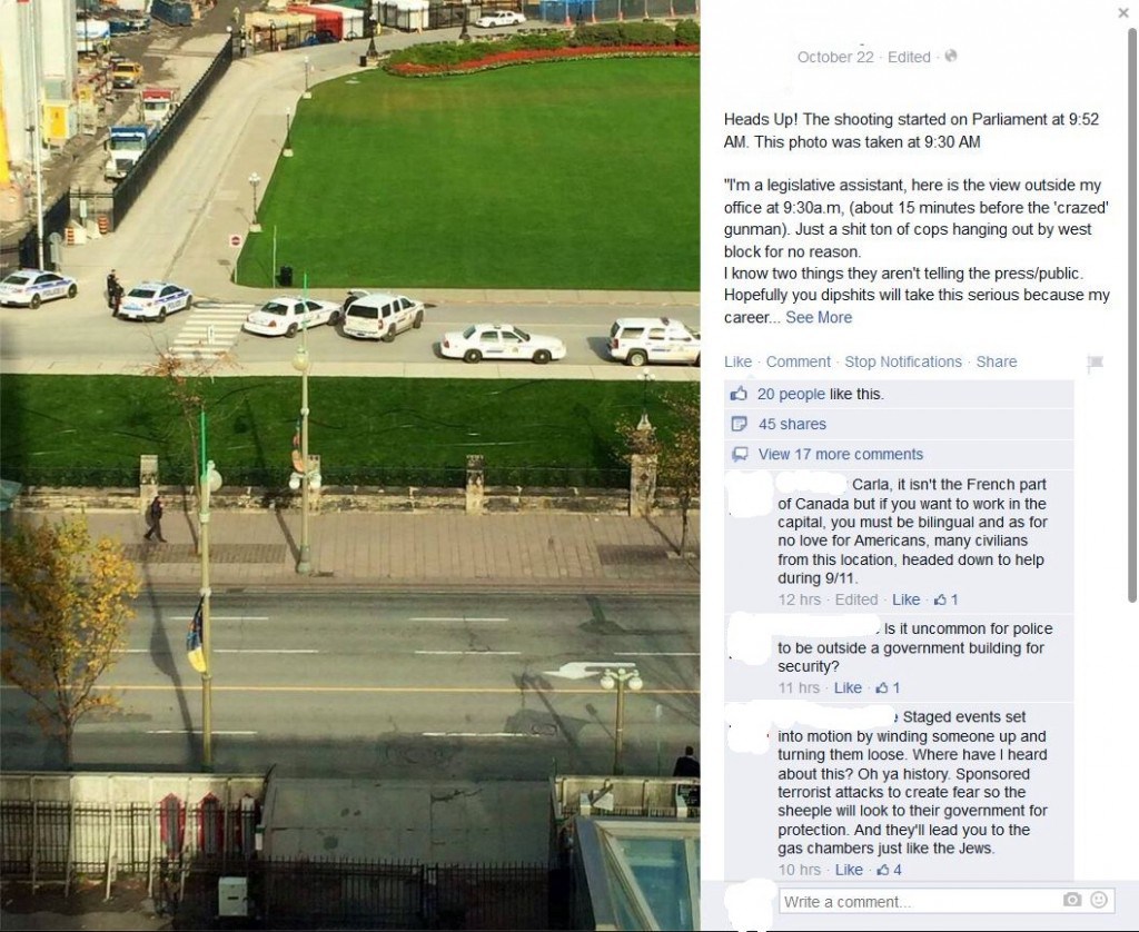
 Nice work, Trailspotter...