
You are using an out of date browser. It may not display this or other websites correctly.
You should upgrade or use an alternative browser.
You should upgrade or use an alternative browser.
Twentynine Palms, Camp Wilson "Triangle UAP" [Flares]
- Thread starter Mick West
- Start date
I think this is incorrect, if you take a frame at the start and a frame at the end (timecoded here) you see a distinct drop when you alight the three lights. Here's the two frames, and the overlayAssuming the observer is stationary*, the apparent descent is [mostly] illusory, driven by the camera shake and the motion compensation of the video.
* - No significant perspective change for the three lights in the bottom right. Video stabilized on these for location, rotation and scale:
I got two original photos with timestamps from Redditor u/FMelvin666 (attached in ZIP to preserve EXIF). They were sent via iMessage, which usually preserves the in-camera original.
Timestamps are 2021:04:20 20:24:01 and 20:24:20 (19 seconds between shots)
Overlaying them shows a noticeable descent.


(minor note: the flare on the left in the bottom image seems to be partically obscured by the power line, indicating that the larger shapes are mostly glare)
Timestamps are 2021:04:20 20:24:01 and 20:24:20 (19 seconds between shots)
Overlaying them shows a noticeable descent.
(minor note: the flare on the left in the bottom image seems to be partically obscured by the power line, indicating that the larger shapes are mostly glare)
Attachments
Last edited:
deirdre
Closed Account
They were sent via iMessage, which usually preserves the in-camera original.
20:24:01 and 20:24:20
imessage is an iphone? so does that mean the phone knows what timezone it is in? that is 8:24 pm then right? (in his original thread on reddit april of 2021 he said 7pm. ...not that the time likely matters, just curious.
It basically sends what is on his phone unaltered. Offset time -7. i.e. PDT, the correct local time zone.imessage is an iphone? so does that mean the phone knows what timezone it is in? that is 8:24 pm then right? (in his original thread on reddit april of 2021 he said 7pm. ...not that the time likely matters, just curious.
He said, when I showed him this: "I can't remember times and dates but yeah that sounds right"
deirdre
Closed Account
It basically sends what is on his phone unaltered. Offset time -7. i.e. PDT, the correct local time zone.
") so... "yes, the pic was taken at 8:24"?
so... "yes, the pic was taken at 8:24"?(p.s. dont forget, you always have to start your answers to me with a Yes or No. as i often dont fully understand the reponse without that. )
Yes. 8:24 PDT.
Scaramanga
Senior Member
Left most object doesn't look attached to the "triangle".
I'm seeing trails from them falling. The bright edge of "triangle" on the right being the trail of the lower object on the right being lit by the others. Left most trial is quite easy to see but squint and they've all got trails like they are falling and leaving something behind.
If the lights are attached to the body of a triangular ship, as Corbell implies, then howcome the relative position of the lights changes to such a high degree, with the light secondmost from the right ( in particular ) moving upwards considerably relative to the rest. That's not what one would expect if the lights were physically attached to the leading edge of a 'V' shape.
Try as hard as I may...I cannot see Corbell's 'craft' in the photos.
Comparing the shooting location of FMelvin666 to the Weaponzied low light photo:

The Weaponized photo is about 600 feet to the right of the FMelvin photo. So if there were a craft hovering between mountains and the camp, then parallax would move it left, relative to the background.
Instead it moves right, which means it's actually moving right. It's impossible for that to be parallax.
The lack of change in distance means that it is also descending.
ManInBlack
Active Member
I don't believe this information has been explored in full and does relate to the post above. According to the claim, the object was in the sky for 10 minutes. As highlighted by Mick West a decoy IR flare can illuminate for 7 or so minutes, which would account for the sighting duration (this will vary dependent on the flare being used, assuming it is a flare?).
Below are a range of flares used by the military, detailed are the aircraft that use them:
Looking at the training videos it is possible that a M206 Infrared Countermeasure/IR decoy was deployed by a helicopter or osprey. Each unit only weighs 300 grams or 0.30 pounds (as part of a larger cluster).
On the night in question, the wind speed was 14-18 mph with gusts up to 22-28mph (see below). You can hear the wind gusts in the videos released.


A formation of flares even from a distance would unlikely maintain a 'V' pattern/formation even as they drop? More data on the videos would help. Fairly sure these are flares though...
Below are a range of flares used by the military, detailed are the aircraft that use them:
- https://www.chemring.com/~/media/Fi...measures/ccm-usa-conv-flare-m206-brochure.pdf
- https://www.chemring.com/~/media/Fi...ents/countermeasures/MJU-50AB Brochure v3.pdf
- https://www.chemring.com/~/media/Fi...easures/ccm-usa-conv-flare-kc002-brochure.pdf
- https://www.chemring.com/~/media/Fi...countermeasures/kc-38-36mm-ir-decoy-flare.pdf
- https://www.chemring.com/~/media/Fi...easures/ccm-usa-conv-flare-mju53-brochure.pdf
Looking at the training videos it is possible that a M206 Infrared Countermeasure/IR decoy was deployed by a helicopter or osprey. Each unit only weighs 300 grams or 0.30 pounds (as part of a larger cluster).
On the night in question, the wind speed was 14-18 mph with gusts up to 22-28mph (see below). You can hear the wind gusts in the videos released.
A formation of flares even from a distance would unlikely maintain a 'V' pattern/formation even as they drop? More data on the videos would help. Fairly sure these are flares though...
Last edited by a moderator:
DATE / TIME - 20 April 2021 / 8:20pm to 9:30pm PST =
Which weather website did you get the data above from, and for which location? Can you post a link to the source please?
On the night in question, the wind speed was 14-18 mph with gusts up to 22-28mph (see below). You can hear the wind gusts in the videos released.
Which weather website did you get the data above from, and for which location? Can you post a link to the source please?
ManInBlack
Active Member
https://www.wunderground.com/history/daily/us/ca/twentynine-palms/KPSP/date/2021-4-20DATE / TIME - 20 April 2021 / 8:20pm to 9:30pm PST =
Which weather website did you get the data above from, and for which location? Can you post a link to the source please?
The weather station is located at Palms Springs international airport approx. <50 miles away, which makes the data inaccurate.
Since the last post I have found the weather station data directly from the marine corps air-ground combat centre. Exactly at the location in question. Just as stated by Deirdre.
Wind speed >12mph and gusts >24mph source below:
https://weatherspark.com/h/d/145414...;-California;-United-States#Figures-WindSpeed
You'll note that the wind was in a SW direction according to this?When you line that up with the imagery below at that time, it is spot on. Considering the position of the lights they have drifted in a SW direction. Re-confirms that these are flares, unless new evidence comes to light. Like a clear 4k image of a giant triangular craft, the size of a three bedroom two story house....
Seems that all my posts need a moderator approval, hence the delay in response.
Last edited:
deirdre
Closed Account
probably this one (its the first that pops up in google search and the format matchesDATE / TIME - 20 April 2021 / 8:20pm to 9:30pm PST =
Which weather website did you get the data above from, and for which location? Can you post a link to the source please?
https://www.wunderground.com/history/daily/us/ca/twentynine-palms/KPSP/date/2021-4-20
i dont see where they list altitudes, so likely low like other sites. ex:
https://weatherspark.com/h/d/2136/2...ms-California-United-States#Figures-WindSpeed
Thanks @deirdre ")
So this is the recorded wind at the time of the sighting... From the NW between 14 - 18 mph (gusting 22 - 28 mph).


So if we're looking north east, and the wind is blowing from the North west (90° to our left, and from left to right as we look) then the observed descent and drift of the flares is inline with the recorded weather at the time.

So this is the recorded wind at the time of the sighting... From the NW between 14 - 18 mph (gusting 22 - 28 mph).
So if we're looking north east, and the wind is blowing from the North west (90° to our left, and from left to right as we look) then the observed descent and drift of the flares is inline with the recorded weather at the time.
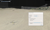
Working on some more exact geolocation and lines of sight. I added some polygon models for the pole and yellow bollard in the Weaponzied low-light photo, and the pole and huts in the FMelvin photo (and video, though that's harder to line up, as it's dark).
Added in a couple of markers for potential locations. But no matter which way you swing it, the light descended, and moved southeast


KML attached.
Added in a couple of markers for potential locations. But no matter which way you swing it, the light descended, and moved southeast
KML attached.
Attachments
Z.W. Wolf
Senior Member.
I don't believe this information has been explored in full and does relate to the post above. According to the claim, the object was in the sky for 10 minutes. As highlighted by Mick West a decoy IR flare can illuminate for 7 or so minutes, which would account for the sighting duration (this will vary dependent on the flare being used, assuming it is a flare?).
Below are a range of flares used by the military, detailed are the aircraft that use them:
- https://www.chemring.com/~/media/Fi...measures/ccm-usa-conv-flare-m206-brochure.pdf
- https://www.chemring.com/~/media/Files/C/Chemring-V3/documents/countermeasures/MJU-50AB Brochure v3.pdf
- https://www.chemring.com/~/media/Fi...easures/ccm-usa-conv-flare-kc002-brochure.pdf
- https://www.chemring.com/~/media/Fi...countermeasures/kc-38-36mm-ir-decoy-flare.pdf
- https://www.chemring.com/~/media/Fi...easures/ccm-usa-conv-flare-mju53-brochure.pdf
Looking at the training videos it is possible that a M206 Infrared Countermeasure/IR decoy was deployed by a helicopter or osprey. Each unit only weighs 300 grams or 0.30 pounds (as part of a larger cluster).
On the night in question, the wind speed was 14-18 mph with gusts up to 22-28mph (see below). You can hear the wind gusts in the videos released.
View attachment 59439
View attachment 59438
A formation of flares even from a distance would unlikely maintain a 'V' pattern/formation even as they drop? More data on the videos would help. Fairly sure these are flares though...
Let's eliminate countermeasure flares.
https://en.wikipedia.org/wiki/Flare_(countermeasure)
Countermeasure flares are small, are free falling and only last a few seconds.[Countermeasure flare] an aerial infrared countermeasure used by a plane or helicopter to counter an infrared homing ("heat-seeking") surface-to-air missile or air-to-air missile. Flares are commonly composed of a pyrotechnic composition based on magnesium or another hot-burning metal, with burning temperature equal to or hotter than engine exhaust. The aim is to make the infrared-guided missile seek out the heat signature from the flare rather than the aircraft's engines.
Some examples of what countermeasure flares look like at night:
(The author of this video presents them as a mystery)
In this case, beyond reasonable doubt, these were parachute illuminating flares. And almost certainly these were large flares dropped at high altitude by an aircraft.
A parachute illuminating (or illumination) flare is meant to be an artificial Sun that lights up the landscape. In the US military there are several types.
Hand held rockets
Artillery rounds - 80mm and 120mm mortar:
80mm mortar
120mm mortar
I'm going to point to this recent thread which will give more info on the large parachute illuminating flares dropped from aircraft at high altitude.
https://www.metabunk.org/threads/strange-lights-over-las-vegas-april-25-2023.12946/#post-289814
In regard to cases that involve large flares that are many miles away from the observer/camera - 10 miles and more:
In this case, and in many others that involve large and very distant parachute illuminating flairs, we see comments from people who identify themselves as military or ex-military who claim the flare idea as impossible. This video illustrates why we get this type of claim.
It's reasonable to conclude that these people have only seen relatively small and relatively close artillery rounds.
The flares we see in this video are hundreds of yards away - not tens of miles away.
We see:
-Noticeable movement
-Obvious smoke trails
-Short duration
But very large and very distant flares appear quite different due to the great distances.
-Very slow or no noticeable movement
-Very little or no trace of smoke trails
-Long duration
These flares, for example, were never part of a UFO case. They are well documented to be illuminating flares dropped by an aircraft in a search and rescue mission. Distance from the camera - about 20 miles. (The aircraft sounds are from a nearby airport, not the aircraft dropping the flares.)
Reports of burning flares observed in the sky last night came in from Oakville and Mississauga tonight after emergency crews are performing a water rescue. Bright shimmer with a faded trail of smoke in the distance could be seen all evening over Lake Ontario. The Royal Air Force dispatched a rescue airplane from 424 Squadron from 8 Wing in Trenton, Ontario. Canadian Coast Guard along with water units from the Halton Regional Police Services are currently searching for a missing boater after an unoccupied vessel was found. In a tweet tonight, the police underlined that the shiny lights over the lake that people may have spotted were in fact flares used by the crews to illuminate the otherwise dark waters below. The last known position of the possible victim as per HRPS is determined to be the mouth of 16 Mile Creek located near the corner of Lakeshore Rd and Water St in Oakville, Canada. In an updated statement we have learned that the person missing is 80 year old Robert Wyles, an experienced boater who had acquired the vessel the same day and who has been missing since about 6h pm last night.
The difference in this present case is that - as already noted here - these seem to be IR illuminating flares. They are designed to illuminate the landscape primarily with infrared light, and are useful for troops who are equipped with passive infrared sensors. (And would be a positive boon if the enemy troops were not equipped with IR sensors.)
So rather than burning with a bright orange flame, they appear to the naked eye to be dimmer and burn with a more magenta flame. In other words, they are most likely Northrup Grumman LUU-19B/B Infrared Flares.
Last edited:
https://www.wunderground.com/history/daily/us/ca/twentynine-palms/KPSP/date/2021-4-20
You'll note that the wind was in a SW direction according to this?
a "SW" wind indicates a wind that is blowing from the south west, so any airborne object in air with a SW wind will drift North East.
This isn't a super good fit for the mountains (nearly invisible), but the two poles plus multiple building give some confidence.
The purple pillars are from the yellow bollards photo, which is almost directly in front of this point (on the other side of the huts). The closest one is one mile, the one behind that is 8 miles away, and it's closer to that on. Not the most accurate fit though, due to lack of clear mountain skyline.
ManInBlack
Active Member
You are correct, you are indicating the direction it is travelling NE from the observers point of view. I misunderstood what you were saying, apologies.a "SW" wind indicates a wind that is blowing from the south west, so any airborne object in air with a SW wind will drift North East.
'...But no matter which way you swing it, the light descended, and moved southeast...' - Mick West... this is curious though...
@Z.W.Wolf that was a good point. We can take decoy/countermeasure flares off the table, @Mick West posted earlier in the thread that showed the possible specifications on the flares (see below).
http://towndock.net/files/LUU_Parachute_Factsheet.pdf
I think he is correct, it definitely matches the burn time. At a descent rate of 4ft/sec.
Distance traveled in approx. 4 minutes.
Time (s) = 4 minutes × 60 seconds/minute = 240 sec.
Therefore, the distance traveled by the parachute flare in approx. 4 minutes can be calculated as, 4 ft/s × 240 sec = 960 feet.
Last edited:
I got two original photos with timestamps from Redditor u/FMelvin666 (attached in ZIP to preserve EXIF). They were sent via iMessage, which usually preserves the in-camera original.
Timestamps are 2021:04:20 20:24:01 and 20:24:20 (19 seconds between shots)
Overlaying them shows a noticeable descent.
View attachment 59396
View attachment 59397
(minor note: the flare on the left in the bottom image seems to be partically obscured by the power line, indicating that the larger shapes are mostly glare)
Your "minor note" is actually an important point for everyone to keep in mind.
The ability of a wire, not all that from the camera, to block so much of the light from the object should tell you how small the actual bright object is.
The size of the "bright" part of the image tells you almost nothing about the actual size of the bright object. All it really tells you is the maximum possible size of the bright part of the object. The actual illumination source is going to be far, far smaller. The landing lights on a commercial airliner are less than a foot in diameter, yet you can see them (at night) from many miles away.
Unfortunately some people see an object like this in the sky and start estimating how many hundreds of feet across these "flying saucers" are.
'...But no matter which way you swing it, the light descended, and moved southeast...' - Mick West... this is curious though...
I should have just said "moved to the right", Based on the photos, it's moving from the green line to the red line, looking at the compass in the top right the simplest movement is SE. However there's a range of possible directions., and the wind at 5000 feet (and 10 miles away) is not the same as the wind at ground level.
Last edited:
I think this is incorrect, if you take a frame at the start and a frame at the end (timecoded here) you see a distinct drop when you alight the three lights. Here's the two frames, and the overlay
I got two original photos with timestamps [...]
Timestamps are 2021:04:20 20:24:01 and 20:24:20 (19 seconds between shots)
Overlaying them shows a noticeable descent.
My comments were only related to the 30 second video.
I'm not disagreeing that the lights are flares, or that they descend over time.
Yes, I agree, this is what you get when aligning them with translation only.
As far as I can tell both you and jarlrmai used translation only for the matching/stabilization. Since the reference points are far across the image from the points of interest, any error in the alignment of the former will be multiplied for the deviation of the latter, so we should account for the small amount of rotation and scale as well.
Comparison of the difference:
Translation only (left) - I think this matches your image reasonably. Translation rotation and scale (right).
I couldn't say if the lesser descent (a bit less than the diameter of the bright flares) would be 'too little' or not. We should also keep in mind that any 2D matching/stabilization is conditional on the assumption:
Assuming the observer is stationary* [...]
* - No significant perspective change for the three lights in the bottom right. [...]
And comparing only single frames misses the context in between:
The vertical descent of the flares in the stabilized footage shows a jump in the middle, suggesting noticeable perspective change, so it might not be meaningful to compare the very beginning to the very end.

Anyway, this is a relatively minor thing in the full context of the thread.
Fnord
New Member
Correct me if i'm wrong, but i think this one hasn't been posted anywhere, yet. Looking familiar?

https://theaviationist.com/2020/11/30/interesting-video-shows-nighttime-operations-near-area-51/
https://theaviationist.com/2020/11/30/interesting-video-shows-nighttime-operations-near-area-51/
It was posted on Twitter. Yes, it's a VERY similar case. I especially like how they show both night vision and visible light video side by side:Correct me if i'm wrong, but i think this one hasn't been posted anywhere, yet. Looking familiar?
Source: https://youtu.be/MrldTqf3yvg?t=224
Z.W. Wolf
Senior Member.
It appears in this tragically neglected thread.
https://www.metabunk.org/threads/strange-lights-over-las-vegas-april-25-2023.12946/#post-289874
*passive-aggressive sigh*
https://www.metabunk.org/threads/strange-lights-over-las-vegas-april-25-2023.12946/#post-289874
*passive-aggressive sigh*
ManInBlack
Active Member
'...We have not seen the extraordinary evidence...' - David Spergel NASA
MonkeeSage
Senior Member.
Found an older video with an LUU-19 flare deployed in the daytime. Seems to match the pinkish hue and is somewhat bright even during the day.
External Quote:
New footage via FOIA from John Greenewald
Source: https://twitter.com/blackvaultcom/status/1677073858925568001
This is the Twitter version, I'll link to the official file when John uploads it to his site.
The video shows the flare pattern over a longer period of time. Remember this is from the other side.
We also see the stark difference between the five IR flares and the two visible light area illumination flares.
Timestamps of three photos spanning the event appear to be a few minutes before the timestamps of the iPhone photos
1037- 20:11:19 - Earliest FOIA photo of the formation of five
1042: 20:12:44 - Last FOIA photo of the formation of five
1049 - 20:18:56 - FOIA photo of the two bright flares
Last edited:
The full set of FOIA files can be found here:
https://www.theblackvault.com/docum...gle-uap-the-foiad-documents-photos-and-video/
I've attached the three photos discussed above, and one from just before - 1036, timestamped 20:09:18
This shows some stars and a plane, and it might be possible to determine any time correction from this.

https://www.theblackvault.com/docum...gle-uap-the-foiad-documents-photos-and-video/
I've attached the three photos discussed above, and one from just before - 1036, timestamped 20:09:18
This shows some stars and a plane, and it might be possible to determine any time correction from this.
Attachments
I uploaded the image to Astrometry net and it auto detected the stars in the image.
https://nova.astrometry.net/user_images/8161690#annotated

Note the star Spica. top left.
Checking against in-the-sky.org and the position of Spica at the time, it shows that the picture is looking roughly SE.

@Mick West said....

20 April 2021 08.09pm PST = 21 April 2021 03.09am UTC
There's quite a few planes in the area at the time....

But by plotting their positions in google earth (kml attached) we can see that one plane seems to fit - N6208U, at 03.06am.


https://nova.astrometry.net/user_images/8161690#annotated
Note the star Spica. top left.
Checking against in-the-sky.org and the position of Spica at the time, it shows that the picture is looking roughly SE.
@Mick West said....
I've attached the three photos discussed above, and one from just before - 1036, timestamped 20:09:18. This shows some stars and a plane, and it might be possible to determine any time correction from this.
20 April 2021 08.09pm PST = 21 April 2021 03.09am UTC
There's quite a few planes in the area at the time....
But by plotting their positions in google earth (kml attached) we can see that one plane seems to fit - N6208U, at 03.06am.
Attachments
Last edited:
Nice! And does seem like a fit for that time 8:06, with a rough ground fit of the buildingsBut by plotting their positions in google earth (kml attached) we can see that one plane seems to fit - N6208U, at 03.06am.
But the photo time is 8:09, and I think the actual time, based on the "UFO" photos of the flares, is a bit later, like between 8:25-8:28
Attachments
Mendel
Senior Member.
But the photo time is 8:09, and I think the actual time, based on the "UFO" photos of the flares, is a bit later, like between 8:25-8:28
If we assume the camera clock is 3 minutes off, then the flare photos were taken ~20:09 and ~20:16. But you're saying that's wrong, and the actual times were over 15 minutes later, and the time span between the flares was less than 7 minutes?
Scaramanga
Senior Member
View attachment 60285
Note the star Spica. top left.
Checking against in-the-sky.org and the position of Spica at the time, it shows that the picture is looking roughly SE.
View attachment 60286
My understanding is that the range where the artillery flares were fired was to the north east of the 29 Palms military base.
You're correct, but this picture is from that range looking south east.My understanding is that the range where the artillery flares were fired was to the north east of the 29 Palms military base.
Similar threads
- Replies
- 24
- Views
- 4K
- Replies
- 42
- Views
- 7K