Structures in The gulf Of Mexico Appearing to make Waves in Clouds

Mick West

Administrator
Staff member
Metabunk 2018-03-24 11-31-36.jpg


Date/Time of Event 2018-02-18 4:45PM

Long Description of Sighting Report
I was on a flight to Ft Lauderdale and saw something interesting after 1-1:2 hr into flight. we are about 39000 ft up. Pilot told me those clouds in the photos below us in the plane are about 6-10 thousand high up
Looks like giant antenna or smoke stacks. Something large enough to be making the clouds look like a wake from a boat is going through them.
So here's what's weird, tallest man made structure is 2400 ft tall and is in Dubai.
Oil plat forms are only 200-240 ft above sea level.
That's how I noticed it. Saw the wake in the clouds
These are Live Photo's. You can play them and see that they weren't moving.
Flying over gulf heading towards ft Lauderdale
Near Louisiana
I thought maybe oil platform.
But. Nothing is that tall in the gulf
Again these things could be over 6-10,000 ft tall if the originate on the surface.
If you go on google earth to look at this area, it's all grainy and they only have it clear close to land.
Whatever it is is extremely tall and not just skinny. But massive enough to make large wakes in the cloud patterns
And it's like two large structures with several of the towers on them.
I could see oil platforms further on in my trip and they were tiny in comparison. So I'm ruling that explanation out.

And this is over the gulf. Unless there is some high mountain where they put stacks or antennas over 6/10 thousand ft tall to get them that high, I have no clue
No clue how accurate this is with the geo location in photo app, but here is the google satellite image shows nothing but dark blue in the area of the photos. Again the map is only clear close to land
You can see how they feather the image with photoshop so that everything beyond this line is not a clear image.
Content from External Source
https://mufoncms.com/cgi-bin/report...=f1_submitted_datetime+DESC&case_number=90956

Metabunk 2018-03-24 11-32-12.jpg
upload_2018-3-24_11-32-44.png

Metabunk 2018-03-24 11-33-12.jpg

This looks to me like ground based structures, however he says he was over the ocean, so that means one of:
  1. Ships
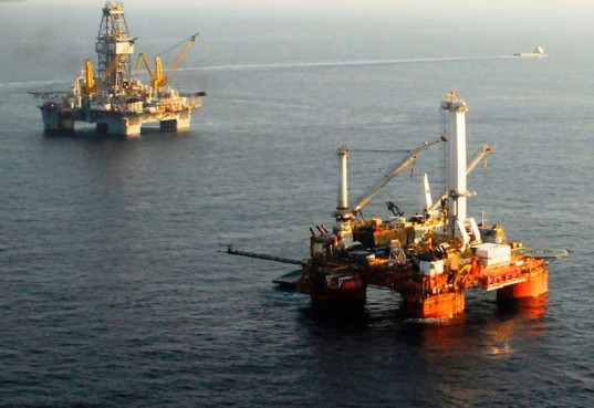
  2. Oil Platforms
  3. Islands
  4. Giant hovering UFOs
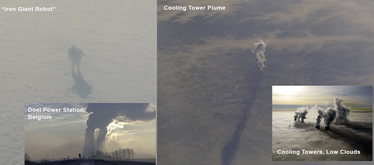
Somewhat similar to the "Iron Giant" cooling towers:

But here's it's leaving some kind of wake - either in the air or in the sea.
 

Attachments

  • Metabunk 2018-03-24 11-32-36.jpg
    Metabunk 2018-03-24 11-32-36.jpg
    64 KB · Views: 517
There seem to be two wakes, each, at different angles. Probably one in the water and one in haze in the air just above. The picture reminds me of a snap I took off the Irish coast. An object being towed could be behind the denser cloud.IMGP0706.JPG
..And a little later to show the effect of perspective..
 

Attachments

  • IMGP0707.JPG
    IMGP0707.JPG
    178.9 KB · Views: 475
Not clear what time zone, assuming central then 4:45PM is 21:45UTC

There's a few possible flights:
Metabunk 2018-03-24 12-06-22.jpg
 
Ah, looks like SouthWest
Metabunk 2018-03-24 12-08-00.jpg
Metabunk 2018-03-24 12-10-39.jpg

So SWA 3169. Dallas to FLL, departed Dallas 14:19 CST
Metabunk 2018-03-24 12-15-21.jpg
 

Attachments

  • FlightAware_SWA3169_KDAL_KFLL_20180218.kml
    15.3 KB · Views: 781
Last edited:
He said "1-1:2 hr into flight.", which is not really clear. But he says the time was 4:45, which works if he'd switched to Eastern.
 
There's a variety of oil wells around there, but it's hard to get aerial images of them for geolocation. This overlay was the best I've got so far. Google Earth file attached
Metabunk 2018-03-24 12-41-24.jpg
 

Attachments

  • Gulf Oil Rigs.kmz
    478 bytes · Views: 625
I am a bit late with posting my conclusion about these structures being at the sea surface. In the first photo, there are cumulus clouds that can be matched to their shadows, which are at the sea surface and on the same level with the structures:
Screen Shot 2018-03-24 at 20.38.00.png

In theory, these could be used to check the sun elevation and azimuth and verify date, time and location.

I find it a bit strange that the case was posted more than a month after the event. Could it be that the event was more recent, on March 18, rather than February 18?
 
Last edited:
In my opinion this case is enough debunked. I'd be quite surprised if that weren't those oil wells postulated by Clouds and located by Mick.

But I'd like to know which part of the picture is showing Trailspotter, I can't match that.

Also, what's inaugural picture source? The one given covers a much wider area, however it doesn't cover the rightmost part of the picture here.
 
Well heck:

Metabunk 2018-03-24 15-10-06.jpg

It's the only image that has GPS. GPS reception is spotty in planes (with an iPhone, at least). This is almost certainly the exact position of the shot, within a few seconds of motion.

Date Time Digitized: Feb 18, 2018 at 4:43:17 PM
Date Time Original: Feb 18, 2018 at 4:43:17 PM
FNumber: 2.4
Focal Length In 35mm Film: 52
Lens Model: iPhone X back dual camera 6mm f/2.4
Altitude: 11,904.42 m (39,056.49 ft)
Altitude Reference: above sea level
Date Stamp: Feb 18, 2018
Destination Bearing: 96.141
Destination Bearing Reference: True direction
Horizontal Positioning Error: 32
Image Direction: 96.141
Image Direction Reference: True north
Latitude: 29° 40’ 38.298” N
Longitude: 93° 10’ 36.27” W
Speed: 255.409
Speed Reference: Kilometers per hour
Time Stamp: 06:43:16 UTC
Content from External Source
https://www.google.com/maps/place/29°40'38.3"N+93°10'36.3"W/@29.6691374,-93.1767417,9.54z/data=!4m5!3m4!1s0x0:0x0!8m2!3d29.677305!4d-93.1767417

Some of the near-shore rigs were captured in Google Maps
Metabunk 2018-03-24 15-15-48.jpg

Metabunk 2018-03-24 15-15-15.jpg

Metabunk 2018-03-24 15-17-16.jpg
 
It's the only image that has GPS. GPS reception is spotty in planes (with an iPhone, at least). This is almost certainly the exact position of the shot, within a few seconds of motion.

Date Time Digitized: Feb 18, 2018 at 4:43:17 PM
Date Time Original: Feb 18, 2018 at 4:43:17 PM
FNumber: 2.4
Focal Length In 35mm Film: 52
Lens Model: iPhone X back dual camera 6mm f/2.4
Altitude: 11,904.42 m (39,056.49 ft)
Altitude Reference: above sea level
Date Stamp: Feb 18, 2018
Destination Bearing: 96.141
Destination Bearing Reference: True direction
Horizontal Positioning Error: 32
Image Direction: 96.141
Image Direction Reference: True north
Latitude: 29° 40’ 38.298” N
Longitude: 93° 10’ 36.27” W
Speed: 255.409
Speed Reference: Kilometers per hour
Time Stamp: 06:43:16 UTC
Content from external source​
There is something wrong in this info; for this location 4:43:17 PM cannot be 06:43:16 UTC.

Regarding the geotagging photos taken from a plane, my GPS camera (not iPhone) puts in the last known location, which is usually the origin, but occasionally updates the coordinates in flight if I keep it close to a window for a while.
 
There is something wrong in this info; for this location 4:43:17 PM cannot be 06:43:16 UTC.

That's a display error on the Photos app. A more raw dump of the data gives:

Date/Time Created : 2018:02:18 16:43:17
Digital Creation Date/Time : 2018:02:18 16:43:17
GPS Altitude : 11904.4 m Above Sea Level
GPS Date/Time : 2018:02:18 22:43:16Z
GPS Latitude : 29 deg 40' 38.30" N
GPS Longitude : 93 deg 10' 36.27" W
GPS Position : 29 deg 40' 38.30" N, 93 deg 10' 36.27" W

22:43 is correct for Central time 16:43 +6h,

hence it's actually
Metabunk 2018-03-24 16-02-35.jpg
 

Attachments

  • FlightAware_SWA1851_KHOU_KFLL_20180218.kml
    14.5 KB · Views: 785
Last edited:
Regarding the geotagging photos taken from a plane, my GPS camera (not iPhone) puts in the last known location, which is usually the origin, but occasionally updates the coordinates in flight if I keep it close to a window for a while.

The other photos seem to have been edited in some which removed the EXIF. This was the only one with text on it, so presumably they went through a different editing program to add the text, and the preserved the EXIF.

I've noticed the lagging with GPS too. In this case though it's an almost exact match for the plane's GPS at at that exact time.
Metabunk 2018-03-24 16-24-26.jpg

So that must be very close to the actual photo location.
 
The approximate fwd view in GE
Metabunk 2018-03-24 16-42-42.jpg
I doubt it's any of these though, seems too shallow an angle to see through the window.
 
I doubt it's any of these though, seems too shallow an angle to see through the window.
I've added the photo to Google Earth in a quick way, guided by cloud shadows and the Sun position at the time, and pinpointed the location of these structures by trial and error.
Gulf structures location.jpg

The pin coordinates are: 29°28'4.14"N 93°17'14.73"W. There is nothing in this location on Google Maps/Earth, but the deep underwater channel from the lake goes straight toward it (stopping halfway).

Edit: the updates have been removed as the likely explanation of the structures have been presented in the next post.
 
Last edited:
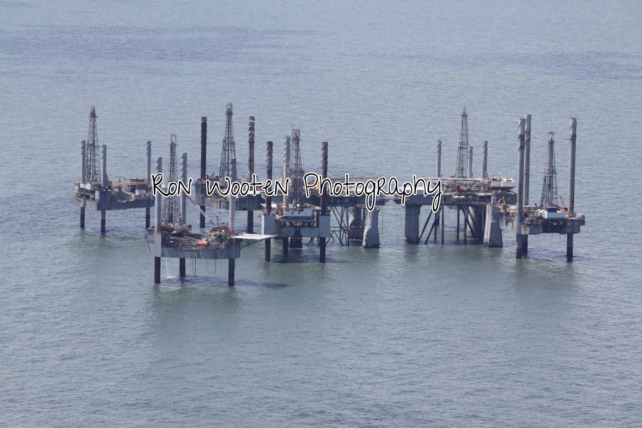
This is a likely explanation of the structures from the following flickr photo description:

Deep Water Drilling Rig Graveyard by Ron Wooten, on Flickr

Just off Cameron, Louisiana there lies a graveyard of abandoned jack-up drilling barges, 2 separate islands of steel. Each 'island' consists of 7-10 structures, and each of the assemblies is joined by gang planks.

All these Hercules structures have been essentially abandoned outside the Louisiana state waters, but lie within federal water. State taxes are avoided, as the rigs sit in disrepair, rusting masses of drilling equipment, some of which are too expensive to repair or salvage. A similar structure became a Superfund site in the waters off Quintana Beach, Texas, and was removed at a very hefty taxpayer cost. With a minimum of 15-20 of these needing to be removed, the bill will be excessive!
Content from External Source

Unfortunately, the flickr photo is not properly geotagged, but this interactive map shows a cluster of rigs in the deduced location:
Oil rig graveyard?.png
http://ldwf.maps.arcgis.com/apps/webappviewer/index.html?id=a71d6758535042dd969114fb6a356888

Another map shows this cluster of rigs in West Cameron block 110 belongs to BP America Production Company:
https://www.offshore-mag.com/conten...lfOfMexicoMap_OffshoreMag__CorrectedFinal.pdf
 
Last edited:
Back
Top