
A surprising fun science fact is that the curve of the earth is detectable simply by standing up. This works best with the surface of the ocean or a large lake, and it's something you can easily do at the beach. I recently gave it a go in a visit to Venice Beach near Los Angeles. With my Nikon P900 I held it close to the water level (about two feet up) and took a photo of a boat off in the distance. I then stood up and took another photo:

[Update, Aug 2020: This isn't the best example to use, as the boat naturally goes up and down a couple of feet with the ocean, the hotel example is far better]
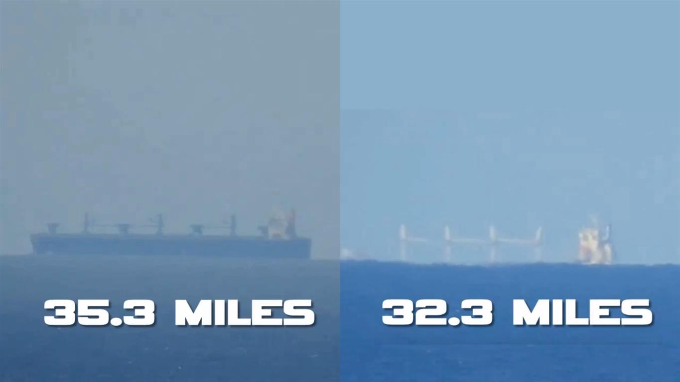
And I did a similar comparison with a beachside hotel that was 11.2 miles away

This difference here is just from me standing up [Update: and walking up the slope of the beach a few feet]. (The red roof is another building behind the hotel)
I also had a very clear view of Catalina Island, significant parts of which were under the horizon.

I had to do a bit more than stand up here, but walking up to the nearby Palisades park (about 100 feet up) made a significant difference.

Lining them all up (pink lines):

[Update, Aug 2020: This isn't the best example to use, as the boat naturally goes up and down a couple of feet with the ocean, the hotel example is far better]
And I did a similar comparison with a beachside hotel that was 11.2 miles away
This difference here is just from me standing up [Update: and walking up the slope of the beach a few feet]. (The red roof is another building behind the hotel)
I also had a very clear view of Catalina Island, significant parts of which were under the horizon.
I had to do a bit more than stand up here, but walking up to the nearby Palisades park (about 100 feet up) made a significant difference.
Lining them all up (pink lines):
Last edited:


") timestamp embedded in link.
timestamp embedded in link.