steve holmes
Member
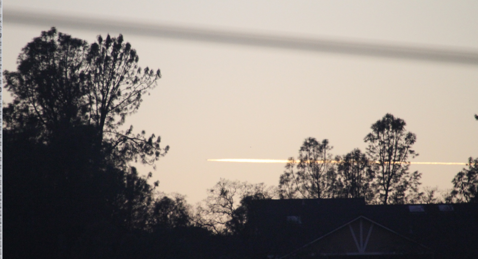
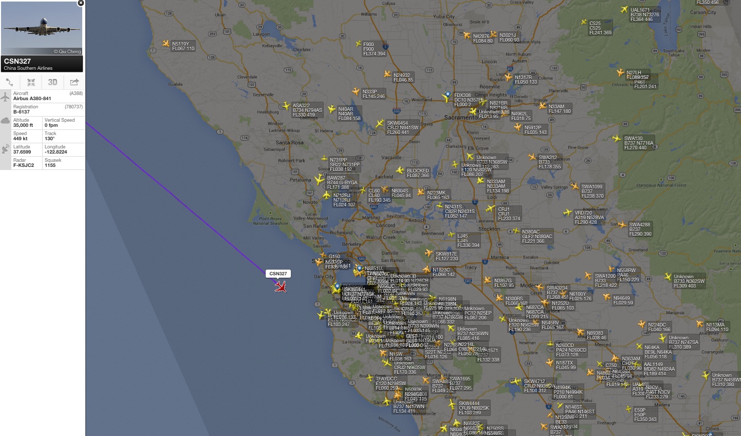
On the evening of Oct 5th, I saw a very persistent trail heading NW from where I was in McKinley Park, Sacramento, at 6:24 pm. Here's a few pictures of the trail and also what results I got when trying to ID it on flightradar24.com.
There were several "persistent" trails that I saw between 6:00 and 7:00 pm, which was followed the next 2 days by lots of more persistent trails while during most of the day (Oct 5th) the trails were short (and as you can see by this being number 37 for me that day, there were plenty of them to see)
.JPG")
.JPG")
.JPG")


There were several "persistent" trails that I saw between 6:00 and 7:00 pm, which was followed the next 2 days by lots of more persistent trails while during most of the day (Oct 5th) the trails were short (and as you can see by this being number 37 for me that day, there were plenty of them to see)
Last edited by a moderator: