Some Albatross research (assuming this is still an option)
The maximum documented speed for an Albatross I found is 104 mph, stated in
this study.
External Quote:
measurements of one grey-headed albatross during an Antarctic storm showed that the bird travelled for 9 h at ground speeds of between 110 kph (30.5 m s−1) and 168 kph (46.7 m s−1).
168 kph = 104 mph
The Albatross is not native to the North American East Coast. However, the ranges of long-distance fliers are quite variable and accordingly there are dozens of sightings of Albatross along the East Coast, including at least one shot by a hunter

. This study catalogues 171 observed Albatross, 13 in Florida:
https://birdingornithology.files.wordpress.com/2015/09/nab-68-1-1feature-albatross-final.pdf
While rare, I suspect Albatross are much more common than extraterrestrial aircraft.
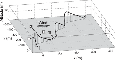
The Albatross flies in what's called
dynamic soaring, depicted here:
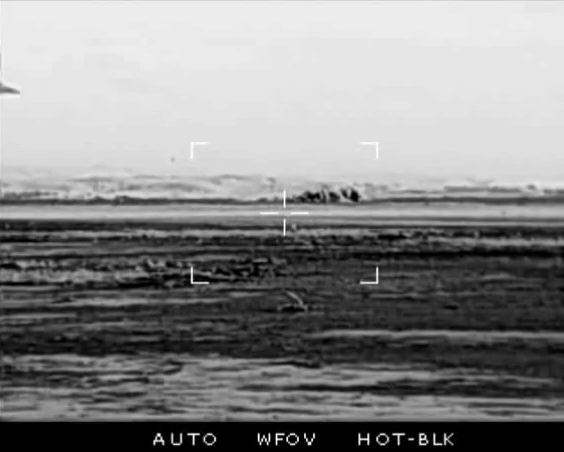
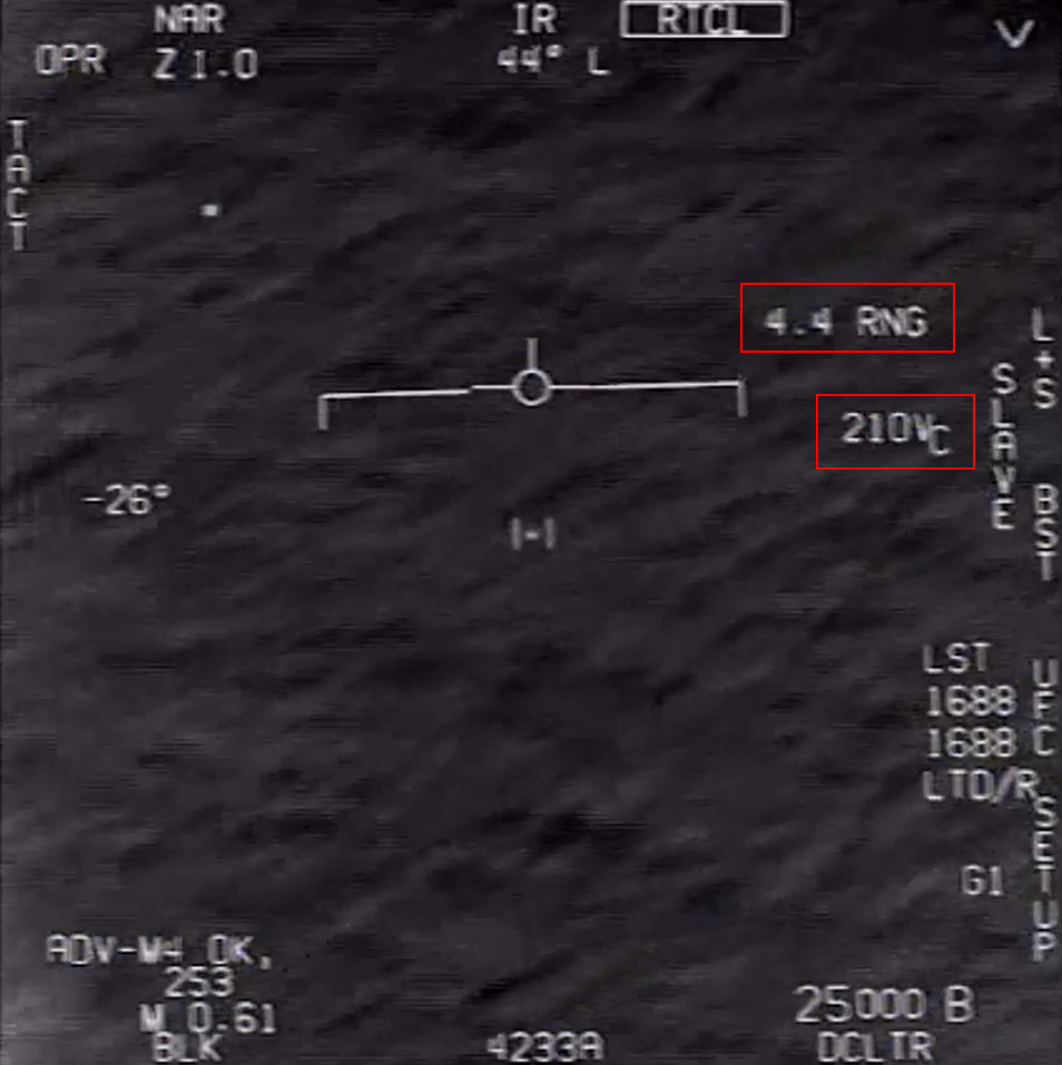
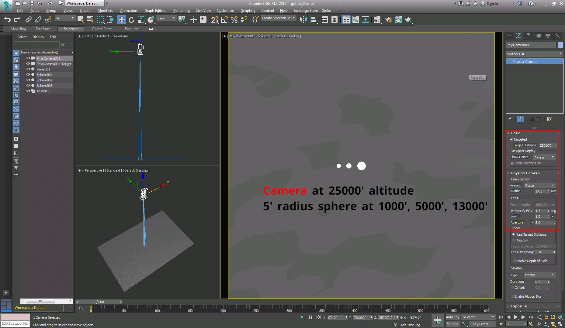
So the question arises if the object in the Go-Fast video could be an Albatross based on its flight path. The question would be if during a 30-second snapshot an Albatross could maintain a fairly straight flightpath. I suspect the answer is yes.


")