TEEJ
Senior Member.
In the following video Gary Cameron claims that the aircraft is not visible on Flight Radar 24.

https://www.facebook.com/garycameron121/posts/933359546715123?pnref=story
https://www.facebook.com/garycameron121?fref=browse_search

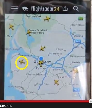
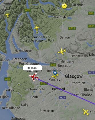
Contrary to what he claims the aircraft does appear on Flight Radar 24. I've ringed the aircraft in yellow.
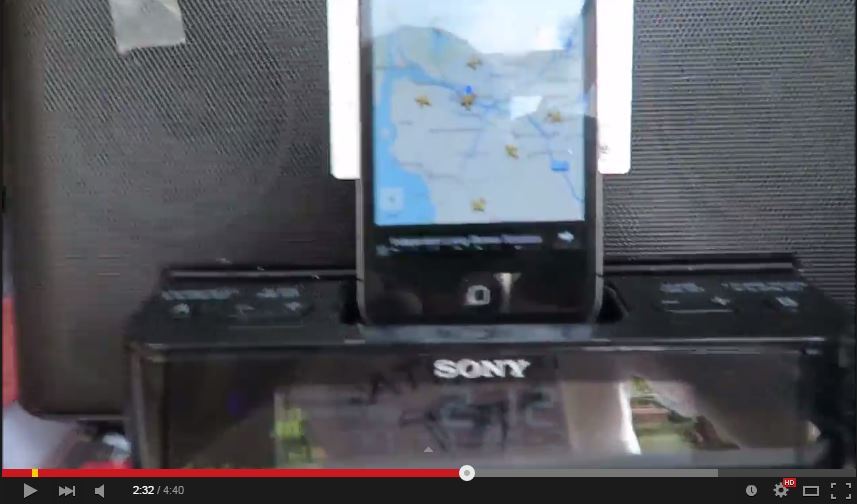
Time of filming the phone with FR24 active is 2:12PM (British Summer Time) 13:12 (Greenwich Mean Time)
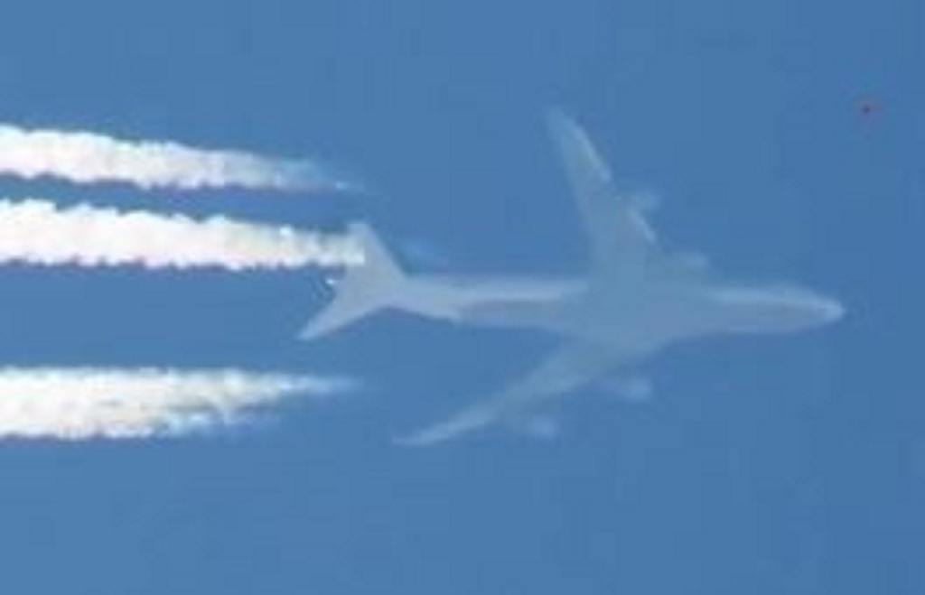
Blow up from video
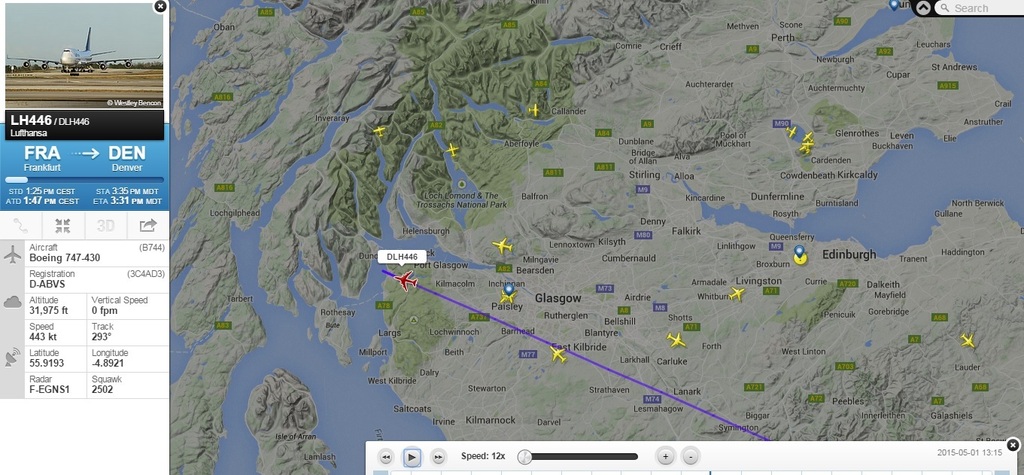
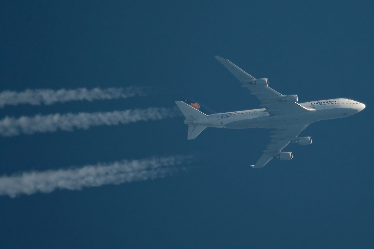
The flight is Lufthansa Boeing 747 DLH446, Registration D-ABVS
http://uk.flightaware.com/live/flight/DLH446/history/20150501/1125Z/EDDF/KDEN
http://uk.flightaware.com/live/flight/DLH446/history/20150501/1125Z/EDDF/KDEN/tracklog
Flight Radar 24 snapshot with DLH446 labelled.
FR24 Playback.
http://www.flightradar24.com/2015-05-01/13:10/12x/DLH446/624e8bc
D-ABVS
From
http://www.luchtzak.be/forums/viewtopic.php?t=47372
Filming location in Clydebank, Scotland. You can see the distinctive light pole with sign.
https://goo.gl/maps/wzp1K
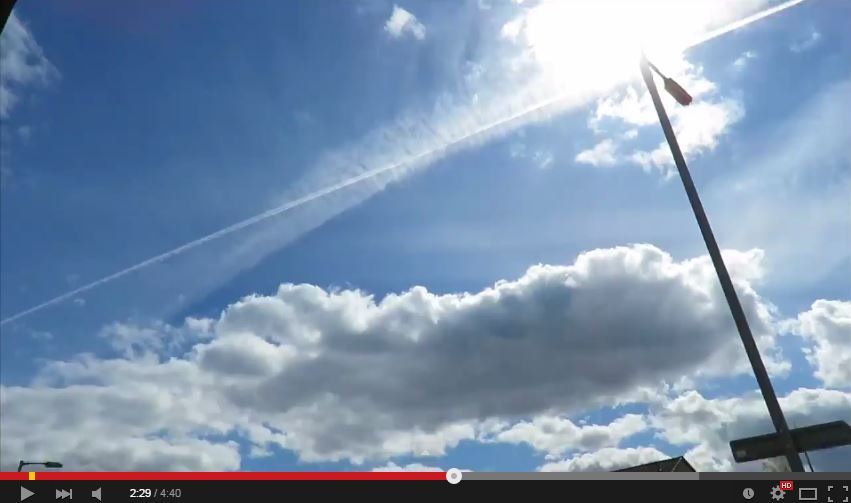
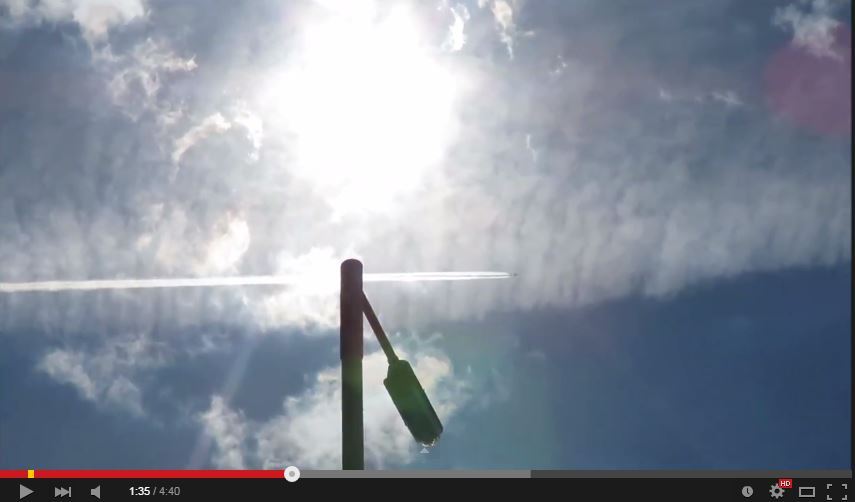
Gary assumes that the aircraft is directly overhead his filming location. In reality the Lufthansa Boeing 747 track is approximately 7 miles to the south.
After filming the aircraft Gary films Flight Radar 24 on his phone and claims the following.External Quote:
Published on 1 May 2015
FlightRadar24 footage PROVES these are Traitor Miltary Chemjets and not Commercial Flights.
External Quote:
That one is on the other side of Greenock miles away, and that one is miles away too. There is no sign of the jet flying down the Clyde in
our direction, not at all...... He's not on Flight Radar 24. That's because they are military jets specially kitted out for spraying chemtrails.
They are not commercial jets... traitor military pilots.
https://www.facebook.com/garycameron121/posts/933359546715123?pnref=story
https://www.facebook.com/garycameron121?fref=browse_search
Contrary to what he claims the aircraft does appear on Flight Radar 24. I've ringed the aircraft in yellow.
Time of filming the phone with FR24 active is 2:12PM (British Summer Time) 13:12 (Greenwich Mean Time)
Blow up from video
The flight is Lufthansa Boeing 747 DLH446, Registration D-ABVS
http://uk.flightaware.com/live/flight/DLH446/history/20150501/1125Z/EDDF/KDEN
http://uk.flightaware.com/live/flight/DLH446/history/20150501/1125Z/EDDF/KDEN/tracklog
Flight Radar 24 snapshot with DLH446 labelled.
FR24 Playback.
http://www.flightradar24.com/2015-05-01/13:10/12x/DLH446/624e8bc
D-ABVS
From
http://www.luchtzak.be/forums/viewtopic.php?t=47372
Filming location in Clydebank, Scotland. You can see the distinctive light pole with sign.
https://goo.gl/maps/wzp1K
Gary assumes that the aircraft is directly overhead his filming location. In reality the Lufthansa Boeing 747 track is approximately 7 miles to the south.
")
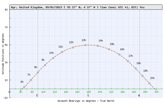
 The plane passes below the Sun that is near its highest position in the sky on the date, ~50°. This means, the plane's elevation is only ~45°, that is, it is about the same distance from the camera, as its altitude, 7 miles.