scombrid
Senior Member.
http://www.youtube.com/watch?feature=player_embedded&v=d2bWwlohOpE
Harold is claiming that he can see weather manipulation meant to control hurricane Isaac on satellite loops.
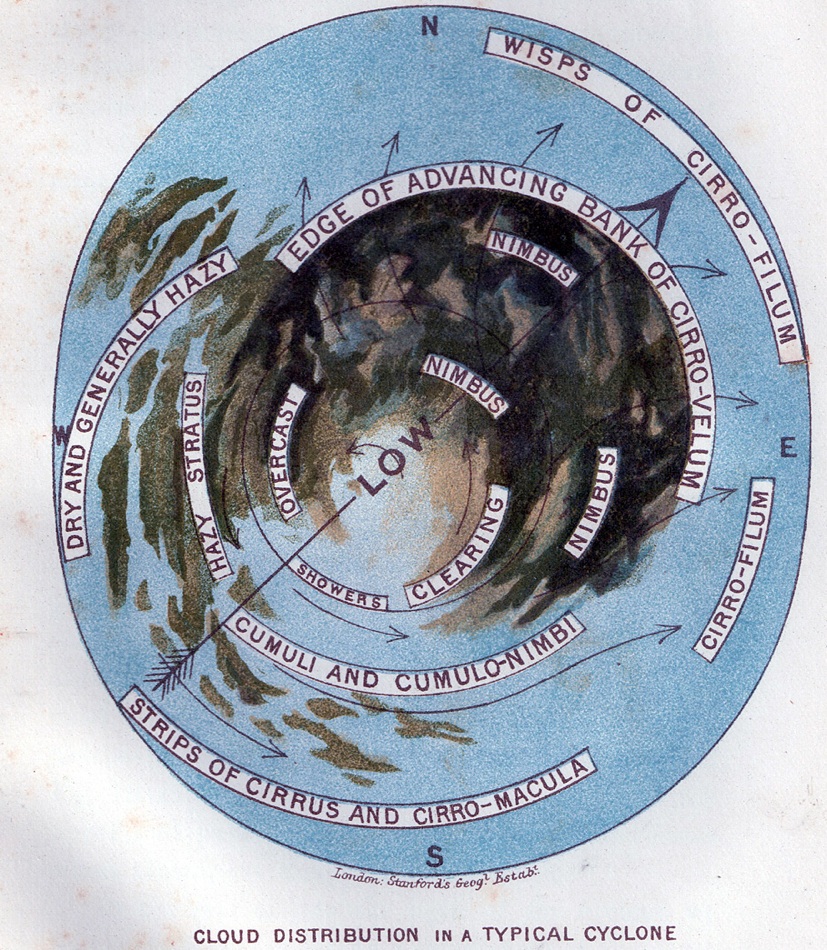
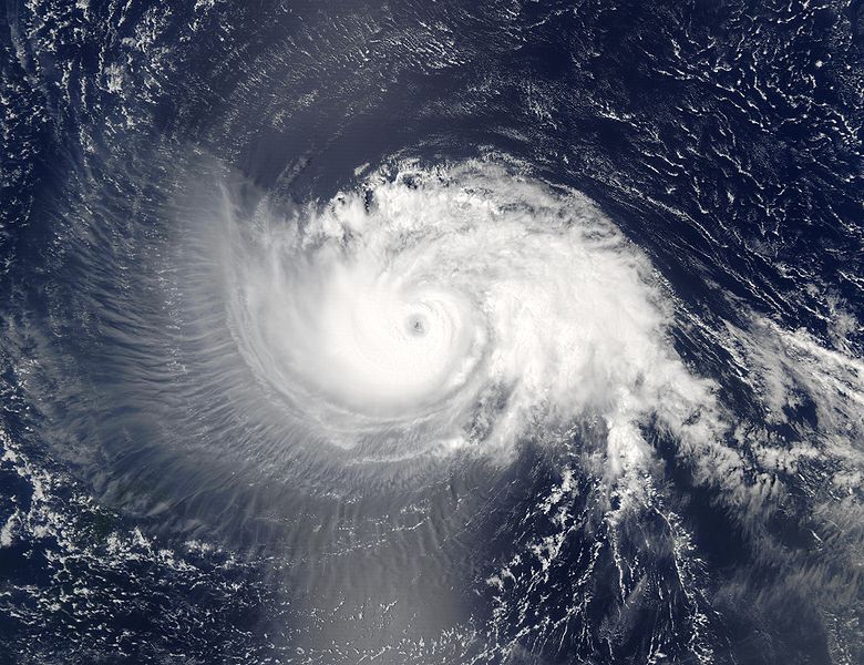
The first half of the video focuses on cirrus clouds around the cyclone. He refers to the cirrus cloulds being aerosols "contributing to the geoengineering of the storm".
What he is actually pointing at are natural cirrus clouds blowing off of the deep convection associated with the storm. It is known as "cirrus outflow".
Here is a description of the cirrus clouds typically associated with tropical cyclones that describes well the images that Harold has placed in that youtube video. It was published in 1967.
http://docs.lib.noaa.gov/rescue/mwr/095/mwr-095-03-0111.pdf
" CIRRUS CANOPIES IN TROPICAL STORMS"
Furthermore. An internet image search for satellite views of major hurricanes such as David in 1979 and Glorida in 1985 show similar cirrus cloud patterns. Clearly Mr. Saive is mistaken, or hurricanes were being manipulated by "aerosol engineering" by the time we had satellites in space and probably before that. The cirrus deck approaching from the south or southeast in advance of a storm has been a warning of an approaching tropical system on the east coast of the US for centuries before we has any modern forcasting techniques or remote sensing capabilities.
be
Harold is claiming that he can see weather manipulation meant to control hurricane Isaac on satellite loops.
The first half of the video focuses on cirrus clouds around the cyclone. He refers to the cirrus cloulds being aerosols "contributing to the geoengineering of the storm".
What he is actually pointing at are natural cirrus clouds blowing off of the deep convection associated with the storm. It is known as "cirrus outflow".
Here is a description of the cirrus clouds typically associated with tropical cyclones that describes well the images that Harold has placed in that youtube video. It was published in 1967.
http://docs.lib.noaa.gov/rescue/mwr/095/mwr-095-03-0111.pdf
" CIRRUS CANOPIES IN TROPICAL STORMS"
Furthermore. An internet image search for satellite views of major hurricanes such as David in 1979 and Glorida in 1985 show similar cirrus cloud patterns. Clearly Mr. Saive is mistaken, or hurricanes were being manipulated by "aerosol engineering" by the time we had satellites in space and probably before that. The cirrus deck approaching from the south or southeast in advance of a storm has been a warning of an approaching tropical system on the east coast of the US for centuries before we has any modern forcasting techniques or remote sensing capabilities.
be