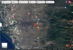
Cumbre Vieja is a currently (Sept 19, 2021) erupting volcanic ridge on the Southern end of the island of La Palma, in the Canary Isles, a Spanish territory off the coast of West Africa. It's of interest because it was theorized in 2001 that seismic activity on the island could cause a massive landslide, and in turn create a mega-tsunami.

A 25m (82 foot) wave would be devastating for low-lying areas like Florida and New York City. Closer to the origin it would be vastly higher, with huge amounts of devastation in Africa and Europe. A civilization defining moment in human history.
Of course this is great fodder for the tabloids, edutainment shows, and the disaster-porn sites. But other studies were less apocalyptic.
These differences come from variations in the models used, and the input to those models. Ward and Day used a collapse volume of 450 cubic kilometers (km3). A more recent (2019) study by Abedie, et al, uses a smaller volume of just 80 km3, which they thought was consistent with the last big collapse about 300,000 years ago. This still had massive local destruction, but only moderate effects (less than 1 meter) across the atlantic.

And again, note this more modest disaster is still a one-in-300,000-years event. Cumbre Vieja has been erupting every few decades since then, and there's nothing specific to indicate that this might be the one.
Article: In the event of a collapse driven by a fresh eruption, Day found that anywhere between 150 to 500 cubic kilometres of rock could slide into the ocean at 100 metres per second.
The immense force caused by such a landslide would generate huge waves, hundreds of metres high, that would spread across the Atlantic and hit the coast of the Americas at heights of up to 25 metres.
The pair found that, although there is no historical record of a mega-tsunami caused by the lateral collapse of an oceanic volcano, the geological record shows clear evidence of their power.
A 25m (82 foot) wave would be devastating for low-lying areas like Florida and New York City. Closer to the origin it would be vastly higher, with huge amounts of devastation in Africa and Europe. A civilization defining moment in human history.
Of course this is great fodder for the tabloids, edutainment shows, and the disaster-porn sites. But other studies were less apocalyptic.
Article: Day and Ward's research shocked many when it was released in 2001, but subsequent studies of the potential consequences of a collapse at Cumbe Vieja have significantly played down the risk.
In later years, and often with the benefit of experience hard-won from the 2004 Boxing Day tsunami, scientists using different models have found that any waves created could be considerably smaller.
Some have argued that any collapse of the ridge could not occur with the force described in Ward and Day's paper, with some positing that a collapse would happen in stages.
Others have pointed out that undersea topography could reduce the height of the waves in many areas.
But most agree that if a collapse were to occur, large waves would be generated that would prove tragic for the Canary Islands themselves.
Where scientists differ is how far away effects would be felt and to what extent.
These differences come from variations in the models used, and the input to those models. Ward and Day used a collapse volume of 450 cubic kilometers (km3). A more recent (2019) study by Abedie, et al, uses a smaller volume of just 80 km3, which they thought was consistent with the last big collapse about 300,000 years ago. This still had massive local destruction, but only moderate effects (less than 1 meter) across the atlantic.
And again, note this more modest disaster is still a one-in-300,000-years event. Cumbre Vieja has been erupting every few decades since then, and there's nothing specific to indicate that this might be the one.

