Kyle Ferriter
Senior Member.
Flight KTA1732 flown by aircraft with registration AP-BOI has gone missing in the Gulf of Oman after departing Dubai and going east, intending to land in Karachi.
https://www.flightradar24.com/data/aircraft/ap-boi#408bc3bc
FlightRadar24 reports there has been active GPS interference in the area related to the war with Iran, causing difficulty for ADSB aggregators.
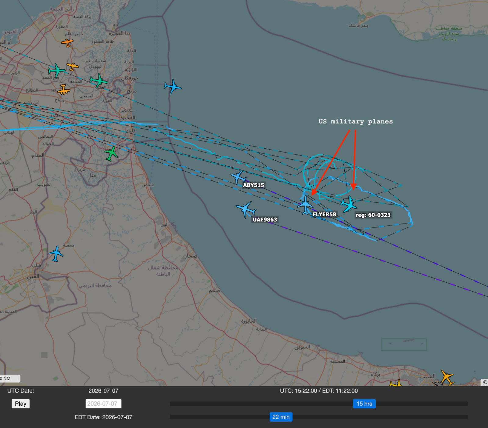
There have been multiple US-flown aircraft circling above the Gulf of Oman east of Dubai and the Straight of Hormuz, and ADSB Exchange shows very spotty tracks of civilian planes in that area. Looking back the past week, the US has had one or more large planes flying a holding pattern in the same location at least since 7/1 (that's as far as I looked back right now), so their presence today is not out of the ordinary.
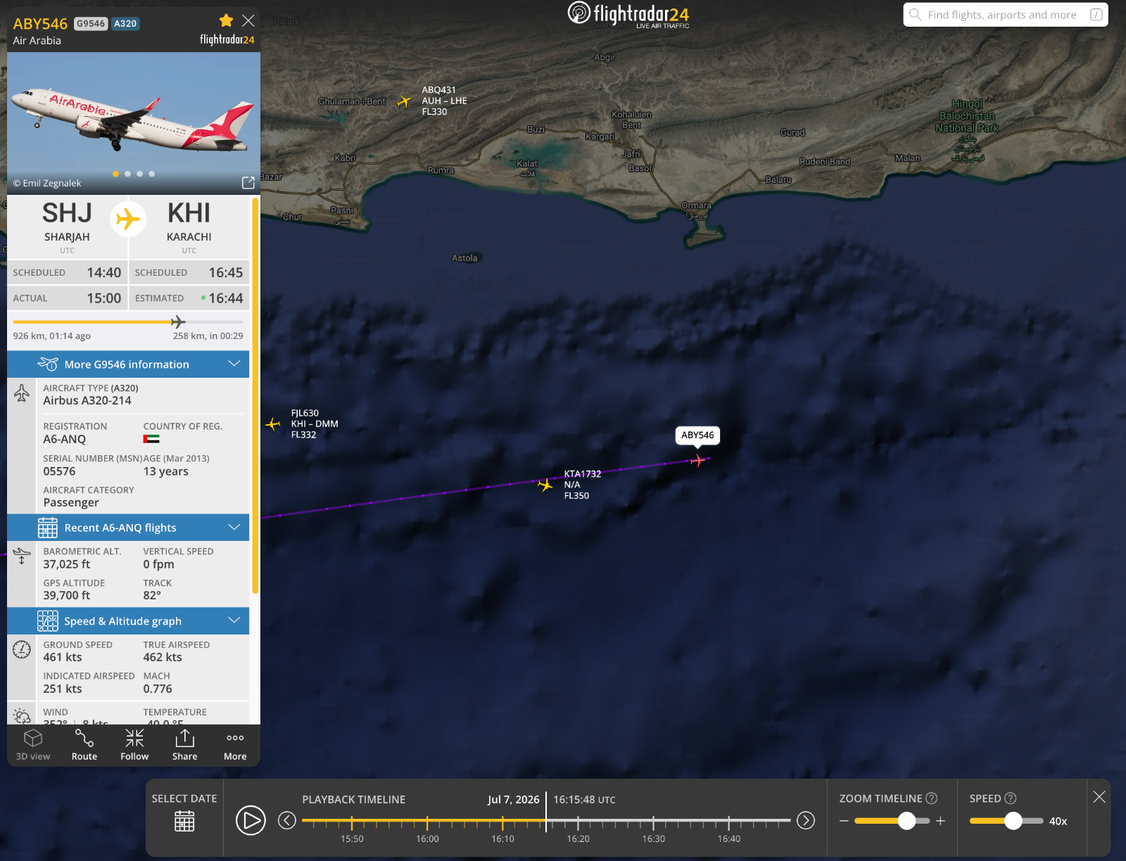
FlightRadar24 shows that flight ABY546 which was flying just ahead of KTA1732 on the same route from Sharjah airport (Dubai) to Karachi, did complete its trip.
I'm not sure where FlightRadar24 is getting their data for these flights or if they have tweaks to enable more interpolation, because ADSB Exchange shows massive gaps in the tracks. Unless FR24 has a lot more feeders in that area than ADSBx does, I'm not sure to what extent specific points along this track are reliable, or how much is extrapolation/interpolation over noisy data. It's possible ADSBx is filtering out some low-quality time points that FR24 is not.
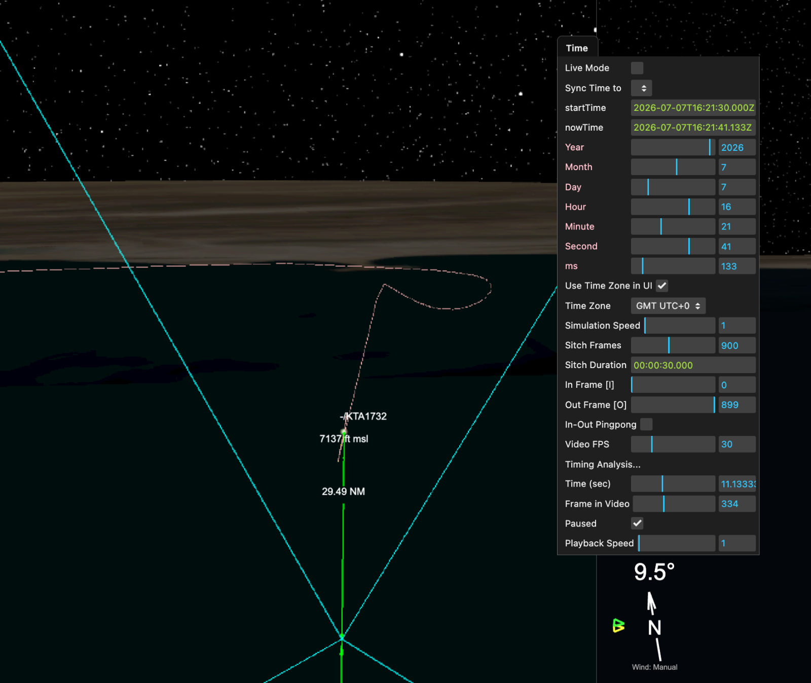
ADSBx's track ends at 2026-07-07 15:53:32 UTC, but FR24 continues to 2026-07-07 16:21:59 UTC, at which point it shows a turn, a brief dip, and then a very rapid decline, after which the track ends.
https://www.metabunk.org/sitrec/?custom=17113/FR24 KTA1732 20260707/20260707_214113.js
FlightRadar24 KML for this flight is attached as 408bc3bc.kml. ADSB Exchange KMLs attached in zip file.
https://www.flightradar24.com/data/aircraft/ap-boi#408bc3bc
FlightRadar24 reports there has been active GPS interference in the area related to the war with Iran, causing difficulty for ADSB aggregators.
https://www.flightradar24.com/blog/...major-incident/k2-airways-cargo-737-accident/External Quote:...
Preliminary ADS-B data indicate a loss of altitude, followed by a climb, and then a second, sudden and dramatic loss of altitude. The final received data point from the aircraft was at 16:21 UTC, placing the aircraft at 1,100 ft AMSL with a reported vertical rate of -22,400 feet per minute.
...
Shortly after takeoff the aircraft, all others in the region, experienced GNSS interference, resulting in the degraded data near Sharjah and transition to MLAT tracking by Flightradar24. Once the the aircraft exited the area subject to GNSS interference, ADS-B data was once again received by Flightradar24.
...
There have been multiple US-flown aircraft circling above the Gulf of Oman east of Dubai and the Straight of Hormuz, and ADSB Exchange shows very spotty tracks of civilian planes in that area. Looking back the past week, the US has had one or more large planes flying a holding pattern in the same location at least since 7/1 (that's as far as I looked back right now), so their presence today is not out of the ordinary.
FlightRadar24 shows that flight ABY546 which was flying just ahead of KTA1732 on the same route from Sharjah airport (Dubai) to Karachi, did complete its trip.
I'm not sure where FlightRadar24 is getting their data for these flights or if they have tweaks to enable more interpolation, because ADSB Exchange shows massive gaps in the tracks. Unless FR24 has a lot more feeders in that area than ADSBx does, I'm not sure to what extent specific points along this track are reliable, or how much is extrapolation/interpolation over noisy data. It's possible ADSBx is filtering out some low-quality time points that FR24 is not.
ADSBx's track ends at 2026-07-07 15:53:32 UTC, but FR24 continues to 2026-07-07 16:21:59 UTC, at which point it shows a turn, a brief dip, and then a very rapid decline, after which the track ends.
https://www.metabunk.org/sitrec/?custom=17113/FR24 KTA1732 20260707/20260707_214113.js
FlightRadar24 KML for this flight is attached as 408bc3bc.kml. ADSB Exchange KMLs attached in zip file.