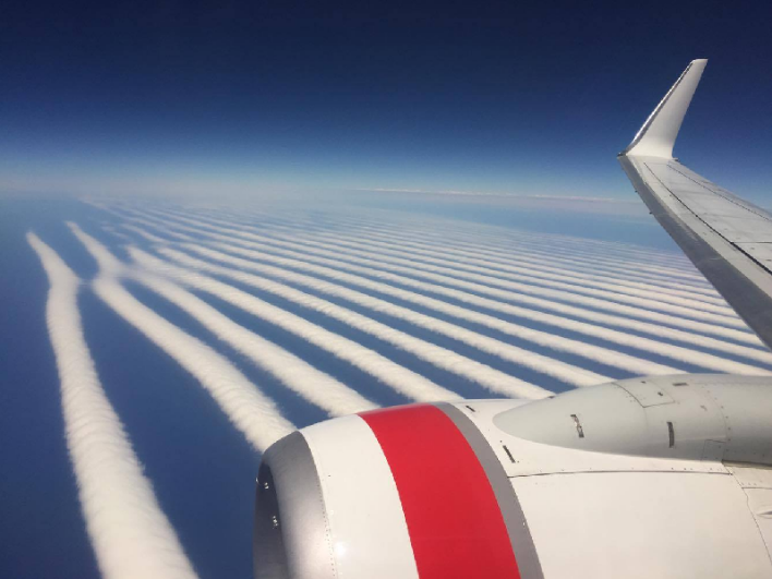
A Slightly Square Cloud South of Australia

Mick West

Administrator
Staff member
20170730-091854-e29mg.jpg
Source: https://worldview.earthdata.nasa.go...18477314,137.0533488922281,-31.55257743477314

More supposed "undeniable proof" of weather modification with radio waves comes in the form of the above image. Here's a closeup
20170730-092031-som7c.jpg
(The sharp line on the right is the result of stitching together different images, hopefully nobody was saying THAT was cloud modification)

It's just a region of cloud streets. Not something you see every day, but not really uncommon. To give you some perspective, it's here:
20170730-092229-hw3q6.jpg

It also did not stick around. Later it looked like this:
20170730-092457-baj3g.jpg

Then:
20170730-092602-b27zp.jpg

So it's a very dynamic structure.

It would be interesting if there's an animation of the cloud cover from that time - so you could see how it formed. Feb 09 2016 is not that long ago, so it seems possible there might even be Himawari-8 coverage. But a quick look around has yet to reveal anything.

Update: Here's the video of the cloud forming on Himawari-8

Source: https://www.youtube.com/watch?v=r4XaBalulVs
 
Last edited:
I made a GIF from the Himawari-8 images last year, when Patrick Roddie (of stopsprayingus-sf.com) first started promoting this image as "proof" of something nefarious.

output_FBhOt8.gif
 
More supposed "undeniable proof" of weather modification

The "right angle" meme is a growing one amongst Believers. Supposedly right angles are "unnatural" and can only be the result of weather modification.

Tropical Storm Cindy is now marked on the National Hurricane Center's maps as of 10 AM this morning in the Gulf of Mexico, and currently has a core pressure of 997 mb. This video was made at 10:30 AM PDT today and in the maps we see a right angle on the center of Cindy as a phased array microwave transmitter leaves an imprint.
Content from External Source
https://www.youtube.com/user/1PacificRedwood
 
Back
Top